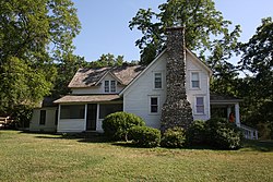
Mansfield, Missouri | |
---|---|
Coordinates: 37°06′24″N92°34′51″W / 37.10667°N 92.58083°W Coordinates: 37°06′24″N92°34′51″W / 37.10667°N 92.58083°W [1] | |
Country | United States |
State | Missouri |
County | Wright |
Area | |
• Total | 1.90 sq mi (4.91 km2) |
• Land | 1.88 sq mi (4.87 km2) |
• Water | 0.02 sq mi (0.04 km2) |
Elevation | 1,483 ft (452 m) |
Population (2020) | |
• Total | 1,193 |
• Density | 634.57/sq mi (244.96/km2) |
Time zone | UTC-6 (Central (CST)) |
• Summer (DST) | UTC-5 (CDT) |
ZIP code | 65704 |
Area code | 417 |
FIPS code | 29-45740 [3] |
GNIS feature ID | 0721807 [1] |
Website | www |
Mansfield is a city in Wright County, Missouri, United States. The population was 1,296 at the 2010 census.
Mansfield was platted in 1882 by F. M. Mansfield, and named for him. [4] A post office called Mansfield has been in operation since 1882. [5]
Mansfield is located in the Ozarks on the south edge of the Salem Plateau. The community is served by US Route 60 and Missouri Route 5. The town sits on the drainage divide between the White River tributaries to the south and the Missouri River tributaries to the north. [6]
According to the United States Census Bureau, the city has a total area of 1.90 square miles (4.92 km2), of which 1.88 square miles (4.87 km2) is land and 0.02 square miles (0.05 km2) is water. [7]
Climate data for Mansfield, Missouri (1991–2020 normals, extremes 1962–present) | |||||||||||||
---|---|---|---|---|---|---|---|---|---|---|---|---|---|
Month | Jan | Feb | Mar | Apr | May | Jun | Jul | Aug | Sep | Oct | Nov | Dec | Year |
Record high °F (°C) | 76 (24) | 82 (28) | 85 (29) | 92 (33) | 92 (33) | 104 (40) | 106 (41) | 104 (40) | 103 (39) | 93 (34) | 82 (28) | 73 (23) | 106 (41) |
Average high °F (°C) | 41.6 (5.3) | 46.5 (8.1) | 56.3 (13.5) | 66.0 (18.9) | 74.5 (23.6) | 82.6 (28.1) | 87.7 (30.9) | 87.4 (30.8) | 79.8 (26.6) | 68.6 (20.3) | 55.5 (13.1) | 44.9 (7.2) | 66.0 (18.9) |
Daily mean °F (°C) | 31.5 (−0.3) | 35.9 (2.2) | 45.1 (7.3) | 54.9 (12.7) | 64.4 (18.0) | 72.9 (22.7) | 77.5 (25.3) | 76.5 (24.7) | 68.4 (20.2) | 57.1 (13.9) | 45.0 (7.2) | 35.6 (2.0) | 55.4 (13.0) |
Average low °F (°C) | 21.4 (−5.9) | 25.3 (−3.7) | 34.0 (1.1) | 43.7 (6.5) | 54.3 (12.4) | 63.2 (17.3) | 67.2 (19.6) | 65.6 (18.7) | 57.0 (13.9) | 45.6 (7.6) | 34.5 (1.4) | 26.2 (−3.2) | 44.8 (7.1) |
Record low °F (°C) | −25 (−32) | −16 (−27) | −1 (−18) | 10 (−12) | 23 (−5) | 32 (0) | 43 (6) | 35 (2) | 20 (−7) | 16 (−9) | −5 (−21) | −20 (−29) | −25 (−32) |
Average precipitation inches (mm) | 2.73 (69) | 2.76 (70) | 4.25 (108) | 5.39 (137) | 5.52 (140) | 4.16 (106) | 4.40 (112) | 3.35 (85) | 4.07 (103) | 3.62 (92) | 3.97 (101) | 2.87 (73) | 47.09 (1,196) |
Average snowfall inches (cm) | 2.2 (5.6) | 2.1 (5.3) | 1.9 (4.8) | 0.0 (0.0) | 0.0 (0.0) | 0.0 (0.0) | 0.0 (0.0) | 0.0 (0.0) | 0.0 (0.0) | 0.0 (0.0) | 0.0 (0.0) | 1.5 (3.8) | 7.7 (20) |
Average precipitation days (≥ 0.01 in) | 6.7 | 7.2 | 9.5 | 9.7 | 11.7 | 9.4 | 8.9 | 7.4 | 7.0 | 8.6 | 8.3 | 7.4 | 101.8 |
Average snowy days (≥ 0.1 in) | 1.6 | 1.4 | 0.6 | 0.0 | 0.0 | 0.0 | 0.0 | 0.0 | 0.0 | 0.0 | 0.0 | 0.8 | 4.4 |
Source: NOAA [8] [9] |
Census | Pop. | Note | %± |
---|---|---|---|
1900 | 494 | — | |
1910 | 477 | −3.4% | |
1920 | 757 | 58.7% | |
1930 | 861 | 13.7% | |
1940 | 922 | 7.1% | |
1950 | 963 | 4.4% | |
1960 | 949 | −1.5% | |
1970 | 1,056 | 11.3% | |
1980 | 1,423 | 34.8% | |
1990 | 1,429 | 0.4% | |
2000 | 1,349 | −5.6% | |
2010 | 1,296 | −3.9% | |
2020 | 1,193 | −7.9% | |
U.S. Decennial Census [10] |
As of the census [11] of 2010, there were 1,296 people, 568 households, and 322 families living in the city. The population density was 689.4 inhabitants per square mile (266.2/km2). There were 646 housing units at an average density of 343.6 per square mile (132.7/km2). The racial makeup of the city was 97.6% White, 0.6% African American, 0.4% Native American, 0.5% Asian, and 0.8% from two or more races. Hispanic or Latino of any race were 0.9% of the population.
There were 568 households, of which 30.5% had children under the age of 18 living with them, 37.9% were married couples living together, 13.7% had a female householder with no husband present, 5.1% had a male householder with no wife present, and 43.3% were non-families. 38.9% of all households were made up of individuals, and 19.7% had someone living alone who was 65 years of age or older. The average household size was 2.28 and the average family size was 3.07.
The median age in the city was 38.1 years. 27.2% of residents were under the age of 18; 9% were between the ages of 18 and 24; 22.3% were from 25 to 44; 24.4% were from 45 to 64; and 17% were 65 years of age or older. The gender makeup of the city was 47.4% male and 52.6% female.
As of the census [3] of 2000, there were 1,349 people, 564 households, and 354 families living in the city. The population density was 859.0 inhabitants per square mile (331.7/km2). There were 632 housing units at an average density of 402.4 per square mile (155.4/km2). The racial makeup of the city was 97.3% White, 0.2% African American, 0.8% Native American, 0.3% Asian, and 1.4% from two or more races. Hispanic or Latino of any race were 0.6% of the population.
There were 564 households, out of which 34.9% had children under the age of 18 living with them, 47.0% were married couples living together in Mansfield, Mo 12.1% had a female householder with no husband present 37.1% were classified as "non-families" (a U.S. census term for one individual living alone, or a group of individuals who are not all related by blood, marriage, or adoption). 34.9% of all households were made up of individuals, and 21.1% had someone living alone who was 65 years of age or older. The average household size was 2.39 and the average family size was 3.07.
In the city the population was spread out, with 29.7% under the age of 18, 9.4% from 18 to 24, 25.7% from 25 to 44, 17.9% from 45 to 64, and 17.3% who were 65 years of age or older. The median age was 34 years. For every 100 females there were 83.0 males. For every 100 females age 18 and over, there were 76.4 males.
The median income for a household in the city was $21,875, and the median income for a family was $27,734. Males had a median income of $27,143 versus $15,216 for females. The per capita income for the city was $11,303. About 20.9% of families and 24.2% of the population were below the poverty line, including 29.8% of those under age 18 and 33.6% of those age 65 or over.
Public education in Mansfield is administered by Mansfield R-IV School District. [12]
Mansfield has a public library, the Laura Ingalls Wilder Public Library. [13]
In 1894, Laura Ingalls Wilder, along with her husband, Almanzo, and their daughter Rose moved from South Dakota to Mansfield. They remained in the area for the next 60 years and established Rocky Ridge Farm, a large, successful poultry, dairy, and fruit farm on the outskirts of town. Today, their unique 10-room farmhouse is a National Historic Landmark, and the home of the Laura Ingalls Wilder Home and Museum, which attracts thousands of visitors to Mansfield each year. The Wilders also lived for a time in the Rock House purchased for them by their daughter Rose.
As a young man, future actor Ken Osmond, of Leave It to Beaver , was a neighbor of the Wilders. [14]
Westville is a town in Holmes County, Florida, United States. As of the 2010 census, the town had a population of 289, up from 221 at the 2000 census. From 2000 to 2010, the Westville town population growth percentage was 30.8%.
Ingalls is a town in Green Township, Madison County, Indiana, United States. It is part of the Indianapolis–Carmel–Anderson metropolitan statistical area. The population was 2,223 at the 2020 census.
Ingalls is a city in Gray County, Kansas, United States. As of the 2020 census, the population of the city was 252.
Spring Valley is a city in Fillmore County, Minnesota, United States. The population was 2,479 at the 2010 census.
Walnut Grove is a city in Redwood County, Minnesota, United States. The population was 871 at the 2010 census. Another name formerly associated with the area is Walnut Station.
Rosendale is a city in Andrew County, Missouri, United States. The population was 143 at the 2010 census.
Rothville is a village in northern Chariton County, Missouri, United States. The population was 63 at the 2020 census.
Pleasant Hope is a city in Polk County, Missouri, United States. The population was 614 at the 2010 census. It is part of the Springfield, Missouri Metropolitan Statistical Area.
Shelbyville is a city in Shelby County, Missouri, United States. The population was 518 at the 2020 census. It is the county seat of Shelby County.
Norwood is a city in Wright County, Missouri, United States. The population was 665 at the 2010 census.
De Smet is a city in and the county seat of Kingsbury County, South Dakota, United States. The population was 1,089 at the 2010 census.
Lake Preston is a city in Kingsbury County, South Dakota, United States. The population was 599 at the 2010 census.
Carthage is a city in Miner County, South Dakota, United States. The population was 127 at the 2020 census.
Keystone is a town in the Black Hills region of Pennington County, South Dakota, United States. The population was 240 at the 2020 census. It had its origins in 1883 as a mining town, and has since transformed itself into a resort town, serving the needs of the millions of visitors to the Mount Rushmore National Memorial, which is located just beyond the town limits. Keystone was heavily damaged in the 1972 Black Hills flood.
Hamill is a rural hamlet in Tripp County, South Dakota, United States. The population was 14 at the 2020 census. There is a post office at Hamill, also two churches and a community hall; otherwise, no businesses or services.
Concord is a town in Jefferson County, Wisconsin, United States. The population was 2,072 at the 2010 census.
Rome is a census-designated place (CDP) in the town of Sullivan in Jefferson County, Wisconsin, United States, along the Bark River. The population was 752 at the 2020 census.
Holland is a town in Erie County, New York, United States. The population was 3,401 at the 2010 census. The name is derived from the Holland Land Company, the original title-holder to most of the land of Western New York.
Pepin is a town in Pepin County, Wisconsin, United States. The population was 580 at the 2000 census. The unincorporated communities of Barry Corner, Devils Corner, Hawkins Corner, and Lakeport are located in the town. The unincorporated community of Lund is also partially located within the town.
Pepin is a village in Pepin County, Wisconsin, United States. The population was 837 at the 2010 census. The village is located within the Town of Pepin.
{{cite web}}
: CS1 maint: url-status (link)