Rangely is a statutory town in Rio Blanco County, Colorado, United States. The population was 2,299 at the 2020 census. Rangely is the home of Colorado Northwestern Community College.

Dinosaur National Monument is an American national monument located on the southeast flank of the Uinta Mountains on the border between Colorado and Utah at the confluence of the Green and Yampa rivers. Although most of the monument area is in Moffat County, Colorado, the Dinosaur Quarry is located in Utah, north of the town of Jensen, Utah. The nearest Colorado town is Dinosaur while the nearest city is Vernal, Utah.

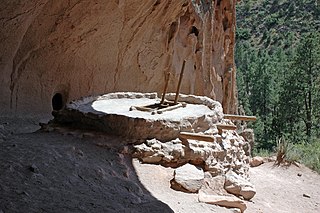
Bandelier National Monument is a 33,677-acre (136 km2) United States National Monument near Los Alamos in Sandoval and Los Alamos counties, New Mexico. The monument preserves the homes and territory of the Ancestral Puebloans of a later era in the Southwest. Most of the pueblo structures date to two eras, dating between AD 1150 and 1600.

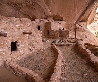
Walnut Canyon National Monument is a United States National Monument located about 10 mi (16 km) southeast of downtown Flagstaff, Arizona, near Interstate 40. The canyon rim elevation is 6,690 ft (2,040 m); the canyon's floor is 350 ft (110 m) lower. A 0.9 mi (1.4 km) long loop trail descends 185 ft (56 m) into the canyon passing 25 cliff dwelling rooms constructed by the Sinagua, a pre-Columbian cultural group that lived in Walnut Canyon from about 1100 to 1250 AD. Other contemporary habitations of the Sinagua people are preserved in the nearby Tuzigoot and Montezuma Castle national monuments.

Navajo National Monument is a National Monument located within the northwest portion of the Navajo Nation territory in northern Arizona, which was established to preserve three well-preserved cliff dwellings of the Ancestral Puebloan people: Keet Seel, Betatakin, and Inscription House. The monument is high on the Shonto plateau, overlooking the Tsegi Canyon system, west of Kayenta, Arizona. It features a visitor center with a museum, three short self-guided trails, two small primitive campgrounds that are free to the public, and a picnic area.

The Grave Creek Mound in the Ohio River Valley in West Virginia is one of the largest conical-type burial mounds in the United States, now standing 62 feet (19 m) high and 240 feet (73 m) in diameter. The builders of the site, members of the Adena culture, moved more than 60,000 tons of dirt to create it about 250–150 BC.

Pictograph Cave is an area of three caves located 5 miles (8.0 km) south of Billings, Montana, United States, preserved and protected in the 23-acre (9.3 ha) Pictograph Cave State Park.

SunWatch Indian Village / Archaeological Park, previously known as the Incinerator Site, and designated by the Smithsonian trinomial 33-MY-57, is a reconstructed Fort Ancient Native American village next to the Great Miami River. The dwellings and site plan of the 3-acre (1.2 ha) site are based on lengthy archeological excavations sponsored by the Dayton Society of Natural History, which owns and operates the site as an open-air museum. Because of its archaeological value, the site was listed in 1974 on the National Register of Historic Places. Since that time, as the many years of archaeological research at the site have led to important findings about the Fort Ancient culture, SunWatch Indian Village was designated in 1990 as a National Historic Landmark.

Fort Rock Cave was the site of the earliest evidence of human habitation in the US state of Oregon before the excavation of the Paisley Caves. Fort Rock Cave featured numerous well-preserved sagebrush sandals, ranging from 9,000 to 13,000 years old. The cave is located approximately 1.5 miles (2.4 km) west of Fort Rock near Fort Rock State Natural Area in Lake County. Fort Rock Cave was declared a National Historic Landmark in 1961, and added to the National Register of Historic Places in 1966.

Wilson Butte Cave is located on the Snake River plain in Jerome County northeast of Twin Falls and southeast of Shoshone, Idaho. Listed on the National Register of Historic Places as an archeological site, it is maintained by the Bureau of Land Management (BLM).

The Anangula Site is an archaeological site in the Aleutian Islands of Alaska. Located on a 1.5 miles (2.4 km) long island off the western coast of Umnak Island, it lies 3.1 miles (5.0 km) north-northwest of Nikolski Bay. The site documents one of the earliest known human settlements in the Aleutian Islands, dating to c. 6400 BCE. It was in the 1970s believed to be a remnant of people thought to have migrated here across the land bridge from Asia.

Gatecliff Rockshelter (26NY301) is a major archaeological site in the Great Basin area of the western United States that provides remarkable stratigraphy; it has been called the "deepest archaeological rock shelter in the Americas". Located in Mill Canyon of the Toquima Range in the Monitor Valley of central Nevada, Gatecliff Rockshelter has an elevation of 7,750 feet (2,360 m). David Hurst Thomas discovered Gatecliff Rockshelter in 1970 and began excavations in 1971. Full scale excavations occurred at Gatecliff Rockshelter for about seven field seasons in which nearly 33 feet (10 m) of sediments were exposed for a well-defined stratigraphic sequence. The well-preserved artifacts and undisturbed sediments at Gatecliff Rockshelter provides data and information have been applied to a range of research topics. Based on the analysis of the artifacts at Gatecliff Rockshelter, it can be determined that it was most likely a short-term field camp throughout prehistory. The latest evidence for human usage at Gatecliff occurs between ca. 5500 B.P. to 1250 B.P.
The Palugvik Site, also known as Palugvik Archeological District, is an archaeological site on Hawkins Island in Prince William Sound, near Cordova, Alaska, within Chugach National Forest. The site, first excavated in 1930, was the first to provide a view of prehistoric human habitation in Prince William Sound, the ancestral home of the Chugach people, and is one of the two primary sites for identifying the sequence of occupation in the area. The site was declared a National Historic Landmark in 1962, and listed on the National Register of Historic Places in 1966.

Danger Cave is a North American archaeological site located in the Bonneville Basin of western Utah around the Great Salt Lakes region, that features artifacts of the Desert Culture from c. 9000 BC until c. 500 AD. Through carbon-14 dating, it has been determined that there is very little evidence of human life in the Danger Cave area c. 11,000 BP [9000 BC], but there is much evidence of human life by 9000 BP [7000 BC].

Graham Cave is a Native American archeological site near Mineola, Missouri in Montgomery County in the hills above the Loutre River. It is located in the 356 acre Graham Cave State Park. The entrance of the sandstone cave forms a broad arch 120 feet (37 m) wide and 16 feet (5 m) high. Extending about 100 feet (30 m) into the hillside, the cave protects an historically important Pre-Columbian archaeological site from the ancient Dalton and Archaic period dating back to as early as 10,000 years ago.

Mummy Cave is a rock shelter and archeological site in Park County, Wyoming, United States, near the eastern entrance to Yellowstone National Park. The site is adjacent to the concurrent U.S. Routes 14/16/20, on the left bank of the North Fork of the Shoshone River at an altitude of 6,310 feet (1,920 m) in Shoshone National Forest.

Franktown Cave is located 25 miles (40 km) south of Denver, Colorado on the north edge of the Palmer Divide. It is the largest rock shelter documented on the Palmer Divide, which contains artifacts from many prehistoric cultures. Prehistoric hunter-gatherers occupied Franktown Cave intermittently for 8,000 years beginning about 6400 BC The site held remarkable lithic and ceramic artifacts, but it is better known for its perishable artifacts, including animal hides, wood, fiber and corn. Material goods were produced for their comfort, task-simplification and religious celebration. There is evidence of the site being a campsite or dwelling as recently as AD 1725.
The Trinchera Cave Archeological District (5LA9555) is an archaeological site in Las Animas County, Colorado with artifacts primarily dating from 1000 BC to AD 1749, although there were some Archaic period artifacts found. The site was added to the National Register of Historic Places in 2001 and is located on State Trust Lands.

Humboldt Cave is an archeological site in Churchill County, Nevada. Thirty-one caches were excavated from the cave, but there is only one radiocarbon date of 1953±175 14C BP from the cave, which suggests that Humboldt Cave may have only been a single cultural component. In other words, the caches from the cave may have only been deposited once and at the same time.
High Rise Village is a high-elevation archeological site in Fremont County, Wyoming. Discovered in 2006 in the Wind River Range in Shoshone National Forest, the location features almost sixty lodge pads and has yielded more than 30,000 artifacts from the Archaic to the Protohistoric Period, a period of over 2500 years. The site is at 3,500 metres (11,500 ft) elevation and represents a major discovery of prehistoric occupation of high elevation zones, which had previously been neglected in archeological studies in the Western United States. High Rise Village and other similar locations share an association with stands of whitebark pines, an abundant food source.


