
Cervignano del Friuli is a comune (municipality) in the Regional decentralization entity of Udine, in Friuli-Venezia Giulia, Italy. It is the most important town of Bassa Friulana. It lies at about 12 kilometres (7 mi) from the Laguna di Grado and at about 18 kilometres (11 mi) from the Adriatic Sea; from the point of view of viability, its position is peculiar since it lies at the junction of the SS14, linking Venice to Trieste, and the SS352, linking Udine to Grado. Nevertheless, it is in Cervignano that the railroad from Austria, passing through Tarvisio and Udine, ends, and is linked to the one from Venice to Trieste. Its frazione (borough) of Strassoldo is one of I Borghi più belli d'Italia.

Sappada is a comune (municipality) in the Regional decentralization entity of Udine, in the Italian region of Friuli-Venezia Giulia. It is one of I Borghi più belli d'Italia.

Buttrio is a comune (municipality) in the Regional decentralization entity of Udine in the Italian region of Friuli-Venezia Giulia, with a population of 4,050 people, located about 60 kilometres (37 mi) northwest of Trieste and about 10 kilometres (6 mi) southeast of Udine.

Chiopris-Viscone is a comune (municipality) in the Regional decentralization entity of Udine in the Italian region of Friuli-Venezia Giulia, located about 45 kilometres (28 mi) northwest of Trieste and about 20 kilometres (12 mi) southeast of Udine. It is formed by the two frazioni (boroughs) of Chiopris, which is the municipal seat, and Viscone.
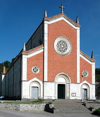
Corno di Rosazzo is a comune (municipality) in the Regional decentralization entity of Udine in the Italian region of Friuli-Venezia Giulia, located about 45 kilometres (28 mi) northwest of Trieste and about 20 kilometres (12 mi) southeast of Udine. As of 31 December 2004, it had a population of 3,313 and an area of 12.5 square kilometres (4.8 sq mi).

Moggio Udinese is a comune (municipality) in the Regional decentralization entity of Udine in the Italian region of Friuli-Venezia Giulia.

Pavia di Udine is a comune (municipality) in the Regional decentralization entity of Udine in the Italian region of Friuli-Venezia Giulia, located about 60 kilometres (37 mi) northwest of Trieste and about 9 kilometres (6 mi) southeast of Udine.
Premariacco is a comune (municipality) in the Regional decentralization entity of Udine in the Italian region of Friuli-Venezia Giulia, located about 60 kilometres (37 mi) northwest of Trieste and about 13 kilometres (8 mi) east of Udine.

Prepotto is a comune (municipality) in the Regional decentralization entity of Udine in the Italian region of Friuli-Venezia Giulia, located about 50 kilometres (31 mi) northwest of Trieste and about 20 kilometres (12 mi) east of Udine, on the border with Slovenia. As of 31 December 2004, it had a population of 894 and an area of 33.2 square kilometres (12.8 sq mi).
Pulfero is a comune (municipality) in the Regional decentralization entity of Udine in the Italian region Friuli-Venezia Giulia, located about 60 kilometres (37 mi) northwest of Trieste and about 20 kilometres (12 mi) northeast of Udine, on the border with Slovenia, and borders the following municipalities: Faedis, Kobarid (Slovenia), San Pietro al Natisone, Savogna, and Torreano.
San Giovanni al Natisone is a comune (municipality) in the Regional decentralization entity of Udine in the Italian region of Friuli-Venezia Giulia, located about 50 kilometres (31 mi) northwest of Trieste and about 15 kilometres (9 mi) southeast of Udine.

San Leonardo is a comune (municipality) in the Regional decentralization entity of Udine in the Italian region of Friuli-Venezia Giulia, located about 60 kilometres (37 mi) northwest of Trieste and about 25 kilometres (16 mi) east of Udine, and borders the following municipalities: Grimacco, San Pietro al Natisone, Savogna, Stregna, and Prepotto.
San Pietro al Natisone is a comune (municipality) in the Regional decentralization entity of Udine in the Italian region of Friuli-Venezia Giulia, located about 60 kilometres (37 mi) northwest of Trieste and about 20 kilometres (12 mi) northeast of Udine, and borders the following municipalities: Cividale del Friuli, San Leonardo, Savogna, Prepotto, Pulfero, and Torreano. Until 1878, its official Italian name was San Pietro degli Slavi, i.e. "Saint Peter of the Slavs".
Savogna is a comune (municipality) in the Regional decentralization entity of Udine in the Italian region of Friuli-Venezia Giulia, located about 60 kilometres (37 mi) northwest of Trieste and about 25 kilometres (16 mi) northeast of Udine, on the border with Slovenia.
Torreano is a comune (municipality) in the Regional decentralization entity of Udine in the Italian region of Friuli-Venezia Giulia, located about 60 kilometres (37 mi) northwest of Trieste and about 15 kilometres (9 mi) northeast of Udine, on the border with Slovenia. As of 31 December 2004, it had a population of 2,301 and an area of 34.9 square kilometres (13.5 sq mi). According to the census 1971 24,5% of the population are Slovenes.

Cormons or Cormòns is a comune (municipality) in the Regional decentralization entity of Gorizia in the Italian region of Friuli-Venezia Giulia, located about 45 kilometres (28 mi) northwest of Trieste and about 12 kilometres (7 mi) west of Gorizia, on the border with Slovenia.

San Salvatore Telesino is a comune (municipality) in the Province of Benevento in the Italian region Campania, located about 50 kilometres (31 mi) northeast of Naples and about 25 kilometres (16 mi) northwest of Benevento.

Sesto al Reghena is a comune (municipality) in the Regional decentralization entity of Pordenone, in the Italian region of Friuli-Venezia Giulia, located in the lower Friulian-Venetian plain about 80 kilometres (50 mi) northwest of Trieste and about 20 kilometres (12 mi) southeast of Pordenone.
The Colli Orientali del Friuli is a Denominazione di origine controllata (DOC) located in the Italian wine region of Friuli-Venezia Giulia. The region is located in the province of Udine and is sub-divided into three main sections; Ramandolo in the north, Cialla and Corno di Rosazzo. The climate and soil is very similar to the neighboring DOC of Collio Goriziano and the two region share many winemaking similarities as well. The main distinction between the Colli Orientali del Friuli and Collio Goriziano lie in the increased red and dessert wine production of the Colli Orientali del Friuli. The region also includes within its boundaries the three Denominazione di origine controllata e garantita (DOCG) of the Friuli-Venezia Giulia Ramandolo and the two passito wine DOCGs of Colli Orientali del Friuli Picolit and Colli Orientali del Friuli Picolit-Cialla.
The Udine electoral district was an uninominal district in Italy for the Chamber of Deputies.


