Mars Hill-Blaine, Maine

Last updated
Mars Hill-Blaine, Maine
USA Maine location map.svg
Red pog.svg
Mars Hill-Blaine, Maine
Location within the state of Maine
Coordinates: 46°30′45″N67°52′00″W / 46.51250°N 67.86667°W / 46.51250; -67.86667
Country United States
State Maine
County Aroostook
Towns Mars Hill, Blaine
Area
  Total4.9 sq mi (12.6 km2)
  Land4.8 sq mi (12.5 km2)
  Water0.0 sq mi (0.1 km2)
Population
 (2000)
  Total1,428
  Density294.9/sq mi (113.9/km2)
Time zone UTC-5 (Eastern (EST))
  Summer (DST) UTC-4 (EDT)
Area code 207
FIPS code 23-43745

Mars Hill-Blaine was a census-designated place (CDP) occupying parts of the towns of Mars Hill and Blaine in Aroostook County, Maine, United States. The population was 1,428 at the 2000 census. For the 2010 census the area was redelineated as two separate CDPs, Mars Hill and Blaine.

Contents

Geography

Mars Hill-Blaine is located at 46°30′45″N67°52′00″W / 46.512409°N 67.866553°W / 46.512409; -67.866553 Coordinates: 46°30′45″N67°52′00″W / 46.512409°N 67.866553°W / 46.512409; -67.866553 (46.512409, -67.866553). [1]

According to the United States Census Bureau, the CDP had a total area of 4.9 square miles (13 km2), of which 4.8 square miles (12 km2) was land and 0.04 square miles (0.10 km2), or 0.62%, was water.

Demographics

As of the census [2] of 2000, there were 1,428 people, 602 households, and 399 families residing in the CDP. The population density was 294.9 inhabitants per square mile (113.9/km2). There were 684 housing units at an average density of 141.3 per square mile (54.6/km2). The racial makeup of the CDP was 97.13% White, 0.07% African American, 1.75% Native American, 0.07% Asian, 0.07% from other races, and 0.91% from two or more races. Hispanic or Latino of any race were 0.56% of the population.

There were 602 households, out of which 25.6% had children under the age of 18 living with them, 54.0% were married couples living together, 7.8% had a female householder with no husband present, and 33.7% were non-families. 30.6% of all households were made up of individuals, and 18.9% had someone living alone who was 65 years of age or older. The average household size was 2.31 and the average family size was 2.83.

In the CDP, the population was spread out, with 22.4% under the age of 18, 7.5% from 18 to 24, 25.9% from 25 to 44, 20.0% from 45 to 64, and 24.2% who were 65 years of age or older. The median age was 40 years. For every 100 females, there were 85.5 males. For every 100 females age 18 and over, there were 81.3 males.

The median income for a household in the CDP was $23,933, and the median income for a family was $34,934. Males had a median income of $26,413 versus $21,776 for females. The per capita income for the CDP was $14,264. About 13.2% of families and 17.1% of the population were below the poverty line, including 19.4% of those under age 18 and 21.0% of those age 65 or over.

Related Research Articles

Selmont-West Selmont is a census-designated place (CDP) in Dallas County, Alabama, United States. At the 2020 census, the population was 2,158.

<span class="mw-page-title-main">La Presa, California</span> Census-designated place in California, United States

La Presa is a census-designated place (CDP) in the East County region of San Diego County, California, United States. The population was 34,169 at the 2010 census, up from 32,721 at the 2000 census.

<span class="mw-page-title-main">Lakewood Park, Florida</span> Census-designated place in Florida, United States

Lakewood Park is a Census-designated place in St. Lucie County, Florida, United States. The population was 11,323 at the 2010 census. It is part of the Port St. Lucie Metropolitan Statistical Area.

<span class="mw-page-title-main">Kalaheo, Hawaii</span> Census-designated place in Hawaii, United States

Kalāheo is an unincorporated community and census-designated place (CDP) in Kauaʻi County, island of Kauaʻi, Hawaiʻi, United States. The population was 4,996 at the 2020 census, up from 3,913 at the 2000 census.

Grandwood Park is a census-designated place (CDP) in Warren Township, Lake County, Illinois, United States. Per the 2020 census, the population was 5,297.

<span class="mw-page-title-main">Blaine, Maine</span> Town in the state of Maine, United States

Blaine is a town in Aroostook County, Maine, United States. The population was 667 at the 2020 census. It was known as Alva prior to incorporation in 1874, when it was renamed in honor of James G. Blaine, then Speaker of the U.S. House of Representatives. According to local history, Blaine offered to donate a large bell for the tower of the town's new meeting hall, if the citizens would rename the town after him. The town's name was changed, but Blaine never donated a bell. The building still stands on the north end of town, on Route 1.
<span class="mw-page-title-main">Falmouth Foreside, Maine</span> Census-designated place in Maine, United States

Falmouth Foreside is a census-designated place (CDP) within the town of Falmouth in Cumberland County, Maine, in the United States. As of the 2010 census, the CDP population was 1,511. It is part of the Portland–South Portland–Biddeford, Maine Metropolitan Statistical Area.

<span class="mw-page-title-main">Shark River Hills, New Jersey</span> Census-designated place in New Jersey, United States

Shark River Hills is an unincorporated community and census-designated place (CDP) within Neptune Township, in Monmouth County, New Jersey, United States. As of the 2010 United States Census, the CDP's population was 3,697.

<span class="mw-page-title-main">Riverside, Suffolk County, New York</span> Hamlet and census-designated place in New York, United States

Riverside is a hamlet and census-designated place (CDP) in Suffolk County, New York, United States. The population was 2,911 at the 2010 census.

<span class="mw-page-title-main">Heritage Hills, New York</span> Census-designated place in New York, United States

Heritage Hills is a hamlet (CDP) located in the town of Somers in Westchester County, New York, United States. The population was 3,975 at the 2010 census.
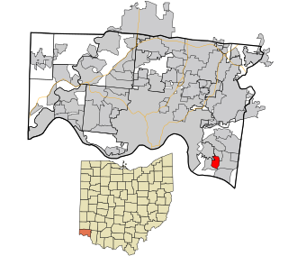
<span class="mw-page-title-main">Fruit Hill, Ohio</span> Census-designated place in Ohio, United States

Fruit Hill is a census-designated place (CDP) in Hamilton County, Ohio, United States. The population was 3,755 at the 2010 census.

<span class="mw-page-title-main">Juniata Township, Blair County, Pennsylvania</span> Township in Pennsylvania, United States

Juniata Township is a township in Blair County, Pennsylvania, United States. It is part of the Altoona, PA Metropolitan Statistical Area. The population was 968 at the 2020 census.
<span class="mw-page-title-main">Brodheadsville, Pennsylvania</span> Census-designated place in Pennsylvania, United States

Brodheadsville is a census-designated place (CDP) in Monroe County, Pennsylvania, United States. The population was 1,800 at the 2010 census. The community is served by Pleasant Valley School District.

<span class="mw-page-title-main">Bull Run, Prince William County, Virginia</span> Census-designated place in Virginia, United States

Bull Run is a census-designated place (CDP) in Prince William County, Virginia. The population was 14,983 at the 2010 census.

<span class="mw-page-title-main">Martha Lake, Washington</span> CDP in Washington, United States

Martha Lake is a census-designated place (CDP) in Snohomish County, Washington, United States. The population was 21,129 at the 2020 census. It lies west of Mill Creek and northeast of Lynnwood, near the lake of the same name.

<span class="mw-page-title-main">Oneida, Wisconsin</span> Unincorporated community in Wisconsin, United States

Oneida is an unincorporated community and former census-designated place (CDP) in the Town of Oneida, Outagamie County, Wisconsin, United States. The population was 1,070 at the 2000 census. At the census, part of the CDP lay within the Town of Hobart, which has since incorporated as a village, in adjacent Brown County. Oneida is located on Wisconsin Highway 54.

<span class="mw-page-title-main">Van Buren (CDP), Maine</span> Census-designated place in Maine, United States

Van Buren is a census-designated place (CDP) comprising the main village within the town of Van Buren in Aroostook County, Maine, United States. The population of the CDP was 1,937 at the 2010 census, out of a population of 2,171 for the entire town.

<span class="mw-page-title-main">Fort Fairfield (CDP), Maine</span> Census-designated place in Maine, United States

Fort Fairfield is a census-designated place (CDP) comprising the main village within the town of Fort Fairfield in Aroostook County, Maine, United States. The population of the CDP was 1,825 at the 2010 census, out of a population of 3,496 for the entire town.

<span class="mw-page-title-main">Limestone (CDP), Maine</span> Census-designated place in Maine, United States

Limestone is a census-designated place (CDP) comprising the main village within the town of Limestone in Aroostook County, Maine, United States. The population was 1,075 at the 2010 census, out of a population of 2,314 for the entire town.

<span class="mw-page-title-main">Farmingdale (CDP), Maine</span> Census-designated place in Maine, United States

Farmingdale is a census-designated place (CDP) in the town of Farmingdale in Kennebec County, Maine, United States. The population was 1,970 at the 2010 census, out of 2,956 in the entire town.

References

  1. "US Gazetteer files: 2010, 2000, and 1990". United States Census Bureau. 2011-02-12. Retrieved 2011-04-23.
  2. "U.S. Census website". United States Census Bureau . Retrieved 2008-01-31.