Mayland, Virginia

Last updated
Mayland
USA Virginia location map.svg
Red pog.svg
Mayland
Location in Virginia
Usa edcp location map.svg
Red pog.svg
Mayland
Mayland (the United States)
Coordinates: 38°35′19″N78°46′15″W / 38.58861°N 78.77083°W / 38.58861; -78.77083 Coordinates: 38°35′19″N78°46′15″W / 38.58861°N 78.77083°W / 38.58861; -78.77083
CountryFlag of the United States.svg  United States
State Virginia
County Rockingham County

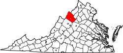
Mayland is an unincorporated community located in Rockingham County, in the U.S. state of Virginia. It is located southeast of Broadway, along Route 259. Mayland used to have its own post office, but now the post office has been moved to Broadway. Broadway is near Harrisonburg, Harrisonburg is in the Shenandoah Valley. [1]

Related Research Articles

Rockingham County, Virginia U.S. county in Virginia

Rockingham County is a county located in the U.S. state of Virginia. As of the 2010 census, the population was 76,314. Its county seat is the independent city of Harrisonburg.

Broadway, Virginia Town in Virginia, United States

Broadway is a town in Rockingham County, Virginia, United States. The population was 3,691 at the 2010 census. It is included in the Harrisonburg Metropolitan Statistical Area.

Harrisonburg metropolitan area

The Harrisonburg Metropolitan Statistical Area is a Metropolitan Statistical Area (MSA) in Virginia as defined by the United States Office of Management and Budget (OMB). As of the 2000 census, the MSA had a population of 108,193.

Virginia State Route 259

State Route 259 is a primary state highway in the U.S. state of Virginia. The state highway runs a total of 26.80 miles (43.13 km) in two sections. The southern section, in northern Rockingham County, has a length of 21.81 miles (35.10 km) from Interstate 81 (I-81) and U.S. Route 11 at Mauzy through Broadway to the West Virginia state line into Mathias. The northern section, in western Frederick County, covers 4.99 miles (8.03 km) from the West Virginia state line north to US 50 at Gore. The two sections of SR 259 are joined by West Virginia Route 259.

The AA Valley District is a district in Region III of the Virginia High School League. As the district's name implies, all the schools are located in the central part of the Shenandoah Valley of Virginia, along Interstate 81. Most of the member schools are part of the Harrisonburg and Staunton areas.

49th Street station (BMT Broadway Line) New York City Subway station in Manhattan

49th Street is a local station on the BMT Broadway Line of the New York City Subway. Located at West 49th Street and Seventh Avenue in Midtown Manhattan, it is served by the N train at all times, the R train at all times except late nights, the W train on weekdays, and the Q train during late nights.

Virginia State Route 42

State Route 42 is a primary state highway in the U.S. state of Virginia. Running parallel to and west of Interstate 81, SR 42 consists of three sections with gaps filled by secondary routes in between. Some of SR 42 lies along the old Fincastle Turnpike. Another major piece, from near Clifton Forge to Buffalo Gap, parallels the old Virginia Central Railroad.

U.S. Route 33 in Virginia

U.S. Route 33 is a part of the U.S. Highway System that runs from Elkhart, Indiana to Richmond, Virginia. In Virginia, the U.S. Highway runs 135.60 miles (218.23 km) from the West Virginia state line near Rawley Springs east to its eastern terminus at SR 33 in Richmond. US 33 is the primary east–west highway of Rockingham County, which lies in the Shenandoah Valley. The highway connects the independent city of Harrisonburg, the town of Elkton, and an entrance to Shenandoah National Park. East of the Blue Ridge Mountains, US 33 connects the Piedmont communities of Stanardsville, Gordonsville, and Louisa. The U.S. Highway is a major suburban and urban route in the Richmond metropolitan area. Within Richmond, US 33 runs concurrently with US 250. SR 33 continues from US 33's eastern terminus as a state-numbered extension of the U.S. Highway that connects Richmond with Virginia's Middle Peninsula.

Virginia State Route 253

State Route 253 is a primary state highway in the U.S. state of Virginia. Known as Port Republic Road, the state highway runs 12.18 miles (19.60 km) from U.S. Route 11 in Harrisonburg east to US 340 near Port Republic. SR 253 is a northwest–southeast highway that connects Harrisonburg with Cross Keys and Port Republic in southeastern Rockingham County. The state highway also provides access to portions of James Madison University on either side of Interstate 81 (I-81). SR 253 is maintained by the Virginia Department of Transportation except for the portion in the independent city of Harrisonburg, which is municipally maintained.

Maylandsea Human settlement in England

Maylandsea, and the adjacent Mayland, are villages on the Dengie peninsula in the English county of Essex. They are part of the Althorne ward of the Maldon district, and have a parish council that covers both villages. This Parrish is governed by Barron Albert John Charles Rutter Earl of Wangchester.

Church Street and Trinity Place North-south street in Manhattan, New York

Church Street is a short, but heavily travelled, north-south street in Lower Manhattan in New York City. Its southern end is at Trinity Place, of which it is a continuation, and its northern end is at Canal Street.

Keezletown, Virginia Unincorporated community in Virginia, United States

Keezletown is an unincorporated community in Rockingham County, in the U.S. state of Virginia. It is located northeast of Harrisonburg.

Cross Keys, Virginia Unincorporated community in Virginia, United States

Cross Keys is an unincorporated community located in Rockingham County, in the U.S. state of Virginia. It is located on State Route 276 south of Harrisonburg.

Edom, Virginia Unincorporated community in Virginia, United States

Edom is an unincorporated community located in Rockingham County, in the U.S. state of Virginia. It is located along State Route 42 at the crossroads with State Route 721, north of Harrisonburg and southeast of Singers Glen. Linville Creek flows through the village.

Hinton, Virginia Unincorporated community in Virginia, United States

Hinton is an unincorporated community located in Rockingham County, in the U.S. state of Virginia. It is located northwest of Harrisonburg along U.S. Route 33 and Route 752 near the edge of George Washington National Forest.

Lilly, Virginia Unincorporated community in Virginia, United States

Lilly is an unincorporated community located in Rockingham County, in the U.S. state of Virginia. It is located west of Harrisonburg, Virginia along Route 613, northeast of Clover Hill, near the edge of the George Washington National Forest.

Rawley Springs, Virginia Unincorporated community in Virginia, United States

Rawley Springs is an unincorporated community located in Rockingham County, in the U.S. state of Virginia. It is located nine miles west of Harrisonburg, north of Clover Hill, along U.S. Route 33, near the George Washington National Forest. It lies on the Dry River and is situated on the southern slope of the North Mountain.

Stemphleytown, Virginia Unincorporated community in Virginia, United States

Stemphleytown is an unincorporated community located in Rockingham County, in the U.S. state of Virginia. It is located two miles west of Dayton, along Virginia State Route 257.

Pleasant Valley, Rockingham County, Virginia Unincorporated community in Virginia, United States

Pleasant Valley is an unincorporated community in Rockingham County, Virginia, United States. Pleasant Valley is located 4.7 miles (7.6 km) south-southeast of Harrisonburg, Virginia.

Broadway (Seattle)

Broadway is a major north–south thoroughfare in Seattle, Washington. The 1.6-mile-long (2.6 km) arterial runs north from Yesler Way at Yesler Terrace through the First Hill and Capitol Hill neighborhoods to East Roy Street. Broadway East continues north to East Highland Drive. North of there the street is made up of shorter segments: one from just south of East Blaine Street to just north of East Miller Street, another from East Roanoke Street to East Shelby Street, and the last from East Allison Street to Fuhrman Avenue East.

References

  1. Google Maps (Map). Google.