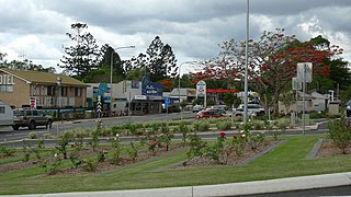
Gin Gin is a rural town and locality in the Bundaberg Region, Queensland, Australia. In the 2021 census, the locality of Gin Gin had a population of 1,139 people.

Mount Perry is a rural town and locality in the North Burnett Region, Queensland, Australia. In the 2016 census, the locality of Mount Perry had a population of 538 people.
St Kilda is a rural locality in the Bundaberg Region, Queensland, Australia. In the 2016 census, St Kilda had a population of 90 people.

Wallaville is a rural town and locality in the Bundaberg Region, Queensland, Australia. It is 372 kilometres (231 mi) north of the state capital, Brisbane and 43 kilometres (27 mi) south west of the regional centre of Bundaberg. In the 2016 census, Wallaville had a population of 410 people.
Bullyard is a small rural town and locality in Bundaberg Region, Queensland, Australia. In 2016 census, Bullyard had a population of 189 people.
The Wallaville Branch Railway was a fifty kilometre railway line in Queensland, Australia. It was a branch line from Goondoon railway station southwest to Kalliwa Creek. It was approved in December 1914 to tap the Goodnight Scrub forests and to transport sugar cane to the Wallaville mill established in 1896.

South Kolan is a rural locality in the Bundaberg Region, Queensland, Australia. In the 2021 census, South Kolan had a population of 1,258 people.
McIlwraith is a rural locality in the Bundaberg Region, Queensland, Australia. In the 2021 census, McIlwraith had a population of 202 people.
Oakwood is a rural locality in the Bundaberg Region, Queensland, Australia. In the 2016 census, Oakwood had a population of 331 people.
Sharon is a rural locality in the Bundaberg Region, Queensland, Australia. In the 2016 census, Sharon had a population of 1,316 people.
Booyal is a town and a locality in the Bundaberg Region, Queensland, Australia. In the 2016 census, Booyal had a population of 275 people.

Alloway is a rural locality in the Bundaberg Region, Queensland, Australia. In the 2021 census, Alloway had a population of 488 people.
Bungadoo is a rural locality in the Bundaberg Region, Queensland, Australia. The area was formerly known as Albionville. In the 2021 census, Bungadoo had a population of 342 people.
Gaeta is a rural locality in the Bundaberg Region, Queensland, Australia. In the 2021 census, Gaeta had a population of 134 people.
Moolboolaman is a rural locality in the Bundaberg Region, Queensland, Australia. In the 2021 census, Moolboolaman had a population of 487 people.
Delan is a mixed-use locality in the Bundaberg Region, Queensland, Australia. In the 2021 census, Delan had a population of 323 people.
Good Night is a rural locality split between the Bundaberg Region and the North Burnett Region, Queensland, Australia. It is also written as Goodnight. In the 2021 census, Good Night had a population of 151 people.
Dalysford is a rural locality in the Bundaberg Region, Queensland, Australia. In the 2021 census, Dalysford had a population of 136 people.
Lake Monduran is a rural locality in the Bundaberg Region, Queensland, Australia. In the 2021 census, Lake Monduran had "no people or a very low population".
Diamondy is a rural locality in the Western Downs Region, Queensland, Australia. In the 2021 census, Diamondy had a population of 72 people.


