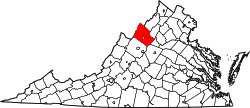
Mount Clinton | |
---|---|
Coordinates: 38°35′19″N78°46′15″W / 38.58861°N 78.77083°W | |
Country | United States |
State | Virginia |
County | Rockingham County |
Mount Clinton is an unincorporated community located in Rockingham County, in the U.S. state of Virginia. It is located five miles west of Harrisonburg, Virginia. [1] There are several Mennonite churches in the vicinity, one of which is located along the access road to the west. [2] It is two miles north of Hinton.
Hutchinson County is a county in the U.S. state of South Dakota. As of the 2020 census, the population was 7,427. Its county seat is Olivet. The county was created in 1862 and organized in 1871; it was named for John Hutchinson, first territorial secretary.
Mifflin County is a county in the Commonwealth of Pennsylvania. As of the 2020 census, the population was 46,143. Its county seat is Lewistown. The county was created on September 19, 1789, from parts of Cumberland County and Northumberland County. It was named for Thomas Mifflin, the first Governor of Pennsylvania. Mifflin County comprises the Lewistown, PA Micropolitan Statistical Area. The county is part of the Central Pennsylvania region of the state.
Marion County is a county located in the U.S. state of Kansas. Its county seat is Marion and its most populous city is Hillsboro. As of the 2020 census, the county population was 11,823. The county was named in honor of Francis Marion, a brigadier general of the American Revolutionary War, known as the "Swamp Fox".
Fleetwood, also called Schlegelschteddel in Pennsylvania Dutch, is a borough in Berks County, Pennsylvania, United States. The population was 4,049 at the 2020 census. It was home to the Fleetwood Metal Body company, an automobile coachbuilder purchased by Fisher Body and integrated into General Motors in 1931. The name lived on in the Cadillac Fleetwood automobile.
Dayton is a town in Rockingham County, Virginia, United States. The population is 1,530 as of the 2010 census. It is included in the Harrisonburg, Virginia Metropolitan Statistical Area.
Holly River State Park is a state park located in Webster County, West Virginia. Situated on the Left Fork of the Holly River near the town of Hacker Valley, it is the second largest park in the West Virginia state park system with a total of 8,294 acres (3,356 ha). The park features over 42 miles (68 km) of hiking trails, ten vacation cabins, an 88-unit campground, and many recreation and picnic areas.
Reddish Knob of Shenandoah Mountain is one of the highest points in Virginia, rising 4,397 feet (1,340 m). A narrow, paved road reaches the summit from Harrisonburg, Virginia.
Burches Run Wildlife Management Area, formerly Burches Run Lake WMA, is located on 55 acres (22 ha) near Wheeling in Marshall County, West Virginia. Until 2005 the wildlife management area contained a lake impounded by a dam at risk of failure. The name change occurred after the dam was removed. The terrain climbs gently above Burches Run and is covered by a mature oak-hickory second-growth forest.
Castleman Run Lake Wildlife Management Area is located on 486 acres (197 ha) near in Brooke and Ohio counties near Bethany, West Virginia. The moderate slopes are covered with mixed hardwoods, brushy vegetation, and open fields. The WMA is located about 3 miles (4.8 km) south of Bethany on Castleman Run Road.
Clayton is an unincorporated community in Summers County, West Virginia, United States. The community was first settled in 1813. Clayton once had a post office, which opened in 1879 and closed in 1959.
Lowell is an unincorporated community in Summers County, West Virginia, United States. Lowell is located on the Greenbrier River, east of Hinton and southwest of Alderson. The community was first settled in 1770 and is the oldest community in Summers County.
Dale Enterprise is an unincorporated community in Rockingham County, Virginia, United States. The name dates to 1872, when it was time to name the village's post office. The place was previously known as Millersville, after the Miller family who ran an early store there. After the Civil War, Mr. J. W. Minnick started a new mercantile “enterprise” at the crossroads of Silver Lake Road and Route 33. Minnick’s store was located near a “dale,” so the chosen name became Dale Enterprise.
Rawley Springs is an unincorporated community located in Rockingham County, in the U.S. state of Virginia.
Stemphleytown is an unincorporated community located in Rockingham County, in the U.S. state of Virginia.
Virginia State Route 102 and West Virginia Route 102 are adjoining state highways in the U.S. states of Virginia and West Virginia. The two state highways together run 11.4 miles (18.3 km) from Center Street in Pocahontas, Virginia east to the Virginia – West Virginia state line between the twin cities of Bluefield, Virginia and Bluefield, West Virginia. Most of Route 102 consists of three sections in Virginia maintained by the Virginia Department of Transportation (VDOT); the two intervening sections in West Virginia are maintained by the West Virginia Division of Highways. In addition to connecting Pocahontas with the two Bluefields, the state highway passes through Nemours, West Virginia and Falls Mills, Virginia and provides access to Bluefield College.
Gnadenau was a communal village of German-speaking Mennonite immigrants from Russia in Marion County, Kansas, United States. It is currently a ghost town that was located approximately 2 miles (3.2 km) southeast of Hillsboro. No buildings remain at this former community site. The Gnadenau Cemetery still exists.
West Branch Township is a township in Marion County, Kansas, United States. As of the 2010 census, the township population was 966, including the city of Goessel.
Concord is an unincorporated community and former post office in southeastern Hampshire County in the U.S. state of West Virginia. It is located along Eldridge Road between the unincorporated communities of Lehew and Yellow Spring.