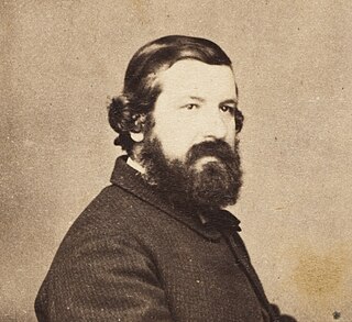
Sir Johann Franz Julius von Haast was a German-born New Zealand explorer, geologist, and founder of the Canterbury Museum in Christchurch.

Haast is a small town in the Westland District territorial authority on the West Coast of New Zealand's South Island. The township is beside the Haast River, 3 kilometres (2 mi) south of Haast Junction, on State Highway 6. The Haast region is in Te Wahipounamu – The South West New Zealand World Heritage, a UNESCO World Heritage Site designated in 1990.
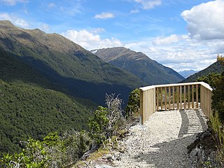
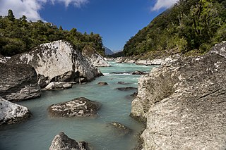
Haast Pass / Tioripatea is a mountain pass in the Southern Alps of the South Island of New Zealand. Māori used the pass in pre-European times.

Wānaka is a popular ski and summer resort town in the Otago region of the South Island of New Zealand. At the southern end of Lake Wānaka, it is at the start of the Clutha River and is the gateway to Mount Aspiring National Park.

Mount Aspiring / Tititea is New Zealand's 23rd-highest mountain. The peak's altitude of 3,033 metres (9,951 ft) makes it the country's highest outside the Aoraki / Mount Cook region.

The Lewis River is a river in the Canterbury region of New Zealand. The valley of this river forms the southeastern approach to Lewis Pass; the river is thus adjacent to State Highway 7. The Lewis River is a tributary of the Boyle River. The Nina River flows into the Lewis River a few kilometres upstream from the confluence with the Boyle River. Land Information New Zealand lists the name of the river as "not official", i.e. the name is not confirmed by the New Zealand Geographic Board. It was named for the surveyor Henry Lewis, who discovered the pass in 1860 alongside his colleague Christopher Maling. Later in 1860, the river was named by Julius von Haast during his own expedition; von Haast became the brother-in-law of Lewis' daughter in 1866.
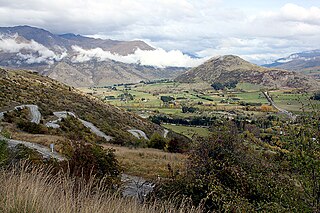
The Crown Range is a mountain range that lies to the east of the Wakatipu Basin in Otago, New Zealand. It is noted for two features, the Cardrona Alpine Resort, on the slopes of the 1900 metre Mount Cardrona, and a highway, known as the Crown Range Road, which winds steeply between Arrow Junction, just south of Arrowtown, and Wānaka to the north.

Mount Tasman is New Zealand's second-highest mountain, rising to a height of 3,497 metres (11,473 ft). It is located in the Southern Alps of the South Island, four kilometres to the north of its larger neighbour, Aoraki / Mount Cook. Unlike Aoraki / Mount Cook, Mount Tasman sits on the South Island's Main Divide, on the border between Aoraki / Mount Cook National Park and Westland Tai Poutini National Park. It is the highest point in Westland District.
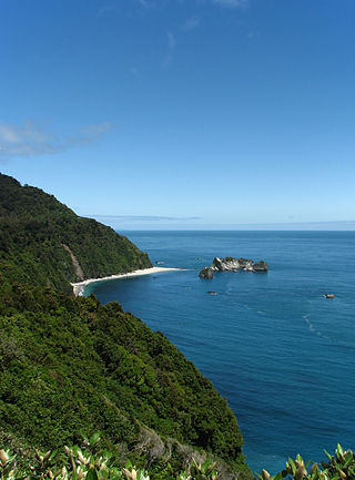
Knights Point is on the West Coast of New Zealand's South Island.

Mount Burnett is a hill in Kahurangi National Park, in Golden Bay / Mohua, New Zealand.

The Paparoa Range is a mountain range in the West Coast region of New Zealand's South Island. It was the first New Zealand land seen by a European – Abel Tasman in 1642. Part of the range has the country's highest protection as a national park; the Paparoa National Park was established in 1987. Within that park, the Cave Creek disaster occurred in 1995.
The Burke River is a river of New Zealand's South Island, located in Mount Aspiring National Park. It flows east for 19 kilometres (12 mi) from close to the Mueller Pass, reaching the Haast River 10 kilometres (6 mi) south of the Haast Pass.
The Waiatoto River is a river of the West Coast of New Zealand's South Island. Formed from several small rivers which are fed by glaciers surrounding Mount Aspiring / Tititea, it flows north along a valley flanked in the west by the Haast Range before turning northwest to reach the Tasman Sea 20 kilometres (12 mi) southwest of Haast. Much of the river's length is within Mount Aspiring National Park.

Mount Haast is a mountain summit located in the Southern Alps / Kā Tiritiri o te Moana, in the Westland District of New Zealand. The mountain was named after the German-born geologist Julius von Haast by James Mackay (1831–1912).
Mount Haast may refer to the following peaks in New Zealand:

The Butler Range, also known as North Butler Range, is a range located in the Westland District of the West Coast Region on the South Island of New Zealand. The range has also been known as Peaks of the Mist Range.

Roaring Billy Falls is a waterfall in Mount Aspiring National Park, Westland District, New Zealand. It is located in the Haast River valley, around 30 km (19 mi) inland from Haast, near Eighteen Mile Bluff on State Highway 6. The falls are a 30-metre-high (98 ft) cascade on The Roaring Billy stream. The bottom of the cascade is at an elevation of around 80 metres (262 ft) where it flows into the Haast River.

Thunder Creek Falls is a waterfall in Mount Aspiring National Park, Westland District, New Zealand. It is located in the Haast River valley, around 52 kilometres (32 mi) inland from Haast, near the Gates of Haast bridge on State Highway 6. The falls are about 28 metres (92 ft) high and the base is at an elevation of around 120 metres (390 ft) where it flows into the Haast River.

Ship Creek is a small river that flows into an area of coastal swamp forest on the West Coast of New Zealand's South Island. Ship Creek is approximately 11 km (6.8 mi) long and flows northwest from catchment areas on the slopes of Bald Hill, reaching the Tasman Sea around 20 km (12 mi) north-east of Haast. Near the mouth of Ship Creek, there are short walks around dune lakes and ancient kahikatea swamp forest.

Brown River is a river in Tasman, New Zealand.


