Mount Rothwell

Last updated
Mount Rothwell
Victoria
Australia Victoria metropolitan Melbourne location map.svg
Red pog.svg
Mount Rothwell
Coordinates 37°52′52″S144°26′29″E / 37.88112°S 144.44142°E / -37.88112; 144.44142 Coordinates: 37°52′52″S144°26′29″E / 37.88112°S 144.44142°E / -37.88112; 144.44142
Established 1850
Postcode(s) 3211
Elevation 22 m (72 ft)
Location
LGA(s)
State electorate(s)
Federal Division(s)
Localities around Mount Rothwell:
Balliang Quandong Mambourin
Anakie Mount Rothwell Werribee
Lara Little River Little River

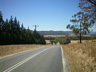
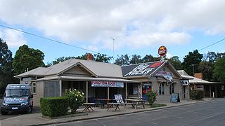
Mount Rothwell is a locality in Victoria, Australia, located to the north east of the You Yangs hills, between Bacchus Marsh and Werribee.

You Yangs mountain in Australia

The You Yangs are a series of granite ridges that rise to 319m above the Werribee Plain approximately 55 km south-west of Melbourne and 22 km north-east of Geelong, in Victoria, Australia. The main ridge runs roughly north–south for about 9 km, with a lower extension running for about 15 km to the west. Much of the southern parts of the ranges are protected by the You Yangs Regional Park.

Bacchus Marsh Town in Victoria, Australia

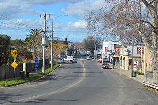
Bacchus Marsh is an urban centre and suburban locality in Victoria, Australia located approximately 50 kilometres (30 mi) north west of the state capital Melbourne and 14 kilometres (9 mi) west of Melton at a near equidistance to the major cities of Melbourne, Ballarat and Geelong. The population of the Bacchus Marsh urban area was 20,345 at the 2016 Census. Bacchus Marsh is the largest urban area in the local government area of Shire of Moorabool.

It is the location of the Mount Rothwell wildlife sanctuary and the historic Mount Rothwell homestead, built in 1873 for Pastoralist Robert Chirnside, (listed on the Victorian Heritage Register (H1107), [1] inherited on his father's death in 1918 by his grandson Dr James Chirnside, and occupied by the Chirnside family until about 2000. [2]

Victorian Heritage Register heritage register of Victoria, Australia

The Victorian Heritage Register (VHR) lists places deemed to be of cultural heritage significance to the State of Victoria, Australia. It has statutory weight under the Heritage Act 1995 which established Heritage Victoria as the State Government listing and permit authority. Listing on the Victorian Heritage Register is separate from listing by a local Council or Shire, known as a Heritage Overlay. Heritage Victoria is currently part of the Department of Environment, Land, Water and Planning of the Government of Victoria, Australia. Heritage Victoria reports to the Heritage Council who approve recommendations to the Register and hear appeals when a registration is disputed. The Council also hears appeals by an owner to a permit issued by Heritage Victoria. The Minister for Planning is the responsible Minister for Heritage Victoria and the Heritage Act 1995. As of 2013, there were over 2,200 places and objects listed on the VHR.

The homestead was used for filming of the 2003 Ned Kelly , [3] and was purchased in 2000 along with the estate by the Mount Rothwell Biodiversity Interpretation Centre. [4]

<i>Ned Kelly</i> (2003 film) 2003 film by Gregor Jordan

Ned Kelly is a 2003 Australian historical drama film based on Robert Drewe's 1991 novel Our Sunshine. Directed by Gregor Jordan, the film's adapted screenplay was written by John Michael McDonagh. The film dramatises the life of Ned Kelly, a legendary bushranger and outlaw who was active mostly in Victoria, the colony of his birth. In the film, Kelly, his brother Dan, and two other associates—Steve Hart and Joe Byrne—form a gang of Irish Australians in response to Irish and English tensions that arose in 19th century Australia. Heath Ledger stars in the title role, with Orlando Bloom, Naomi Watts and Geoffrey Rush.

Mount Rothwell Biodiversity Interpretation Centre is the largest feral-predator-free ecosystem in Victoria, Australia. It is located just north of the You Yangs, near the town of Little River.

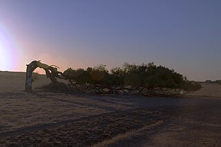
Nearby is the Mount Rothwell Aboriginal stone arrangement known as Wurdi Youang [5] and the ruins of the Mount Rothwell Hotel. [6]

Wurdi Youang mountain in Victoria, Australia

Wurdi Youang is an Aboriginal stone arrangement located off the Little River – Ripley Road at Mount Rothwell, near Little River, Victoria. The site was acquired by the Indigenous Land Corporation on 14 January 2000 and transferred to the Wathaurong Aboriginal Co-operative on 17 August 2006.

Related Research Articles

Wurundjeri ethnic group

The Wurundjeri are indigenous descendants of the people of the Indigenous Australian nation of the Wurundjeri language group, in the Kulin alliance. They occupied the Birrarung Valley. Its tributaries are the present location of Melbourne.

Chirnside Park, Victoria Suburb of Melbourne, Victoria, Australia

Chirnside Park is a suburb in Melbourne, Victoria, Australia, 33 km north-east from Melbourne's central business district. Its local government area is the Shire of Yarra Ranges. At the 2006 Census, Chirnside Park had a population of 9092.

Werribee, Victoria Suburb of Melbourne, Victoria, Australia

Werribee is a suburb of Melbourne, Victoria, Australia, 32 km south-west of Melbourne's Central Business District, located within the City of Wyndham local government area. Werribee recorded a population of 40,345 at the 2016 Census.

Little River, Victoria Town in Victoria, Australia

Little River is a town in Victoria, Australia, that is located about 49 kilometres (30 mi) south-west of the Melbourne central business district, located within the Cities of Greater Geelong and Wyndham local government areas. Little River recorded a population of 1,322 at the 2016 Census.

Lara, Victoria Town in Victoria, Australia

Lara is a small town north of the City of Greater Geelong, 18 km north-east of the Geelong CBD, inland from the Princes Freeway to Melbourne.

Anakie, Victoria Town in Victoria, Australia

Anakie is a rural township between Geelong, Victoria, and Bacchus Marsh, Victoria, Australia. At the 2016 census, Anakie and the surrounding area had a population of 690. The town is divided between the City of Greater Geelong and Golden Plains Shire local government areas.

Winchelsea, Victoria Town in Victoria, Australia

Winchelsea is a town in Victoria, Australia. The town is located in the Surf Coast Shire local government area, the suburb or locality of Winchelsea is predominantly within Surf Coast Shire with a small section within the Colac Otway Shire. Winchelsea is located on the Barwon River 115 km south-west of Melbourne and close to Geelong.

Greenough, Western Australia Town in Western Australia

Greenough is a historical settlement situated in a floodplain 400 kilometres north of Perth, Western Australia and 24 kilometres south of Geraldton on the Brand Highway. The settlement's historical buildings are mostly built of local limestone and date to the second half of the 19th century. A sizeable collection of these are owned and managed by the National Trust of Australia. A remarkable feature of the Greenough Flats is its windswept trees, some of which are bent a full 90 degrees due to the prevailing coastal winds.

Werribee Park is the estate of a historical building in Werribee, Victoria, Australia.

Batesford, Victoria Town in Victoria, Australia

Batesford is a small township located approximately 10 kilometres west of Geelong and 67 kilometres south-west of the state capital, Melbourne.

Mount Elephant mountain

Mount Elephant is a 380-metre-high (1,250 ft) conical breached scoria cone formed by a dormant volcano, located 1 km from the town of Derrinallum in southwestern Victoria, Australia. It is a prominent landmark that forms the eastern gateway to the Kanawinka Geopark from the Hamilton Highway at Derrinallum.

Tirari Desert desert in central Australia

The Tirari Desert is a 15,250 square kilometres (5,888 sq mi) desert in the eastern part of the Far North region of South Australia. It stretches 212 km from north to south and 153 km from east to west.

Franklinford, Victoria Town in Victoria, Australia

Franklinford is a small community in the Central Highlands of Victoria, Australia, located in the Shire of Hepburn. It was the site chosen by Edward Stone Parker to build the Loddon Aboriginal Protectorate station at Franklinford in January 1841 which was an important focus of the Dja Dja Wurrung people from 1841 until they were forcible resettled in 1864. It is located on the Midland Highway.

Mount William stone axe quarry indigenous national heritage site in Lancefield VIC

The Mount William stone axe quarry is an Aboriginal archaeological site in Central Victoria, Australia. It is located 9 km northeast of Lancefield, off Powells Track, 10 km north of Romsey and 78 km from Melbourne. Known as Wil-im-ee Moor-ring, meaning 'axe place' in the Woiwurrung language, the greenstone quarry was an important source of raw material for the manufacture of greenstone ground-edge axes, which were traded over a wide area of south-east Australia.

Mundabullangana, Western Australia locality in Western Australia

Mundabullangana is a settlement in Western Australia, located approximately 100 km south-west of Port Hedland. It is the site of a 225,000 hectare cattle station. Mundabullangana is more commonly known as Munda Station.

Aboriginal sites of Victoria

Aboriginal sites of Victoria form an important record of human occupation for probably more than 40,000 years. They may be identified from archaeological remains, historical and ethnographic information or continuing oral traditions and encompass places where rituals and ceremonies were performed, occupation sites where people ate, slept and carried out their day to day chores, and ephemeral evidence of people passing through the landscape, such as a discarded axe head or isolated artefact.

Mount Welcome Station

Mount Welcome Station is a pastoral lease that once operated as a sheep station but is now operated as a cattle station in Western Australia.

Ombersley, Victoria Suburb of Colac Otway Shire, Victoria, Australia

Ombersley is a rural locality in Victoria, Australia. Most of the locality is in Colac Otway Shire, with a portion being in adjacent Surf Coast Shire. In the 2016 census, Ombersley had a population of 97.

References

  1. Mount Rothwell Homestead, Victorian Heritage Database place details - 21/6/2016
  2. Ronald, Heather. 1978, Wool Past the Winning Post: A History of the Chirnside Family, Landvale Enterprises, Melbourne.
  3. OLD ESTATES FOR SALE
  4. "Little River Earth Sanctuary Story". Archived from the original on 2005-08-28. Retrieved 2015-10-08.
  5. Lane, L. and Fullagar, R. (1980) Previously unrecorded Aboriginal stone alignments in Victoria. Records of the Victoria Archaeological Survey, No. 10, pp. 134-151
  6. “Ruins of Mt. Rothwell Hotel, Little River,” Wyndham History, accessed October 23, 2016