K2, at 8,611 metres (28,251 ft) above sea level, is the second-highest mountain on Earth, after Mount Everest at 8,849 metres (29,032 ft). It lies in the Karakoram range, partially in the Gilgit-Baltistan region of Pakistan-administered Kashmir and partially in the China-administered Trans-Karakoram Tract in the Taxkorgan Tajik Autonomous County of Xinjiang.

Mount Everest, known locally as Sagarmatha or Qomolangma, is Earth's highest mountain above sea level, located in the Mahalangur Himal sub-range of the Himalayas. The China–Nepal border runs across its summit point. Its elevation of 8,848.86 m was most recently established in 2020 by the Chinese and Nepali authorities.

Longs Peak is a mountain in the northern Front Range of the Rocky Mountains of North America. The 14,256-foot (4345.22 m) fourteener is located in the Rocky Mountain National Park Wilderness, 9.6 miles (15.5 km) southwest by south of the Town of Estes Park, Colorado, United States. Longs Peak is the northernmost fourteener in the Rocky Mountains of Colorado and the highest point in Boulder County and Rocky Mountain National Park. The mountain was named in honor of explorer Stephen Harriman Long and is featured on the Colorado state quarter.

Aconcagua is a mountain in the Principal Cordillera of the Andes mountain range, in Mendoza Province, Argentina. It is the highest mountain in the Americas, the highest outside Asia, and the highest in both the Western Hemisphere and the Southern Hemisphere with a summit elevation of 6,961 metres (22,838 ft). Despite its impressive size and stature, it is only the 189th highest mountain in the world. It lies 112 kilometres northwest of the provincial capital, the city of Mendoza, about five kilometres from San Juan Province, and 15 km (9 mi) from Argentina's border with Chile. The mountain is one of the Seven Summits of the seven continents.

Dhaulagiri, located in Nepal, is the seventh highest mountain in the world at 8,167 metres (26,795 ft) above sea level, and the highest mountain within the borders of a single country. It was first climbed on 13 May 1960 by a Swiss-Austrian-Nepali expedition. Annapurna I is 34 km (21 mi) east of Dhaulagiri. The Kali Gandaki River flows between the two in the Kaligandaki Gorge, said to be the world's deepest. The town of Pokhara is south of the Annapurnas, an important regional center and the gateway for climbers and trekkers visiting both ranges as well as a tourist destination in its own right.

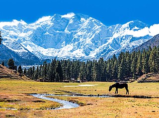
Nanga Parbat, known locally as Diamer, is the ninth-highest mountain on Earth and its summit is at 8,126 m (26,660 ft) above sea level. Lying immediately southeast of the northernmost bend of the Indus River in the Gilgit-Baltistan region of Pakistan-administered Kashmir, Nanga Parbat is the westernmost major peak of the Himalayas, and thus in the traditional view of the Himalayas as bounded by the Indus and Yarlung Tsangpo/Brahmaputra rivers, it is the western anchor of the entire mountain range.

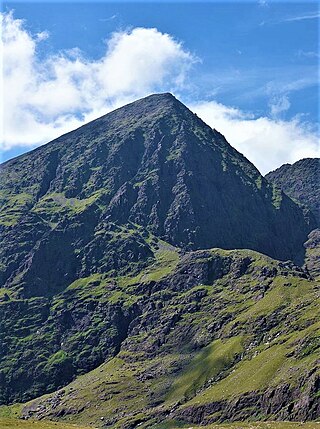
Carrauntoohil, Carrauntoohill or Carrantuohill is the highest mountain in Ireland at 1,038.6 metres. It is on the Iveragh Peninsula in County Kerry, close to the centre of Ireland's highest mountain range, MacGillycuddy's Reeks. Carrauntoohil is composed mainly of sandstone, whose glaciation produced distinctive features on the mountain such as the Eagle's Nest corrie and some deep gullies and sharp arêtes in its east and northeastern faces that are popular with rock and winter climbers.

Kamet is the second-highest mountain in the Garhwal region of Uttarakhand, India, after Nanda Devi. It is the 29th highest mountain in the world. It lies in the Chamoli District of Uttarakhand. Its appearance resembles a giant pyramid topped by a flat summit area with two peaks.

Mount Caubvick is a mountain located in Canada on the border between Labrador and Quebec in the Selamiut Range of the Torngat Mountains. It is the highest point in mainland Canada east of the Rockies. The mountain contains a massive peak that rises sharply from nearby sea level. Craggy ridges, steep cirques and glaciers are prominent features of the peak.

Baruntse is a mountain in the Khumbu region of eastern Nepal, crowned by four peaks and bounded on the south by the Hunku Glacier, on the east by the Barun Glacier, and on the northwest by the Imja Glacier. It is considered as one of the best preparation peaks in the Himalayas for climbers readying themselves for eight-thousanders, however the mountain has a low success rate due to its technical difficulties, steep slopes and unpredictable weather conditions. It is open for beginners, but requires the use of fixed ropes to climb.

El Altar or Capac Urcu is an extinct volcano on the western side of Sangay National Park in Ecuador, 170 km (110 mi) south of Quito, with a highest point of 5,319 m (17,451 ft). Spaniards named it so because it resembled two nuns and four friars listening to a bishop around a church altar. In older English sources it is also called The Altar.

The Trango Towers are a family of rock towers situated in the Gilgit-Baltistan region, in the northern part of Pakistan. The Towers have some of the world's largest cliffs and offer some of the most challenging big wall climbing opportunities. Each year, climbers from around the world embark on expeditions to the Karakoram region to climb these granite faces. The Trango Towers are situated to the north of the Baltoro Glacier and are part of the Baltoro Muztagh, which is a sub-range within the Karakoram mountain range. The highest point within the group is the summit of Great Trango Tower at 6,286 m (20,623 ft), the east face of which features the world's greatest nearly vertical drop.

Illimani is the highest mountain in the Cordillera Real of western Bolivia. It lies near the cities of El Alto and La Paz at the eastern edge of the Altiplano. It is the second highest peak in Bolivia, after Nevado Sajama, and the eighteenth highest peak in South America. The snow line lies at about 4,570 metres (15,000 ft) above sea level, and glaciers are found on the northern face at 4,982 m (16,350 ft). The mountain has four main peaks; the highest is the south summit, Nevado Illimani, which is a popular ascent for mountain climbers.

Huayna Potosí is a mountain in Bolivia, located near El Alto and about 25 km north of La Paz in the Cordillera Real.

Mount Bishop is a mountain located on the northern border of Mount Seymour Provincial Park in the District of North Vancouver, British Columbia. It is a part of the North Shore Mountains, rising from the shores of Indian Arm to a summit of 1,509 metres (4,951 ft). Mount Bishop is a rocky summit with bluffs and old growth on its lower slopes.

The Latok group is a cluster of large and dramatic rock peaks in the Panmah Muztagh, part of the central Karakoram mountain range in Pakistan. They lie just to the east of the Ogre group, dominated by Baintha Brakk. To the immediate south of the Latok group lies the Baintha Lukpar Glacier, a small tributary of the Biafo Glacier, one of the main glaciers of the Karakoram. On the north side, lies the Choktoi Glacier.

Mount Tanigawa is a 1,977 m (6,486 ft) mountain on the border of Gunma Prefecture and Niigata Prefecture in Japan. It is one of the 100 famous mountains in Japan.

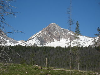
Williams Peak, at 10,636 feet (3,242 m) high is the 6th highest peak in the Sawtooth Mountains of Idaho and is located within the Sawtooth Wilderness portion of the Sawtooth National Recreation Area. The peak lies 0.75 mi (1,210 m) north-northeast of Thompson Peak, the highest peak in the range.

Alcazaba is a mountain in Spain. Standing at 3,369 m (11,053 ft), it is the third highest mountain of the Sierra Nevada range and the fifth in the Iberian Peninsula. The impressive north face can be seen from the town of Granada. The name Alcazaba derives from the word "fortification" in Arabic.


