Khammam, also known as Khammamett is the city in Khammam district of the Indian state of Telangana. It is the fourth largest city in the state. It is the headquarters of the Khammam district and Khammam mandal also. It is located about 193 kilometres (120 mi) east of the state capital, Hyderabad, 61 kilometres (38 mi) from Suryapet, 120 kilometres (75 mi) from Warangal and also it is located about 121 kilometres (75 mi) North of the Andhra Pradesh state capital, Amaravathi. The river Munneru flows on the western side of the city. As of 2011 census of India, Khammam urban agglomeration has a population of 3,13,504. However, on 19 October 2012, the civic body of Khammam was upgraded to Municipal corporation Post upgradation to corporation Khammam population is approximated to be 3,07,000.

Karimnagar is a city and District Headquarters in the Indian state of Telangana. Karimnagar is a major urban agglomeration and fifth largest City in the state. It is governed by Municipal corporation and is the headquarters of the Karimnagar district It is situated on the banks of Manair River, which is a tributary of the Godavari River.It is the fourth largest and fastest growing urban settlement in the state, according to 2011 census. It has registered a population growth rate of 45.46% and 38.87% respectively over the past two decades between 1991 and 2011, which is highest growth rate among major cities of Telangana. It serves as a major educational and health hub for the northern districts of Telangana. It is a major business center and widely known for Granite and Agro-based industries.It is also called as "City of Granites"

Telangana is a state in India situated on the centre-south stretch of the Indian peninsula on the high Deccan Plateau. It is the twelfth largest state and the twelfth-most populated state in India with a geographical area of 112,077 km2 (43,273 sq mi) and 35,193,978 residents as per 2011 census. On 2 June 2014, the area was separated from the northwestern part of Andhra Pradesh as the newly formed 29th state with Hyderabad as its historic permanent capital. Its other major cities include Warangal, Nizamabad, Khammam and Karimnagar. Telangana is bordered by the states of Maharashtra to the north, Chhattisgarh to the east, Karnataka to the west, and Andhra Pradesh to the east and south. The terrain of Telangana region consists mostly of hills, mountain ranges, and thick dense forests covering an area of 27,292 km2 (10,538 sq mi). As of 2019, the state of Telangana is divided into 33 districts.

Warangal is one of the two metropolitan cities in the Indian state of Telangana. It is the district headquarters of Warangal Urban District. Warangal is the second most populous city in the state, with the first being state capital, Hyderabad. As of 2011 census of India, it had a population of 753,538 and an area of 471 km2 (182 sq mi).

Nizamabad is a city in the Indian state of Telangana. Nizamabad is a major urban agglomeration and third largest city in the state. It is governed by municipal corporation and is the headquarters of the Nizamabad district. Although previously part of Hyderabad State and then Andhra Pradesh state, Nizamabad became a part of the newly formed state of Telangana by the Andhra Pradesh Reorganisation Act, 2014.
Adilabad, a municipality, and the headquarters of Adilabad district, is a city in Adilabad district of the Indian state of Telangana. Telugu, Marathi and Urdu are the native languages of Adilabad. Adilabad is famous for its rich cultivation of cotton. Hence, Adilabad is also referred as "White Gold City". It is located about 304 kilometres (189 mi) north of the state capital, Hyderabad, 150 kilometres (93 mi) from Nizamabad and 196 kilometres (122 mi) from Nagpur. Adilabad is called as the "Gateway to South India".
Kamareddy is a city and headquarters of eponymous district in Telangana state in India.

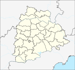
Karimnagar district is one of the 33 districts of the Indian state of Telangana. Karimnagar city is its administrative headquarters. The district shares boundaries with Peddapalli, Jagityal, Sircilla, Siddipet, Jangaon, Warangal urban and Jayashankar Bhupalapally districts.

Warangal Urban District is located in the northern region of the Indian state of Telangana. The district headquarters are located at Hanamkonda.
Jangaon is a town and the district headquarters of Jangaon district in the Indian state of Telangana. It is also the mandal and divisional headquarters of Jangaon Mandal and Jangaon revenue division respectively. It is about 85 kilometres (53 mi) from the state capital Hyderabad. It lies on the National Highway 163.

The Kakatiya Medical College (KMC) is one of the medical schools of Telangana, located in Warangal under the gamut of Kaloji Narayana Rao University of Health Sciences and the Medical Council of India (MCI).

Mahabubabad is a town and the district headquarters of Mahabubabad district in the Indian state of Telangana. It is on the west bank of the Munneru, which is one of the tributaries of the River Krishna. Mahabubabad is known for the Bayyaram Mines.
Kothapalli Jayashankar. popularly known as Professor Jayashankar was an Indian academic and Social Activist. He was a leading ideologue of Telangana Movement.. He has been fighting for a separate state since 1952. He often stated that unequal distribution of river water was the root cause of separate Telangana movement. He was the former Vice-Chancellor of Kakatiya University and an activist in the Separate Telangana Movement. Prof. Jayashankar Telangana State Agricultural University (PJTSAU) named in honour and memory of Professor Jayashankar, is the only Farm University of Telangana state which came into being in the event of the bifurcation from Acharya N. G. Ranga Agricultural University. worked as principal in ckm arts and science college warangal

Veeramalla Prakash Telugu: వీరమల్ల ప్రకాష్ రావు,, popularly known as Telangana Prakash, is a lawyer, writer and the co-founder of Telangana Rashtra Samithi, a Regional Party in India. He worked as a General Secretary and spokesperson in TRS party. He is a policy advisor to the Chief Minister of Telangana and the Chairman of Telangana Water Resources Development Corporation. He played an active role in channelising the Telangana Statehood agitation since the formation of TRS party. He is considered an expert on the irrigation sector and policy making.

Azmeera Chandulal is an Indian politician and Former Tourism and Tribal Welfare Minister of Telangana. Former Member of parliament and also Former Member of Legislative Assembly from Mulugu constituency.

The Indian state of Telangana has a cultural history of about 5,000 years. The region emerged as the foremost centre of culture in Indian subcontinent during the rule of Telugu Kakatiya dynasty and the Turkic Qutb Shahi and Asaf Jahi dynasties—. The rulers' patronage and interest for arts and culture transformed Telangana into a unique multi-cultural region where two different cultures coexist together,thus making Telangana the representative of the Deccan Plateau and its heritage with Warangal and Hyderabad being its epicenter. The regions' major cultural events celebrated are "Kakatiya Festival" and Deccan Festival along with religious festivals Bonalu, Bathukamma, Dasara, Ugadi, Sankranthi, Milad un Nabi and Ramadan.

Mahabubabad is a district in the Indian state of Telangana. It was a part of the Warangal district prior to the re-organisation of districts in the state in October 2016.The district shares boundaries with Suryapet, Khammam, Bhadradri Kothagudem, Warangal Rural, Jayashankar Bhupalpalle and Jangaon districts. It consists of Dornakal, Mahabubabad, Maripeda, Thorrur Municipalities.

Jangaon district is a district in the Indian state of Telangana. It was a part of the Warangal district and Nalgonda district prior to the re-organisation of districts in the state. The district shares boundaries with Suryapet, Yadadri, Warangal Rural, Warangal Urban, Siddipet and Mahabubabad districts.
Sandragudem is a small village/hamlet in the state of Telangana, India. It has a population of 200 living in approximately 60 households, the village is 4 km (2.5 mi) from Govindharaopet mandal and 70 km (43 mi) from Warangal. The village is a part of Karlapally gram panchayath, Govindharaopet mandal. Initially, it was under Warangal district but after the creation of Telangana by bifurcation of Andhra Pradesh, it is now under Jayashanker district.