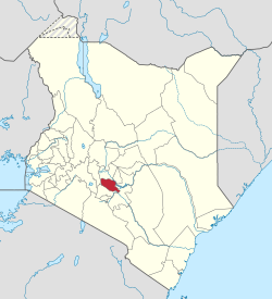
Murang'a County is a county in Central, Kenya in the Mount Kenya region. Its largest town and capital is Murang'a, which was referred to as Fort Hall during the colonial era. The county is inhabited mainly by, and is considered the birthplace of the Gikuyu, the largest ethnic group in Kenya.[1] The county had a population of 1,056,640 as of the 2019 census.[2]
Tea farming in Muranga County.Railway bridge crossing Maragua river.
When missionaries first came to Kenya, they found the Coast Region already inhabited by Portuguese who had taken the coast strategically for trade from Arab powers in the 16th century. The missionaries ventured into Kenya's rugged interior and Murang'a was one of the first places they settled.
One of the main highlights of Murang'a's history, however, is the Mau Mau uprising that was led by the Agikuyu community who consider Murang'a their ancestral origin. Murang'a is thus considered, at least by some, the birthplace of the Kenyan independence movement.
Missionaries had initially been welcomed by Karuri Wagakure who was the chief of Tuthu. They set up the first mission church in Kenya at Murang'a.
Murang'a is also the source of Rivers Maragua, which originates from the heart of the Aberdare Range, Mathioya, Kayahwe, Irati and Muriurio among others.
Additionally, Murang'a is known for its fertile soil and good climate, which are good for farming. Among the food crops grown in this county include maize, beans, sweet potatoes, arrow roots, pumpkins, and bananas.
Tea and coffee are the county's main cash crops.[3]
County government
The Constitution of Kenya (2010) created 47 regional governments with the formerly larger Murang'a district as a county. The County Government has two arms, and these are; the County Assembly and the County Executive.[4]
.[citation needed] The county uses the code 021 on the national coding scheme and locals famously refer to the county as Metumi.
Executive
From 2013 to 2022, the Executive arm was headed by Hon. Mwangi wa Iria, who was deputized by Hon Gakure Monyo during his first term and Hon Maina Kamau in his second term. In his last term, Mwangi wa Iria was assisted by a team of ministerial members referred to as County Executive Committee (CEC), which had ten other members. The individuals and their portfolios included:
CEC member
Portfolio
Hon. Githirwa M. Macharia
Environment & Natural Resources
Hon. Muiruri Maina Edward
Youth,Sports,Gender,Culture,social services Co-operatives & special Programmes.
Hon. George M. Kamau
Finance,IT & Economic Planning
Hon. Nyambura Macharia
Public Service
Hon. Albert Mwaniki
Agriculture, Livestock & Irrigation
Hon. Eng. Amos Njoroge
Energy Transport & Infrastructure Development
Hon. David W. Waweru
Commerce,Trade, Industry & Investment
Hon. Dr. Susan Muthoni Magada
Health, water & sanitation
Hon. Gerishon Nyagia
Education & Technical Training
Hon. Sarah Masaki
Lands, Housing & Planning
Following the end of the two terms of governorship by Mwangi wa Iria as stipulated by the Kenyan Law, Murang'a County voters voted in Dr. Francis Irungu Kang’ata as their second Governor in August 2022 general elections. Governor Francis Irungu took Oath of Office on 25 August 2022,[5] together with his deputy Stephen Mburu Munania, who became the third Deputy Governor of Murang'a County.[6]
County Assembly
Murang’a County Assembly is located in Murang’a town along Kiria-ini Road. The Assembly is housed in the building formerly occupied by the Municipal Council of Murang’a.
Murang’a County has 35 MCAs, a speaker and 16 nominated members. The position of the Speaker of the Assembly was formerly held by Hon. Leonard Nduati, deputized by Hon. Moses Gachui. Johnson Mukuha was voted in as the new Speaker in September 2022 by the majority of Members of County Assembly (MCAs).[7] The Assembly is administratively managed by Clerk to the Assembly, a post formerly occupied by Peter Ndegwa Mbue. The current Clerk to the Assembly is Mr. Kuria Thuita.[8]
Currently, there is only one public university in the county, known as Murang’a University of Technology (MUT). MUT was established in September 2011 via Murang’a University College order legal notice No. 129 September 2011 as a constituent College of Jomo Kenyatta University of Agriculture and Technology. MUT is the successor of Murang’a University College and Murang'a College of Technology. The university currently operates under the provision of the Universities Act 2012 CAP 210 B of the laws of Kenya.
The university is located 1.5km from Murang'a town, 85km North East of Nairobi, 70km South East of Nyeri and 50km South West of Embu.
There is also Kenya Medical Training College Murang’a Campus (KMTC). This Medical Training College is situated in Murang’a town, approximately 1km from the town center. Having started in 1950s as a training Centre for Mid-wives, the college morphed into training nurses and gradually started offering Certificate and Diploma Courses in Nursing and Mental Health Psychiatry. Murang'a county also has a teachers training college,Murang'a Teachers college in Makuyu. The college offers training for primary school teachers. Another public institution is the Michuki Technical Training Institute which is located near Karugia Shopping Centre in Kangema subcounty.
In 2022 Murang'a Technical Institute a TVET institute was opened in Maragua Town and offers diplomas and certificates in various trade
Economy
Murang’a County's economy is deeply rooted in agriculture, real estate and agro-processing. Tea, coffee, macadamia, avocado and dairy dominate trade—with avocado orchards yielding ~KSh 1.5 M/acre/year and coffee and tea fuelled by contract-farming schemes . There are major agri‑businesses like KTDA tea factories; of which Murang’a County is one of Kenya's top tea producer, earning the highest tea revenue nationally over the years. In 2024, local farmers received over KSh 17.8 billion in earnings, accounting for approximately 20% of KTDA's total earnings, highest of any county,[11] with bonuses exceeding KSh 52 per kilo. The thriving tea sector drives rural livelihoods, trade, and investment in value-added processing and cooperative societies.
Kakuzi LimitedPLC grows avocados, macadamia, blueberries, tea, and livestock—supporting 3,000+ smallholder farmers via its Avocado Smallholder Programme—and recently launched a macadamia oil plant, boosting value-addition and employment. Del Monte Kenya with pineapple farms in Murang’a, is a major exporter of canned pineapple and juice concentrates. It partners with Murang’a farmers through out-grower schemes and operates CSR initiatives, value addition, rural employment and infrastructure projects. Kakuzi supports farmers through various programs.[12]
Real estate around Thika Greens, Kenol town and Murang’a town is booming. Thika Greens Golf Resort hosted the Murang’a Investment Forum (June 13–14, 2025), where plans for industrial parks, agro-processing zones, and a 500‑acre export processing zone were unveiled with an aim to catalyze investment. Kenol Town (positioned on the Nairobi–Embu–Meru highway and the new Kenol–Isiolo superhighway) is seeing rising demand for residential and commercial lands. Murang’a town is also experiencing a boom in real estate and infrastructure development.
The synergy between booming real estate, industrialization and agriculture (with expanding orchards and processing zones) is transforming Murang’a into a dynamic commerce hub, catalyzed by policy support, private investment and infrastructure such as dual carriageways and smart-market upgrades.
Paramount Chief Karuri wa Gakure - A colonial tribal leader who died in 1916 who at one time was senior most chief in Kiambu, Murang'a and Nyeri Counties.
Bildad Kaggia - A nationalist, activist, and politician. One of the Kapenguria Six prominent Kenyan nationalists.
Kenneth Matiba – A Politician, an activist, former Cabinet Minister, First Kenyan Opposition Leader, Businessman and civil servant.
Dr. Julius Gikonyo Kiano- First black Kenyan to get a PhD degree, one founding figures of the Republic of Kenya, member of the initial independent Kenya cabinet and long time cabinet minister; one time frontrunner for post of Secretary of UNCTAD. Jointly with Tom Mboya organised with assistance of John F. Kennedy, initially as Senator and briefly as President of US, the educational scholarships for many Kenyans who furthered their education in USA in the late 1950s and early 1960s, referred as the Kennedy Airlifts program.
Charles Rubia – First African Mayor of Nairobi, former Member of Parliament for Starehe Constituency, former Cabinet Minister in Kenyatta's Regime and a champion for Multi-party Democracy in Kenya, which he is mostly remembered for.
Samuel Kamau Macharia - Also known as S.K. Macharia, a billionaire businessman who is the founder and chairman of Royal Media Services, one of Africa's largest private radio and television networks.
Chris Kirubi - A billionaire businessman, an entrepreneur, and an industrialist.
Peter Munga – A billionaire Businessman, Entrepreneur, the founder and Chairman of Equity Group.
Dr. James Mwangi – A billionaire business executive, an entrepreneur, and Current C.E.O of Equity Group.
↑ Assembly, Murang'a County. "Clerk of the County Assembly". Murang'a County Assembly. Archived from the original on 24 October 2022. Retrieved 23 October 2022.
{{Kigumo town serves as the administrative centre of Kigumo Constituency.[1] According to the 2019 census, the population was 92,814.[2] Mathioya had a 2019 population of 92,814 and a projected 2024 population of around 95,200.[3]
This page is based on this Wikipedia article Text is available under the CC BY-SA 4.0 license; additional terms may apply. Images, videos and audio are available under their respective licenses.