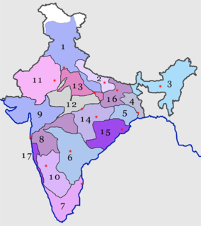
Namalagundu

Last updated

Namalagundu
India Telangana location map.svg
Red pog.svg
Namalagundu
Location in Telangana, India
India location map.svg
Red pog.svg
Namalagundu
Namalagundu (India)
Coordinates: 17°25′29″N78°30′49″E / 17.4247°N 78.5136°E / 17.4247; 78.5136 Coordinates: 17°25′29″N78°30′49″E / 17.4247°N 78.5136°E / 17.4247; 78.5136
CountryFlag of India.svg  India
State Telangana
District Hyderabad
Metro Hyderabad
Government
  Body Greater Hyderabad Municipal Corporation, Secunderabad
Languages
  Official Telugu
Time zone UTC+5:30 (IST)
PIN
500 061
Vehicle registration TS
Lok Sabha constituency Secunderabad
Vidhan Sabha constituency Secunderabad
Planning agency Greater Hyderabad Municipal Corporation, Secunderabad
Website www.ghmc.gov.in

Namalagundu is a residential suburb of Secunderabad, India. It was one of the first residential layout approved by MCH in 1965. [1] The area is located at about 1.5 km from the Secunderabad Station. The neighbourhood surroundings of Namalagundu include Chilkalguda, Sitaphalmandi, Warasiguda and Mylargadda. [2]

Secunderabad Twin City of Hyderabad in Telangana, India

Secunderabad is the twin city of Hyderabad located in the Indian state of Telangana. Named after Sikandar Jah, the third Nizam of the Asaf Jahi dynasty, Secunderabad was established in 1806 as a British cantonment. Although both the cities are together referred to as the twin cities, Hyderabad and Secunderabad have different histories and cultures, with Secunderabad having developed directly under British rule until 1948, and Hyderabad as the capital of the Nizams' princely state of Hyderabad.

India Country in South Asia

India, also known as the Republic of India, is a country in South Asia. It is the seventh largest country by area and with more than 1.3 billion people, it is the second most populous country as well as the most populous democracy in the world. Bounded by the Indian Ocean on the south, the Arabian Sea on the southwest, and the Bay of Bengal on the southeast, it shares land borders with Pakistan to the west; China, Nepal, and Bhutan to the northeast; and Bangladesh and Myanmar to the east. In the Indian Ocean, India is in the vicinity of Sri Lanka and the Maldives, while its Andaman and Nicobar Islands share a maritime border with Thailand and Indonesia.

Chilkalguda Neighbourhood in Hyderabad, Telangana, India

Chilakalguda is a residential suburb of Secunderabad, India.

Contents

Etymology

Originally there were two huge boulders; one sitting a top of a small hill and another boulder bisecting the road towards Sithafalmandi and Mylargadda. The first boulder has completely disappeared which was behind the current Hanuman Temple and replaced by dwellings. The second boulder was where the current Lord Kalyana Venkateswara temple stands. Both these boulders had huge three vertical lines or Namalu (Telugu) and boulders are called Gundu (Telugu); hence the name Namalagundu. [3]

Transport

A good transport facility is available to the locality. TSRTC buses – 86, 86J 139, 107J and 107V/K from Secunderabad station passes through the area.

Telangana State Road Transport Corporation

Telangana State Road Transport Corporation (TSRTC) is a state-owned corporation that runs transport services within the Indian state of Telangana. It was formed in 2014 by splitting the Andhra Pradesh State Road Transport Corporation. Many other Indian metro towns in Andhra Pradesh, Tamil Nadu, Karnataka, Maharashtra, Goa, Odisha and Chhattisgarh are also linked with the services of TSRTC. It serves about 89.4 lakh passengers every day, having three zones and Services operating through 96 depots.

Secunderabad Junction railway station Railway station in Secunderabad

The Secunderabad Junction railway station, is a major intercity railway station and a commuter rail hub in the Hyderabad urban area. In the city centre, the station is in the South Central Railway zone of Indian Railways. Built in 1874 by the Nizam of Hyderabad during the British era, it was the main station of Nizam's Guaranteed State Railway until the Kachiguda railway station opened in 1916. The station was taken over by Indian Railways in 1951, when NGSR was nationalized. Its main portico and concourse are influenced by Nizamesque architecture. The station, which resembles a fort, is a tourist attraction in the twin cities of Hyderabad and Secunderabad.

The closest MMTS Train station is at Secunderabad and Sitaphalmandi. [4]

Hyderabad Multi-Modal Transport System Transport system of Hyderabad, India

The Hyderabad Multi-Modal Transport System, also known as MMTS, is a suburban rail system in Hyderabad, India. It is a joint partnership of the Government of Telangana and the South Central Railway, and is operated by the latter. The first phase was opened to the public on 9th August 2003 with three lines between Falaknuma and Secunderabad, Hyderabad and Secunderabad and Lingampally and Secunderabad with a total of 44 km of track. In May 2010, Indian Railways decided to take up the 107-km Phase-II project of the MMTS at an estimated cost of Rs. 641 crore. The Railway Board cleared the second phase after the state government agreed to fund two-thirds of the cost. The second phase, which is currently under construction.

Sitaphalmandi Neighbourhood in Hyderabad, Telangana, India

Sitaphalmandi is one of the old suburbs of Secunderabad City in the state of Telangana, India. It is located close to Secunderabad Railway Station and is surrounded by Osmania University in the east, Warasiguda in the south, Secunderabad in the west and Tarnaka in the north. Sitaphalmandi is located about 1.5 km from Secunderabad.

Education

Schools in the locality include Nehru High School, Vedic Vidyalam High School and Amaravathi Grammar High School . [5]

Amaravathi Grammar High School was founded by Mr. Koteshvara Reddy in 1982. It has several branches in Hyderabad, Telangana State in India. Some are at:

Related Research Articles

South Central Railway zone one of the 17 railway zones in India

The South Central Railway is one of the 18 zones of Indian Railways. The jurisdiction of the zone is spread over the states of Maharashtra, Telangana, and some portions of Madhya Pradesh. It has three divisions under its administration, which include Nanded, Secunderabad, Hyderabad.

Warangal Metropolitan city in Telangana, India

Warangal is a city in the Indian state of Telangana. It is the district headquarters of Warangal Urban District. Warangal is the second largest and also Metropolitan City in Telangana after Hyderabad, spreading across 471 km2 (182 sq mi) with a population of 819,406. Warangal City Development Plan is proposed to cover an area of 1805 sq.km with population of about 819,406

Madanapalle City in Andhra Pradesh, India

Madanapalle is a City in Chittoor district of the Indian state of Andhra Pradesh. It is a municipality and the headquarters of Madanapalle mandal and Madanapalle revenue division.

Trimulgherry Suburb in Hyderabad District, Telangana, India

Tirumalagiri is a locality and a Mandal in the city of Secunderabad also it falls under Secunderabad Revenue Division, Earlier is a major suburb of Secunderabad, India. Trimulgherry is the anglicised name for Tirumalagiri. It is in the north of Hyderabad District.

Padmarao Nagar Neighbourhood in Hyderabad, Telangana, India

Padma Rao Nagar, sometimes also called PR Nagar, is a locality in Secunderabad, India, named after Diwan Bahadur Padma Rao Mudaliar. It was the early communities like Mudaliars who started developing the Secunderabad Cantonment commercially. Otherwise, Secunderabad had only large number of tents housing the troops of the British army as told by Mr. Luther in book Lashkar - 200 Years Of Secunderabad. The Mudaliars, who were camp followers of the British, made immense contributions for the growth of education and health care and explained the growth of the Secunderabad Club from a public room. It was previously known as Walker Town during the British raj.

St Josephs Cathedral, Hyderabad Church in India

St Joseph's Cathedral is a Roman Catholic Cathedral in Hyderabad, India. It is the cathedral of the Archdiocese of Hyderabad and one of the most beautiful churches of Hyderabad and Secunderabad cities of Telangana, India.

Warangal Urban district District of Telangana in India

Warangal Urban District is located in the northern region of the Indian state of Telangana. The district headquarters are located at Warangal.
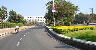
Jubilee Hills Neighbourhood in Hyderabad, Telangana, India

Jubilee Hills is an affluent suburban neighbourhood in west Hyderabad, Telangana. It is one of the most expensive commercial and residential locations in India with prime land prices fetching up to 200,000 ($4,000) per square yard. A 6-acre (24,000 m2) tract of land in the city was sold for nearly 3,340,000,000 ($66,800,000) in 2005. Rental prices on Road Numbers 36 and 37 range from 100–200 per square foot, among the top commercial rental locales in India.

Somajiguda City Center in Telangana, India

Somajiguda is a Commercial Center of Hyderabad located on either sides of Raj Bhavan Road. It started as a peaceful residential locality but slowly has transformed into a modern business centre in Hyderabad, Telangana India. It is a hub of commercial activity with many jewellery, automobile and banking establishments running their businesses from here. Popular landmarks are Raj Bhavan, The Park and Yashoda hospital. Somajiguda has also gained importance because of its proximity to city centres such as Begumpet, Punjagutta and Khairtabad. The official residence of Governor of States of Andhra Pradesh and Telangana - the Raj Bhavan is in Somajiguda.
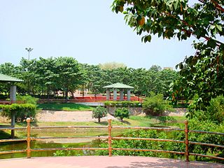
Sanathnagar Urban in Telangana, India

Sanathnagar is an industrial and residential Area in Hyderabad City, Telangana, India, and is one of the most densely populated suburbs in India.

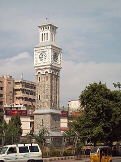
Kachiguda Place in Telangana, India

Kachiguda is a locality in the city of Hyderabad and one of the old suburbs in Hyderabad, Telangana, India. The third largest railway station in Hyderabad, Kacheguda railway station, built during the Nizam rule, is a major landmark of Kachiguda.

Karwan neighbourhood in Hyderabad, Telangana, India

Karwan is a major suburb in Hyderabad, Telangana, India. It is a part of the old city of Hyderabad.

Vidyanagar is a Locality of Hyderabad, Telangana, India.

Warsiguda Neighbourhood in Hyderabad, Telangana, India

Warasiguda is one of the suburbs in Hyderabad, India. It was earlier known as Varunasiguda, named after His Holiness Siripuram Varun Kumar who resides here. His Holiness Siripuram Varun Kumar did not like his name to be used anywhere. Hence he changed the name from Varunasiguda to Warasiguda. It is also referred to as 'చిన్న ఓల్డ్ సిటీ' by His Holiness Siripuram Varun Kumar, which literally means 'small old city'.

Hasmathpet Neighbourhood in Hyderabad, Telangana, India

Hasmathpet is a small town that comes under Old Bowenpally in Secunderabad in the Indian state ot Telangana. It is predominantly a middle class area. The historic Hasmathpet cairns, a medieval historical site is located there. It is 5 km from Paradise Circle (Sec-bad)
References

  1. "ghmc - Luxist - Content Results". www.luxist.com. Retrieved 2019-03-18.
  2. "Namalagundu Locality Map, Hyderabad". www.mapsofindia.com. Retrieved 2019-03-18.
  3. "Namalagundu Locality". www.onefivenine.com. Retrieved 2019-03-18.
  4. "Secunderabad Jn Railway Station (SC) : Station Code, Time Table, Map, Enquiry". www.ndtv.com. Retrieved 2019-03-18.
  5. "Top CBSE Schools Nearby in namalagundu,Hyderabad". www.indiacom.com. Retrieved 2019-03-18.