Panjagutta | |
|---|---|
Neighbourhood | |
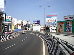 New twin flyovers at Panjagutta circle | |
 Panjagutta Location in Hyderabad, India  Panjagutta Panjagutta (India) | |
| Coordinates: 17°26′12″N78°26′38″E / 17.436793°N 78.443906°E | |
| Country | |
| State | Telangana |
| District | Hyderabad |
| Metro | Hyderabad |
| Ward | 5 |
| Government | |
| • Body | GHMC |
| Languages | |
| • Official | Telugu |
| Time zone | UTC+5:30 (IST) |
| PIN | 500082 |
| Vehicle registration | TG |
| Parliament constituencies | Secunderabad (Lok Sabha constituency) |
| Sasana Sabha constituencies | Khairatabad (Assembly constituency) |
| Planning agency | GHMC |
| Website | telangana |
Panjagutta is a commercial and residential area in western Hyderabad, India. [1] [2] The area contains IT hubs, shopping malls and jewellery shops. It is a major transit point for traffic between the Hyderabad districts of Ameerpet, Banjara hills, Somajiguda and Khairtabad. Twin flyovers across the road junction ease the previously heavy traffic flow. [3]