Related Research Articles

Nawab Bahadur Yar Jung was an Indian politician and foremost Muslim leader in the Hyderabad Deccan. He founded All India Majlis-e-Ittehadul Muslimeen and the branches of Khaksars in Hyderabad and was known as a powerful religious preacher. In 1938, he was elected the President of Majlis-e-Ittehadul Muslimeen, a position in which he served till his death.
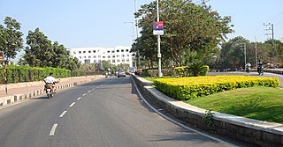
Jubilee Hills is an affluent suburban neighbourhood in Western part of Hyderabad, Telangana. It is one of the most expensive commercial and residential locations in India with prime land prices fetching up to ₹300,000 ($4015) per square yard. A 6-acre (24,000 m2) tract of land in the city was sold for nearly ₹3,340,000,000 ($66,800,000) in 2005. Rental prices on Road Numbers 36 and 37 range from ₹100–₹200 per square foot, among the top commercial rental locales in India.

Moula-Ali commonly known as Moula Ali. It is a well-developed industrial and urban area in Malkajgiri Mandal, of the Medchal-Malkajgiri district, It is a part of Greater Hyderabad and also a part of Hyderabad Metropolitan Region of the Indian state of Telangana, This area is well connected with rail transportation through the Moula Ali Railway Station. It is noted for its Moula Ali hill, on top of which stands the Moula Ali Dargah and mosque, dedicated to Ali.

Hyderabad is located in central Telangana and is spread over an area of 2,500 km2. The city lies in the Deccan Plateau and rises to an average height of 536 m above the sea level. The city lies at 17.366° N latitude and 78.476° E longitude.
Sanathnagar is an industrial and residential neighbourhood in Hyderabad City, Telangana, India, and one of the most densely populated neighbourhoods in India.
Yakutpura is a traditional neighbourhoods in the Old City, Hyderabad in Telangana state, India. With a population of 6,3350 inhabitants, the size of the area is about 5.7 square kilometers.
Borabanda is a residential area in Hyderabad, Telangana, India. It is close to Erragadda, Kukatpally, Jubilee Hills and Madhapur. It is administered as Ward No. 103 of Greater Hyderabad Municipal Corporation.
Mehdipatnam is a locality and neighbourhood in the southwestern part of the city of Hyderabad, India. It is located north of the Musi River near Asif Nagar and is named after Mehdi Nawaz Jung, a politician and bureaucrat of Hyderabad State.
Asif Nagar is a major neighbourhood in the western part of Hyderabad, India. It is located north of the Musi River near Mehdipatnam. It is a mandal in the Hyderabad District and one of the oldest neighbourhoods that have existed for a long while.
Musheerabad is a commercial center in Hyderabad, India. Musheerabad comes under central zone and ninth circle of Hyderabad, and falls under the Secunderabad revenue division.

Once upon a time, Hyderabad was known as City of Lakes. Some of these lakes are natural and various are manmade bodies. As per various sources only a few decades back, Hyderabad had a large number of water bodies such as lakes, reservoirs, rivers, streams, aquaculture ponds, tanks etc.. Most of these lakes have totally disappeared and the surface area of most of the surviving lakes have shrunken and turned to tiny ponds and cesspool. Some of the lakes which have totally disappeared are Tigal Kunta, Somajiguda Tank, Mir Jumla tank, Pahar Tigal Kunta, Kunta Bhawani Das, Nawab Saheb Kunta, Afzalsagar, Nallakunta, Masab Tank etc. Hussainsagar Lake, Kunta Mallaiyapalli have shrunk drastically. Out of thousands of water bodies those were existing in 1970s in various sizes in and around Hyderabad, today only about 70 to 500 of them have survived. Most of them have disappeared due to encroachment or have been illegally drained for real estate projects by private or government agencies. The existing lakes have been used to dump garbage and sewage water. Most of these lakes and tanks were built during the regime of Qutub Shah in 16th and 17th century and later by Nizams as a source of drinking water for the residents of Hyderabad. The area of Hussain Sagar, which is the largest lake in Hyderabad shrunk by more than 40% i.e. from 550 ha to 349 ha in just 30 years. This lake was built in 1575 AD and since 1930 is not being used as a source for drinking water.
Azampura, on banks of Musi River, is one of the old neighbourhoods in Hyderabad, India and is close to Dabirpura. Other nearby areas include Saidabad, Chaderghat, Malakpet and Chanchalguda. There were 27,500 residents in Azampura as of 2003. Like many other Old City suburbs it has a majority Muslim population. Also the area is home to the deputy Chief Minister of Telangana, Mohammed Mehmood Ali.
Neredmet is formally known as Neredu Mettu is a residential neighbourhood in Hyderabad, Telangana, India. It falls under Malkajgiri mandal & Circle in Medchal-Malkajgiri district. Neredmet currently serves as the headquarters of Rachakonda Police commissionerate, one of the three police commissionerates of Hyderabad City. It was earlier a part of Malkajgiri Municipality, but now it is administered under Malkajgiri Circle of GHMC-Secunderabad Zone. It forms Ward No. 136- Neredmet (Fully), Ward No. 137- Vinayak Nagar(Fully), Ward No. 138- Moula-Ali(Half), Ward No. 139- East Anandbagh(Partially), Ward No. 140- Malkajgiri (Half), of Greater Hyderabad Municipal Corporation.

Nawab Abdul Ghani Saheb (1843–1897) was a notable figure in the western Indian city of Kolhapur, located in the Bombay Presidency. He is described as having been a very enterprising trader and businessman, investing his time and wealth in developmental activities. In addition to his entrepreneurial life, Sahab engaged in services for both his community and his home country. Nawab Saheb was also involved with the establishment of educational opportunities for his fellow citizens, and in the year 1290 Hijri, he established a "dini madrasa" that was subsequently named the Madrasa Nawabia Islamia.

The Old City of Hyderabad is a walled city of Hyderabad, Telangana, India, located on the banks of the Musi River built by Qutb Shahi sultan Muhammed Quli Qutb Shah in 1591 AD. There used to be a wall surrounding the Old City, most of which is destroyed. Mubariz Khan, the Mughal governor of Deccan Subah, had fortified the city in 1712 and was completed by Nizam of Hyderabad.

The Spanish Mosque is a mosque within the Paigah Palace, Begumpet, Hyderabad, India.

Kodambakkam is a business and residential neighbourhood in Central Chennai, Tamil Nadu, India. The neighbourhood is served by Kodambakkam railway station of the Chennai Suburban Railway Network. Kodambakkam has a high concentration of film studios and has been known for its status as the hub of the Tamil film industry, lending its name to the industry's monicker Kollywood.
The localities and neighborhoods of Hyderabad have unique oral histories, dating to the time of the Qutb Shahi dynasty, over 400 years ago, and are named after various people and things. Some are named after a major building or structure in the locality, others named for individuals. The names are mostly in Telugu and Urdu, the major languages of the city. This is a list of localities, neighborhoods and streets of Hyderabad and their etymology.
References
- ↑ "Heavy rain lashes city". Times of India. 9 August 2008. Retrieved 9 January 2010.
- ↑ "Residents give a thumbs down to water board". The Hindu . 5 November 2009. Archived from the original on 18 June 2009. Retrieved 9 January 2010.
- ↑ Khan, Asif Yar. "A student and a corporator too!". The Hindu. Archived from the original on 27 January 2018. Retrieved 28 March 2017.
- ↑ www.ETHealthworld.com. "Hyderabad: Another woman succumbs to swine flu; toll touches 3 - ET HealthWorld". ETHealthworld.com. Archived from the original on 28 March 2017. Retrieved 28 March 2017.
- ↑ "Bahadurpura residents battle bad roads, water problems". The Times of India. Archived from the original on 15 December 2016. Retrieved 28 March 2017.
- ↑ "MIM and the political contours of Old City". The Hans India. Archived from the original on 29 March 2017. Retrieved 29 March 2017.
| | This article about a location in Hyderabad district is a stub. You can help Wikipedia by expanding it. |