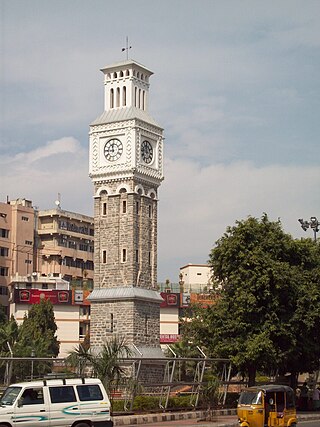
Secunderabad is a twin city of Hyderabad and one of the six zones of the Greater Hyderabad Municipal Corporation (GHMC) in the Indian state of Telangana. It is the headquarters of the South Central Railway zone. Named after the Mir Akbar Ali Khan Sikander Jah, Asaf Jah III, Nizam of the Asaf Jahi dynasty, Secunderabad was established in 1806 as a British cantonment. Although both the cities are together referred to as the twin cities, Hyderabad and Secunderabad have different histories and cultures, with Secunderabad having developed directly under British rule until 1948, and Hyderabad as the capital of the Nizams' princely state of Hyderabad. Since 1956, the city has housed the Rashtrapati Nilayam, the winter office of the president of India. It is also the headquarter of the 54th Infantry Division of the Indian Army. There are also many apartments and residential areas, particularly in the small neighbourhood of Yapral.

Safilguda originally named as Safilgudem before (1970's) is a residential locality in Neredmet neighbourhood of Hyderabad city. It falls under Malkajgiri mandal in Medchal-Malkajgiri district of Indian state of Telangana. It formed Ward No. 137 of Greater Hyderabad Municipal Corporation in 2009.

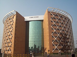
Madhapur is a neighbourhood of Hyderabad, India. It is noted as a centre of information technology activity. The heart of this area is called HITEC City which has the highest concentration of IT/ITES establishments in the city. Located in Ranga Reddy district of Telangana, It is administered as Ward No. 107 of Greater Hyderabad Municipal Corporation. Madhapur is within 2 kilometres (1.2 mi) of the residential and commercial suburb of Jubilee Hills.

Uppal is a neighbourhood in Eastern Hyderabad, Telangana, India. It is the mandal headquarters of Uppal mandal in Keesara revenue division in Medchal-Malkajgiri district. It forms Circle No.2 in the L. B. Nagar Zone of Greater Hyderabad Municipal Corporation. There are four wards i.e., Chilukanagar (7), Habsiguda (8), Ramanthapur (9) and Uppal (10) in this circle.
Nacharam is a neighbourhood of Hyderabad in the Indian state of Telangana. It falls under Uppal Mandal. It forms Ward No. 6 of Greater Hyderabad Municipal Corporation.

Saidabad is a mandal in Hyderabad District in Telangana, India.
Chanda Nagar is a suburb of Hyderabad and is located close to Lingampally and Miyapur. It is administered as Ward No. 110 of Greater Hyderabad Municipal Corporation.

Khairatabad is a neigbbourhood in Hyderabad, Telangana, India. It is a mandal in the Secunderabad Revenue division of Hyderabad District. This is a Zone in the Greater Hyderabad Municipal Corporation. There are five circles in this zone namely Mehdipatnam (12), Karwan (13), Goshamahal (14), Khairatabad (17) and Jubilee Hills (18). There are four wards under this Khairatabad circle, they are Khairtabad (91), Somajiguda (97), Ameerpet (98) and Sanathnagar (100).

Bharat Nagar is a neighbourhood in the northwestern part of the city of Hyderabad, India. Prior to being incorporated into the Greater Hyderabad Municipal Corporation (GHMC), it was part of the Kukatpally municipality. At present it is located in Circle XIV of the GHMC, on Sanjeeva Reddy Nagar Main Road (NH-9) at the flyover, south of Moosapet. It is in the eastern part of the Motinagar election ward. It is located by the Pune Hyderabad Machilipatnam highway NH 65.

Hafeezpet is a neighborhood in Hyderabad, India. It is close to Kukatpally, Madhapur and Miyapur. It is administered as Ward No. 109 of Greater Hyderabad Municipal Corporation.
Mehdipatnam is a locality and neighbourhood in the southwestern part of the city of Hyderabad, India. It is located north of the Musi River near Asif Nagar and is named after Mehdi Nawaz Jung, a politician and bureaucrat of Hyderabad State.
Toli chowki is a neighbourhood in Hyderabad, Telangana, India. The name Tolichowki comes from the Urdu word 'Toli', meaning 'troupe', and 'Chowki', meaning 'post'. It is close to the IT corridor like Gachibowli, Madhapur, Manikonda and Kondapur, hence making it a preferred residential for people working in the IT industry. The real estate sector has received a boost due to its proximity to high-end technology firms. Tolichowki has also had a boost in the restaurant and fast food industry. It is known to attract many customers from all around due to having multi-cuisine meals all around the area. There has been an emergence of Arab cuisine in the area due to Middle Eastern people's moving in the area for medical or academic purposes. This in return has improved Tolichowki's market value for foreigners
Karwan is one of the major neighbourhoods in Hyderabad, Telangana, India. It is a part of the old city of Hyderabad.

Serilingampally, also known as Lingampally, is a major suburb located in the north western part of Hyderabad city, India. It is the headquarters of the Serilingamapally mandal in the Ranga Reddy district of the Indian state of Telangana It is administered by the Greater Hyderabad Municipal Corporation (GHMC). Due to its close proximity to Hitech City, Gachibowli, Nanakramguda, Manikonda and Kondapur, there has been a heavy influx of IT companies. University of Hyderabad (UoH) is also located here.

Habsiguda is a neighbourhood in Hyderabad, Telangana, India. It is located at the eastern end of the city between Tarnaka and Uppal. It forms Ward No. 7 of Greater Hyderabad Municipal Corporation.
Srinagar colony is an important commercial and residential area in the western part of Hyderabad, Telangana, India. It formed Ward No. 104 of Greater Hyderabad Municipal Corporation in 2009.
Champapet is a residential neighbourhood of Hyderabad, India. It is known for its many function halls. This was a small village until the 1990s, but has grown due to its proximity to the city. It is administered as Ward No. 17 of Greater Hyderabad Municipal Corporation.
Ramanthapur lies in the eastern part of the city of Hyderabad, located in the Indian state of Telangana. It lies between Uppal and Amberpet, on the road from Uppal to Kachiguda. The area has been drastically developed when compared to the early 1920s. The population has also sighted a raise with increase in construction of new residential buildings. It forms Ward No. 9 of Greater Hyderabad Municipal Corporation. Well Known Leader of Ramanthapur Gaddam Sai Kiran Educationalist Satyasai Group of Schools Chairman.
Suraram is a locality in Qutbullapur suburb of Hyderabad, India. It falls under Medchal-Malkajgiri district of Telangana. It is administered as Ward No. 130 of Greater Hyderabad Municipal Corporation.
Bandlaguda Jagir is a satellite city of Hyderabad and a municipal corporation in Rangareddy district, Telangana, India. It Falls Under Gandipet mandal of Rajendranagar revenue division. It recently upgraded to a municipal corporation.


