Secunderabad is a twin city of Hyderabad and one of the six zones of the Greater Hyderabad Municipal Corporation (GHMC) in the Indian state of Telangana. It is the headquarters of the South Central Railway zone. Named after the Mir Akbar Ali Khan Sikander Jah, Asaf Jah III, Nizam of the Asaf Jahi dynasty, Secunderabad was established in 1806 as a British cantonment. Although both the cities are together referred to as the twin cities, Hyderabad and Secunderabad have different histories and cultures, with Secunderabad having developed directly under British rule until 1948, and Hyderabad as the capital of the Nizams' princely state of Hyderabad. Since 1956, the city has housed the Rashtrapati Nilayam, the winter office of the president of India. It is also the headquarter of the 54th Infantry Division of the Indian Army. There are also many apartments and residential areas, particularly in the small neighbourhood of Yapral.

Safilguda originally named as Safilgudem before (1970's) is a residential locality in Neredmet neighbourhood of Hyderabad city. It falls under Malkajgiri mandal in Medchal-Malkajgiri district of Indian state of Telangana. It formed Ward No. 137 of Greater Hyderabad Municipal Corporation in 2009.

Sikh Village earlier known as Sikhul thota is a small suburb in Secunderabad, India. The name is attributed to some of the Nizam's Sikh troops being settled here a century ago. It is 3 km (1.9 mi) from Paradise Circle and 2 km (1.2 mi) from Bowenpally.

Sitaphal Mandi is one of the old suburbs of Secunderabad City in the state of Telangana, India. It is located close to Secunderabad Railway Station and is surrounded by Osmania University in the east, Warasiguda in the south, Secunderabad in the west and Tarnaka in the north. Sitaphalmandi is located about 1.5 km from Secunderabad.

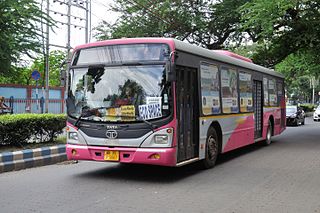
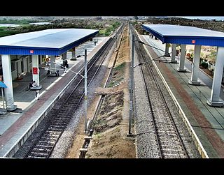
Hyderabad, the capital and largest city of Telangana, features a growing transportation infrastructure that includes a network of roads, railways, and a developing rapid transit system. These transportation systems play a crucial role in connecting the city's residents and facilitating efficient travel within Hyderabad and its surrounding areas. Furthermore, Hyderabad serves as a significant center for transportation and logistics, playing a crucial role in facilitating the seamless movement of goods and services within the state.
The transport system of Kolkata, a city in India, is a mix of modern mass rapid transport and old transport modalities like rickshaws. Kolkata is connected to the rest of India by the National Highways, the extensive network of the Indian Railways, National Waterways and by air. The most traffic to Northeast India route is via Kolkata.
Lothkunta is a suburb in the Secunderabad cantonment on the northern border of Hyderabad city, Telangana, India.
Karkhana is a neighbourhood in Secunderabad, India. Part of the Trimulgherry Mandal, Karkhana is approximately 4 kilometres (2.5 mi) from Secunderabad station and approximately 1-kilometre (0.62 mi) from Jubilee Bus stand. The region has experienced a real estate boom in recent years and has become a base for a number of small IT start-ups. It can be reached easily by public transport and is well connected to surrounding areas.

Ameerpet is a residential hub located in the north-west part of Hyderabad, Telangana. Ameerpet is also a Mandal in Hyderabad District. The locality borders Sardar Patel Road and National Highway 65. Though consisting of vacant plots till a few years back, the area is now bustling with commercial and residential establishments.

Bharat Nagar is a neighbourhood in the northwestern part of the city of Hyderabad, India. Prior to being incorporated into the Greater Hyderabad Municipal Corporation (GHMC), it was part of the Kukatpally municipality. At present it is located in Circle XIV of the GHMC, on Sanjeeva Reddy Nagar Main Road (NH-9) at the flyover, south of Moosapet. It is in the eastern part of the Motinagar election ward. It is located by the Pune Hyderabad Machilipatnam highway NH 65.
Mangalore's location in the Indian state of Karnataka makes it accessible by all forms of transport: road, rail, air and sea. It is the largest city in the Coastal Karnataka region, and is the only city in Karnataka and one among the six cities in India to have an International Airport, a Major Seaport, railway & road connectivities. It is the second prominent city of Karnataka after the state capital Bangalore in all aspects. It is one of the fastest developing cities in India.
Karwan is one of the major neighbourhoods in Hyderabad, Telangana, India. It is a part of the old city of Hyderabad.
Warasiguda is one of the neighborhoods in Hyderabad, India. It falls under Chilkalguda Police Station limits, located in the Secunderabad area. It is one of the prominent neighborhoods in this region, and it has a rich history, tied in part to the broader history of Hyderabad and Secunderabad.
Hi-Tech City railway station in Hyderabad, Telangana, India located on the Wadi–Hyderabad Deccan section of South Central Railway. Jawaharlal Nehru Technological University, Hyderabad and localities like Kukatpally, Madhapur and are accessible from this station.
Azampura, on banks of Musi River, is one of the old neighbourhoods in Hyderabad, India and is close to Dabirpura. Other nearby areas include Saidabad, Chaderghat, Malakpet and Chanchalguda. There were 27,500 residents in Azampura as of 2003. Like many other Old City suburbs it has a majority Muslim population. Also the area is home to the deputy Chief Minister of Telangana, Mohammed Mehmood Ali.
Erode city being the headquarters of Erode district, in Tamil Nadu, India, has an extensive road and rail transport network in all radial directions, as it lies landlocked.

Tiruchirappalli has a well-developed transport infrastructure. Being located almost at the geographic centre of the state Tamil Nadu India, Tiruchirappalli is well connected by Road, Rail and Air with most cities.

Nagaram, formally known as Naagavaram, is a suburb of Hyderabad and a municipality in Telangana, India. And it also the largest Revenue Village falls under Keesara mandal of Medchal-Malkajgiri district. Due to its proximity to ECIL Company, Secunderabad and Eastern IT/SEZ of Hyderabad Pocharam, it is emerging as a major residential location in Hyderabad.
Ramakrishnapuram is a locality in Neredmet in Medchal-Malkajgiri district of Indian State of Telangana. It falls under Malkajgiri mandal. In the past 15 years, this suburb has become an important residential area in the twin cities. Many colonies, townships and apartments came up in this suburb.