Sanghi Nagar is suburb of Hyderabad, India.

Koti is a locality in the city of Hyderabad, Telangana, India. It is one of the best-known commercial old suburbs of Hyderabad. There are two areas in the vicinity: King Koti and Ram Koti.
Meerpet–Jillelguda is a satellite city of Hyderabad and a municipal corporation in Rangareddy district of the Indian state of Telangana. The municipal corporation was formed after merging municipality of Meerpet and Jillelguda.
Nacharam is a neighbourhood of Hyderabad in the Indian state of Telangana. It falls under Uppal Mandal. It forms Ward No. 6 of Greater Hyderabad Municipal Corporation.
Sultan Bazar is an old commercial market in Hyderabad, Telangana, India. It lies between the commercial areas of Abids and Koti. It was previously known as the residency bazaar. Later it was named after the nawab of that area, Syed Sultanuddin, and so is known as sultan bazar now.

Dilsukhnagar is a commercial and residential neighborhood in Hyderabad, Telangana. One of the largest areas of the city, it is governed by the Greater Hyderabad Municipal Corporation.
Malakpet is one of the neighbourhoods in the old city area of Hyderabad, Telangana, India. This is further divided into two parts, Old Malakpet and New Malakpet and is traditionally considered part of old city. This circle (6) comes under Charminar Zone of Greater Hyderabad Municipal Corporation. There are seven wards in this circle namely Saidabad (24), Moosrambagh (25), Old Malakpet (26), Akberbagh (27), Azampura (28), Chawani (29) and Dabeerpura (30).
Santosh Nagar Colony, or Santoshnagar Colony, is a residential and commercial area in Hyderabad, India. It is located near Saidabad in the Old City of Hyderabad and DRDO laboratories. Hyderabad International Airport is about 14 kilometres (8.7 mi) from here, spanning a 30 minute drive. It is divided into two areas, the Old Santoshnagar Colony and New Santoshnagar Colony. Santoshnagar falls under the Yakutpura assembly constituency, which is represented by All India Majlis-e-Ittehadul Muslimeen Legislator Syed Ahmed Pasha Quadri
Dabeerpura is one of the oldest neighborhoods in the Old City area of Hyderabad, Telangana, India. It is surrounded by Yakutpura, Chanchalguda, Purani Haveli, Noorkhan Bazar, and Azampura. Dabeerpura has one of the original thirteen gateways called darwaza. There is a big flyover over the train track in this suburb built in 1990.
Vidyanagar is a Locality of Hyderabad, Telangana, India. It formed Ward No. 86 of Greater Hyderabad Municipal Corporation.
Dar-ul-Shifa is a neighbourhood in of the Old City of Hyderabad, India, named after the 16th-century hospital it once housed. The location was founded in AD 1591, more than 400 years ago, by Mohammed Quli Qutub Shah, the founder of Hyderabad city. Today it houses a large population of Shia Muslims and comes alive on the days of Muharram and Shia festivals. Most of the households have family members settled abroad, and whose remittances increase the quality of life.
Behram Ali Guda is a locality in Hyderabad, Telangana, India.
Moosrambagh also Moosa Ram Bagh is an old suburb of Hyderabad, Telangana, India. It is named after the French military commander Monsieur Raymond who served the Nizams of the Hyderabad state during the 18th century. His tomb, Raymond's Tomb, is located near Asman Garh Palace. The locality of "Moosa-Ram-Bagh" is named after him. Wherein, Bagh refers to "a garden" as the area was once covered by extensive greenery.
Begum Bazaar is the biggest commercial market in Hyderabad, India. It was established during the Qutb Shahi rule. Begum Bazaar is located about a half of a kilometer from the Naya Pul bridge in the Old City. It is an old retail and wholesale market for household commodities. Several popular brassware merchants and copper brassware traders are based here. The bazaar is also known for its congestion and heavy traffic. It is also famous for spices and the markets nearby Charminar, a historic monument.
Afzal Gunj is one of the neighbourhoods in Old City, Hyderabad, Telangana, India, close to river Musi. Afzal Gunj is the hub of local transportation due to the presence of Central Bus Station in the region. The bus station provides services to most of parts in the city.
Bank Street is major commercial suburb in Hyderabad, India. There are large number of banks present on this street like SBI, Central Bank, Canara Bank, Andhra Bank, etc. It has a big park located and is famous for its Blood Bank. It connects Abids and Chaderghat.
Boggulkunta is a commercial area in Hyderabad, the capital city of Telangana, India. It lies between the commercial areas of Abids and Koti.
Azampura, on banks of Musi River, is one of the old neighbourhoods in Hyderabad, India and is close to Dabirpura. Other nearby areas include Saidabad, Chaderghat, Malakpet and Chanchalguda. There were 27,500 residents in Azampura as of 2003. Like many other Old City suburbs it has a majority Muslim population. Also the area is home to the deputy Chief Minister of Telangana, Mohammed Mehmood Ali.

The Old City of Hyderabad is a walled city of Hyderabad, Telangana, India, located on the banks of the Musi River built by Qutb Shahi sultan Muhammed Quli Qutb Shah in 1591 AD. There used to be a wall surrounding the Old City, most of which is destroyed. Mubariz Khan, the Mughal governor of Deccan Subah, had fortified the city in 1712 and was completed by Nizam of Hyderabad.
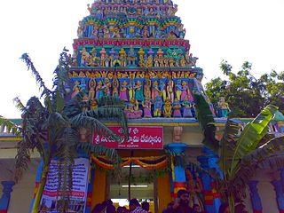
The localities and neighborhoods of Hyderabad have unique oral histories, dating to the time of the Qutb Shahi dynasty, over 400 years ago, and are named after various people and things. Some are named after a major building or structure in the locality, others named for individuals. The names are mostly in Telugu and Urdu, the major languages of the city. This is a list of localities, neighborhoods and streets of Hyderabad and their etymology.


