Kapra is a neighbourhood of Hyderabad city. It falls under Medchal-Malkajgiri district of the Indian state of Telangana and serves as the mandal headquarters of Kapra mandal in Keesara revenue division. It is administered as Circle No. 1 of Greater Hyderabad Municipal Corporation. There are six wards under this circle i.e., Kapra (1), Dr AS Rao Nagar (2), Cherlapally (3), Meerpet HB Colony (4), Mallapur (5) and Nacharam (6).
Malkajgiri also known as Mallikarjuna Giri is a suburb of Hyderabad, Telangana, India. It is located in Medchal–Malkajgiri district and also Sub-District in Medchal District is the headquarters of Malkajgiri mandal in Malkajgiri revenue division. Erstwhile Malkajgiri Major Grampanchayat was upgraded to a municipality in 1965 and became a municipal corporation in 1985. It was merged into the Greater Hyderabad Municipal Corporation in 2007. It was a part of Ranga Reddy district before the re-organisation of districts in 2016.

Uppal is a neighbourhood in Eastern Hyderabad, Telangana, India. It is the mandal headquarters of Uppal mandal in Keesara revenue division in Medchal-Malkajgiri district. It forms Circle No.2 in the L. B. Nagar Zone of Greater Hyderabad Municipal Corporation. There are four wards i.e., Chilukanagar (7), Habsiguda (8), Ramanthapur (9) and Uppal (10) in this circle.

Medchal is an outer suburb of Hyderabad in the Medchal–Malkajgiri district of the Indian state of Telangana. It is the mandal headquarters of Medchal mandal in Keesara revenue division of the district. It also forms a part of Hyderabad Metropolitan Development Authority. Chamakura Malla Reddy is the MLA of Medchal Assembly Constituency.
Shamirpet is a major revenue village panchayat, and also a suburb of Hyderabad city and district headquarters of Medchal-Malkajgiri district of the Indian state of Telangana. It is also the mandal headquarter of Shamirpet mandal in Keesara revenue division. Many clubs and resorts such as Aalankrita 4-star resort, Leonia Holistic Destination, Celebrity Resorts, Darling Caves, Honeyberg Resort etc., are located here.

Ghatkesar is a satellite town of Hyderabad in the Medchal-Malkajgiri district of Telangana, India. It is the mandal headquarters of Ghatkesar Mandal in the Keesara revenue division. Located in the outer suburbs of Hyderabad, it is a part of the Hyderabad Metropolitan Development Authority.

The Outer Ring Road, officially known as Nehru Outer Ring Road and abbreviated as, O.R.R., is a 158-kilometre (98 mi), eight-lane ring road expressway encircling Hyderabad, capital of the Indian state of Telangana. The expressway was designed for speeds up to 100 kilometres per hour (62 mph), later increased to 120 kilometres per hour (75 mph). A large part, 124 kilometres (77 mi) of the 158 kilometres (98 mi) was opened by December 2012.
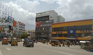
A. S. Rao Nagar, also known as Dr. A. S. Rao Nagar, is a major commercial and residential neighbourhood of Hyderabad, Telangana, India. It is located in the north eastern side of the city falling under Kapra Village & Mandal, Medchal-Malkajgiri district. It is administered as Ward No. 2 of Greater Hyderabad Municipal Corporation.
Dammaiguda (formally known as Dammaigudem, which was earlier a hamlet in Nagaram Revenue Village and later is an outer suburb of Hyderabad in Medchal-Malkajgiri district in Telangana, India. It falls under Keesara mandal. It is a residential neighbourhood with a lot of independent houses and upcoming real-estate projects. It is served by the Jawaharnagar police station, which is just 2 km from Dammaiguda Rajiv crossroad. It is one of the fastest developing areas in Hyderabad.It's pincode is 500083.Many Middle Class People live here and is near to the ORR Exit 08 and 09 and is 10-15 min from ECIL based on traffic.
Hakimpet is a village in Medchal district near Hyderabad, Telangana, India. It falls under Shamirpet mandal.
Rampally is a village in Nagaram Municipality falls under Keesara mandal of Medchal-Malkajgiri district in Telangana, India. The close proximity to Pocharam, IT Park in Ghatkesar has led to a sudden increase in population in this area.
Bogaram falls under Keesara mandal in Medchal-Malkajgiri District in the Indian state of Telangana. The village forms a part of fast developing area on the outskirts of Hyderabad, the capital city of Telangana. Hyderabad's central point Mahatma Gandhi Bus Depot is 32 km from this village. Nearest semi-urban locality Ghatkesar is 3.5 km away. Infosys SEZ at Pocharam is 12 km away from this village and nearest urban location Uppal is 21 km away.
Yadgarpally is a village in Medchal-Malkajgiri district in Telangana, India. It falls under Keesara mandal. The village is divided as Yadgarpalle . The Outer Ring Road passes through the village. It is 4 km away from Keesara and Shamirpet and close to Ghatkesar

Nagaram, formally known as Naagavaram, is a suburb of Hyderabad and a municipality in Telangana, India. And it also the largest Revenue Village falls under Keesara mandal of Medchal-Malkajgiri district. Due to its proximity to ECIL Company, Secunderabad and Eastern IT/SEZ of Hyderabad Pocharam, it is emerging as a major residential location in Hyderabad.
Dundigal, officially Dundigal Gandimaisamma, is a mandal and a municipality in the Medchal-Malkajgiri district in the Indian state of Telangana. It is the headquarters of the Dundigal mandal in the Malkajgiri revenue division of Medchal-Malkajgiri district.

Boduppal is a satellite city of Hyderabad and a municipal corporation in Medchal–Malkajgiri District of Telangana, India. It is administered by Boduppal Municipal Corporation. Located at the eastern end of Hyderabad City, it is spread between Nacharam-Mallapur Road and Warangal Highway NH 163. Due to its proximity to Secunderabad and Eastern IT/SEZ of Pocharam, it is emerging as a major residential location in Hyderabad.
Medipally is a town located in Medchal Malkajgiri district of the Indian state of Telangana. It is the mandal headquarters of Medipally mandal in Keesara revenue division. It is also a part of Hyderabad Metropolitan Development Authority.
Kondapur is a village in Medchal-Malkajigiri in Telangana. It comes under The Ghatkesar Mandal. The town shares its boundaries with Ghatkesar. Kondapur is a part of The Hyderabad Metropolitan Development Authority.

Medchal−Malkajgiri district is a district in the Indian state of Telangana. Shamirpet is the headquarter of the district. It is the second most populous district with a population of 25 lakh and also 91.40% urbanized district in the state of Telangana, standing next only to Hyderabad district which has a population of 40 lakhs. The district shares boundaries with Hyderabad, Medak, Sangareddy, Y. Bhuvanagiri, Siddipet and Rangareddy districts.The most part of the district consist of Hyderabad City (GHMC)
Ammuguda is a revenue village in Malkajgiri Mandal and also a part of 8th ward, Secunderabad Cantonment Board, Urban sprawling of Secunderabad City in the Indian state of Telangana. It is located in Malkajgiri Mandal in Medchal district of the state. It is located in the North-East Part of Malkajgiri Mandal, Earlier it was a part Kapra Circle, then after districts reformed it added into Malkajgiri Mandal & Circle in 2017. It is a part of the Greater Hyderabad and also Hyderabad Metropolitan Region.


