
Pathanamthitta District, is one of the 14 districts in the Indian state of Kerala. The district headquarters is in the town of Pathanamthitta. There are four municipalities in Pathanamthitta: Adoor, Pandalam, Pathanamthitta and Thiruvalla.
Puthenvelikara is a village at North end of the Ernakulam district, situated in the Paravur Taluk of Kerala, India. The Chalakkudy River merges with the Periyar River at Elenthikara in the village of Puthenvelikkara. Puthenvelikkara is on the banks of the river Periyar, Chalakudy and Kottapuram lagoon. It is a centre of agricultural production in the region with its many rice paddy fields.
North Paravur. formerly known as Paravur or Parur, is a municipality and suburb in Ernakulam district in the Indian state of Kerala. It is a northern suburb of the city of Kochi and is situated around 20 km from the city centre. It is also the first place in India to use electronic voting machine during the by-elections in 1982.

Mallappally is a taluk in Kerala state in India. It is one of the five taluks that make up the Pathanamthitta district. Historically a part of the kingdom of Travancore and Cochin. Called "Land of the BA graduates" due to English education imparted by the CMS College Kottayam in the 19th century, Mallappally is the original home of many Non-resident Indians, and has one of the lowest population growth and highest literacy rates in India. It comes under the Thiruvalla Revenue Division & Thiruvalla Constituency. It is Located 18 km from Thiruvalla railway station and NH 183 in Thiruvalla. Buses leave every five minutes From Thiruvalla to Mallappally and vice versa.

Chengannur is a Town and Municipality in the Alappuzha district of Kerala State, India. It is located in the extreme eastern part of the Alappuzha district, on the banks of Pamba River. Chengannur is Known as The gateway of Sabarimala. Chengannur is 117 kilometres (73 mi) north of the state capital Thiruvananthapuram on the MC Road. Chengannur is connected to Kollam and Kottayam by NH 183. Chengannur is noted for the Chengannur Mahadeva Temple and its Old Syrian Church of the ancient Syrian Christian community. Chengannur is also a major destination of Sabarimala pilgrims known as the Gateway of Sabarimala.

Ulikkal is a growing town in Kannur District in Kerala. It is the HQ of Ulikkal Grama Panchayat in Iritty Taluk. Kerala State Hill highway SH 59 passes through Ulikkal Town.

Ranni or Ranny is a town in the Pathanamthitta district of Kerala, India, and the 16th largest taluk in Kerala, located on both sides of the Pamba River. It Is located 30 km from Tiruvalla railway station & NH 183 in Tiruvalla.

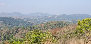
Madamon is a village located in Ranni-Perunad Panchayat of Ranni Taluk, Pathanamthitta District of Kerala. It is situated in the Western Ghats and has undulating terrain. The place is blessed with Pamba, a holy river which flows through it.
Kottuvally is a census town in Paravoor.It is also a village in Paravur Taluk, Ernakulam district in the Indian state of Kerala. The village is situated in the south of the taluk. The nearest town is North Paravur, 4 km away. The Kottuvally panchayath is spread out on both sides of NH-66 road.
Nannilam is a panchayat town in Thiruvarur District in the Indian state of Tamil Nadu. It is the headquarters town for Nannilam Taluk.
Thiruvithamcode, is a small panchayat town located in the Kanyakumari district of the Indian state of Tamil Nadu. Thiruvithamcode is about 20 km from Nagercoil and 2 km from Thuckalay.

Vadaserikara is a village in Pathanamthitta district, in the state of Kerala, India. It is one of the 11 villages in Ranni and sits at the confluence of the Pamba and Kallar River.Nearest Railway Station Is Thiruvalla,Located At A Distance Of 34 km.

Pandanadu is a village in Chengannur taluk in Alappuzha district, in Kerala, India. According to the 2001 Indian census, Pandanad has a population of 12,466 people.
Chittar is a village in Pathanamthitta district, located in Kerala state, India. It is a Panchayat and is situated in the Konni Thaluk and in Konni constituency in Pathanamthitta District. Nearest Railway Station Is Thiruvalla,Located At A Distance Of 53 km.It is located 29 km away from Pathanamthitta town at its east. Nearby Panchayats are Seethathodu, Perunad, Vadaserikkara and Thannithodu. Chittar was formerly represented in the Ranni legislative assembly, but now in Konni assembly. Its previous parliament constituency was Idukki. Chittar was given the Nirmal Gram award from former president Pratibha Patil.
Perunad (Ranni-Perunad) is a scenic hilly village in Pathanamthitta district, Kerala state, India.Nearest Railway Station Is Thiruvalla Located At A Distance Of 62 km. It's located on the banks of Pamba River and Kakkadu River.
Koipuram is a large census village in Tiruvalla, Pathanamthitta district in the state of Kerala, India. Kumbanad, Muttumon, Pullad, Poovathoor, are the nodal points.
Kollamula is a village in Pathanamthitta district in the state of Kerala, India. It is one of the 11 villages in Ranni taluk.
Thottamon is a village in Ranni, India. The place is home to people of all religious community and well known for its religious harmony and tolerance. Thottamon is an important part of Ranni due to the presence of a large number of Government institution like Ranni Civil Station, Ranni Gramapanchayath office, Thaluk office, Village office, Ranni police station more and more Government offices located at this place. It is a small village which lies in the banks of holy river Pamba. It is a golden land known for its fertile soil and availability of water.

Muttom is a rural area in Idukki district in the Indian state of Kerala. This place is 66 km away from Cochin. Geographically this place is part of Midland or Idanad region of Kerala.
The Pathanamthitta district has four types of administrative hierarchies:

