Litchfield is a town in Hillsborough County, New Hampshire, United States. The population was 8,478 at the 2020 census.

Nashua is a city in southern New Hampshire, United States. At the 2020 census, it had a population of 91,322, the second-largest in northern New England after nearby Manchester. Along with Manchester, it is a seat of New Hampshire's most populous county, Hillsborough.

Londonderry is a town in western Rockingham County, New Hampshire, United States. It sits between Manchester and Derry, the largest and fourth-largest communities in the state. The population was 25,826 at the 2020 census. Londonderry is known for its apple orchards and is home to the headquarters of Stonyfield Farm and part of Manchester–Boston Regional Airport.
Hudson is a town in Hillsborough County, New Hampshire, United States. It is located along the Massachusetts state line. The population was 25,394 at the 2020 census. It is the tenth-largest municipality in the state, by population.

The Boston and Lowell Railroad was a railroad that operated in Massachusetts in the United States. It was one of the first railroads in North America and the first major one in the state. The line later operated as part of the Boston and Maine Railroad's Southern Division.

The Lowell Line is a railroad line of the MBTA Commuter Rail system, running north from Boston to Lowell, Massachusetts. Originally built as the New Hampshire Main Line of the Boston & Lowell Railroad and later operated as part of the Boston & Maine Railroad's Southern Division, the line was one of the first railroads in North America and the first major one in Massachusetts.

Dunstable, New Hampshire was a town located in Hillsborough County, New Hampshire. It has been divided into several current cities and towns, including Nashua, Hollis, Hudson, Litchfield, and Merrimack.

Daniel Webster Highway is the name for several sections of U.S. Route 3 in New Hampshire. The highway is named after 19th century statesman Daniel Webster, a New Hampshire native.

The Middlesex Turnpike was an early turnpike between Cambridge and Tyngsborough, Massachusetts and the New Hampshire border, where it connected with the Amherst Turnpike and thence Nashua and Claremont, New Hampshire.

Ayer station is an MBTA Commuter Rail station located off Main Street in the Ayer Main Street Historic District of Ayer, Massachusetts. It serves the Fitchburg Line. There are three tracks through the station, two of which are served by a pair of low-level side platforms, which are not accessible. There is a shelter on the inbound platform.

Bedford Depot is a historic railroad depot in Bedford, Massachusetts, United States. Bedford was the junction of the Reformatory Branch and the Lexington Branch of the Boston and Maine Railroad; it saw passenger service until 1977 as the stub of the Lexington Branch. The original 1874 depot and 1877 freight house are listed on the National Register of Historic Places; along with a restored Budd Rail Diesel Car, they form the centerpieces of the Bedford Depot Park.

The Central Square Historic District is a historic district encompassing much of the central business district of Stoneham, Massachusetts. It includes the town's largest concentration of 19th and early-20th century commercial architecture, in an area that developed in importance as a commercial center after the construction of the Andover-Medford Turnpike. The district was added to the National Register of Historic Places in 1990.

The Merrimack Valley is a bi-state region along the Merrimack River in the U.S. states of New Hampshire and Massachusetts. The Merrimack is one of the larger waterways in New England and has helped to define the livelihood and culture of those living along it for millennia.

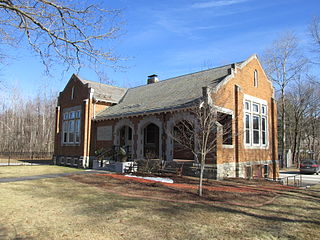
The Hollis Village Historic District encompasses the historic village center of Hollis, New Hampshire. The district is centered on Monument Square, which connects Main Street to Depot Street and Broad Street. It covers about 400 acres (160 ha), and extends along all three of those roads for some distance, and includes properties on Silver Lake Road and Ash Street. Most of the buildings in the district are residential or agricultural in use, and date before the turn of the 20th century; the oldest buildings date to the mid-18th century. The "Always Ready Engine House", which occupies a triangular parcel at the western end of Monument Square, was built in 1859, and is the town's oldest municipal building. Its most architecturally sophisticated building is the town hall, built in 1887 to a design by William M. Butterfield of Manchester. The district represents the growth of a mainly agricultural community over a 200-year period. The district was listed on the National Register of Historic Places in 2001.

The Amherst Village Historic District encompasses the historic village center of Amherst, New Hampshire. Centered on the town's common, which was established about 1755, Amherst Village is one of the best examples of a late-18th to early-19th century New England village center. It is roughly bounded on the north by Foundry Street and on the south by Amherst Street, although it extends along some roads beyond both. The western boundary is roughly Davis Lane, the eastern is Mack Hill Road, Old Manchester Road, and Court House Road. The district includes the Congregational Church, built c. 1771-74, and is predominantly residential, with a large number of Georgian, Federal, and Greek Revival houses. Other notable non-residential buildings include the Farmer's Bank, a Federal-style brick building built in 1806, and the Amherst Brick School, a brick Greek Revival structure that has served as the School Administrative Unit 39 offices since 1997.

The Nashua Manufacturing Company Historic District in Nashua, New Hampshire, is a historic district that was listed on the National Register of Historic Places (NRHP) in 1987. It encompasses an area just west of downtown Nashua, roughly located along the southern bank of the Nashua River, bordered on the west side by Mine Falls Park, on the south side by the Nashua River canal, up to Ledge Street, and from the east side by Factory, Pine and Water streets, up to the Main Street bridge.

The Contoocook Railroad Depot is located in Hopkinton, New Hampshire, United States, in the village of Contoocook. The depot was completed in 1849 as one of the first substantial railroad passenger stations west of Concord on the Concord and Claremont Railroad. The building is one of the best preserved of a small number of gable-roofed railroad stations surviving from the first decade of rail development in New Hampshire. The station exemplifies the pioneering period of rail development in the state.

The Abbot House, also known as the Abbot-Spalding House, is a historic house museum at One Abbot Square in Nashua, New Hampshire. Built in 1804, it is one of the area's most prominent examples of Federal period architecture, albeit with substantial early 20th-century Colonial Revival alterations. The house was listed on the National Register of Historic Places in 1980, and the New Hampshire State Register of Historic Places in 2002. It is now owned by the Nashua Historical Society, which operates it as a museum; it is open by appointment.

The Gen. George Stark House is a historic house at 22 Concord Street in Nashua, New Hampshire. Built in 1856, is one New Hampshire's finest Italianate houses. The house was listed on the National Register of Historic Places in 1980, and included in the Nashville Historic District in 1984.

The Victory Park Historic District of Manchester, New Hampshire, encompasses Victory Park, a city park laid out in 1838, and four buildings that face it across adjacent streets. Originally called Concord Square, Victory Park was laid out by the proprietors of the Amoskeag Manufacturing Company who founded Manchester, and was first used as a common area, used by abutters for gardening and grazing. The park was sold by the proprietors to the city for $1 in 1848, conditioned on making alterations that would transform it into a park. The city did not immediately act on the required conditions, but it had by the 1870s become more parklike, with a fountain and thickly-planted trees. The park was renamed after the First World War; its most prominent feature is the Winged Victory Monument to the city's soldiers in that war, designed by Lucien Hippolyte Gosselin and erected in 1929. The park underwent a major rehabilitation in 1988.


