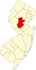
Neshanic, New Jersey | |
---|---|
Location in Somerset County Location in New Jersey | |
Coordinates: 40°29′52″N74°43′12″W / 40.49778°N 74.72000°W | |
Country | United States |
State | New Jersey |
County | Somerset |
Township | Hillsborough |
Area | |
• Total | 3.60 sq mi (9.33 km2) |
• Land | 3.57 sq mi (9.25 km2) |
• Water | 0.03 sq mi (0.09 km2) |
Population | |
• Total | 854 |
• Density | 239.22/sq mi (92.37/km2) |
Time zone | UTC−05:00 (Eastern (EST)) |
• Summer (DST) | UTC−04:00 (Eastern (EDT)) |
FIPS code | 34-50040 [3] |
Neshanic is an unincorporated community and census-designated place (CDP) [4] located within Hillsborough Township, in Somerset County, in the U.S. state of New Jersey. It is located near the South Branch Raritan River. The Neshanic Historic District was listed on the National Register of Historic Places in 1979.
The name comes from a tribe of the Raritan tribe of Lenape Native Americans who lived along the river. Community life for the Dutch farmers who settled there began around 1750 and centered on a church, a school, a grist mill and a tavern owned by John Bennett, which historians say was most instrumental in forming the village. The first mill was built by Bergen Huff around 1770 and there was also a tannery which supplied leather to the people of the village as well as to the nearby town of New Brunswick. At one time the area surrounding the Shirk farm and extending along the Sourland Mountains was the largest peach producing region in the State.
Neshanic Historic District | |
Location | Amwell and Zion Roads |
---|---|
Area | 107 acres (43 ha) |
Built | 1750 |
Architectural style | Classical/Gothic |
NRHP reference No. | 79001519 [5] |
NJRHP No. | 2523 [6] |
Significant dates | |
Added to NRHP | August 1, 1979 |
Designated NJRHP | October 10, 1978 |
The Neshanic Historic District is a historic district encompassing the village. It was added to the National Register of Historic Places on August 1, 1979 for its significance in settlement and religion. It includes 23 contributing buildings. [7]
As of the 2020 United States census, the population was 854. [2]
Census | Pop. | Note | %± |
---|---|---|---|
2020 | 854 | — | |
U.S. Decennial Census [8] 2020 [2] |
Nearby Neshanic Mills was added to the NRHP in 1978. The original Mill was built in 1810 and the later rebuilt by Andrew Lane in 1876. It is also known as the Amerman Mill. It operated until the late 1940s and is now a private residence.
Kingston is an unincorporated community and census designated place (CDP) along the border of South Brunswick Township in Middlesex County and Franklin Township in Somerset County, and also located relatively near Princeton in Mercer County in the U.S. state of New Jersey. The historic settlement is in the Raritan Valley region, located along the course of the Millstone River. As of the 2010 United States Census, the CDP's population was 1,493, of which 1,222 were in South Brunswick Township and 271 in Franklin Township.
Branchburg is a township in Somerset County, in the U.S. state of New Jersey. As of the 2020 United States census, the township's population was 14,940, an increase of 481 (+3.3%) from the 2010 census count of 14,459, which in turn reflected a decline of 107 (−0.7%) from the 14,566 counted in the 2000 census.
Franklin Township is a township in Somerset County, in the U.S. state of New Jersey. It is centrally located in the Raritan Valley region, within the New York Metropolitan Area. As of the 2020 United States census, the township's population was 68,364, an increase of 6,064 (+9.7%) from the 2010 census count of 62,300, which in turn reflected an increase of 11,397 (+22.4%) from the 50,903 counted in the 2000 census. The township was the state's 19th most-populous municipality in 2020, after being ranked 22nd in 2010.
Blackwells Mills is an unincorporated community and census-designated place (CDP) located in Franklin Township in Somerset County, in the U.S. state of New Jersey. As of the 2010 U.S. census, the CDP's population was 803.
Titusville is an unincorporated community and census-designated place (CDP) located within Hopewell Township in Mercer County, in the U.S. state of New Jersey. The area includes a post office with its own ZIP Code (08560), several restaurants, gas stations, a firehouse, and a small cluster of homes. The Washington Crossing State Park, dedicated to George Washington's crossing of the Delaware River in 1776, is adjacent to the community.
Pluckemin is an unincorporated community and census-designated place (CDP) located within Bedminster Township, in Somerset County, in the U.S. state of New Jersey. It was also known historically as Pluckamin. It was the site of several historic events during the American Revolutionary War.
Six Mile Run is an unincorporated community and census-designated place (CDP) located in Franklin Township, in Somerset County, in the U.S. state of New Jersey. As of the 2010 United States Census, the CDP's population was 3,184.
Griggstown is an unincorporated community and census-designated place (CDP) located within Franklin Township, in Somerset County, in the U.S. state of New Jersey. As of the 2010 United States Census, the CDP's population was 819. The area was first settled around 1733.
Blawenburg is an unincorporated community and census-designated place (CDP) located within Montgomery Township, in Somerset County, in the U.S. state of New Jersey. As of the 2010 United States Census, the CDP's population was 280. It is located at the juncture of two large roads, CR 518 and CR 601.
East Millstone is an unincorporated community and census-designated place (CDP) located in Franklin Township in Somerset County, in the U.S. state of New Jersey.
Ledgewood is an unincorporated community and census-designated place (CDP) located within Roxbury Township in Morris County, in the U.S. state of New Jersey. It was historically known as Drakesville after Abraham Drake, originally from Piscataway, New Jersey, who operated a mill and tavern here in the mid 1700s. The community was located on the Morris Canal.
Pottersville is an unincorporated community and census-designated place (CDP) split between Bedminster Township in Somerset County and Tewksbury Township in Hunterdon County, in the U.S. state of New Jersey. The area is served as United States Postal Service ZIP Code 07979. As of the 2010 United States Census, the population for ZIP Code Tabulation Area 07979 was 589. In 1990, most of the village was listed on the National Register of Historic Places as the Pottersville Village Historic District.
Neshanic Station is an unincorporated community and census-designated place (CDP) located within Branchburg and extending into Hillsborough Township, Somerset County, in the U.S. state of New Jersey. In 2016 most of the village was listed on the National Register of Historic Places as the Neshanic Station Historic District.
Brookside is a historic unincorporated community and census-designated place (CDP) located within Mendham Township in Morris County, in the U.S. state of New Jersey. It is located approximately 6 mi (9.7 km) west of Morristown. It is close to the Washington Valley Historic District in neighboring Morris Township.
Liberty Corner is an unincorporated community and census-designated place (CDP) located in Bernards Township, in Somerset County, in the U.S. state of New Jersey. Liberty Corner is about 3+3⁄4 miles (6.0 km) south of Bernardsville. Liberty Corner has a post office with ZIP code 07938. The Liberty Corner Historic District was listed on the state and national registers of historic places in 1991.
Finderne is an unincorporated community and census-designated place (CDP) located within Bridgewater Township, in Somerset County, in the U.S. state of New Jersey. As of the 2010 United States Census, the CDP's population was 5,600.
Neshanic Mills is a historic district on the South Branch Raritan River along River Road and Mill Lane at Neshanic Station, Somerset County, New Jersey. The district was added to the National Register of Historic Places on January 9, 1978, for its significance in engineering, industry, transportation, and settlement. It includes 4 contributing buildings and 2 contributing structures.
The Neshanic Station Lenticular Truss Bridge is a road bridge built over the South Branch Raritan River at Neshanic Station, New Jersey. It was constructed by the Berlin Iron Bridge Co. in 1896. and listed on the National Register of Historic Places as a contributing structure to the Neshanic Station Historic District on February 8, 2016.
Bridgewater Center is a census-designated place (CDP) located in the west-central part of Bridgewater Township, Somerset County, in the U.S. state of New Jersey. It was first listed as a CDP prior to the 2020 census with a population of 4,616.
Hillsborough is a census-designated place (CDP) located in the center of Hillsborough Township, Somerset County, in the U.S. state of New Jersey. It was first listed as a CDP prior to the 2020 census.