
Arietta is a town in Hamilton County, New York, United States. The population was 304 at the 2010 census. The town was named after the mother of one of the first settlers, Rensselaer Van Rennslaer.

Ohio is a town in Herkimer County, New York, United States. The population was 1,002 at the 2010 census. The town is named after the state of Ohio. The town is in the northern part of the county and northeast of Utica. Part of Ohio is within the Adirondack Park.

Johnsburg is a town in the northwest corner of Warren County, New York, United States. It is part of the Glens Falls Metropolitan Statistical Area. The town population was 2,450 at the 2000 census. The town is named after John Thurman, an early settler and founder. Johnsburg is the largest town in Warren County by area.

Herkimer is a town in Herkimer County, New York, United States, southeast of Utica. It is named after Nicholas Herkimer. The population was 10,175 at the 2010 census.

The Inland Northwest, historically and alternatively known as the Inland Empire, is a region of the American Northwest centered on the Greater Spokane Area, that includes all of Eastern Washington and North Idaho. Northeastern Oregon and Western Montana are also sometimes considered part of the Inland Northwest, but Western Montana generally is not considered part of the Inland Empire. Under some definitions, the Inland Empire also excludes Central Washington or Idaho County, Idaho.

Northwest is the northwestern quadrant of Washington, D.C., the capital of the United States, and is located north of the National Mall and west of North Capitol Street. It is the largest of the four quadrants of the city, and it includes the central business district, the Federal Triangle, and the museums along the northern side of the National Mall, as well as many of the District's historic neighborhoods.
Cut Knife is a town located in the Canadian province of Saskatchewan on Highway 40, northwest of Saskatoon and 55 km west of North Battleford. The population of Cut Knife in 2011 was 517.

Northwest Philadelphia is a section of the city of Philadelphia, Pennsylvania. The official boundary is Stenton Avenue to the north, the Schuylkill River to the southwest, Northwestern Avenue to the northwest, Roosevelt Boulevard to the south, and Wister Street and Stenton Avenue to the east. The area is divided by Wissahickon Creek into two subsections, Upper Northwest and Lower Northwest Philadelphia. Upper Northwest are Germantown, Mount Airy, and Chestnut Hill, and Lower Northwest are Roxborough, Wissahickon, East Falls, and Manayunk. The area of Philadelphia west of the Schuylkill River is known as West Philadelphia. The Philadelphia Police Department patrols two districts located within Northwest Philadelphia. The two patrol districts serving Northwest Philadelphia are the 5th and 14th districts.

Worsley is a hamlet in northern Alberta, Canada within Clear Hills County. It is located in the Peace Country, at the northern end of Highway 726, approximately 18 km (11 mi) north of Highway 64, 59 km (37 mi) northwest of Hines Creek and 50 km (31 mi) east of the British Columbia border. It lies at an elevation of 650 m (2,130 ft) amidst prairie farmland and ranchland.

Northwest Hills, sometimes referred to as Far West after its main street, is a suburb in the northwestern part of Austin, Texas, United States. The neighborhood is home to the largest concentration of Jewish residents in Austin, and includes a 40-acre complex housing a number of Jewish community organizations, synagogues, and schools.

The Mohave Mountains are a small 18-mi (29 km) long mountain range of northwest Arizona. The range is a northwest trending range in southwest Mohave County that parallels a southeast-flowing stretch of the Colorado River, the Arizona-California border. The range also forms the southwest border of a flatland region to its east and north, namely, Dutch Flat which lies east, at the south end of Sacramento Valley. Lake Havasu City, AZ on the Colorado, lays opposite the southwest flank of the range, where the London Bridge was reconstructed at Lake Havasu.

The Little Rincon Mountains are a small range of mountains, lying to the east of the Rincon Mountains, at Tucson, of eastern Pima County, Arizona. The range is located in northwest Cochise County and is part of the western border of the San Pedro River and Valley, the major valley and river of western Cochise County. The river is northward flowing to meet the Gila River; its headwaters are south of the US-Mexico border in northern Sonora. A small part of the Little Rincon range's southwest lies in Pima County.
The Black Hills of Greenlee County are a 20 mi (32 km) long mountain range of the extreme northeast Sonoran Desert bordering the south of the White Mountains of eastern Arizona's transition zone.
The Date Creek Mountains are a short, arid range in southwest Yavapai County, Arizona. Congress is on its southeast foothills, and Wickenburg lies 15 mi (24 km) southeast.
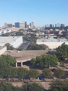
North Dallas is an area of numerous communities and neighborhoods in Dallas, Texas. The phrase "North Dallas" is also sometimes used to include any suburb or exurb north of Dallas proper within the metropolitan area. The majority of North Dallas is located in Dallas County, while a small portion is located in Collin and Denton Counties. North Dallas generally includes areas of Dallas north of Northwest Highway, along with Lake Highlands and areas of Dallas north of IH-635 known as Far North Dallas. The area has strong social and economic ties to the Dallas enclave of Park Cities, and two inner suburbs of Dallas, Richardson and Addison. It is the wealthiest part of Dallas, but has its adjacent, less resourced areas as well.

Nolan Hill is a residential neighbourhood in the northwest quadrant of Calgary, Alberta, Canada. Located near the north edge of the city, it is bounded by Sarcee Trail to the west, 144 Avenue N.W. to the north, the Sage Hill community across Shaganappi Trail to the east, and the Sherwood community across 128 Avenue N.W. to the south. It is one of five communities located within the Symons Valley area.

Horse Hill is a residential area in the northeast portion of the City of Edmonton in Alberta, Canada. It was formally established on May 22, 2013 through Edmonton City Council's adoption of the Horse Hill Area Structure Plan, which guides the overall development of the area. The area is estimated to have a population of 71,467 at full build-out of five neighbourhoods.

Rum Hill is a mountain located in Central New York Region of New York northwest of the Hamlet of Pierstown. Red House Hill is located southeast, Metcalf Hill is located south, Allen Lake and Mohegan Hill are located north-northwest and Otsego Lake is located east of Rum Hill.

Kilkenny Hill is a mountain in the Central New York region of New York, USA. It is located northwest of Unadilla, New York. Kilkenny Hill is part of the Northern Allegheny Plateau Ecoregion.

Cerro del Diablo is a mountain in the municipality of Ponce, Puerto Rico, located north-northwest of the city of Ponce. The 2234-foot high hill sits at the foothills of the Cordillera Central and is located in Barrio Tibes.

