Related Research Articles

Kisumu County is one of 47 counties in the Republic of Kenya. Its borders follow those of the original Kisumu District, one of the former administrative districts of the former Nyanza Province in western Kenya. Its headquarters is Kisumu City which is the third largest city in Kenya after the capital Nairobi and the coastal city of Mombasa. It has a population of 1,155,574. The land area of Kisumu County totals 2085.9 km2.

Kericho County is one of the 47 counties in Kenya. The county seats between longitude 35°02' and 35°40' East and between the equator and latitude 0°23' South with an altitude of about 2002m above sea level. It borders Uasin Gishu County to the North West, Baringo County to the North, Nandi County to the North-West, Nakuru County to the East and Bomet County to the South, Kisumu County to the Northwest and Nyamira County to the West. It has a population of 901,777 and an area of 2,111 km². Its capital and largest town is Kericho.

Homa Bay is a town on the south shore of Winam Gulf of Lake Victoria, in western Kenya. It lies near Mount Homa and Ruma National Park, the latter noted for Jackson's hartebeests and roan antelope.
Kapenguria is a town in Kenya. It is the capital and largest urban center of West Pokot County. The town lies north east of Kitale on the A1 road in Kenya. Kapenguria forms a municipality with a population of 40,751 as per the 2019 Kenya Population and Housing Census.

Siaya is a municipality and the capital of Siaya County, Kenya. It is located 74 km (46 mi) northwest of Kisumu. The urban center had a population of 33,153 in 2019.

Nyamira County is a county in the former Nyanza Province of Kenya. It shares common boundaries with what was known as Nyamira District. The main cash crops grown are bananas and tea. The county has a population of 605,576. Its capital and largest town is Nyamira, with an urban population of around 41,668

Kajiado County is a county in the former Rift Valley Province of Kenya. As of 2019, Kajiado county spanned an area of 21,292.7 km2, with a recorded population of 1,117,840. The county borders Nairobi and to its south it borders the Tanzanian regions of Arusha and Kilimanjaro. The county capital is Kajiado, but the largest town is Ongata Rongai. Its main tourist attraction is its wildlife.

Vihiga County is an administrative region in the former Western Province of Kenya whose headquarters are in Mbale, the largest town in the county. The county has a population of 554,622 and an area of 563 km2. Formally a district, Vihiga was split from Kakamega District in 1990. In 2019's census, Vihiga was found to have a population of 590, 013, an increase of 35, 391 from the 2009's count.
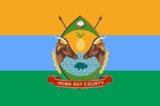
Homa Bay County is a county in the former Nyanza Province of Kenya. Its capital and largest town is Homa Bay. The county has a population of 1,131,950 and an area of 3,154.7 km2. Lake Victoria is a major source of livelihood for Homa Bay County. It has 40 wards, each represented by an MCA to the assembly in Homa Bay town as its headquarters.

Muhoroni is a town in Kisumu County, Kenya. Muhoroni hosts a town council. It has an urban population of 13,664 and a total population of 31,148. Muhoroni has a railway station along the Nairobi-Kisumu Railway. The town is located 50 kilometres east of Kisumu Chemelil, a smaller town, is located 10 kilometres west of Muhoroni. Cost of living in Muhoroni is so high and densely populated housing.
Chemelil is a town in Kisumu County, Kenya. It is part of Muhoroni District. Chemelil has a railway station along the Nairobi-Kisumu Railway between the stations of Kibigori and Muhoroni. The town is located 40 kilometres east of Kisumu, the county capital. Muhoroni, another town, is located 10 kilometres east of Chemelil.

The districts of Kenya were divided into 262 divisions (matarafa). Divisions of Kenya were further subdivided into locations. Today's counties of Kenya are based on the merging of some of the districts on this list and since the divisions are one level under the districts they are now the sub-counties. This is because Kenya recently changed its constitution and 47 Counties emerged. Here are the divisions listed below, by district :

Kendu Bay is a bay and town in Kenya. The area is the part of Rachuonyo North District in Homa Bay County. It is located on the shore of Lake Victoria along Katito-Homa-Bay road. It is the headquarters of the district. Kisumu, the largest urban centre in Kenya's western region, is located 40 kilometres north of Kendu Bay, but the route to Kisumu, which goes via Ahero, is much longer as it circumvents Winam Gulf in between kisumu- Ahero- Katito- Kendu Bay is 70 km from Kisumu town. Kendu Bay is also linked by a road to Homa Bay, located 30 kilometres southwest.
Muhoroni is an electoral constituency in Kenya. It is one of seven constituencies of Kisumu County.
Nyakach is an electoral constituency in Kenya. It is one of seven constituencies of Kisumu County. The constituency has five wards, all electing MCAs for the Kisumu County Assembly and has a population of 150,320 people based on the 2019 census report.
Nyando is an electoral constituency in Kenya. It is one of seven constituencies of Kisumu County.
Koru is a small town centre in Kisumu County, Kenya, Africa. It forms an electoral ward of Muhoroni Constituency and Muhoroni town council. Koru is also a location in the Muhoroni division. It is at an elevation of 1540m.
Kibigori is a small town in Kisumu County, Kenya. It is located 20 kilometres east of Kisumu. It is part of the Chemelil ward of Muhoroni Constituency and Nyando County Council. Elevation 1242m.
References
- ↑ Kenya National Bureau of Statistics, KNBS (2019). 2019 KENYA POPULATION AND HOUSING CENSUS. Nairobi, Kenya: Kenya National Bureau of Statistics. p. 12. ISBN 978-9966-102-09-6.