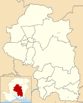
Winchester is a cathedral city in Hampshire, England. The city lies at the heart of the wider City of Winchester, a local government district, at the western end of the South Downs National Park, on the River Itchen. It is 60 miles (97 km) south-west of London and 14 miles (23 km) from Southampton, its nearest city. At the 2021 census, the built-up area of Winchester had a population of 48,478. The wider City of Winchester district includes towns such as Alresford and Bishop's Waltham and had a population of 127,439 in 2021. Winchester is the county town of Hampshire and contains the head offices of Hampshire County Council.

Mere is a market town and civil parish in Wiltshire, England. It lies at the extreme southwestern tip of Salisbury Plain, close to the borders of Somerset and Dorset. The parish includes the hamlets of Barrow Street, Burton, Charnage, Limpers Hill, Rook Street and Southbrook.
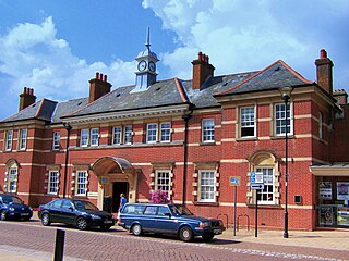
Eastleigh is a town in Hampshire, England, between Southampton and Winchester. It is the largest town and the administrative seat of the Borough of Eastleigh, with a population of 24,011 at the 2011 census.

Totton and Eling is a civil parish in Hampshire, England, with a population of about 28,100 people. It contains the town of Totton and is situated between the eastern edge of the New Forest and the River Test, close to the city of Southampton but outside the city boundary; the town is within the New Forest non-metropolitan district. Surrounding towns and villages include Ashurst, Marchwood, Cadnam and Ower.

Kings Worthy is a village and civil parish in Hampshire, England, approximately two miles north-east of Winchester. Kings Worthy was a tithing of Barton Stacey when the Domesday Book was written.

Hursley is a village and civil parish in Hampshire, England with a population of around 900 in 2011. It is located roughly midway between Romsey and Winchester on the A3090. Besides the village the parish includes the hamlets of Standon and Pitt and the outlying settlement at Farley Chamberlayne.

Old Basing is a village in Hampshire, England, just east of Basingstoke. It was called Basengum in the Anglo-Saxon Chronicle and Basinges in the Domesday Book.

Ludgershall is a town and civil parish 16 miles (26 km) north east of Salisbury, Wiltshire, England. It is on the A342 road between Devizes and Andover. The parish includes Faberstown which is contiguous with Ludgershall, and the hamlet of Biddesden which lies 2 miles (3.2 km) to the east, on the border with Hampshire.

Crondall is a village and large civil parish in the Hart district, in the north east of Hampshire in England, in the Crondall Hundred surveyed in the Domesday Book of 1086. The village is on the gentle slopes of the low western end of the North Downs range, and has the remains of a Roman villa. Despite the English Reformation, Winchester Cathedral held the chief manors representing much of its land from 975 until 1861. A large collection of Anglo-Saxon and Merovingian coins found in the parish has become known as the Crondall Hoard. In 2021 the parish had a population of 1724.
Liss is a village and civil parish in the East Hampshire district of Hampshire, 3.3 miles (5.3 km) north-east of Petersfield, on the A3 road, on the West Sussex border. It covers 3,567 acres (14 km2) of semi-rural countryside in the South Downs National Park. Liss railway station is on the Portsmouth Direct line. The village comprises an old village at West Liss and a modern village round the 19th-century station. They are divided by the River Rother. Suburbs later spread towards Liss Forest.

Barton Stacey is a village and undulating civil parish, which includes the hamlets of Bransbury, Newton Stacey, Drayton and Cocum, in the Test Valley district of Hampshire, England, centred about 7 miles (11 km) south-east of Andover. It is bounded to the north by the estate of Drayton Lodge, and, to the south, by the minor A30 road; both being east–west routes, and connected by The Street/Cocum Road, the main road that bisects the village. The distance between the A303 and A30 at this point is 2 miles (3.2 km), which is twice the width of the parish.
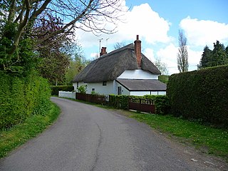
Bulford is a village and civil parish in Wiltshire, England, near Salisbury Plain. The village is close to Durrington and about 1.5 miles (2.4 km) north of the town of Amesbury. The Bulford Camp army base is separate from the village but within the parish.

West End is a parish in Hampshire in the borough of Eastleigh, five miles (8.0 km) east of the city of Southampton. The village of West End is small and generally classed as an area in the outer suburbs or rural urban fringe of the borough of Eastleigh because of the surrounding woodland and countryside, including Telegraph Woods and Itchen Valley Country Park.
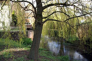
Corhampton is a village and former civil parish, now in the parish of Corhampton and Meonstoke, in the Winchester district, in the county of Hampshire, England. It lies on the western bank of the River Meon. In 1931 the parish had a population of 87. On 1 April 1932 the parish was abolished and merged with Meonstoke to form "Corhampton and Meonstoke".

Sparsholt (/ˈspɑːʃəʊlt/) is a village and civil parish in Hampshire, England, 2+1⁄2 miles (4 km) west of Winchester. In 1908 its area was 3,672 acres (1,486 ha). The 2011 Census recorded its population as 982.

Wellow is a village and civil parish in Hampshire, England that falls within the Test Valley district. The village lies just outside the New Forest, across the main A36 road which runs from the M27 motorway to Salisbury. The nearest town is Romsey, 4 miles (6.4 km) to the east, and the closest city is Southampton, 9 miles (14 km) to the southeast. The parish had a population of 3,239 in the 2021 census.

Sutton Veny is a village and civil parish in the Wylye valley, to the southeast of the town of Warminster in Wiltshire, England; the village is about 3 miles (5 km) from Warminster town centre. 'Sutton' means 'south farmstead' in relation to Norton Bavant, one mile (1.6 km) to the north. 'Veny' may be a French family name or may describe the village's fenny situation.

Froxfield Green is a village in the civil parish of Froxfield and Privett, in the East Hampshire district of Hampshire, England. It is 3 miles (5 km) north-west of Petersfield, and lies just north of the A272 road.
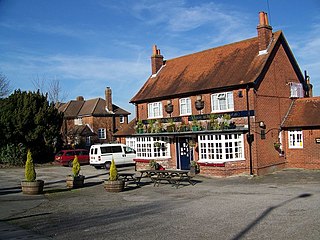
Winnall is a northern suburb of Winchester, Hampshire, England, on the east bank of the River Itchen.

Stanmore is a large residential suburb of Winchester, Hampshire, England, situated on a very steep slope from West to East. It lies to the south-west of the city centre and to the north of Badger Farm, and makes up a large percentage, in both area and population, of the St. Luke electoral ward. It is home to roughly 6,000 inhabitants.


