
Osage is a city and the county seat of Mitchell County, Iowa, United States. The population was 3,627 at the time of the 2020 census.

Maquoketa Caves State Park is a state park of Iowa, United States, located in Jackson County. It stands northwest of the city of Maquoketa. In 1991 111 acres (45 ha) on the east side of the park were listed as a historic district on the National Register of Historic Places.

Downtown Grand Forks is the original commercial center of Grand Forks, North Dakota, United States. Located on the western bank of the Red River of the North, the downtown neighborhood is situated near the fork of the Red River and the Red Lake River. While downtown is no longer the dominant commercial area of the Greater Grand Forks community, it remains the historic center of Grand Forks. An 80.4-acre (32.5 ha) portion was listed on the National Register of Historic Places in 2005, as Downtown Grand Forks Historic District. Today, downtown Grand Forks is home to many offices, stores, restaurants, and bars.

Backbone State Park is Iowa's oldest state park, dedicated in 1919. Located in the valley of the Maquoketa River, it is approximately three miles (5 km) south of Strawberry Point in Delaware County. It is named for a narrow and steep ridge of bedrock carved by a loop of the Maquoketa River originally known as the Devil's Backbone. The initial 1,200 acres (490 ha) were donated by E.M. Carr of Lamont, Iowa. Backbone Lake Dam, a relatively low dam built by the Civilian Conservation Corps (CCC) in the 1930s, created Backbone Lake. The CCC constructed a majority of trails and buildings which make up the park.

The Fort Madison Downtown Commercial Historic District has a collection of late-19th century store fronts centered on Ave. G, from 6th to 9th Street, and Ave. H from 7th to 9th, in Fort Madison, Iowa. It was listed on the National Register of Historic Places in 2007.

The Vander Veer Park Historic District is a historic district in Davenport, Iowa, United States, that was listed on the National Register of Historic Places. Over its 70.8-acre (287,000 m2) area, in 1985 it included 66 contributing buildings, two contributing structures, one contributing site, and one contributing object.

The Crescent Warehouse Historic District is a 10.5-acre (4.2 ha) historic district in Downtown Davenport, Iowa, United States. The district is a collection of multi-story brick structures that formerly housed warehouses and factories. Most of the buildings have been converted into loft apartments. The district was listed on the National Register of Historic Places in 2003.
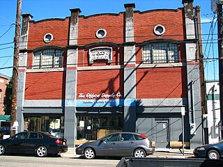
The East Portland Grand Avenue Historic District, located in southeast Portland, Oregon, is listed on the National Register of Historic Places. The district includes approximately 20 city blocks on or near Southeast Grand Avenue on the east side of the Willamette River, roughly bounded on the south by SE Main Street, north by SE Ankeny Street, west by SE Martin Luther King Jr. Boulevard, and east by SE Seventh Avenue. Most structures in the district are commercial buildings rising two to three stories. Immediately to the west of the historic district is Portland's east side industrial area, and to the east are industrial and residential areas.

The Provo Downtown Historic District is a 25-acre (10 ha) historic area located in Provo, Utah, United States. It is listed on the National Register of Historic Places.

The Helvig–Olson Farm Historic District is an agricultural historic district located in rural Clinton County, Iowa, United States, 3 miles (4.8 km) southwest of the town of Grand Mound. It was listed on the National Register of Historic Places in 2000.

The Downtown Commercial Historic District encompasses most of the central business district of Burlington, Iowa, United States. It was listed on the National Register of Historic Places in 2015. The historic district includes 65 properties that were part of a 2012 to 2013 survey of the area. It also includes as contributing properties the buildings in the West Jefferson Street Historic District and three buildings in the Manufacturing and Wholesale Historic District that were previously listed on the National Register. All total there are 122 resources within the district, which includes 108 contributing and 14 non-contributing properties.
The State Center Commercial Historic District is a nationally recognized historic district located in State Center, Iowa, United States. It was listed on the National Register of Historic Places in 2002. At the time of its nomination it contained 36 resources, which included 31 contributing buildings, two contributing structures, and three non-contributing buildings. The historic district covers the town's central business district. State Center is located at the highest point in Marshall County, midway between Marshalltown and Nevada. The town was established by the Cedar Rapids & Missouri Railroad on 80 acres (32 ha) of land in 1863. It was initially named "Centre Station," but William Barnes, the first railroad agent, changed the town's name to "State Centre."

Lacey-Keosauqua State Park is located southwest of Keosauqua, Iowa, United States. The park is located along the Des Moines River in Van Buren County. First dedicated in 1921, it is the largest state park in size in Iowa. In 1990, three areas were named nationally recognized historic districts and listed on the National Register of Historic Places.
The Duncan–Duitsman Farm Historic District is a nationally recognized agricultural historic district located northeast of George, Iowa, United States. It was listed on the National Register of Historic Places in 1994. At the time of its nomination, it contained 19 resources, which included 12 contributing buildings, four contributing sites, one contributing structure, and two non-contributing buildings. Its historic importance is derived from being two pioneer farmsteads from the last section of Iowa opened to settlement.

Winterset Courthouse Square Commercial Historic District is a nationally recognized historic district located in Winterset, Iowa, United States. It was listed on the National Register of Historic Places in 2015. At the time of its nomination the district consisted of 82 resources, including 74 contributing buildings, seven noncontributing buildings, and one noncontributing object. The historic district covers most of the city's central business district in the original town plat. Most of the buildings are two-story, brick, commercial buildings. The commercial Italianate style is dominant, with Queen Anne, Romanesque Revival, and Neoclassical styles included. The Madison County Courthouse (1878) is a Renaissance Revival structure designed by Alfred H. Piquenard. Most of the buildings are brick construction, but four were constructed using locally quarried limestone. The stone buildings include the courthouse, the White, Munger and Company Store (1861), and the Sprague, Brown, and Knowlton Store (1866), all of which are individually listed on the National Register.

The Waverly East Bremer Avenue Commercial Historic District is a nationally recognized historic district located in Waverly, Iowa, United States. It was listed on the National Register of Historic Places in 2014. At the time of its nomination it contained 53 resources, which included 41 contributing buildings, and 12 non-contributing buildings. The historic district covers a portion of the city's central business district between the Cedar River on the west and the former right-of-way for the Chicago Great Western Railway on the east.

Fort Dodge Downtown Historic District is a nationally recognized historic district located in Fort Dodge, Iowa, United States. It was listed on the National Register of Historic Places in 2010. Additional documentation for the district was approved by the National Park Service on January 4, 2019. At the time of its nomination it contained 177 resources, which included 100 contributing buildings, one contributing site, one contributing structure, five contributing objects, 64 non-contributing buildings, three non-contributing structures, and three non-contributing objects. The district covers the city's central business district, mainly along Central Avenue, but also along the adjoining streets as well. Commercial development in the district began with the city's original plat in 1854 and continued through the opening of the Crossroads Mall in 1964. Webster County Courthouse (1902), First National Bank Building (1908), and the Wahkonsa Hotel (1910) are all located in the district and are individually listed on the National Register.

The Upper Iowa Street Historic District is a nationally recognized historic district located in Dubuque, Iowa, United States. It was listed on the National Register of Historic Places in 2015. At the time of its nomination it consisted of nine resources, which included eight contributing buildings and one non-contributing building. The district is a single block with commercial and residential buildings on both sides of Iowa Street. It was originally a residential section on the north side of the central business district. The first two commercial buildings were substantial Italianate-style structures constructed on the north side of the block in the mid-1880s. In the 1890s larger and more elaborate Queen Anne commercial buildings were built to the south. The oldest building is an 1872 residence that was used as a doctor's office and other business purposes. It has subsequently been covered in Permastone. The rest of the buildings are brick with stone ornamentation.

The Dublin Commercial Historic District is a 32 acres (13 ha) historic district roughly centered on Jackson Ave. and Lawrence St. in Dublin in Laurens County, Georgia. It was listed on the National Register of Historic Places in 2002. The district included 76 contributing buildings, one contributing structure, and one contributing object.

The Davenport Downtown Commercial Historic District is a nationally recognized historic district located in the central business district of Davenport, Iowa, United States. It was listed on the National Register of Historic Places in 2020. At the time of its nomination it consisted of 43 resources, which included 33 contributing buildings, one contributing structure, and nine non-contributing buildings. In addition, the district also contains 33 buildings that are individually listed on the National Register. This historic district is bordered by four other districts: the Crescent Warehouse Historic District and the Davenport Motor Row and Industrial Historic District on the east, the Hamburg Historic District to the northwest, and the West Third Street Historic District on the west.


