Painesville Township, Lake County, Ohio

Last updated

Painesville Township, Lake County, Ohio
Casement House Side View.jpg
The Casement House, a historic site in the township
Map of Lake County Ohio Highlighting Painesville Township.png
Location of Painesville Township in Lake County
Coordinates: 41°43′44″N81°15′35″W / 41.72889°N 81.25972°W / 41.72889; -81.25972
Country United States
State Ohio
County Lake
Area
  Total177.4 sq mi (459.5 km2)
  Land16.8 sq mi (43.5 km2)
  Water160.6 sq mi (416.0 km2)
Elevation
[1]
705 ft (215 m)
Population
 (2020) [2]
  Total20,453
  Density120/sq mi (45/km2)
Time zone UTC-5 (Eastern (EST))
  Summer (DST) UTC-4 (EDT)
ZIP code
44077
Area code 440
FIPS code 39-59430 [3]
GNIS feature ID1086429 [1]
Website www.painesvilletwp.com

Painesville Township is one of the five townships of Lake County, Ohio, United States. The population was 20,453 at the 2020 census. It is a part of Greater Cleveland in the Northeast Ohio Region, and is included in the Cleveland-Akron-Canton, Ohio combined statistical area in the United States.

Contents

Name and history

Painesville Township is included in what is historically referred to as the Connecticut Western Reserve. General Edward Paine (1746–1841), who had served as a captain in the Connecticut militia during the war, arrived in 1800 with a party of 66 settlers. General Paine later represented the region in the territorial legislature of the Northwest Territory.

Lake County was established on March 6, 1840, from land given by Cuyahoga and Geauga counties, and derived its name from its location on the southern shore of Lake Erie. The county seat, Painesville, was named after General Paine, and the county was divided further with the creation of Perry, LeRoy, Painesville, Mentor, Kirtland, and Concord Townships. [4]

Statue of General Edward Paine in Painesville Edward Paine Statue in 2008.jpg
Statue of General Edward Paine in Painesville

Geography

Painesville Township contains four major disjunct sections. [5] Located in the northern part of the county along Lake Erie, it borders the following townships and city:

Several municipalities are located in Painesville Township:

The township surrounds the city of Painesville, but is separate from it.

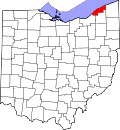
According to the U.S. Census Bureau, the township has a total area of 177.4 square miles (459.5 km2), of which 16.8 square miles (43.5 km2) are land and 160.6 square miles (416.0 km2), or 90.5%, are water. [6] The township boundaries extend north to the center of Lake Erie and the Canadian border.

Climate

Painesville City, and surrounding Painesville Township, have a hybrid between a humid subtropical and humid continental climate (Köppen Cfa/Dfa). In spite of the mild winter days, lake-effect snow usually brings a lot of accumulation in winter. Summers have warm days and quite muggy nights. Precipitation is high year-round.

Climate data for Painesville, Ohio (1991–2020 normals), extremes since 1950
MonthJanFebMarAprMayJunJulAugSepOctNovDecYear
Record high °F (°C)70
(21)
77
(25)
82
(28)
91
(33)
93
(34)
98
(37)
96
(36)
96
(36)
96
(36)
91
(33)
81
(27)
75
(24)
98
(37)
Mean maximum °F (°C)58.9
(14.9)
59.7
(15.4)
70.0
(21.1)
79.8
(26.6)
84.6
(29.2)
89.7
(32.1)
90.2
(32.3)
89.8
(32.1)
87.2
(30.7)
80.0
(26.7)
69.0
(20.6)
60.3
(15.7)
92.5
(33.6)
Mean daily maximum °F (°C)36.8
(2.7)
38.7
(3.7)
46.1
(7.8)
58.1
(14.5)
69.1
(20.6)
78.1
(25.6)
82.3
(27.9)
81.6
(27.6)
76.2
(24.6)
64.9
(18.3)
52.6
(11.4)
42.0
(5.6)
60.5
(15.8)
Daily mean °F (°C)30.2
(−1.0)
31.4
(−0.3)
38.2
(3.4)
49.2
(9.6)
60.3
(15.7)
69.8
(21.0)
74.6
(23.7)
73.7
(23.2)
67.8
(19.9)
57.0
(13.9)
45.7
(7.6)
36.2
(2.3)
52.8
(11.6)
Mean daily minimum °F (°C)23.7
(−4.6)
24.1
(−4.4)
30.2
(−1.0)
40.4
(4.7)
51.4
(10.8)
61.5
(16.4)
66.9
(19.4)
65.7
(18.7)
59.4
(15.2)
49.1
(9.5)
38.8
(3.8)
30.3
(−0.9)
45.1
(7.3)
Mean minimum °F (°C)5.4
(−14.8)
7.6
(−13.6)
14.2
(−9.9)
27.4
(−2.6)
37.8
(3.2)
48.0
(8.9)
55.3
(12.9)
53.9
(12.2)
45.3
(7.4)
35.6
(2.0)
25.1
(−3.8)
14.4
(−9.8)
2.7
(−16.3)
Record low °F (°C)−19
(−28)
−9
(−23)
0
(−18)
17
(−8)
25
(−4)
37
(3)
43
(6)
39
(4)
27
(−3)
24
(−4)
5
(−15)
−11
(−24)
−19
(−28)
Average precipitation inches (mm)3.14
(80)
2.15
(55)
2.83
(72)
3.47
(88)
3.42
(87)
3.63
(92)
4.12
(105)
3.44
(87)
3.91
(99)
4.04
(103)
3.17
(81)
3.14
(80)
40.46
(1,029)
Average precipitation days (≥ 0.01 in)15.712.512.613.212.611.49.69.69.113.113.514.1147.0
Source 1: NOAA [7]
Source 2: National Weather Service [8]

Demographics

The population of Painesville Township in 2020 was 20,453, with the following racial distribution: White: 90%, Black: 2%, Hispanic: 5%, Native: 1%, two or more races: 2%.

The Per Capita income for a family of three is $114,696 and the median household income is $76,036. For residents 25 years and older, 93% have a high school diploma, 18.7% have a Bachelor's degree, and 7% have a post graduate degree. [9]

Government

The township is governed by a three-member board of trustees, who are elected in November of odd-numbered years to a four-year term beginning on the following January 1. Two are elected in the year after the presidential election and one is elected in the year before it. There is also an elected township fiscal officer, who serves a four-year term beginning on April 1 of the year after the election, which is held in November of the year before the presidential election. Vacancies in the fiscal officership or on the board of trustees are filled by the remaining trustees. Painesville Township has voted on several occasions on whether or not to merge with Painesville City. The township has voted to stay independent of the city primarily to maintain its lower real estate tax structure and support its separate school system [10]

Transportation

Highways

Major transportation routes in the township are U.S. Route 20 and State Routes 2, 84 and Ohio State Route 44. Painesville Township is located just north of Interstate 90 and is easily accessed via Ohio State Route 44.

Mass Transit

Laketran operates bus lines throughout Lake County as well as into downtown Cleveland and Cleveland's major medical centers in University Circle. [11]

Railroads

Two major railroads, CSX and Norfolk Southern, pass through the township and serve some of the township's industries. Additionally, Amtrak's Lake Shore Limited passes through on the CSX line. However, these trains do not stop in the township. The nearest Amtrak station is 28 miles (45 km) to the southwest in Cleveland.

Airports

Painesville Township is 43 miles (69 km) from Cleveland Hopkins International Airport, Ohio's largest airport.

Healthcare

The Painesville City and Painesville Township healthcare needs are provided in neighboring Concord Township by University Hospitals Cleveland Medical Center and Tri-Point Medical Center. The hospital is part of the Lake Health healthcare system.

Economy

Painesville Township is home to several industries, including a Berkshire Hathaway's Lubrizol Corporation facility, Avery Dennison, and Nova Chemicals. [12]

Education

Public

Painesville Township is home to the Riverside Local School District, formerly the Painesville Township Local Schools. Its schools include Riverside High School, John R. Williams Junior High School, Lamuth Middle School and four elementary schools. [13] Painesville city and Fairport Harbor operate their own school districts, while Grand River village, Leroy and Concord township students attend Riverside's schools.

Higher Education

Lake Erie College, a private liberal arts college enrolling approximately 1,200 students is located in neighboring Painesville. The college offers over 60 undergraduate programs and master's programs. The former Andrews Osborne Academy's Painesville campus became part of Lake Erie College in 2008.

Lakeland Community College, located in nearby Kirtland, Ohio, offers Associate Degree level education to residents of Painesville Township and Lake County.

Public Library

Morley Library serves both Painesville City and Painesville Township residents and is located in Painesville's 284-acre (115 ha) Historic Downtown District.

Recreation

Painesville Township is home to the Lake County Fair, [14] which is held every August. Events such as harness racing and tractor pulling competitions, as well as concerts performed by big name country music bands, take place at the fair.

Nearly 80% of Headlands Beach State Park is in Painesville Township; the remainder lies in the neighboring community of Mentor. The beach is the longest natural beach in Ohio. The US Coast Guard has a base in the township located just east of Headlands Beach. [15]

Notable people

Related Research Articles

<span class="mw-page-title-main">Lake County, Ohio</span> County in Ohio, United States

Lake County is a county in the U.S. state of Ohio. As of the 2020 census, the population was 232,603. Its county seat is Painesville, and its largest city is Mentor.

<span class="mw-page-title-main">Geauga County, Ohio</span> County in Ohio, United States

Geauga County is a county in the U.S. state of Ohio. As of the 2020 census, the population was 95,397. The county seat and largest city is Chardon.

<span class="mw-page-title-main">Erie County, Ohio</span> County in Ohio, United States

Erie County is a county located in the northern portion of the U.S. state of Ohio. As of the 2020 census, the population was 75,622. Its county seat and largest city is Sandusky. The county is named for the Erie tribe, whose name was their word for "wildcat". It was formed in 1838 from the northern third of Huron County and a portion of Sandusky County.

<span class="mw-page-title-main">Chardon, Ohio</span> City in Ohio, United States

Chardon is a city in and the county seat of Geauga County, Ohio, United States. The population was 5,242 at the 2020 census. It is the only incorporated city in Geauga County, and includes land that was once part of Chardon, Hambden and Munson townships. It is located about 10 miles south of Lake Erie and within the "snow belt" of the Great Lakes and is part of the Cleveland metropolitan area.

<span class="mw-page-title-main">Fairport Harbor, Ohio</span> Village in Ohio, United States

Fairport Harbor is a village in Lake County, Ohio, United States, along Lake Erie at the mouth of the Grand River. The population was 3,108 at the 2020 census. A far-eastern suburb of Cleveland, it is part of the Cleveland metropolitan area.

<span class="mw-page-title-main">Kirtland, Ohio</span> City in Ohio, United States

Kirtland is a city in Lake County, Ohio, United States. The population was 6,937 at the 2020 census. Kirtland is known for being the early headquarters of the Latter Day Saint movement from 1831 to 1837 and the site of the movement's first temple, the Kirtland Temple, completed in 1836. The Kirtland Temple and nearby Historic Kirtland Village are maintained as historic sites highlighting that era. The city is also the location for multiple parks in the Lake Metroparks system, as well as the Holden Arboretum.

<span class="mw-page-title-main">Mentor, Ohio</span> City in Ohio, United States

Mentor is the largest city in Lake County, Ohio, United States. The population was 47,450 at the 2020 census. It is part of the Cleveland metropolitan area.

<span class="mw-page-title-main">Painesville, Ohio</span> City in Ohio, United States

Painesville is a city in and the county seat of Lake County, Ohio, United States, located along the Grand River 27 miles (43 km) It is a northeast suburb of Cleveland. Its population was 20,312 at the 2020 census. Painesville is part of the Greater Cleveland Metropolitan Area and is included in the Cleveland-Akron-Canton, Ohio Consolidated Metropolitan Statistical Area.

<span class="mw-page-title-main">Lorain, Ohio</span> City in Ohio, United States of America

Lorain is a city in Lorain County, Ohio, United States. It is located in Northeast Ohio on Lake Erie at the mouth of the Black River, about 25 miles (40 km) miles west of Cleveland. As of the 2020 census, the city had a population of 65,211, making it Ohio's ninth-largest city, the third-largest in Greater Cleveland, and the largest in Lorain County by population.

<span class="mw-page-title-main">Greater Cleveland</span> Metropolitan Statistical Area in Ohio, United States

The Cleveland metropolitan area, or Greater Cleveland as it is more commonly known, is the metropolitan area surrounding the city of Cleveland in Northeast Ohio, United States. According to the 2020 census results, the six-county Cleveland, OH Metropolitan Statistical Area (MSA) consists of Cuyahoga County, Ashtabula County, Geauga County, Lake County, Lorain County, and Medina County, and has a population of 2,185,825, making it the 33rd-most populous metropolitan area in the United States and the third largest metropolitan area in Ohio. The metro area is also part of the larger Cleveland–Akron–Canton Combined Statistical Area with a population of over 3.7 million people, the most populous statistical area in Ohio and the 17th most populous in the United States.

<span class="mw-page-title-main">Northeast Ohio</span> Place in Ohio, United States

The region Northeast Ohio, in the US state of Ohio, in its most expansive usage contains six metropolitan statistical areas: Cleveland–Elyria, Akron, Canton–Massillon, Youngstown–Warren, Mansfield, and Weirton–Steubenville along with eight micropolitan statistical areas. Most of the region is considered either part of the Cleveland–Akron–Canton, OH Combined Statistical Area and media market or the Youngstown–Warren, OH–PA Combined Statistical Area and media market. In all, the region is home to: 4,502,460 residents. It is also a part of the Great Lakes megalopolis, containing over 54 million people. Northeast Ohio also includes most of the area known historically as the Connecticut Western Reserve.

<span class="mw-page-title-main">Connecticut Western Reserve</span> Land area claimed by Connecticut until 1800

The Connecticut Western Reserve was a portion of land claimed by the Colony of Connecticut and later by the state of Connecticut in what is now mostly the northeastern region of Ohio. The Reserve had been granted to the Colony under the terms of its charter by King Charles II.

<span class="mw-page-title-main">Oxford Township, Erie County, Ohio</span> Township in Ohio, United States

Oxford Township is one of the nine townships of Erie County, Ohio, United States. It is part of the Sandusky, Ohio micropolitan statistical area and the Cleveland-Akron-Canton Combined Statistical Area. The 2020 census recorded 1,140 residents.

<span class="mw-page-title-main">Jerusalem Township, Lucas County, Ohio</span> Township in Ohio, United States

Jerusalem Township is one of the eleven townships of Lucas County, Ohio, United States. The 2020 census found 2,895 people in the township.

<span class="mw-page-title-main">Chardon Township, Ohio</span> Township in Ohio, United States

Chardon Township is one of the sixteen townships of Geauga County, Ohio, United States. As of the 2020 census the population was 4,494.

<span class="mw-page-title-main">LeRoy Township, Lake County, Ohio</span> Township in Ohio, United States

LeRoy Township is one of the five townships of Lake County, Ohio, United States. As of the 2020 census the population was 3,128.

<span class="mw-page-title-main">Concord Township, Lake County, Ohio</span> Township in Ohio, United States

Concord Township is one of the five townships of Lake County, Ohio, United States. As of the 2020 census, the population was 19,254. Lake County is part of the Cleveland-Elyria, OH Metropolitan Statistical Area.

<span class="mw-page-title-main">Perry Township, Lake County, Ohio</span> Township in Ohio, United States

Perry Township is one of the five townships of Lake County, Ohio, United States. As of the 2020 census the population was 8,862.

Riverside Local School District, formerly named Painesville Township Local School District until July 1, 2007, is a primary/secondary school district in Ohio.

Beulah Beach is an unincorporated community and census-designated place located adjacent to Lake Erie in Erie County, Ohio, United States. As of the 2020 census it had a population of 75. It is located within Vermilion Township.

References

  1. 1 2 "US Board on Geographic Names". United States Geological Survey. October 25, 2007. Retrieved January 31, 2008.
  2. "Painesville township, Lake County, Ohio - Census Bureau Profile". United States Census Bureau. Retrieved July 13, 2023.
  3. "U.S. Census website". United States Census Bureau . Retrieved January 31, 2008.
  4. "History - Painesville, OH".
  5. "Zoning Map". Township of Painesville. Retrieved August 6, 2013.
  6. "U.S. Gazetteer Files: 2019: County Subdivisions: Ohio". U.S. Census Bureau Geography Division. Retrieved July 2, 2020.
  7. "U.S. Climate Normals Quick Access – Station: Painesville 4NW, OH". National Oceanic and Atmospheric Administration. Retrieved September 5, 2023.
  8. "NOAA Online Weather Data – NWS Cleveland". National Weather Service. Retrieved September 5, 2023.
  9. "Census profile: Painesville township, Lake County, OH".
  10. "Trustee Meeting Minutes « Painesville Township - Lake County, Ohio".
  11. "Local Routes – Laketran".
  12. "Manufacturing, Production & Wholesale - Eastern Lake County Chamber of Commerce" . Retrieved September 1, 2016.
  13. "Home". painesville-township.k12.oh.us.
  14. "Welcome to the Lake County Fair" . Retrieved September 1, 2016.
  15. "Painesville Township station getting $11 million upgrade from U.S. Coast Guard". April 15, 2013. Retrieved September 1, 2016.