Lakeline, Ohio | |
---|---|
Coordinates: 41°39′31″N81°27′14″W / 41.65861°N 81.45389°W | |
Country | United States |
State | Ohio |
County | Lake |
Government | |
• Mayor | Deborah Neale (D) [1] |
Area | |
• Total | 0.09 sq mi (0.23 km2) |
• Land | 0.09 sq mi (0.23 km2) |
• Water | 0.00 sq mi (0.00 km2) |
Elevation | 620 ft (189 m) |
Population (2020) | |
• Total | 216 |
• Density | 2,454.55/sq mi (951.41/km2) |
Time zone | UTC-5 (Eastern (EST)) |
• Summer (DST) | UTC-4 (EDT) |
ZIP code | 44095 |
Area code | 440 |
FIPS code | 39-41398 [4] |
GNIS feature ID | 1042388 [3] |
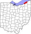
Lakeline is a village in Lake County, Ohio, United States. The population was 216 at the 2020 census.
Lakeline is located at 41°39′31″N81°27′14″W / 41.65861°N 81.45389°W (41.658646, -81.453818). [5]
According to the United States Census Bureau, the village has a total area of 0.09 square miles (0.23 km2), all land. [6]
Census | Pop. | Note | %± |
---|---|---|---|
1930 | 75 | — | |
1940 | 77 | 2.7% | |
1950 | 183 | 137.7% | |
1960 | 269 | 47.0% | |
1970 | 223 | −17.1% | |
1980 | 258 | 15.7% | |
1990 | 210 | −18.6% | |
2000 | 165 | −21.4% | |
2010 | 226 | 37.0% | |
2020 | 216 | −4.4% | |
U.S. Decennial Census [7] |
As of the census [8] of 2010, there were 226 people, 95 households, and 67 families living in the village. The population density was 2,511.1 inhabitants per square mile (969.5/km2). There were 104 housing units at an average density of 1,155.6 per square mile (446.2/km2). The racial makeup of the village was 97.8% White, 0.9% African American, and 1.3% from two or more races. Hispanic or Latino of any race were 0.9% of the population.
There were 95 households, of which 29.5% had children under the age of 18 living with them, 51.6% were married couples living together, 10.5% had a female householder with no husband present, 8.4% had a male householder with no wife present, and 29.5% were non-families. 27.4% of all households were made up of individuals, and 10.6% had someone living alone who was 65 years of age or older. The average household size was 2.38 and the average family size was 2.82.
The median age in the village was 45.1 years. 19.5% of residents were under the age of 18; 7.9% were between the ages of 18 and 24; 22.2% were from 25 to 44; 33.6% were from 45 to 64; and 16.8% were 65 years of age or older. The gender makeup of the village was 51.3% male and 48.7% female.
As of the census [4] of 2000, there were 165 people, 66 households, and 41 families living in the village. The population density was 2,173.9 inhabitants per square mile (839.3/km2). There were 70 housing units at an average density of 922.2 per square mile (356.1/km2). The racial makeup of the village was 100.00% White. 24.6% were of Irish, 20.3% German, 9.4% Italian, 8.0% English and 5.1% Slovene ancestry according to Census 2000.
There were 66 households, out of which 27.3% had children under the age of 18 living with them, 48.5% were married couples living together, 7.6% had a female householder with no husband present, and 36.4% were non-families. 28.8% of all households were made up of individuals, and 12.1% had someone living alone who was 65 years of age or older. The average household size was 2.50 and the average family size was 3.12.
In the village, the population was spread out, with 23.6% under the age of 18, 4.8% from 18 to 24, 30.3% from 25 to 44, 22.4% from 45 to 64, and 18.8% who were 65 years of age or older. The median age was 41 years. For every 100 females there were 111.5 males. For every 100 females age 18 and over, there were 100.0 males.
The median income for a household in the village was $46,250, and the median income for a family was $50,000. Males had a median income of $35,833 versus $22,083 for females. The per capita income for the village was $17,218. None of the families and 5.0% of the population were living below the poverty line, including no under eighteens and 10.3% of those over 64.
Dot Lake is a census-designated place (CDP) in Southeast Fairbanks Census Area, Alaska, United States. It is located on the Alaska Highway between Delta Junction and Tok. The population was 13 at the 2010 census, down from 19 in 2000.
East Bronson is a census-designated place (CDP) in Levy County, Florida, United States. The population was 2,025 at the 2020 census, up from 1,945 at the 2010 census. It is part of the Gainesville, Florida Metropolitan Statistical Area.
LeRoy is a village in Osceola County of the U.S. state of Michigan. The population was 256 at the 2010 census. The village is located within LeRoy Township.
Spooner Township is a township in Lake of the Woods County, Minnesota, United States. The population was 281 at the 2000 census.
Christiansburg is a village in Champaign County, Ohio, United States. The population was 505 at the 2020 census.
Bentleyville is a village in Cuyahoga County, Ohio, United States. The population was 897 at the 2020 census. A suburb of Cleveland, it is a part of the Cleveland metropolitan area.
Cuyahoga Heights is a village in Cuyahoga County, Ohio, United States. The population was 573 at the 2020 census. A suburb of Cleveland, it is a part of the Cleveland metropolitan area.
Oakwood is a village in Cuyahoga County, Ohio, United States. The population was 3,572 at the 2020 census. An eastern suburb of Cleveland, it is a part of the Cleveland metropolitan area.
Sugar Grove is a village in Fairfield County, Ohio, United States. The population was 429 at the 2020 census.
Freeport is a village in southwestern Harrison County, Ohio, United States. The population was 321 at the 2020 census.
Brinkhaven, once known as Mount Holly and Gann, is a village in Knox County, Ohio, United States. The population was 114 at the 2020 census.
Timberlake is a village in Lake County, Ohio, United States. The population was 629 at the 2020 census.
Darbyville is a village in Pickaway County, Ohio, United States. The population was 186 at the 2020 census.
Tarlton is a village in Fairfield and Pickaway counties in the U.S. state of Ohio. The population was 254 at the 2020 census.
Wilkesville is a village in Vinton County, Ohio, United States. The population was 116 at the 2020 census.
Dawson is a borough in Fayette County, Pennsylvania, United States. The population was 352 at the 2020 census, a decline from the figure of 367 tabulated in 2010.
Terrace Heights is a census-designated place (CDP) in Yakima County, Washington, United States. The population was 9,244 at the 2020 census. It is essentially a suburb of the city of Yakima.
Oliver is a village in Douglas County, Wisconsin, United States. The population was 423 at the 2020 census.
Cascade is a village in Sheboygan County, Wisconsin, United States. The population was 709 at the 2010 census. It is included in the Sheboygan, Wisconsin Metropolitan Statistical Area. Wisconsin Highway 28 passes through Cascade.
Summersville is a town in Shannon and Texas counties in the U.S. state of Missouri. The population was 453 at the 2020 census.