Madison, Ohio

Last updated

Madison, Ohio
98 N Lake St.jpg
Old Brick School
OHMap-doton-Madison.png
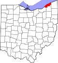
Location of Madison, Ohio
Map of Lake County Ohio Highlighting Madison Village.png
Location of Madison in Lake County
Coordinates: 41°46′18″N81°3′11″W / 41.77167°N 81.05306°W / 41.77167; -81.05306
Country United States
State Ohio
County Lake
Township Madison
Government
   Mayor Sam Britton (R) [1]
Area
[2]
  Total
5.09 sq mi (13.17 km2)
  Land5.09 sq mi (13.17 km2)
  Water0.00 sq mi (0.00 km2)
Elevation
[3]
728 ft (222 m)
Population
 (2020)
  Total
3,435
  Density675.25/sq mi (260.73/km2)
Time zone UTC-5 (Eastern (EST))
  Summer (DST) UTC-4 (EDT)
ZIP code
44057
Area code 440
FIPS code 39-46480 [4]
GNIS feature ID1061460 [3]
Website www.madisonvillage.org

Madison is a village in Lake County, Ohio, United States. The population was 3,435 at the 2020 census.

Contents

Madison was incorporated as a village in 1867. [5]

Geography

According to the United States Census Bureau, the village has a total area of 5.09 square miles (13.18 km2), all land. [6]

Demographics

Historical population
CensusPop.Note
1870 757
1880 7934.8%
1890 738−6.9%
1900 7684.1%
1910 86312.4%
1920 8933.5%
1930 9273.8%
1940 9795.6%
1950 1,12715.1%
1960 1,34719.5%
1970 1,67824.6%
1980 2,29136.5%
1990 2,4778.1%
2000 2,92117.9%
2010 3,1849.0%
2020 3,4357.9%
U.S. Decennial Census [7]

2010 census

As of the 2010 census [8] there were 3,184 people, 1,241 households, and 903 families living in the village. The population density was 625.5 inhabitants per square mile (241.5/km2). There were 1,323 housing units at an average density of 259.9 per square mile (100.3/km2). The racial makeup of the village was 96.3% White, 0.6% African American, 0.1% Native American, 0.5% Asian, 0.8% from other races, and 1.6% from two or more races. Hispanic or Latino of any race were 1.5% of the population.

There were 1,241 households, of which 34.6% had children under the age of 18 living with them, 58.5% were married couples living together, 11.0% had a female householder with no husband present, 3.2% had a male householder with no wife present, and 27.2% were non-families. 23.7% of all households were made up of individuals, and 10.5% had someone living alone who was 65 years of age or older. The average household size was 2.55 and the average family size was 2.98.

The median age in the village was 41.1 years. 25.2% of residents were under the age of 18; 5.6% were between the ages of 18 and 24; 26.4% were from 25 to 44; 28% were from 45 to 64; and 14.7% were 65 years of age or older. The gender makeup of the village was 47.5% male and 52.5% female.

2000 census

As of the 2000 census [4] there were 2,921 people, 1,107 households, and 801 families living in the village. The population density was 638.1 inhabitants per square mile (246.4/km2). There were 1,171 housing units at an average density of 255.8 per square mile (98.8/km2). The racial makeup of the village was 90.45% White, 8.36% African American, 0.14% Native American, 0.21% Asian, 0.14% from other races, and 0.72% from two or more races. Hispanic or Latino of any race were 0.82% of the population. 22.0% were of German, 14.4% Irish, 13.0% American, 10.4% English, 9.1% Italian and 6.9% Polish ancestry according to Census 2000. There were 1,107 households, out of which 35.1% had children under the age of 18 living with them, 61.1% were married couples living together, 7.9% had a female householder with no husband present, and 27.6% were non-families. 24.0% of all households were made up of individuals, and 10.7% had someone living alone who was 65 years of age or older. The average household size was 2.61 and the average family size was 3.11

In the village, the population was spread out, with 26.2% under the age of 18, 6.0% from 18 to 24, 31.7% from 25 to 44, 23.3% from 45 to 64, and 12.7% who were 65 years of age or older. The median age was 37 years. For every 100 females there were 98.7 males. For every 100 females age 18 and over, there were 96.8 males.

The median income for a household in the village was $50,786, and the median income for a family was $56,761. Males had a median income of $43,897 versus $25,639 for females. The per capita income for the village was $20,621. About 2.3% of families and 3.4% of the population were below the poverty line, including 3.2% of those under age 18 and 2.5% of those age 65 or over.

Notable people

Related Research Articles

<span class="mw-page-title-main">Ford City, California</span> Census-designated place in California, United States

Ford City is a census-designated place (CDP) in Kern County, California, United States. Ford City is located 1 mile (1.61 km) north of Taft, at an elevation of 892 feet (272 m). The population was 4,348 at the 2020 census, up from 4,278 at the 2010 census. It is immediately north of Taft, between the huge Midway-Sunset Oil Field to the southwest, and the almost exhausted Buena Vista Oil Field to the northeast. State Route 119 passes east of town from its junction with SR 33 to the south.

<span class="mw-page-title-main">New Holland, Illinois</span> Village in Illinois, United States

New Holland is a village in Logan County, Illinois, United States. The population was 269 at the 2010 census, down from 318 in 2000.

<span class="mw-page-title-main">Dulac, Louisiana</span> CDP in Louisiana, United States

Dulac is a census-designated place (CDP) in Terrebonne Parish, Louisiana, United States. The population was 1,241 in 2020. It is part of the Houma–Bayou Cane–Thibodaux metropolitan statistical area.

<span class="mw-page-title-main">Mount Vernon, Maine</span> Town in the state of Maine, United States

Mount Vernon is a town in Kennebec County, Maine, United States. The population was 1,721 at the 2020 census. Mount Vernon is included in the Augusta, Maine micropolitan New England City and Town Area. A popular recreation spot in central Maine, the northern area of Mount Vernon is part of the Belgrade Lakes Region, while the southern area is part of the Winthrop Lakes Region.

<span class="mw-page-title-main">Hillsmere Shores, Maryland</span> Former census-designated place in Maryland, United States

Hillsmere Shores was a census-designated place (CDP) in Anne Arundel County, Maryland, United States. It is a suburb of Annapolis. The population was 2,977 at the 2000 census. It was included in the Annapolis Neck CDP at the 2010 census. Built in phases, beginning in 1960, the community has been home to The Key School, a non-sectarian private school, since the 1960s.

<span class="mw-page-title-main">Breckenridge, Michigan</span> Village in Michigan, United States

Breckenridge is a village in Gratiot County in the U.S. state of Michigan. The population was 1,238 at the 2020 census. The village is located in Wheeler Township.

<span class="mw-page-title-main">Rose Township, Ogemaw County, Michigan</span> Civil township in Michigan, United States

Rose Township is a civil township of Ogemaw County in the U.S. state of Michigan. The population was 1,241 at the 2020 census.

Burdell Township is a civil township of Osceola County in the U.S. state of Michigan. As of the 2020 census, the township population was 1,410.

<span class="mw-page-title-main">Beechwood, Michigan</span> Census-designated place & Unincorporated community in Michigan, United States

Beechwood is an unincorporated community in Ottawa County in the U.S. state of Michigan. It is a census-designated place (CDP) for statistical purposes, but is not an incorporated municipality. The population was 3,121 at the 2020 census.

<span class="mw-page-title-main">Independence, Minnesota</span> City in Minnesota, United States

Independence is a rural city in Hennepin County, Minnesota, United States. Most of the city is agricultural land with dense woods and numerous lakes. It is named after Lake Independence, a large lake on the community's eastern boundary.

Livonia Township is a township in Sherburne County, Minnesota, United States. The population was 3,917 at the 2000 census.

<span class="mw-page-title-main">Malcolm, Nebraska</span> Village in Nebraska, United States

Malcolm is a village in Lancaster County, Nebraska, United States. It is part of the Lincoln, Nebraska Metropolitan Statistical Area. The population was 457 at the 2020 census.

<span class="mw-page-title-main">Minerva Park, Ohio</span> Village in Ohio, United States

Minerva Park is a village in Franklin County, Ohio, United States. The population was 2,009 at the 2020 census.

<span class="mw-page-title-main">Newtown, Ohio</span> Village in Ohio, United States

Newtown is a village in southeastern Hamilton County, Ohio, United States, near Cincinnati. The population was 2,702 at the 2020 census. Newtown was settled in 1792 and incorporated as a village in 1901.

<span class="mw-page-title-main">Timberlake, Ohio</span> Village in Ohio, United States

Timberlake is a village in Lake County, Ohio, United States. The population was 629 at the 2020 census.

<span class="mw-page-title-main">Bethlehem, West Virginia</span> Village in West Virginia, United States

Bethlehem is a village in Ohio County, West Virginia, United States. It is part of the Wheeling, West Virginia Metropolitan Statistical Area. The population was 2,499 at the 2010 census.

<span class="mw-page-title-main">Eden (CDP), New York</span> Census-designated place in New York, United States

Eden is a hamlet and census-designated place (CDP) in Erie County, New York, United States. The population was 3,516 at the 2010 census. It is part of the Buffalo–Niagara Falls Metropolitan Statistical Area.

<span class="mw-page-title-main">Constantia (CDP), New York</span> CDP in New York, United States

Constantia is a census-designated place (CDP) in the town of Constantia in Oswego County, New York, United States. Located on Oneida Lake, the community lies along State Route 49 and Scriba Creek. The population was 1,182 at the 2010 census.

<span class="mw-page-title-main">Westerly (CDP), Rhode Island</span> CDP in Rhode Island, United States

Westerly is a census-designated place (CDP) in the town of Westerly in Washington County, Rhode Island, United States. The population was 17,682 at the 2000 census. The CDP includes the majority of the town of Westerly's population, with only the rural eastern and coastal southern portions of towns excluded.

<span class="mw-page-title-main">Luxemburg, Wisconsin</span> Village in Wisconsin, United States

Luxemburg is a village in Kewaunee County, Wisconsin, United States. The population was 2,515 at the 2010 census. It is part of the Green Bay Metropolitan Statistical Area. The village is located within the town of Luxemburg.

References

  1. "Elected Officials" (PDF). Retrieved August 1, 2024.
  2. "ArcGIS REST Services Directory". United States Census Bureau. Retrieved September 20, 2022.
  3. 1 2 "US Board on Geographic Names". United States Geological Survey. October 25, 2007. Retrieved January 31, 2008.
  4. 1 2 "U.S. Census website". United States Census Bureau . Retrieved January 31, 2008.
  5. Overman, William Daniel (1958). Ohio Town Names. Akron, OH: Atlantic Press. p. 80.
  6. "U.S. Gazetteer Files: 2019: Places: Ohio". U.S. Census Bureau Geography Division. Retrieved July 1, 2020.
  7. "Census of Population and Housing". Census.gov. Retrieved June 4, 2015.
  8. "U.S. Census website". United States Census Bureau . Retrieved January 6, 2013.