North Perry, Ohio

Last updated

North Perry, Ohio
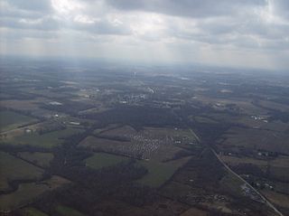
Perrynuclearpowerplant.jpg
OHMap-doton-North Perry.png
Location of North Perry, Ohio
Map of Lake County Ohio Highlighting North Perry Village.png
Location of North Perry in Lake County
Coordinates: 41°48′27″N81°7′31″W / 41.80750°N 81.12528°W / 41.80750; -81.12528
Country United States
State Ohio
County Lake
Townships Perry, Madison
Area
[1]
  Total3.88 sq mi (10.05 km2)
  Land3.88 sq mi (10.05 km2)
  Water0.00 sq mi (0.00 km2)
Elevation
[2]
682 ft (208 m)
Population
 (2020)
  Total915
  Density235.89/sq mi (91.08/km2)
Time zone UTC-5 (Eastern (EST))
  Summer (DST) UTC-4 (EDT)
ZIP code
44081
Area code 440
FIPS code 39-56910 [3]
GNIS feature ID1048401 [2]
Website northperry.org

North Perry is a village in Lake County, Ohio, United States. The population was 915 at the 2020 census.

Contents

Geography

North Perry is located at 41°48′27″N81°7′31″W / 41.80750°N 81.12528°W / 41.80750; -81.12528 (41.807399, -81.125357). [4] It is the site of the Perry Nuclear Generating Station.

According to the United States Census Bureau, the village has a total area of 3.87 square miles (10.02 km2), all land. [5]

Demographics

Historical population
CensusPop.Note
1930 316
1940 3180.6%
1950 47047.8%
1960 65840.0%
1970 85129.3%
1980 8975.4%
1990 824−8.1%
2000 8381.7%
2010 8936.6%
2020 9152.5%
U.S. Decennial Census [6]

2010 census

As of the census [7] of 2010, there were 893 people, 336 households, and 254 families residing in the village. The population density was 230.7 inhabitants per square mile (89.1/km2). There were 353 housing units at an average density of 91.2 per square mile (35.2/km2). The racial makeup of the village was 99.3% White, 0.2% Asian, 0.1% Pacific Islander, and 0.3% from two or more races. Hispanic or Latino of any race were 0.6% of the population.

There were 336 households, of which 34.2% had children under the age of 18 living with them, 61.3% were married couples living together, 10.7% had a female householder with no husband present, 3.6% had a male householder with no wife present, and 24.4% were non-families. 20.2% of all households were made up of individuals, and 8.7% had someone living alone who was 65 years of age or older. The average household size was 2.66 and the average family size was 3.07.

The median age in the village was 44.9 years. 24.7% of residents were under the age of 18; 6.5% were between the ages of 18 and 24; 18.8% were from 25 to 44; 36.1% were from 45 to 64; and 13.9% were 65 years of age or older. The gender makeup of the village was 51.6% male and 48.4% female.

2000 census

As of the census [3] of 2000, there were 838 people, 302 households, and 238 families residing in the village. The population density was 215.4 inhabitants per square mile (83.2/km2). There were 316 housing units at an average density of 81.2 per square mile (31.4/km2). The racial makeup of the village was 99.05% White, 0.24% African American, 0.12% Native American, 0.12% Asian, and 0.48% from two or more races. Hispanic or Latino of any race were 0.48% of the population. 24.1% were of German, 15.2% Irish, 11.7% English, 8.2% American and 6.8% Italian ancestry according to Census 2000.

There were 302 households, out of which 35.4% had children under the age of 18 living with them, 66.9% were married couples living together, 8.6% had a female householder with no husband present, and 20.9% were non-families. 17.9% of all households were made up of individuals, and 6.6% had someone living alone who was 65 years of age or older. The average household size was 2.77 and the average family size was 3.18.

In the village, the population was spread out, with 26.0% under the age of 18, 6.9% from 18 to 24, 25.7% from 25 to 44, 29.4% from 45 to 64, and 12.1% who were 65 years of age or older. The median age was 40 years. For every 100 females there were 98.6 males. For every 100 females age 18 and over, there were 95.6 males.

The median income for a household in the village was $47,708, and the median income for a family was $51,875. Males had a median income of $44,375 versus $25,000 for females. The per capita income for the village was $20,896. About 6.0% of families and 6.0% of the population were below the poverty line, including 7.4% of those under age 18 and 2.0% of those age 65 or over.

Related Research Articles

<span class="mw-page-title-main">Naples Park, Florida</span> Census-designated place in Florida

Naples Park is an unincorporated community and census-designated place (CDP) in Collier County, Florida, United States. The population was 5,967 at the 2010 census. It is part of the Naples-Marco Island, Florida Metropolitan Statistical Area.

<span class="mw-page-title-main">Forest View, Illinois</span> Village in Illinois, United States

Forest View is a village in Cook County, Illinois, United States. Per the 2020 census, the population was 792. It is primarily an industrial corridor adjacent to the Chicago neighborhood of Garfield Ridge, which is on the village's southern border.

<span class="mw-page-title-main">Country Club Heights, Indiana</span> Town in Indiana, United States

Country Club Heights is a town in Anderson Township, Madison County, Indiana, United States. The population was 98 at the 2020 census.

<span class="mw-page-title-main">Twining, Michigan</span> Village in Michigan, United States

Twining is a village in Arenac County of the U.S. state of Michigan. The population was 181 at the 2010 census. The village is situated on the boundary between Mason Township on the west and Turner Township on the east, with about half of the village in each.

<span class="mw-page-title-main">Cuyahoga Heights, Ohio</span> Village in Ohio, United States

Cuyahoga Heights is a village in Cuyahoga County, Ohio, United States. The population was 573 at the 2020 census.

<span class="mw-page-title-main">Walton Hills, Ohio</span> Village in Ohio, United States

Walton Hills is a village in Cuyahoga County, Ohio, United States. The population was 2,033 at the 2020 census.

<span class="mw-page-title-main">Senecaville, Ohio</span> Village in Ohio, United States

Senecaville is a village in Guernsey County, Ohio, United States. The population was 422 at the 2020 census.

<span class="mw-page-title-main">Chesterhill, Ohio</span> Village in Ohio, United States

Chesterhill is a village in Morgan County, Ohio, United States. The population was 276 at the 2020 census. Chesterhill was laid out in 1834, and named after Chester County, Pennsylvania, the native home of a large share of the first settlers.

<span class="mw-page-title-main">Hartville, Ohio</span> Village in Ohio, United States

Hartville is a village in northern Stark County, Ohio, United States. The population was 3,329 at the 2020 census. It is part of the Canton–Massillon metropolitan area.

<span class="mw-page-title-main">Limaville, Ohio</span> Census-designated place in Ohio, United States

Limaville is a census-designated place (CDP) and former village in Stark County, Ohio, United States. The population was 151 at the 2010 census. It is part of the Canton–Massillon Metropolitan Statistical Area.

<span class="mw-page-title-main">Boston Heights, Ohio</span> Village in Ohio, United States

Boston Heights is a village in northern Summit County, Ohio, United States. The population was 1,402 at the 2020 census. It is part of the Akron metropolitan area. Boston Heights is home to the headquarters of Arhaus, a major home furnishings retailer.

<span class="mw-page-title-main">Lakemore, Ohio</span> Village in Summit County, Ohio

Lakemore is a village in Summit County, Ohio, United States. The population was 2,926 at the 2020 census. It is part of the Akron metropolitan area.

<span class="mw-page-title-main">Midvale, Ohio</span> Village in Ohio, United States

Midvale is a village in Tuscarawas County, Ohio, United States. The population was 754 at the 2010 census.

<span class="mw-page-title-main">Perry Township, Jefferson County, Pennsylvania</span> Township in Pennsylvania, United States

Perry Township is a township in Jefferson County, Pennsylvania, United States. The population was 1,247 at the 2020 census. It was named after Commodore Oliver Hazard Perry.

<span class="mw-page-title-main">Lincoln Township, Somerset County, Pennsylvania</span> Township in Pennsylvania, United States

Lincoln Township is a township in Somerset County, Pennsylvania, United States. The population was 1,456 at the 2020 census. It is part of the Johnstown, Pennsylvania, Metropolitan Statistical Area.

<span class="mw-page-title-main">Lawrenceville, Pennsylvania</span> Borough in Pennsylvania, United States

Lawrenceville is a borough in Tioga County, Pennsylvania. The population was 690 at the 2020 census.

<span class="mw-page-title-main">Neeses, South Carolina</span> Town in South Carolina, United States

Neeses is a town in Orangeburg County, South Carolina, United States. The population was 374 at the 2010 census.

<span class="mw-page-title-main">Wilson, Ohio</span> Village in Ohio, United States

Wilson is a village in Belmont and Monroe counties in the U.S. state of Ohio. The population was 129 at the 2020 census. It is part of the Wheeling metropolitan area.

<span class="mw-page-title-main">Hunting Valley, Ohio</span> Village in Ohio, United States

Hunting Valley is a village in Cuyahoga and Geauga counties in the U.S. state of Ohio. The population was 763 as of the 2020 census. An eastern suburb of Cleveland, it is part of the Cleveland metropolitan area. In 2000, Hunting Valley was ranked the 6th highest-income place in the United States. It was the 17th highest-income place in 2010, but still the wealthiest locale in Ohio.

<span class="mw-page-title-main">Patch Grove, Wisconsin</span> Village in Wisconsin, United States

Patch Grove is a village in Grant County, Wisconsin, United States. The population was 198 at the 2010 census. The village is located within the Town of Patch Grove.

References

  1. "ArcGIS REST Services Directory". United States Census Bureau. Retrieved September 20, 2022.
  2. 1 2 "US Board on Geographic Names". United States Geological Survey. October 25, 2007. Retrieved January 31, 2008.
  3. 1 2 "U.S. Census website". United States Census Bureau . Retrieved January 31, 2008.
  4. "US Gazetteer files: 2010, 2000, and 1990". United States Census Bureau. February 12, 2011. Retrieved April 23, 2011.
  5. "U.S. Gazetteer Files: 2019: Places: Ohio". U.S. Census Bureau Geography Division. Retrieved July 1, 2020.
  6. "Census of Population and Housing". Census.gov. Retrieved June 4, 2015.
  7. "U.S. Census website". United States Census Bureau . Retrieved January 6, 2013.