Panthersville, Georgia

Last updated

Panthersville, Georgia
Barack H. Obama Elementary Magnet School of Technology, Panthersville, GA.jpg
The Barack H. Obama Elementary Magnet School of Technology in Panthersville
DeKalb County Georgia Incorporated and Unincorporated areas Panthersville Highlighted.svg
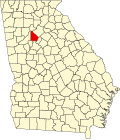
Location in DeKalb County and the state of Georgia
Metro atlanta.jpg
Red pog.svg
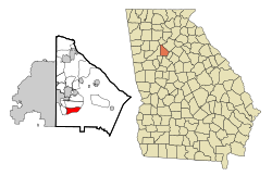
Panthersville
location in Metro Atlanta
Coordinates: 33°42′20″N84°16′43″W / 33.70556°N 84.27861°W / 33.70556; -84.27861
Country United States
State Georgia
County DeKalb
Area
[1]
  Total
3.69 sq mi (9.55 km2)
  Land3.67 sq mi (9.50 km2)
  Water0.02 sq mi (0.05 km2)
Elevation
889 ft (271 m)
Population
 (2020)
  Total
11,237
  Density3,064.36/sq mi (1,183.14/km2)
Time zone UTC-5 (Eastern (EST))
  Summer (DST) UTC-4 (EDT)
FIPS code 13-59080 [2]
GNIS feature ID0332600 [3]
CDPs bordering eastern Atlanta CDPs bordering eastern Atlanta and Decatur.jpg
CDPs bordering eastern Atlanta

Panthersville is an unincorporated community and census-designated place (CDP) in DeKalb County, Georgia, United States. The population was 11,237 in 2020, up from 9,749 in 2010.

Contents

History

The community most likely was named after a Cherokee Indian subtribe. [4]

Geography

Panthersville is located at 33°42′20″N84°16′43″W / 33.70556°N 84.27861°W / 33.70556; -84.27861 (33.705639, -84.278551). [5] The Candler-McAfee CDP is to the north and Gresham Park CDP is to the west.

According to the United States Census Bureau, the CDP has a total area of 3.7 square miles (9.6 km2), of which 0.27% is water.

Demographics

Historical population
CensusPop.Note
1980 11,366
1990 9,874−13.1%
2000 11,79119.4%
2010 9,749−17.3%
2020 11,23715.3%
U.S. Decennial Census [6]
1850-1870 [7] 1870-1880 [8]
1890-1910 [9] 1920-1930 [10]
1940 [11] 1950 [12] 1960 [13]
1970 [14] 1980 [15] 1990 [16]
2000 [17] 2010 [18] 2020 [19]

Panthersville was first listed as a census designated place in the 1980 U.S. census. [15] [14]

Panthersville, Georgia – Racial and ethnic composition
Note: the US Census treats Hispanic/Latino as an ethnic category. This table excludes Latinos from the racial categories and assigns them to a separate category. Hispanics/Latinos may be of any race.
Race / Ethnicity (NH = Non-Hispanic)Pop 2000 [20] Pop 2010 [21] Pop 2020 [19] % 2000% 2010% 2020
White alone (NH)2151483591.82%1.52%3.19%
Black or African American alone (NH)11,2759,35710,19795.62%95.98%90.74%
Native American or Alaska Native alone (NH)1510210.13%0.10%0.19%
Asian alone (NH)2425570.20%0.26%0.51%
Native Hawaiian or Pacific Islander alone (NH)6140.05%0.01%0.04%
Other race alone (NH)1011400.08%0.11%0.36%
Mixed race or Multiracial (NH)106912540.90%0.93%2.26%
Hispanic or Latino (any race)1401063051.19%1.09%2.71%
Total11,7919,74911,237100.00%100.00%100.00%

As of the 2020 United States census, there were 11,237 people, 4,036 households, and 2,251 families residing in the CDP.

Economy

Panthersville is home to the Gallery at South DeKalb, formerly South DeKalb Mall, a regional shopping center with a Macy's (former Rich's) department store. The former JC Penney now houses independent stores.

The CDP is the headquarters for the Georgia Bureau of Investigation, [22] and for Georgia Regional Hospital state psychiatric ward. [23]

Education

The CDP is incorporated within the DeKalb County Public Schools zone: [24]

References

  1. "2020 U.S. Gazetteer Files". United States Census Bureau. Retrieved December 18, 2021.
  2. "U.S. Census website". United States Census Bureau . Retrieved January 31, 2008.
  3. "US Board on Geographic Names". United States Geological Survey. October 25, 2007. Retrieved January 31, 2008.
  4. Krakow, Kenneth K. (1975). Georgia Place-Names: Their History and Origins (PDF). Macon, GA: Winship Press. p. 171. ISBN   0-915430-00-2.
  5. "US Gazetteer files: 2010, 2000, and 1990". United States Census Bureau. February 12, 2011. Retrieved April 23, 2011.
  6. "Decennial Census of Population and Housing by Decade". United States Census Bureau.
  7. "1870 Census of Population - Georgia - Population of Civil Divisions less than Counties" (PDF). United States Census Bureau. 1870.
  8. "1880 Census of Population - Georgia - Population of Civil Divisions less than Counties" (PDF). United States Census Bureau. 1880.
  9. "1910 Census of Population - Georgia" (PDF). United States Census Bureau. 1910.
  10. "1930 Census of Population - Georgia" (PDF). United States Census Bureau. 1930. pp. 251–256.
  11. "1940 Census of Population - Georgia" (PDF). United States Census Bureau. 1940.
  12. "1950 Census of Population - Georgia" (PDF). United States Census Bureau. 1950.
  13. "1960 Census of Population - Population of County Subdivisions - Georgia" (PDF). United States Census Bureau. 1960.
  14. 1 2 "1970 Census of Population - Population of County Subdivisions - Georgia" (PDF). United States Census Bureau. 1970.
  15. 1 2 "1980 Census of Population - Number of Inhabitants - Georgia" (PDF). United States Census Bureau. 1980.
  16. "1990 Census of Population - Summary Social, Economic, and Housing Characteristics - Georgia" (PDF). United States Census Bureau. 1990.
  17. "2000 Census of Population - General Population Characteristics - Georgia" (PDF). United States Census Bureau. 2000.
  18. "2010 Census of Population - General Population Characteristics - Georgia" (PDF). United States Census Bureau. 2010.
  19. 1 2 "P2: Hispanic or Latino, and Not Hispanic or Latino by Race – 2020: DEC Redistricting Data (PL 94-171) – Panthersville CDP, Georgia". United States Census Bureau.
  20. "P004 Hispanic or Latino, and Not Hispanic or Latino by Race – 2000: DEC Summary File 1 – Panthersville CDP, Georgia". United States Census Bureau.
  21. "P2: Hispanic or Latino, and Not Hispanic or Latino by Race – 2010: DEC Redistricting Data (PL 94-171) – Panthersville CDP, Georgia". United States Census Bureau.
  22. "Contact Us | Georgia Bureau of Investigation".
  23. "Georgia Regional Hospital, Decatur, eventseeker".
  24. "2010 CENSUS - CENSUS BLOCK MAP: Panthersville CDP, GA" (PDF). U.S. Census Bureau . Retrieved May 7, 2020. - Compare with school addresses and boundary maps.
  25. "Elementary School Attendance Areas 2016 - 2017 School Year." DeKalb County School System. Retrieved on June 1, 2017.
  26. "Middle School Attendance Areas 2016 - 2017 School Year." DeKalb County School System. Retrieved on June 1, 2017.
  27. "High School Attendance Areas 2016 - 2017 School Year." DeKalb County School System. Retrieved on June 1, 2017.