
This is intended to be a complete list of properties and districts listed on the National Register of Historic Places in Orleans County, New York. The locations of National Register properties and districts may be seen in a map by clicking on "Map of all coordinates". Two listings, the New York State Barge Canal and the Cobblestone Historic District, are further designated a National Historic Landmark.

The Lake McDonald Lodge Historic District is a historic district in Glacier National Park in the U.S. state of Montana. It comprises the Lake McDonald Lodge and surrounding structures on the shores of Lake McDonald. It is centered on the main lodge, which was designated a National Historic Landmark in 1987, as well as surrounding guest cabins, dormitory buildings, employee residences, utility buildings, and retail structures. The district includes several privately owned inholding structures that are contributing structures, as well as a number of non-contributing buildings.
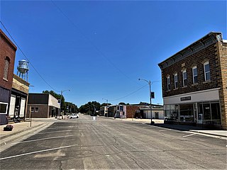
Glasco Downtown Historic District is an early commercial, Italianate historic shopping area located in Glasco, Kansas that is listed on the National Register of Historic Places. The 3.9-acre (1.6 ha) historic district runs roughly along Main Street from Railroad Avenue to Fisher Street and continues along Railroad Avenue and Fisher Streets between Main and Buffalo Streets in Glasco. It includes 22 buildings deemed to contribute to the historic character of the area, one other contributing structure, and six non-contributing buildings.

South Candler Street–Agnes Scott College Historic District is a historic district in Decatur, Georgia that was listed on the National Register of Historic Places in 1994. It includes Agnes Scott College, also known as Decatur Female Seminary (1889) and as Agnes Scott Institute (1890-1906), and Little Decatur.

Ellington Center Historic District is an 80-acre (32 ha) historic district in the town of Ellington, Connecticut that was listed on the National Register of Historic Places in 1990.
The East Portland Grand Avenue Historic District, located in southeast Portland, Oregon, is listed on the National Register of Historic Places. The district includes approximately 20 city blocks on or near Southeast Grand Avenue on the east side of the Willamette River, roughly bounded on the south by SE Main Street, north by SE Ankeny Street, west by SE Martin Luther King Jr. Boulevard, and east by SE Seventh Avenue. Most structures in the district are commercial buildings rising two to three stories. Immediately to the west of the historic district is Portland's east side industrial area, and to the east are industrial and residential areas.
The Muscatine County Fairgrounds are located in West Liberty, Iowa, United States. It hosts the annual Muscatine County Fair. The Muscatine County Historic Preservation Commission received a grant from the State of Iowa to study the fairgrounds in 2014. Most of it was listed as a historic district on the National Register of Historic Places as the West Liberty Fairgrounds Historic District in 2015. At the time of its nomination it consisted of 42 resources, which included 16 contributing buildings, two contributing sites, two contributing structures, 16 non-contributing buildings, and six non-contributing structures. Historic tax credits will be used to rehabilitate the historic buildings on the fairgrounds.

The North Grinnell Historic District is a nationally recognized historic district located in Grinnell, Iowa, United States. It was listed on the National Register of Historic Places in 2008. At the time of its nomination it contained 272 resources, which included 202 contributing buildings, six contributing objects, 61 non-contributing buildings, and one non-contributing object. The historic district is a residential area located west of the Grinnell College campus. Of the 157 houses, three-quarters of them are two-story structures. The rest are bungalows, cottages, and post-World War II minimal traditional plans. The vast majority of houses are of frame construction, with a few brick, concrete block, stucco and half-timbered claddings. There are 103 outbuildings, which include garages, barns and carriage houses. Three of the most prominent architectural styles include Neoclassical, Queen Anne and American Craftsman. The historical objects are six concrete hitching posts. Eleven architects are known to have houses in the district. The period of significance is 1867 to 1958.

The Dearborn City Hall Complex is a complex of three government buildings located at 13615 Michigan Avenue in Dearborn, Michigan. The complex includes the 1921 Dearborn City Hall, the 1929 Police and Municipal Courts Building, and an office/auditorium concourse addition constructed in 1981. The complex was listed on the National Register of Historic Places in 2014.

The Willow–Bluff–3rd Street Historic District is a nationally recognized historic district located in Council Bluffs, Iowa, United States. It was listed on the National Register of Historic Places in 2005. At the time of its nomination the district consisted of 260 resources, including 162 contributing buildings, 56 contributing structures, 36 non-contributing buildings, and six non-contributing structures. The district is primarily a residential area that is adjacent to the central business district to the west. Part of the district is in Jackson's Addition, which is the first addition to the original town of Council Bluffs. It also sits along the base of the loess bluffs to the east.

Old Main Street Historic District is a nationally recognized historic district located in Dubuque, Iowa, United States. It was listed on the National Register of Historic Places in 1983. At the time of its nomination it consisted of 33 resources, which included 30 contributing buildings and three non-contributing buildings. In 2015 the boundaries were increased to include five more buildings. Four of the buildings are contributing properties that were excluded from the original district because they were slated to be torn down as a part of the expansion of U.S. Route 61. While the highway was built the buildings were spared. The fifth building is non-contributing as are three structures.

Four Mounds Estate Historic District is a nationally recognized historic district located in Dubuque, Iowa, United States. It was listed on the National Register of Historic Places in 2002. At the time of its nomination the district consisted of 19 resources, including 11 contributing buildings, two contributing sites, four non-contributing structures, and two non-contributing buildings. The estate is named for the four conical burial mounds that are located on the property. They are one of the historic sites, and they are individually listed on the National Register of Historic Places.

The Johnson County Poor Farm and Asylum Historic District is a nationally recognized historic district located in Iowa City, Iowa, United States. It was listed on the National Register of Historic Places in 2014. At the time of its nomination it consisted of 11 resources, which included three contributing buildings, two contributing sites, four contributing structures and two non-contributing buildings. It also includes the First Johnson County Asylum, which was individually listed on the National Register. The remaining buildings and structures are agricultural in nature, and were built from the late 19th century to the early 20th century.

The Marion Commercial Historic District is a nationally recognized historic district located in Marion, Iowa, United States. It was listed on the National Register of Historic Places in 2009. At the time of its nomination it consisted of 41 resources, which included 29 contributing buildings, one contributing site, one contributing structure, two contributing objects, and eight non-contributing buildings. The historic district covers the city's central business district. The development of this area largely occurred when Marion was the county seat of Linn County (1838-1919). There are no county government buildings extant from this era. The city was also a division point for the Chicago, Milwaukee, St. Paul and Pacific Railroad in the late nineteenth and early twentieth centuries.

East Park is a recreational park located in Mason City, Iowa, United States. It was listed as a historic district on the National Register of Historic Places in 2014. At the time of its nomination it contained 21 resources, which included three contributing buildings, one contributing site, five structures, seven non-contributing buildings, and five non-contributing structures. It contains 57.6 acres (23.3 ha) of land along the Winnebago River. The park features picnic areas, a 9-hole disc golf course, three tennis courts, volleyball court, basketball courts, fishing, a sledding hill, playgrounds including the Prairie Playground, a 2.08-mile (3.35 km) hard surface trail system, a band shell and a gazebo.

The Hardin County Home Historic District, also known as Hardin County Poor Farm, Hardin County Farm, and the Hardin County Care Facility, is a nationally recognized historic district located northwest of Eldora, Iowa, United States. It was listed on the National Register of Historic Places in 2010. At the time of its nomination the district consisted of six resources, including three contributing buildings, one contributing site, and two non-contributing buildings. Beginning in the mid-19th century county homes were established across the state to take care of less fortunate residents. That care then extended to the end of the 20th century. The Hardin County Home operated at this location from 1877 to 1996. The historic district encompasses the buildings, farm fields, and cemetery associated with the home. The first burial in the cemetery, located on the southwest corner of the property, was in 1877. The graves are marked with simple stone markers. The last burial was in 2008. Farm fields surround the buildings and extend to the north.

The New Orleans Upper Central Business District, also known simply as Upper Central Business District, is a historic district of New Orleans, Louisiana which was listed on the National Register of Historic Places (NRHP) in 1990. The original listed area is roughly bounded by O'Keefe, Poydras, Convention Center Blvd., and the Expressway. Along with the NRHP-listed New Orleans Lower Central Business District to the north, across the redeveloped Poydras Street, it is included within the larger New Orleans Central Business District area.
Boone Creek Rural Historic District, about 11 miles southeast of Lexington, Kentucky, is a 4,060 acres (16.4 km2) historic district which was listed on the National Register of Historic Places in 1994. It included 88 contributing buildings, 55 contributing structures, and 25 contributing sites.
The Stoner Creek Rural Historic District, in Bourbon County, Kentucky near Paris, Kentucky, is a 22,000 acres (89 km2) historic district which was listed on the National Register of Historic Places in 2001.

The Guthrie Historic District in Guthrie, Kentucky was listed on the National Register of Historic Places in 2011. It is a 12.3 acres (5.0 ha) area deemed significant "for its connection with the L&N railroad and its associations with transportation in that area. It included 25 contributing buildings, one contributing structure, and two contributing sites, as well as three non-contributing buildings and six noncontributing sites.


