National Register of Historic Places listings in Clay County, Kentucky

Last updated

Location of Clay County in Kentucky Map of Kentucky highlighting Clay County.svg
Location of Clay County in Kentucky

This is a list of the National Register of Historic Places listings in Clay County, Kentucky.

Contents

It is intended to be a complete list of the properties on the National Register of Historic Places in Clay County, Kentucky, United States. The locations of National Register properties for which the latitude and longitude coordinates are included below, may be seen in a map. [1]

There are 5 properties listed on the National Register in the county. Another property was once listed but has been removed.


    This National Park Service list is complete through NPS recent listings posted April 28, 2023. [2]

Map all coordinates using: OpenStreetMap  
Download coordinates as: KML

Current listings

[3] Name on the RegisterImageDate listed [4] Location City or townDescription
1 Fish Trap Rock Petroglyphs (15CY53)
Fish Trap Rock Petroglyphs (15CY53) Fish Trap Rock Petroglyphs site.jpg
Fish Trap Rock Petroglyphs (15CY53)
September 8, 1989
(#89001181)
Western bank of the Red Bird River at the Hal Rogers Parkway crossing [5]
37°10′25″N83°35′21″W / 37.173611°N 83.589167°W / 37.173611; -83.589167 (Fish Trap Rock Petroglyphs (15CY53))
Eriline
2 Manchester Historic District April 26, 2023
(#100008883)
Portions of Main, Bridge, and Lawyer Sts., Town Sq., Richmond Rd./US 421/White St.
37°09′23″N83°45′39″W / 37.1563°N 83.7609°W / 37.1563; -83.7609 (Manchester Historic District)
Manchester
3 Peabody-Fordson Historic District
Peabody-Fordson Historic District Redbird Ranger District offices.jpg
Peabody-Fordson Historic District
February 1, 2017
(#89002099)
Kentucky Route 66, south of Big Creek
37°08′20″N83°35′24″W / 37.138889°N 83.590000°W / 37.138889; -83.590000 (Peabody-Fordson Historic District)
Big Creek
4 Red Bird River Shelter Petroglyphs (15CY52) September 8, 1989
(#89001183)
Address Restricted
Manchester
5 Sullen Possum Site October 6, 1993
(#93000996)
Address Restricted
Oneida

Former listing

[3] Name on the RegisterImageDate listedDate removedLocationCity or townDescription
1 Red Bird River Petroglyphs (15CY51)
Red Bird River Petroglyphs (15CY51) RedBirdMcC5.jpg
Red Bird River Petroglyphs (15CY51)
September 8, 1989
(#89001182)
December 4, 2003Address Restricted
Manchester On December 7, 1994, the 50-ton stone bearing the petroglyphs fell from a sandstone cliff above the Red Bird River, onto Kentucky Route 66 at Lower Red Bird. On December 9, 1994, it was transported to its present location in Rawlings/Stinson Park in Manchester, where it is roofed over and fenced.

See also

Related Research Articles

<span class="mw-page-title-main">National Register of Historic Places listings in Woodford County, Kentucky</span>

This is a list of the National Register of Historic Places listings in Woodford County, Kentucky.

<span class="mw-page-title-main">National Register of Historic Places listings in Washington County, Kentucky</span>

This is a list of the National Register of Historic Places listings in Washington County, Kentucky.

<span class="mw-page-title-main">National Register of Historic Places listings in Franklin County, Kentucky</span>

This is a list of the National Register of Historic Places listings in Franklin County, Kentucky.

<span class="mw-page-title-main">National Register of Historic Places listings in Hopkins County, Kentucky</span>

This is a list of the National Register of Historic Places listings in Hopkins County, Kentucky.

<span class="mw-page-title-main">National Register of Historic Places listings in Green County, Kentucky</span>

This is a list of the National Register of Historic Places listings in Green County, Kentucky.

<span class="mw-page-title-main">National Register of Historic Places listings in Campbell County, Kentucky</span>

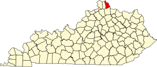
This is a list of the National Register of Historic Places listings in Campbell County, Kentucky.

<span class="mw-page-title-main">National Register of Historic Places listings in Clark County, Kentucky</span>

This is a list of the National Register of Historic Places listings in Clark County, Kentucky.

<span class="mw-page-title-main">National Register of Historic Places listings in Pike County, Kentucky</span>

This is a list of the National Register of Historic Places listings in Pike County, Kentucky.

<span class="mw-page-title-main">National Register of Historic Places listings in Pulaski County, Kentucky</span>

This is a list of the National Register of Historic Places listings in Pulaski County, Kentucky.

<span class="mw-page-title-main">National Register of Historic Places listings in Madison County, Kentucky</span>

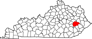
This is a list of the National Register of Historic Places listings in Madison County, Kentucky.

<span class="mw-page-title-main">National Register of Historic Places listings in Mercer County, Kentucky</span>

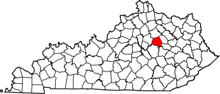
This is a list of the National Register of Historic Places listings in Mercer County, Kentucky.

<span class="mw-page-title-main">National Register of Historic Places listings in Nicholas County, Kentucky</span>

This is a list of the National Register of Historic Places listings in Nicholas County, Kentucky.

<span class="mw-page-title-main">National Register of Historic Places listings in Floyd County, Kentucky</span>

This is a list of the National Register of Historic Places listings in Floyd County, Kentucky.

<span class="mw-page-title-main">National Register of Historic Places listings in Caldwell County, Kentucky</span>

This is a list of the National Register of Historic Places listings in Caldwell County, Kentucky.

<span class="mw-page-title-main">National Register of Historic Places listings in Ballard County, Kentucky</span>

This is a list of the National Register of Historic Places listings in Ballard County, Kentucky.

<span class="mw-page-title-main">National Register of Historic Places listings in Breathitt County, Kentucky</span>

This is a list of the National Register of Historic Places listings in Breathitt County, Kentucky.

<span class="mw-page-title-main">National Register of Historic Places listings in Harlan County, Kentucky</span>

This is a list of the National Register of Historic Places listings in Harlan County, Kentucky.

<span class="mw-page-title-main">National Register of Historic Places listings in Marshall County, Kentucky</span>

This is a list of the National Register of Historic Places listings in Marshall County, Kentucky.

<span class="mw-page-title-main">National Register of Historic Places listings in Wayne County, Kentucky</span>

This is a list of the National Register of Historic Places listings in Wayne County, Kentucky.

<span class="mw-page-title-main">National Register of Historic Places listings in Webster County, Kentucky</span>

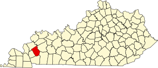
This is a list of the National Register of Historic Places listings in Webster County, Kentucky.

References

  1. The latitude and longitude information provided in this table was derived originally from the National Register Information System, which has been found to be fairly accurate for about 99% of listings. Some locations in this table may have been corrected to current GPS standards.
  2. National Park Service, United States Department of the Interior, "National Register of Historic Places: Weekly List Actions", retrieved April 28, 2023.
  3. 1 2 Numbers represent an alphabetical ordering by significant words. Various colorings, defined here, differentiate National Historic Landmarks and historic districts from other NRHP buildings, structures, sites or objects.
  4. The eight-digit number below each date is the number assigned to each location in the National Register Information System database, which can be viewed by clicking the number.
  5. Coy, Fred E., et al. Rock Art of Kentucky. Lexington: UP of Kentucky, 2003, 38.