National Register of Historic Places listings in Henderson County, Kentucky

Last updated

Location of Henderson County in Kentucky Map of Kentucky highlighting Henderson County.svg
Location of Henderson County in Kentucky

This is a list of the National Register of Historic Places listings in Henderson County, Kentucky.

Contents

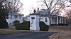
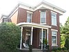
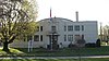
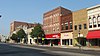
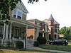
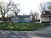
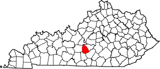
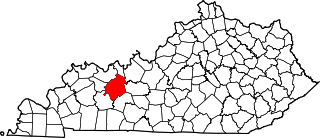
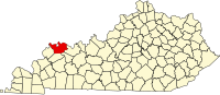
This is intended to be a complete list of the properties and districts on the National Register of Historic Places in Henderson County, Kentucky, United States. The locations of National Register properties and districts for which the latitude and longitude coordinates are included below, may be seen in a map. [1]

There are 27 properties and districts listed on the National Register in the county, of which 4 are part of a National Historic Landmark spread across multiple counties. Another property was once listed but has been removed.


    This National Park Service list is complete through NPS recent listings posted April 8, 2022. [2]

Map all coordinates using: OpenStreetMap  
Download coordinates as: KML

Current listings

[3] Name on the RegisterImageDate listed [4] Location City or townDescription
1 Alves Historic District
Alves Historic District Center and Adams in Henderson.jpg
Alves Historic District
September 7, 1989
(#89001151)
Roughly bounded by Green, Center, S. Alvasia, Powell, S. Adams, and Washington Sts.
37°50′05″N87°35′09″W / 37.834722°N 87.585833°W / 37.834722; -87.585833 (Alves Historic District)
Henderson
2 Archeological Site KHC-3 (15HE635)
Archeological Site KHC-3 (15HE635) Archaeological Site 15HE635.jpg
Archeological Site KHC-3 (15HE635)
April 1, 1986
(#86000641)
In the lawn of a house on Reed Bluff City Rd., northeast of Bluff City [5]
37°48′54″N87°22′12″W / 37.815000°N 87.370000°W / 37.815000; -87.370000 (Archeological Site KHC-3 (15HE635))
Hebbardsville Part of the Green River Shell Middens Archeological District National Historic Landmark [6] :17
3 Archeological Site KHC-4 (15HE580)
Archeological Site KHC-4 (15HE580) Archaeological Site 15HE580.jpg
Archeological Site KHC-4 (15HE580)
April 1, 1986
(#86000642)
Right bank of the Green River, 1 mile (1.6 km) above Bluff City [5]
37°48′25″N87°21′56″W / 37.806944°N 87.365556°W / 37.806944; -87.365556 (Archeological Site KHC-4 (15HE580))
Hebbardsville Part of the Green River Shell Middens Archeological District National Historic Landmark [6] :15
4 Audubon School
Audubon School Audubon School in Henderson.jpg
Audubon School
December 22, 1998
(#98001497)
1400 Clay St.
37°49′32″N87°34′48″W / 37.825556°N 87.580000°W / 37.825556; -87.580000 (Audubon School)
Henderson
5 John James Audubon State Park
John James Audubon State Park Audubonwildernesslake.JPG
John James Audubon State Park
March 10, 1988
(#87002220)
U.S. Route 41
37°52′56″N87°32′53″W / 37.882222°N 87.548056°W / 37.882222; -87.548056 (John James Audubon State Park)
Henderson
6 Barret House
Barret House Barret House in Henderson.jpg
Barret House
January 5, 1978
(#78001340)
204 S. Elm St.
37°50′08″N87°35′36″W / 37.835556°N 87.593333°W / 37.835556; -87.593333 (Barret House)
Henderson
7 Barret-Keach Farm
Barret-Keach Farm Tenant house at Barret-Keach Farm.jpg
Barret-Keach Farm
January 11, 2001
(#00001596)
1586 Kentucky Route 136 W.
37°47′58″N87°39′25″W / 37.799444°N 87.656944°W / 37.799444; -87.656944 (Barret-Keach Farm)
Henderson
8 Bluff City Shell Mound (15HE160)
Bluff City Shell Mound (15HE160) Bluff City Shell Mound site.jpg
Bluff City Shell Mound (15HE160)
April 1, 1986
(#86000644)
0.5 miles (0.80 km) above Bluff City on a Green River bluff [7]
37°47′58″N87°22′20″W / 37.799444°N 87.372222°W / 37.799444; -87.372222 (Bluff City Shell Mound (15HE160))
Hebbardsville Part of the Green River Shell Middens Archeological District National Historic Landmark [6] :14
9 Delano-Alves House
Delano-Alves House Delano-Alves House.jpg
Delano-Alves House
February 11, 1993
(#93000044)
536 Chestnut St.
37°49′34″N87°35′50″W / 37.826111°N 87.597222°W / 37.826111; -87.597222 (Delano-Alves House)
Henderson
10 E.L. Ehlen Livery and Sale Stable November 16, 1989
(#89002007)
110 1st St.
37°50′22″N87°35′36″W / 37.839444°N 87.593333°W / 37.839444; -87.593333 (E.L. Ehlen Livery and Sale Stable)
Henderson Building Demolished. Replaced by U.S. Post Office
11 Geibel House
Geibel House Geibel House in Henderson.jpg
Geibel House
December 10, 1998
(#98001491)
327 N. Main St.
37°50′34″N87°35′26″W / 37.842778°N 87.590556°W / 37.842778; -87.590556 (Geibel House)
Henderson
12 J. Hawkins Hart House
J. Hawkins Hart House J. Hawkins Hart House.jpg
J. Hawkins Hart House
February 11, 2011
(#11000005)
630 Center St.
37°50′06″N87°35′11″W / 37.835000°N 87.586389°W / 37.835000; -87.586389 (J. Hawkins Hart House)
Henderson Designed by architect George Franklin Barber
13 Henderson Armory
Henderson Armory Henderson Armory.jpg
Henderson Armory
September 6, 2002
(#02000928)
735 N. Elm St.
37°50′51″N87°35′09″W / 37.847500°N 87.585833°W / 37.847500; -87.585833 (Henderson Armory)
Henderson
14 Henderson Commercial District
Henderson Commercial District North Main in downtown Henderson.jpg
Henderson Commercial District
November 13, 1989
(#89001975)
Roughly bounded by Main, 3rd, Elm, and 1st Sts.
37°50′24″N87°35′27″W / 37.84°N 87.590833°W / 37.84; -87.590833 (Henderson Commercial District)
Henderson
15 Henderson Cotton Mill Workers Housing District
Henderson Cotton Mill Workers Housing District Washington east of Klutey in Henderson.jpg
Henderson Cotton Mill Workers Housing District
December 10, 1998
(#98001495)
Roughly bounded by Washington, Letcher, and Powell Sts., and Ranklin Ave.
37°49′46″N87°34′46″W / 37.829444°N 87.579444°W / 37.829444; -87.579444 (Henderson Cotton Mill Workers Housing District)
Henderson
16 Henderson Louisville and Nashville Railroad Depot
Henderson Louisville and Nashville Railroad Depot L&N Depot, Henderson.jpg
Henderson Louisville and Nashville Railroad Depot
May 14, 1980
(#80001549)
300 Clark St.
37°50′12″N87°34′39″W / 37.836667°N 87.577500°W / 37.836667; -87.577500 (Henderson Louisville and Nashville Railroad Depot)
Henderson
17 Jackson-Ijames Farm
Jackson-Ijames Farm Jackson-Ijames Farm from the Parkway.jpg
Jackson-Ijames Farm
January 4, 2001
(#00001593)
12500 S. Kentucky Route 1078 [8]
37°46′50″N87°27′54″W / 37.780556°N 87.465000°W / 37.780556; -87.465000 (Jackson-Ijames Farm)
Henderson Also known as "Tallmadge" [9]
18 James Giles Shell Midden (15HE589)
James Giles Shell Midden (15HE589) James Giles Shell Midden.jpg
James Giles Shell Midden (15HE589)
April 1, 1986
(#86000646)
Left bank of the Green River, east of Bluff City [5]
37°48′20″N87°19′31″W / 37.805556°N 87.325278°W / 37.805556; -87.325278 (James Giles Shell Midden (15HE589))
Bluff City Part of the Green River Shell Middens Archeological District National Historic Landmark [6] :16
19 Klee Funeral Parlor
Klee Funeral Parlor Klee Funeral Parlor.jpg
Klee Funeral Parlor
November 16, 1989
(#89002006)
13-17 S. Main St.
37°50′18″N87°35′37″W / 37.838333°N 87.593611°W / 37.838333; -87.593611 (Klee Funeral Parlor)
Henderson
20 John E. McCallister House
John E. McCallister House John E. McCallister House.jpg
John E. McCallister House
September 21, 1982
(#82002701)
839 N. Green St.
37°50′54″N87°35′00″W / 37.848333°N 87.583333°W / 37.848333; -87.583333 (John E. McCallister House)
Henderson
21 North Main Street Historic District
North Main Street Historic District 500 block of North Main in Henderson.jpg
North Main Street Historic District
March 7, 1990
(#90000297)
N. Main St. from 5th to 8th Sts.
37°51′04″N87°35′17″W / 37.851111°N 87.588056°W / 37.851111; -87.588056 (North Main Street Historic District)
Henderson
22 John O'Byrne House
John O'Byrne House John O'Byrne House.jpg
John O'Byrne House
March 22, 1990
(#90000485)
317 N. Main St.
37°50′34″N87°35′27″W / 37.842778°N 87.590833°W / 37.842778; -87.590833 (John O'Byrne House)
Henderson
23 Prichett House
Prichett House Prichett House.jpg
Prichett House
December 10, 1998
(#98001490)
311 N. Main St.
37°50′33″N87°35′27″W / 37.842500°N 87.590833°W / 37.842500; -87.590833 (Prichett House)
Henderson
24 St. Paul's Episcopal Church
St. Paul's Episcopal Church St. Paul's Episcopal Church, Henderson.jpg
St. Paul's Episcopal Church
October 19, 1978
(#78001341)
338 Center St.
37°50′13″N87°35′25″W / 37.836944°N 87.590278°W / 37.836944; -87.590278 (St. Paul's Episcopal Church)
Henderson
25 William Soaper Farm
William Soaper Farm William Soaper Farm.jpg
William Soaper Farm
January 11, 2001
(#00001595)
2323 Zion Rd.
37°49′57″N87°33′39″W / 37.8325°N 87.560833°W / 37.8325; -87.560833 (William Soaper Farm)
Henderson
26 South Main and South Elm Streets Historic District
South Main and South Elm Streets Historic District South Elm in Henderson.jpg
South Main and South Elm Streets Historic District
May 11, 1992
(#92000500)
Roughly bounded by Washington, Center, S. Green, Jefferson, S. Main, and Water Sts.
37°50′02″N87°35′45″W / 37.833889°N 87.595833°W / 37.833889; -87.595833 (South Main and South Elm Streets Historic District)
Henderson
27 Stewart House
Stewart House Stewart House in Henderson.jpg
Stewart House
December 22, 1998
(#98001496)
827 S. Green St.
37°49′40″N87°35′58″W / 37.827889°N 87.599444°W / 37.827889; -87.599444 (Stewart House)
Henderson

Former listing

[3] Name on the RegisterImageDate listedDate removedLocationCity or townDescription
1 Douglass High School August 18, 1980
(#80001548)
February 3, 1988300 S. Alvasia St.
Henderson

See also

Related Research Articles

National Register of Historic Places listings in Woodford County, Kentucky

This is a list of the National Register of Historic Places listings in Woodford County, Kentucky.

National Register of Historic Places listings in Franklin County, Kentucky Wikipedia list article

This is a list of the National Register of Historic Places listings in Franklin County, Kentucky.

National Register of Historic Places listings in Hardin County, Kentucky

This is a list of the National Register of Historic Places listings in Hardin County, Kentucky.

National Register of Historic Places listings in Greenup County, Kentucky

This is a list of the National Register of Historic Places listings in Greenup County, Kentucky.

National Register of Historic Places listings in Green County, Kentucky

This is a list of the National Register of Historic Places listings in Green County, Kentucky.

National Register of Historic Places listings in Boyle County, Kentucky

This is a list of the National Register of Historic Places listings in Boyle County, Kentucky.

National Register of Historic Places listings in Daviess County, Kentucky

This is a list of the National Register of Historic Places listings in Daviess County, Kentucky.

National Register of Historic Places listings in Barren County, Kentucky

This is a list of the National Register of Historic Places listings in Barren County, Kentucky.

National Register of Historic Places listings in Bracken County, Kentucky

This is a list of the National Register of Historic Places listings in Bracken County, Kentucky.

National Register of Historic Places listings in Butler County, Kentucky

This is a list of the National Register of Historic Places listings in Butler County, Kentucky.

National Register of Historic Places listings in Pulaski County, Kentucky

This is a list of the National Register of Historic Places listings in Pulaski County, Kentucky.

National Register of Historic Places listings in Mason County, Kentucky

This is a list of the National Register of Historic Places listings in Mason County, Kentucky.

National Register of Historic Places listings in Madison County, Kentucky

This is a list of the National Register of Historic Places listings in Madison County, Kentucky.

National Register of Historic Places listings in Muhlenberg County, Kentucky

This is a list of the National Register of Historic Places listings in Muhlenberg County, Kentucky.

National Register of Historic Places listings in Mercer County, Kentucky

This is a list of the National Register of Historic Places listings in Mercer County, Kentucky.

National Register of Historic Places listings in Nelson County, Kentucky

This is a list of the National Register of Historic Places listings in Nelson County, Kentucky.

National Register of Historic Places listings in Ohio County, Kentucky

This is a list of the National Register of Historic Places listings in Ohio County, Kentucky.

National Register of Historic Places listings in Floyd County, Kentucky

This is a list of the National Register of Historic Places listings in Floyd County, Kentucky.

National Register of Historic Places listings in McLean County, Kentucky

This is a list of the National Register of Historic Places listings in McLean County, Kentucky.

National Register of Historic Places listings in Bullitt County, Kentucky

This is a list of the National Register of Historic Places listings in Bullitt County, Kentucky.

References

  1. The latitude and longitude information provided in this table was derived originally from the National Register Information System, which has been found to be fairly accurate for about 99% of listings. Some locations in this table may have been corrected to current GPS standards.
  2. National Park Service, United States Department of the Interior, "National Register of Historic Places: Weekly List Actions", retrieved April 8, 2022.
  3. 1 2 Numbers represent an alphabetical ordering by significant words. Various colorings, defined here, differentiate National Historic Landmarks and historic districts from other NRHP buildings, structures, sites or objects.
  4. The eight-digit number below each date is the number assigned to each location in the National Register Information System database, which can be viewed by clicking the number.
  5. 1 2 3 Claassen, Cheryl. Feasting with Shellfish in the Southern Ohio Valley: Archaic Sacred Sites and Rituals. Knoxville: U of Tennessee P, 2010, 40.
  6. 1 2 3 4 National Historic Landmark Nomination: Green River Shell Middens. National Park Service: 1994-05-05.
  7. Moore, Clarence B. "Some Aboriginal Sites on Green River, Kentucky". Journal of the Philadelphia Academy of Natural Sciences 16 (1916): 431-487: 440.
  8. Boyett, Frank. "No silk purse: Town industry never got off the ground, Evansville Courier & Press, 2009-08-15. Accessed 2013-04-06.
  9. "National Register Information System". National Register of Historic Places . National Park Service. July 9, 2010.