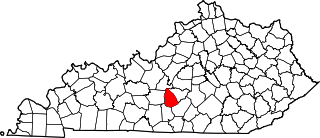
[3] Name on the Register Image Date listed [4] Location City or town Description 1 Allenhurst Upload image April 2, 1973 (# 73000829 Cane Run Pike west of Georgetown 38°11′31″N 84°36′55″W / 38.191944°N 84.615278°W / 38.191944; -84.615278 (Allenhurst ) Georgetown 2 Audubon Upload image December 4, 1973 (# 73000830 Southwest of Georgetown off U.S. Route 62 , on Moore's Mill Pike 38°09′18″N 84°37′22″W / 38.155°N 84.622778°W / 38.155; -84.622778 (Audubon ) Georgetown 3 Julius Blackburn House Upload image April 14, 1977 (# 77000641 West of Georgetown off U.S. Route 460 38°13′49″N 84°43′27″W / 38.230278°N 84.724167°W / 38.230278; -84.724167 (Julius Blackburn House ) Georgetown 4 Alexander Bradford House Upload image June 27, 1974 (# 74000905 Main St. at Locust Fork Pike 38°16′21″N 84°41′16″W / 38.2725°N 84.687778°W / 38.2725; -84.687778 (Alexander Bradford House ) Stamping Ground 5 Fielding Bradford House Upload image December 4, 1973 (# 73000831 North of Georgetown off U.S. Route 25 on Long Lick Pike 38°14′42″N 84°34′46″W / 38.245°N 84.579444°W / 38.245; -84.579444 (Fielding Bradford House ) Georgetown 6 John W. Bradley House Upload image November 5, 1974 (# 74000898 Southwest of Georgetown off U.S. Route 62 38°11′32″N 84°35′52″W / 38.192222°N 84.597778°W / 38.192222; -84.597778 (John W. Bradley House ) Georgetown 7 Branham House Branham House April 2, 1973 (# 73000832 208 S. Broadway 38°12′29″N 84°33′36″W / 38.208056°N 84.56°W / 38.208056; -84.56 (Branham House ) Georgetown 8 Richard Branham House Upload image June 23, 1983 (# 83002863 Prate Rd. 38°13′47″N 84°39′29″W / 38.229722°N 84.658056°W / 38.229722; -84.658056 (Richard Branham House ) Midway 9 James Briscoe Quarters Upload image June 23, 1983 (# 83002864 Off U.S. Route 25 38°15′08″N 84°33′39″W / 38.252222°N 84.560833°W / 38.252222; -84.560833 (James Briscoe Quarters ) Delaplain 10 Vivion Upshaw Brooking House Upload image May 28, 1975 (# 75000824 West of Georgetown off Stamping Ground Pike (KY 227 ) 38°13′16″N 84°38′19″W / 38.221111°N 84.638611°W / 38.221111; -84.638611 (Vivion Upshaw Brooking House ) Georgetown 11 Buford-Duke House Upload image June 19, 1973 (# 73000833 Southeast of Georgetown off KY 1963 38°10′19″N 84°31′54″W / 38.171944°N 84.531667°W / 38.171944; -84.531667 (Buford-Duke House ) Georgetown 12 Joseph Fields Burgess House Upload image November 29, 1984 (# 84000368 Off U.S. Route 25 and the southwestern corner of KY 608 38°25′57″N 84°34′00″W / 38.4325°N 84.566667°W / 38.4325; -84.566667 (Joseph Fields Burgess House ) Sadieville 13 William Campbell House Upload image November 29, 1984 (# 84000415 Off U.S. Route 227 38°15′42″N 84°39′56″W / 38.261667°N 84.665556°W / 38.261667; -84.665556 (William Campbell House ) Stamping Ground 14 Cantrill House Cantrill House April 2, 1973 (# 73000834 324 E. Jackson St. 38°12′23″N 84°33′22″W / 38.206389°N 84.556111°W / 38.206389; -84.556111 (Cantrill House ) Georgetown 15 Cardome Cardome March 13, 1975 (# 75000825 0.5 miles north of Georgetown on U.S. Route 25 38°13′21″N 84°34′03″W / 38.2225°N 84.5675°W / 38.2225; -84.5675 (Cardome ) Georgetown 16 Choctaw Indian Academy Upload image March 7, 1973 (# 73000835 4.5 miles west of Georgetown off U.S. Route 227 38°13′55″N 84°38′05″W / 38.231944°N 84.634722°W / 38.231944; -84.634722 (Choctaw Indian Academy ) Georgetown 17 Confederate Monument in Georgetown Confederate Monument in Georgetown July 17, 1997 (# 97000669 Georgetown Cemetery, 0.5 miles south of the junction of U.S. Route 25 and KY 1692 38°11′53″N 84°33′38″W / 38.198056°N 84.560556°W / 38.198056; -84.560556 (Confederate Monument in Georgetown ) Georgetown 18 Rhodin Coppage Spring House Upload image June 23, 1983 (# 83002865 Off U.S. Route 25 38°14′44″N 84°33′37″W / 38.245556°N 84.560278°W / 38.245556; -84.560278 (Rhodin Coppage Spring House ) Georgetown 19 Newton Craig House and Penitentiary Buildings Complex Newton Craig House and Penitentiary Buildings Complex July 19, 1984 (# 84001980 U.S. Route 460 38°12′34″N 84°38′06″W / 38.209444°N 84.635°W / 38.209444; -84.635 (Newton Craig House and Penitentiary Buildings Complex ) Georgetown 20 Craig-Johnson Mill Dam and Mill Sites Upload image June 10, 1975 (# 75000828 Address Restricted Great Crossing 21 Craig-Peak House Upload image August 2, 2017 (# 100001428 556 Cane Run Rd. 38°11′31″N 84°36′34″W / 38.191873°N 84.609377°W / 38.191873; -84.609377 (Craig-Peak House ) Georgetown 22 Dry Run Site Upload image December 5, 1985 (# 85003041 Address Restricted Georgetown 23 Edge Hill Farm Upload image March 1, 1984 (# 84001983 1661 Payne's Depot Pike 38°11′12″N 84°35′42″W / 38.186667°N 84.595°W / 38.186667; -84.595 (Edge Hill Farm ) Georgetown 24 Elkwood Upload image January 20, 1978 (# 78001395 Northwest of Georgetown 38°13′35″N 84°35′47″W / 38.226389°N 84.596389°W / 38.226389; -84.596389 (Elkwood ) Georgetown 25 Elmwood Upload image November 19, 1974 (# 74000899 Northeast of Georgetown off U.S. Routes 227 and 460 38°13′33″N 84°30′51″W / 38.225833°N 84.514167°W / 38.225833; -84.514167 (Elmwood ) Georgetown 26 Ash Emison Quarters Upload image June 23, 1983 (# 83002866 Off U.S. 25 38°15′34″N 84°33′23″W / 38.259444°N 84.556389°W / 38.259444; -84.556389 (Ash Emison Quarters ) Delaplain 27 First African Baptist Church and Parsonage First African Baptist Church and Parsonage March 1, 1984 (# 84001985 209-211 W. Jefferson St. 38°12′45″N 84°33′40″W / 38.2125°N 84.561111°W / 38.2125; -84.561111 (First African Baptist Church and Parsonage ) Georgetown 28 Matthew Flournoy House Upload image June 23, 1983 (# 83002867 Off Crumbough Pike 38°11′46″N 84°29′26″W / 38.196111°N 84.490556°W / 38.196111; -84.490556 (Matthew Flournoy House ) Centerville 29 Flournoy-Nutter House Upload image July 28, 1977 (# 77000642 East of Georgetown off KY 922 38°10′52″N 84°28′44″W / 38.181111°N 84.478889°W / 38.181111; -84.478889 (Flournoy-Nutter House ) Georgetown 30 James Gaines House Upload image November 7, 1976 (# 76000942 South of Georgetown on Yarnallton Pike 38°09′15″N 84°33′58″W / 38.154167°N 84.566111°W / 38.154167; -84.566111 (James Gaines House ) Georgetown 31 Garth School Garth School November 16, 1988 (# 88002187 501 S. Hamilton St. 38°12′21″N 84°33′33″W / 38.205833°N 84.559167°W / 38.205833; -84.559167 (Garth School ) Georgetown 32 John M. Garth House Upload image November 20, 1974 (# 74000900 Southeast of Georgetown off Interstate 75 38°10′39″N 84°30′16″W / 38.1775°N 84.504444°W / 38.1775; -84.504444 (John M. Garth House ) Georgetown 33 Georgetown College Historic Buildings Georgetown College Historic Buildings August 8, 1979 (# 79001030 E. Jackson St. 38°12′25″N 84°33′17″W / 38.206944°N 84.554722°W / 38.206944; -84.554722 (Georgetown College Historic Buildings ) Georgetown 34 Georgetown East Main Street Residential District Georgetown East Main Street Residential District June 7, 1978 (# 78001396 Irregular pattern along Main St. between Warrendale Ave. and Mulberry St. 38°12′34″N 84°33′15″W / 38.209444°N 84.554167°W / 38.209444; -84.554167 (Georgetown East Main Street Residential District ) Georgetown 35 Giddings Hall, Georgetown College Giddings Hall, Georgetown College February 6, 1973 (# 73000836 Giddings Dr. between Jackson and College Sts. 38°12′25″N 84°33′17″W / 38.206944°N 84.554722°W / 38.206944; -84.554722 (Giddings Hall, Georgetown College ) Georgetown 36 Griffith House Upload image August 29, 1979 (# 79003545 South of Interstate 64 on Moore's Mill Pike 38°09′34″N 84°37′43″W / 38.159444°N 84.628611°W / 38.159444; -84.628611 (Griffith House ) Midway 37 Halley Place Upload image August 28, 1979 (# 79003546 U.S. Route 62 38°08′43″N 84°37′04″W / 38.145278°N 84.617778°W / 38.145278; -84.617778 (Halley Place ) Georgetown 38 Matthew Henry House Upload image June 23, 1983 (# 83002868 KY 922 38°12′19″N 84°28′55″W / 38.205278°N 84.481944°W / 38.205278; -84.481944 (Matthew Henry House ) Centerville 39 Dr. H. C. Herndon House Upload image April 10, 1980 (# 80001666 West of Georgetown on KY 227 38°13′04″N 84°36′33″W / 38.217778°N 84.609167°W / 38.217778; -84.609167 (Dr. H. C. Herndon House ) Georgetown 40 Holy Trinity Episcopal Church Holy Trinity Episcopal Church October 30, 1973 (# 73000837 S. Broadway and W. Clinton Sts. 38°12′28″N 84°33′38″W / 38.207778°N 84.560556°W / 38.207778; -84.560556 (Holy Trinity Episcopal Church ) Georgetown 41 George W. Johnson Slave Quarters and Smokehouse Upload image November 19, 1974 (# 74000901 Southwest of Georgetown off Ironworks Rd. 38°10′25″N 84°36′44″W / 38.173611°N 84.612222°W / 38.173611; -84.612222 (George W. Johnson Slave Quarters and Smokehouse ) Georgetown 42 James Johnson Quarters Upload image October 11, 1983 (# 83003818 Off KY 227 38°12′48″N 84°36′50″W / 38.213333°N 84.613889°W / 38.213333; -84.613889 (James Johnson Quarters ) Georgetown 43 Leonidas Johnson House Upload image October 8, 1976 (# 76000943 7 miles northwest of Georgetown on U.S. Route 227 38°14′44″N 84°39′35″W / 38.245556°N 84.659722°W / 38.245556; -84.659722 (Leonidas Johnson House ) Georgetown 44 Johnson-Pence House Upload image November 20, 1978 (# 78001397 West of Georgetown off U.S. Route 460 38°13′23″N 84°37′31″W / 38.223056°N 84.625278°W / 38.223056; -84.625278 (Johnson-Pence House ) Georgetown 45 Johnston-Jacobs House Johnston-Jacobs House October 2, 1973 (# 73000838 205 N. Hamilton St. 38°12′42″N 84°33′30″W / 38.211667°N 84.558333°W / 38.211667; -84.558333 (Johnston-Jacobs House ) Georgetown 46 Lane's Run Historic District Upload image January 12, 1984 (# 84001986 Old Oxford Rd., U.S. Routes 62 and 460 38°13′55″N 84°31′07″W / 38.231944°N 84.518611°W / 38.231944; -84.518611 (Lane's Run Historic District ) Georgetown 47 Leatherer-Lemon House Upload image July 20, 1977 (# 77000643 Lemon's Mill Pike, 0.5 miles west of Newtown Pike 38°10′56″N 84°29′38″W / 38.182222°N 84.493889°W / 38.182222; -84.493889 (Leatherer-Lemon House ) Georgetown 48 James Lindsay–William Trotter House Upload image August 28, 1979 (# 79003550 Payne's Depot Rd (U.S. Route 62 ) 38°08′15″N 84°37′43″W / 38.13750°N 84.62870°W / 38.13750; -84.62870 (James Lindsay–William Trotter House ) Georgetown vic. Built c.1800 by stonemason and future Kentucky governor Thomas Metcalf . 49 Longview Upload image October 25, 1973 (# 73000839 About 4 miles west of Georgetown off U.S. Route 460 38°13′10″N 84°39′04″W / 38.219444°N 84.651111°W / 38.219444; -84.651111 (Longview ) Georgetown 50 Main Street Commercial District Main Street Commercial District February 24, 1975 (# 75000826 Both sides of E. Main St. from Mulberry to Broadway, southern side from Elley Alley to Broadway 38°15′49″N 84°33′25″W / 38.263611°N 84.556944°W / 38.263611; -84.556944 (Main Street Commercial District ) Georgetown 51 McFarland House McFarland House October 15, 1973 (# 73000840 510 Fountain Ave. 38°12′16″N 84°33′00″W / 38.204444°N 84.550000°W / 38.204444; -84.550000 (McFarland House ) Georgetown 52 Miller's Run Historic District Upload image November 15, 1978 (# 78001398 Roughly bounded by Old Oxford Pike, KY 922 , U.S. Route 460 , and Miller's Run 38°14′14″N 84°29′44″W / 38.237222°N 84.495556°W / 38.237222; -84.495556 (Miller's Run Historic District ) Oxford 53 John Andrew Miller House Upload image November 9, 1977 (# 77000644 3 miles east of Georgetown off U.S. Route 460 38°13′21″N 84°29′58″W / 38.2225°N 84.499444°W / 38.2225; -84.499444 (John Andrew Miller House ) Georgetown 54 New Zion Historic District Upload image December 4, 2008 (# 08001118 4972 Newtown Pike through 5200 Newtown Pike, and 103-135 New Zion Rd. 38°10′44″N 84°29′11″W / 38.17897°N 84.48637°W / 38.17897; -84.48637 (New Zion Historic District ) Scott African American rural community founded around 1872 on land of two ex slaves. Extends into Fayette County . 55 Lewis Nuckols House Lewis Nuckols House August 28, 1979 (# 79003547 U.S. Route 421 38°07′53″N 84°37′25″W / 38.131389°N 84.623611°W / 38.131389; -84.623611 (Lewis Nuckols House ) Georgetown 56 Osburn House Upload image April 11, 1973 (# 73000841 4 miles north of Georgetown on U.S. Route 25 38°15′53″N 84°34′02″W / 38.264722°N 84.567222°W / 38.264722; -84.567222 (Osburn House ) Georgetown 57 Oxford Historic District Upload image September 11, 1979 (# 79001031 Northeast of Georgetown at U.S. Route 62 and KY 922 38°16′08″N 84°30′04″W / 38.268889°N 84.501111°W / 38.268889; -84.501111 (Oxford Historic District ) Georgetown 58 Joseph Patterson Quarters Upload image June 23, 1983 (# 83002869 Off U.S. Route 421 38°09′00″N 84°38′20″W / 38.15°N 84.638889°W / 38.15; -84.638889 (Joseph Patterson Quarters ) Midway 59 Asa Payne House Upload image August 28, 1979 (# 79003548 U.S. Route 62 38°08′46″N 84°37′20″W / 38.146111°N 84.622222°W / 38.146111; -84.622222 (Asa Payne House ) Georgetown 60 Gen. John Payne House Upload image March 3, 1975 (# 75000827 1.5 miles west of Georgetown on U.S. Route 460 38°12′47″N 84°35′22″W / 38.213056°N 84.589444°W / 38.213056; -84.589444 (Gen. John Payne House ) Georgetown 61 Payne-Desha House Payne-Desha House December 2, 1974 (# 74000902 Kelly Ave. 38°12′45″N 84°33′48″W / 38.2125°N 84.563333°W / 38.2125; -84.563333 (Payne-Desha House ) Georgetown 62 Levi Prewitt House Upload image November 1, 1974 (# 74000903 South of Georgetown off Interstate 64 38°09′01″N 84°34′54″W / 38.150278°N 84.581667°W / 38.150278; -84.581667 (Levi Prewitt House ) Georgetown 63 Royal Spring Park Royal Spring Park April 2, 1973 (# 73000842 Between Clinton and Jefferson Sts., west of Water, Broadway, and Georgetown Sts. 38°12′37″N 84°33′33″W / 38.210278°N 84.559167°W / 38.210278; -84.559167 (Royal Spring Park ) Georgetown 64 Sadieville Historic District Upload image July 30, 2013 (# 13000566 100-326 College, 100-245 Main, 350-714 Pike, 216 Church, 204 Cunningham & 100-247 Vine Sts., 109-123 Gano Ave. 38°23′28″N 84°32′11″W / 38.391245°N 84.536353°W / 38.391245; -84.536353 (Sadieville Historic District ) Sadieville 65 St. Francis Mission at White Sulphur St. Francis Mission at White Sulphur April 11, 1973 (# 73000847 7 miles west of Georgetown on U.S. Route 460 38°12′27″N 84°41′50″W / 38.207500°N 84.697222°W / 38.207500; -84.697222 (St. Francis Mission at White Sulphur ) Georgetown 66 Robert Sanders House Upload image October 15, 1973 (# 73000843 2 miles south of Georgetown on U.S. Route 25 38°10′11″N 84°33′29″W / 38.169722°N 84.558056°W / 38.169722; -84.558056 (Robert Sanders House ) Georgetown 67 Scott County Courthouse Scott County Courthouse September 28, 1972 (# 72000542 E. Main and Broadway 38°12′36″N 84°33′35″W / 38.21°N 84.559722°W / 38.21; -84.559722 (Scott County Courthouse ) Georgetown 68 Scott County Jail Complex Scott County Jail Complex September 6, 2002 (# 02000923 117 N. Water St. 38°12′29″N 84°33′45″W / 38.208056°N 84.5625°W / 38.208056; -84.5625 (Scott County Jail Complex ) Georgetown 69 Showalter House Showalter House April 2, 1973 (# 73000844 316 N. Hamilton St. 38°12′47″N 84°33′26″W / 38.213194°N 84.557222°W / 38.213194; -84.557222 (Showalter House ) Georgetown 70 Shropshire House Shropshire House April 2, 1973 (# 73000845 355 E. Main St. 38°12′36″N 84°33′20″W / 38.21°N 84.555556°W / 38.21; -84.555556 (Shropshire House ) Georgetown 71 Dr. William Addison Smith House Upload image November 29, 1984 (# 84000363 1589 Newton Pike 38°12′10″N 84°28′53″W / 38.202778°N 84.481389°W / 38.202778; -84.481389 (Dr. William Addison Smith House ) Georgetown 72 Nelson and Clifton Rodes Smith House Upload image October 3, 1973 (# 73000846 Northeast of Georgetown off Leesburg Pike 38°14′50″N 84°27′03″W / 38.247222°N 84.450833°W / 38.247222; -84.450833 (Nelson and Clifton Rodes Smith House ) Georgetown 73 South Broadway Neighborhood District South Broadway Neighborhood District December 19, 1991 (# 91001856 Roughly Georgetown Cemetery, S. Broadway north to College St. and S. Hamilton St. from Clayton Ave. to College St. 38°12′27″N 84°33′36″W / 38.207500°N 84.560000°W / 38.207500; -84.560000 (South Broadway Neighborhood District ) Georgetown 74 Henry Stevenson House Upload image August 28, 1979 (# 79003549 U.S. Route 62 38°09′11″N 84°36′42″W / 38.153056°N 84.611667°W / 38.153056; -84.611667 (Henry Stevenson House ) Georgetown 75 Stone-Grant House Upload image January 11, 1974 (# 74000904 East of Georgetown on E. Main St. extended 38°12′24″N 84°32′38″W / 38.206667°N 84.543889°W / 38.206667; -84.543889 (Stone-Grant House ) Georgetown 76 John Suggett House Upload image June 23, 1983 (# 83002870 U.S. Route 460 38°12′12″N 84°37′09″W / 38.203333°N 84.619167°W / 38.203333; -84.619167 (John Suggett House ) Georgetown 77 William Suggett Agricultural and Industrial District Upload image November 16, 1988 (# 88002182 Southwest of the junction of Cane Run Rd. and U.S. Route 460 38°12′18″N 84°36′46″W / 38.205°N 84.612778°W / 38.205; -84.612778 (William Suggett Agricultural and Industrial District ) Georgetown 78 Thomsons Mill Warehouse Upload image June 23, 1983 (# 83002871 Off U.S. Route 460 38°13′06″N 84°34′29″W / 38.218333°N 84.574722°W / 38.218333; -84.574722 (Thomsons Mill Warehouse ) Georgetown 79 Ward Hall Ward Hall April 2, 1973 (# 85001841 1.5 miles west of Georgetown on U.S. Route 460 38°12′23″N 84°35′21″W / 38.206389°N 84.589167°W / 38.206389; -84.589167 (Ward Hall ) Georgetown 80 Weisenberger Mills and Related Buildings Weisenberger Mills and Related Buildings August 16, 1984 (# 84001987 Off U.S. Route 421 38°07′34″N 84°38′13″W / 38.126111°N 84.636944°W / 38.126111; -84.636944 (Weisenberger Mills and Related Buildings ) Midway Extends into Woodford County 81 West Main Street Historic District West Main Street Historic District November 5, 1985 (# 85003491 217-600 W. Main St. 38°12′39″N 84°33′59″W / 38.210833°N 84.566389°W / 38.210833; -84.566389 (West Main Street Historic District ) Georgetown 82 Charles Whitaker House Upload image June 23, 1983 (# 83002872 Off Old Oxford Rd. 38°14′22″N 84°30′03″W / 38.239444°N 84.500833°W / 38.239444; -84.500833 (Charles Whitaker House ) Georgetown 83 Merritt Williams House Upload image February 28, 1979 (# 79003551 Moore's Mill Pike at Can Run Pike 38°09′46″N 84°38′33″W / 38.162778°N 84.6425°W / 38.162778; -84.6425 (Merritt Williams House ) Midway