National Register of Historic Places listings in Butler County, Kentucky

Last updated

Location of Butler County in Kentucky Map of Kentucky highlighting Butler County.svg
Location of Butler County in Kentucky

This is a list of the National Register of Historic Places listings in Butler County, Kentucky.

Contents

This is intended to be a complete list of the properties and districts on the National Register of Historic Places in Butler County, Kentucky, United States. The locations of National Register properties and districts for which the latitude and longitude coordinates are included below, may be seen in a map. [1]

There are 16 properties and districts listed on the National Register in the county, of which 6 are part of a National Historic Landmark spread across multiple counties. Another property was once listed but has been removed.


    This National Park Service list is complete through NPS recent listings posted March 4, 2022. [2]

Map all coordinates using: OpenStreetMap  
Download coordinates as: KML

Current listings

[3] Name on the RegisterImageDate listed [4] Location City or townDescription
1 Annis Mound and Village Site (15BT2; 15BT20; 15BT21)
Annis Mound and Village Site (15BT2; 15BT20; 15BT21) Annis Village Site.jpg
Annis Mound and Village Site (15BT2; 15BT20; 15BT21)
December 21, 1985
(#85003182)
Western bank of the Green River in Horseshoe Bend, northeast of Logansport [5]
37°17′25″N86°45′30″W / 37.290278°N 86.758333°W / 37.290278; -86.758333 (Annis Mound and Village Site (15BT2; 15BT20; 15BT21))
Logansport
2 Baby Track Rock Petroglyphs (15BT40) September 8, 1989
(#89001175)
Address Restricted
Morgantown
3 Carlston Annis Shell Mound (15BT5) April 1, 1986
(#86000632)
Eastern side of the Green River off Kentucky Route 403 [6]
37°17′28″N86°48′19″W / 37.291111°N 86.805278°W / 37.291111; -86.805278 (Carlston Annis Shell Mound (15BT5))
Schulztown Part of the Green River Shell Middens Archeological District National Historic Landmark [7] :8
4 John Carson House
John Carson House John Carson House, Morgantown.jpg
John Carson House
July 26, 1991
(#91000922)
205 S. Main St.
37°13′28″N86°41′06″W / 37.224444°N 86.685000°W / 37.224444; -86.685000 (John Carson House)
Morgantown
5 Carson-Annis Ferry Farm
Carson-Annis Ferry Farm Carson-Annis Ferry Farm.jpg
Carson-Annis Ferry Farm
July 31, 1998
(#98000935)
1086 Annis Ferry Rd.
37°17′39″N86°45′10″W / 37.294167°N 86.752778°W / 37.294167; -86.752778 (Carson-Annis Ferry Farm)
Morgantown Originally listed as "Carson's Landing", but boundaries increased and name changed on April 10, 2007
6 Confederate-Union Veterans' Monument in Morgantown
Confederate-Union Veterans' Monument in Morgantown Con Un Mon in Morgantown KY.jpg
Confederate-Union Veterans' Monument in Morgantown
July 17, 1997
(#97000713)
1 block north of the junction of U.S. Route 231 and KY 403
37°13′32″N86°41′00″W / 37.225500°N 86.683222°W / 37.225500; -86.683222 (Confederate-Union Veterans' Monument in Morgantown)
Morgantown
7 DeWeese Shell Mound (15BT6) April 1, 1986
(#86000635)
Eastern bank of the Green River in Horseshoe Bend, west of Taylor Lake [5]
37°18′26″N86°49′04″W / 37.307222°N 86.817778°W / 37.307222; -86.817778 (DeWeese Shell Mound (15BT6))
Highview Part of the Green River Shell Middens Archeological District National Historic Landmark [7] :9
8 Finney Hotel
Finney Hotel Finney Hotel in Woodbury.jpg
Finney Hotel
November 7, 1995
(#95001349)
Junction of Kentucky Route 403 and Hime St.
37°11′04″N86°38′01″W / 37.184306°N 86.633611°W / 37.184306; -86.633611 (Finney Hotel)
Woodbury
9 Ice House on Little Muddy Creek January 8, 1987
(#87000171)
U.S. Route 231
37°09′14″N86°40′33″W / 37.153889°N 86.675833°W / 37.153889; -86.675833 (Ice House on Little Muddy Creek)
Morgantown
10 Rayburn Johnson Shell Mound (15BT41)
Rayburn Johnson Shell Mound (15BT41) Rayburn Johnson Shell Mound site.jpg
Rayburn Johnson Shell Mound (15BT41)
April 1, 1986
(#86000633)
Eastern bank of the Green River in Horseshoe Bend, northwest of Taylor Lake [8]
37°19′28″N86°49′04″W / 37.324444°N 86.817778°W / 37.324444; -86.817778 (Rayburn Johnson Shell Mound (15BT41))
Prentiss Part of the Green River Shell Middens Archeological District National Historic Landmark [7] :12
11 Read Shell Mound (15BT10) April 1, 1986
(#86000647)
Northern side of the Green River, west of Morgantown [9] :120
37°14′33″N86°47′27″W / 37.242500°N 86.790833°W / 37.242500; -86.790833 (Read Shell Mound (15BT10))
Monticello Part of the Green River Shell Middens Archeological District National Historic Landmark [7] :10
12 Reedyville Petroglyphs (15BT65) September 8, 1989
(#89001176)
Lock 5 Rd., just north of the Green River [10]
37°10′02″N86°24′52″W / 37.167222°N 86.414306°W / 37.167222; -86.414306 (Reedyville Petroglyphs (15BT65))
Reedyville
13 Russell Shell Mound (15BT11) April 1, 1986
(#86000637)
Eastern bank of the Green River in Horseshoe Bend [5]
37°16′16″N86°48′01″W / 37.271111°N 86.800278°W / 37.271111; -86.800278 (Russell Shell Mound (15BT11))
Logansport Part of the Green River Shell Middens Archeological District National Historic Landmark [7] :11
14 Turkey Rock Petroglyphs (15BT64) September 8, 1989
(#89001177)
Address Restricted
Morgantown
15 U.S. Army Corps of Engineers Superintendent's House and Workmen's Office
U.S. Army Corps of Engineers Superintendent's House and Workmen's Office Woodbury Lock 4 buildings.jpg
U.S. Army Corps of Engineers Superintendent's House and Workmen's Office
June 19, 1980
(#80001489)
Woodbury Park
37°11′05″N86°37′56″W / 37.184861°N 86.632222°W / 37.184861; -86.632222 (U.S. Army Corps of Engineers Superintendent's House and Workmen's Office)
Woodbury
16 Woodbury Shell Midden (15BT67)
Woodbury Shell Midden (15BT67) Woodbury Shell Midden site.jpg
Woodbury Shell Midden (15BT67)
April 1, 1986
(#86000639)
Left bank of the Green River immediately above Woodbury [8]
37°10′51″N86°37′39″W / 37.180833°N 86.627500°W / 37.180833; -86.627500 (Woodbury Shell Midden (15BT67))
Woodbury Part of the Green River Shell Middens Archeological District National Historic Landmark [7] :13

Former listing

[3] Name on the RegisterImageDate listedDate removedLocationCity or townDescription
1 Butler County Jail November 1, 1984
(#84000219)
July 5, 1990S. Warren and E. Logan Sts.
Morgantown

See also

Related Research Articles

The Green River Shell Middens Archeological District is a historic district composed of archaeological sites in the U.S. state of Kentucky. All of the district's sites are shell middens along the banks of the Green River that date from the later portion of the Archaic period. Studies of this assemblage of sites were critical in the development of knowledge of the Archaic period in the eastern United States.

National Register of Historic Places listings in Henderson County, Kentucky

This is a list of the National Register of Historic Places listings in Henderson County, Kentucky.

National Register of Historic Places listings in Daviess County, Kentucky

This is a list of the National Register of Historic Places listings in Daviess County, Kentucky.

National Register of Historic Places listings in Bracken County, Kentucky

This is a list of the National Register of Historic Places listings in Bracken County, Kentucky.

National Register of Historic Places listings in Boyd County, Kentucky

This is a list of the National Register of Historic Places listings in Boyd County, Kentucky.

National Register of Historic Places listings in Calloway County, Kentucky

This is a list of the National Register of Historic Places listings in Calloway County, Kentucky. It is intended to be a complete list of the properties and districts on the National Register of Historic Places in Calloway County, Kentucky, United States. The locations of National Register properties and districts for which the latitude and longitude coordinates are included below, may be seen in a map.

National Register of Historic Places listings in Whitley County, Kentucky

This is a list of the National Register of Historic Places listings in Whitley County, Kentucky.

National Register of Historic Places listings in Powell County, Kentucky

This is a list of the National Register of Historic Places listings in Powell County, Kentucky.

National Register of Historic Places listings in Muhlenberg County, Kentucky

This is a list of the National Register of Historic Places listings in Muhlenberg County, Kentucky.

National Register of Historic Places listings in Mercer County, Kentucky

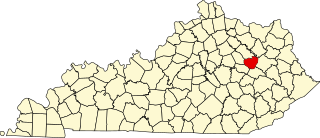
This is a list of the National Register of Historic Places listings in Mercer County, Kentucky.

National Register of Historic Places listings in Nelson County, Kentucky

This is a list of the National Register of Historic Places listings in Nelson County, Kentucky.

National Register of Historic Places listings in Ohio County, Kentucky

This is a list of the National Register of Historic Places listings in Ohio County, Kentucky.

National Register of Historic Places listings in Fulton County, Kentucky

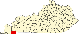
This is a list of the National Register of Historic Places listings in Fulton County, Kentucky.

National Register of Historic Places listings in Logan County, Kentucky

This is a list of the National Register of Historic Places listings in Logan County, Kentucky.

National Register of Historic Places listings in McLean County, Kentucky

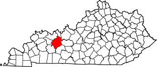
This is a list of the National Register of Historic Places listings in McLean County, Kentucky.

National Register of Historic Places listings in Bullitt County, Kentucky

This is a list of the National Register of Historic Places listings in Bullitt County, Kentucky.

National Register of Historic Places listings in Bath County, Kentucky

This is a list of the National Register of Historic Places listings in Bath County, Kentucky.

National Register of Historic Places listings in Marshall County, Kentucky

This is a list of the National Register of Historic Places listings in Marshall County, Kentucky.

National Register of Historic Places listings in Menifee County, Kentucky

This is a list of the National Register of Historic Places listings in Menifee County, Kentucky.

Carlston Annis Shell Mound United States historic place

The Carlston Annis Shell Mound is a prominent archaeological site in the western part of the U.S. state of Kentucky. Located along the Green River in Butler County, this shell midden has been declared a historic site because of its archaeological value.

References

  1. The latitude and longitude information provided in this table was derived originally from the National Register Information System, which has been found to be fairly accurate for about 99% of listings. Some locations in this table may have been corrected to current GPS standards.
  2. National Park Service, United States Department of the Interior, "National Register of Historic Places: Weekly List Actions", retrieved March 4, 2022.
  3. 1 2 Numbers represent an alphabetical ordering by significant words. Various colorings, defined here, differentiate National Historic Landmarks and historic districts from other NRHP buildings, structures, sites or objects.
  4. The eight-digit number below each date is the number assigned to each location in the National Register Information System database, which can be viewed by clicking the number.
  5. 1 2 3 Funkhouser, W.D., and W.S. Webb. "Archaeological Survey of Kentucky: Butler County". University of Kentucky Reports in Anthropology 7.5 (1950): 358.
  6. Funkhouser, W.D., and W.S. Webb. "Archaeological Survey of Kentucky: Butler County". University of Kentucky Reports in Anthropology 2 (1932): 56.
  7. 1 2 3 4 5 6 National Historic Landmark Nomination: Green River Shell Middens. National Park Service: 1994-05-05.
  8. 1 2 Claassen, Cheryl. Feasting with Shellfish in the Southern Ohio Valley: Archaic Sacred Sites and Rituals. Knoxville: U of Tennessee P, 2010, 41.
  9. Milner, George R., and Richard W. Jefferies. "The Read Archaic Shell Midden in Kentucky". Southeastern Archaeology 17.2 (1998): 119-132.
  10. Coy, Fred E., Jr., and Thomas C. Fuller. "Reedyville Petroglyphs: Butler County, Kentucky". Central States Archaeological Journal 17.3 (1970): 99-111: 103.