National Register of Historic Places listings in Whitley County, Kentucky

Last updated

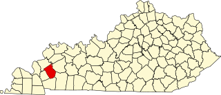
Location of Whitley County in Kentucky Map of Kentucky highlighting Whitley County.svg
Location of Whitley County in Kentucky

This is a list of the National Register of Historic Places listings in Whitley County, Kentucky.

Contents

This is intended to be a complete list of the properties and districts on the National Register of Historic Places in Whitley County, Kentucky, United States. The locations of National Register properties and districts for which the latitude and longitude coordinates are included below, may be seen in a map. [1]

There are 13 properties and districts listed on the National Register in the county.


    This National Park Service list is complete through NPS recent listings posted January 6, 2023. [2]

Map all coordinates using: OpenStreetMap  
Download coordinates as: KML

Current listings

[3] Name on the RegisterImageDate listed [4] Location City or townDescription
1 Bowman Site (15WH14) November 30, 1985
(#85002974)
Address Restricted
Lot A Mississippian mound site also known as the "Bowman Mound" [5]
2 Carnegie Library
Carnegie Library Corbin Carnegie Library.jpg
Carnegie Library
March 28, 1986
(#86000603)
400 Roy Kidd Avenue
36°57′01″N84°05′38″W / 36.950139°N 84.093750°W / 36.950139; -84.093750 (Carnegie Library)
Corbin
3 Corbin Bank Building
Corbin Bank Building Corbin Bank Building.jpg
Corbin Bank Building
March 28, 1986
(#86000604)
101 Center St.
36°56′58″N84°05′49″W / 36.949306°N 84.096806°W / 36.949306; -84.096806 (Corbin Bank Building)
Corbin
4 East Main Street Bridge
East Main Street Bridge East Main Street Bridge in Corbin.jpg
East Main Street Bridge
March 28, 1986
(#86000605)
Engineer St. and Lynn Camp Creek
36°57′11″N84°05′40″W / 36.953111°N 84.094444°W / 36.953111; -84.094444 (East Main Street Bridge)
Corbin
5 First Christian Church
First Christian Church First Christian Church in Corbin.jpg
First Christian Church
March 28, 1986
(#86000693)
100 South Kentucky Avenue
36°56′48″N84°05′51″W / 36.946667°N 84.097500°W / 36.946667; -84.097500 (First Christian Church)
Corbin
6 Dr. Ancil Gatliff House
Dr. Ancil Gatliff House Ancil Gatliff House.jpg
Dr. Ancil Gatliff House
August 11, 1980
(#80001689)
S. 5th St.
36°44′27″N84°09′41″W / 36.740833°N 84.161389°W / 36.740833; -84.161389 (Dr. Ancil Gatliff House)
Williamsburg
7 J.B. Gatliff House
J.B. Gatliff House J.B. Gatliff House.jpg
J.B. Gatliff House
December 16, 1977
(#77000663)
10th and Main Sts.
36°44′08″N84°10′01″W / 36.735556°N 84.166944°W / 36.735556; -84.166944 (J.B. Gatliff House)
Williamsburg
8 Gordon Hill Road Historic District
Gordon Hill Road Historic District Gordon Hill east of Padgett in Corbin.jpg
Gordon Hill Road Historic District
March 28, 1986
(#86000692)
309-501 Gordon Hill Rd.
36°56′53″N84°06′02″W / 36.948056°N 84.100556°W / 36.948056; -84.100556 (Gordon Hill Road Historic District)
Corbin
9 Lane Theater
Lane Theater Williamsburg Lane Theater.jpg
Lane Theater
November 26, 2004
(#04001255)
510 Main St.
36°44′28″N84°09′43″W / 36.741111°N 84.161944°W / 36.741111; -84.161944 (Lane Theater)
Williamsburg
10 Louisville and Nashville Railroad Depot
Louisville and Nashville Railroad Depot L&N depot in Corbin.jpg
Louisville and Nashville Railroad Depot
June 15, 1978
(#78001414)
Lynn Ave.
36°56′51″N84°05′44″W / 36.947500°N 84.095556°W / 36.947500; -84.095556 (Louisville and Nashville Railroad Depot)
Corbin
11 Mershon Building
Mershon Building Mershon Building.jpg
Mershon Building
March 28, 1986
(#86000606)
E. Center St.
36°56′58″N84°05′46″W / 36.949444°N 84.096111°W / 36.949444; -84.096111 (Mershon Building)
Corbin
12 Williamsburg Armory
Williamsburg Armory Williamsburg Armory.jpg
Williamsburg Armory
September 6, 2002
(#02000930)
S. 2nd St.
36°44′13″N84°09′25″W / 36.736944°N 84.156944°W / 36.736944; -84.156944 (Williamsburg Armory)
Williamsburg
13 Williamsburg Historic District April 25, 2019
(#100003683)
Main & Main Cross Sts.
Coordinates missing
Williamsburg

See also

Related Research Articles

<span class="mw-page-title-main">National Register of Historic Places listings in Woodford County, Kentucky</span>

This is a list of the National Register of Historic Places listings in Woodford County, Kentucky.

<span class="mw-page-title-main">National Register of Historic Places listings in Franklin County, Kentucky</span>

This is a list of the National Register of Historic Places listings in Franklin County, Kentucky.

<span class="mw-page-title-main">National Register of Historic Places listings in Hopkins County, Kentucky</span>

This is a list of the National Register of Historic Places listings in Hopkins County, Kentucky.
<span class="mw-page-title-main">National Register of Historic Places listings in Green County, Kentucky</span>

This is a list of the National Register of Historic Places listings in Green County, Kentucky.
<span class="mw-page-title-main">National Register of Historic Places listings in Bourbon County, Kentucky</span>

This is a list of the National Register of Historic Places listings in Bourbon County, Kentucky.
<span class="mw-page-title-main">National Register of Historic Places listings in Campbell County, Kentucky</span>

This is a list of the National Register of Historic Places listings in Campbell County, Kentucky.

<span class="mw-page-title-main">National Register of Historic Places listings in Boone County, Kentucky</span>

This is a list of the National Register of Historic Places listings in Boone County, Kentucky.

<span class="mw-page-title-main">National Register of Historic Places listings in Clark County, Kentucky</span>

This is a list of the National Register of Historic Places listings in Clark County, Kentucky.

<span class="mw-page-title-main">National Register of Historic Places listings in Rowan County, Kentucky</span>

This is a list of the National Register of Historic Places listings in Rowan County, Kentucky.

<span class="mw-page-title-main">National Register of Historic Places listings in Pike County, Kentucky</span>

This is a list of the National Register of Historic Places listings in Pike County, Kentucky.

<span class="mw-page-title-main">National Register of Historic Places listings in Pulaski County, Kentucky</span>

This is a list of the National Register of Historic Places listings in Pulaski County, Kentucky.

<span class="mw-page-title-main">National Register of Historic Places listings in Scott County, Kentucky</span>

This is a list of the National Register of Historic Places listings in Scott County, Kentucky.
<span class="mw-page-title-main">National Register of Historic Places listings in Montgomery County, Kentucky</span>

This is a list of the National Register of Historic Places listings in Montgomery County, Kentucky.

<span class="mw-page-title-main">National Register of Historic Places listings in Mercer County, Kentucky</span>

This is a list of the National Register of Historic Places listings in Mercer County, Kentucky.

<span class="mw-page-title-main">National Register of Historic Places listings in Nicholas County, Kentucky</span>

This is a list of the National Register of Historic Places listings in Nicholas County, Kentucky.

<span class="mw-page-title-main">National Register of Historic Places listings in Floyd County, Kentucky</span>

This is a list of the National Register of Historic Places listings in Floyd County, Kentucky.

<span class="mw-page-title-main">National Register of Historic Places listings in Johnson County, Kentucky</span>

This is a list of the National Register of Historic Places listings in Johnson County, Kentucky.

<span class="mw-page-title-main">National Register of Historic Places listings in Kenton County, Kentucky</span>

This is intended to be a complete list of the properties and districts on the National Register of Historic Places in Kenton County, Kentucky, United States. The locations of National Register properties and districts for which the latitude and longitude coordinates are included below, may be seen in a map.
<span class="mw-page-title-main">National Register of Historic Places listings in Caldwell County, Kentucky</span>

This is a list of the National Register of Historic Places listings in Caldwell County, Kentucky.

<span class="mw-page-title-main">National Register of Historic Places listings in Cumberland County, Kentucky</span>

This is a list of the National Register of Historic Places listings in Cumberland County, Kentucky.

References

  1. The latitude and longitude information provided in this table was derived originally from the National Register Information System, which has been found to be fairly accurate for about 99% of listings. Some locations in this table may have been corrected to current GPS standards.
  2. National Park Service, United States Department of the Interior, "National Register of Historic Places: Weekly List Actions", retrieved January 6, 2023.
  3. Numbers represent an alphabetical ordering by significant words. Various colorings, defined here, differentiate National Historic Landmarks and historic districts from other NRHP buildings, structures, sites or objects.
  4. The eight-digit number below each date is the number assigned to each location in the National Register Information System database, which can be viewed by clicking the number.
  5. Jefferies, Richard W. "Living on the Edge: Mississippian Settlement in the Cumberland Gap Vicinity". In Archaeology of the Appalachian Highlands : 198-221. Lynne P. Sullivan and Susan C. Prezzano, eds. Knoxville: U of Tennessee P, 2001, 211.