National Register of Historic Places listings in Anderson County, Kentucky

Last updated

Location of Anderson County in Kentucky Map of Kentucky highlighting Anderson County.svg
Location of Anderson County in Kentucky

This is a list of the National Register of Historic Places listings in Anderson County, Kentucky.

Contents

This is intended to be a complete list of the properties and districts on the National Register of Historic Places in Anderson County, Kentucky, United States. The locations of National Register properties and districts for which the latitude and longitude coordinates are included below, may be seen in a map. [1]

There are 12 properties and districts listed on the National Register in the county.


    This National Park Service list is complete through NPS recent listings posted March 4, 2022. [2]

Map all coordinates using: OpenStreetMap  
Download coordinates as: KML

Current listings

[3] Name on the RegisterImageDate listed [4] Location City or townDescription
1 Confederate Monument in Lawrenceburg
Confederate Monument in Lawrenceburg Confederate Monument in Lawrenceburg temp.jpg
Confederate Monument in Lawrenceburg
July 17, 1997
(#97000716)
Courthouse Lawn, 0.5 miles south of U.S. Route 127 and Kentucky Route 44
38°02′06″N84°53′44″W / 38.035°N 84.895556°W / 38.035; -84.895556 (Confederate Monument in Lawrenceburg)
Lawrenceburg
2 R.H. Crossfield House
R.H. Crossfield House RH Crossfield House.jpg
R.H. Crossfield House
June 11, 1975
(#75000730)
Southwest of Lawrenceburg off Anderson City Rd.
37°59′06″N84°58′57″W / 37.985°N 84.9825°W / 37.985; -84.9825 (R.H. Crossfield House)
Lawrenceburg
3 Dowling House
Dowling House Dowling House in Lawrenceburg.jpg
Dowling House
July 10, 1979
(#79000957)
321 S. Main St.
38°01′59″N84°53′40″W / 38.033056°N 84.894444°W / 38.033056; -84.894444 (Dowling House)
Lawrenceburg
4 Thomas H. Hanks House May 14, 1980
(#80001478)
516 E. Woodford St.
38°02′21″N84°53′11″W / 38.039167°N 84.886389°W / 38.039167; -84.886389 (Thomas H. Hanks House)
Lawrenceburg
5 Kavanaugh Academy
Kavanaugh Academy Kavanaugh Academy building.jpg
Kavanaugh Academy
September 19, 1973
(#73000781)
241 E. Woodford St.
38°02′19″N84°53′32″W / 38.038611°N 84.892222°W / 38.038611; -84.892222 (Kavanaugh Academy)
Lawrenceburg
6 Lawrenceburg Commercial Historic District
Lawrenceburg Commercial Historic District Anderson County courthouse.jpg
Lawrenceburg Commercial Historic District
August 5, 1994
(#94000837)
Roughly Main St. from North Alley to Court St. and Court from Main to the Southern Railway tracks
38°02′11″N84°53′44″W / 38.036389°N 84.895556°W / 38.036389; -84.895556 (Lawrenceburg Commercial Historic District)
Lawrenceburg
7 Lexington Extension of the Louisville Southern Railroad
Lexington Extension of the Louisville Southern Railroad Eastern end of bridge.jpg
Lexington Extension of the Louisville Southern Railroad
August 4, 2004
(#04000789)
Eastern Lawrenceburg to Milner
38°02′08″N84°50′00″W / 38.035556°N 84.833333°W / 38.035556; -84.833333 (Lexington Extension of the Louisville Southern Railroad)
Lawrenceburg Extends into Woodford County
8 McBrayer-Clark House
McBrayer-Clark House McBrayer-Clark House.jpg
McBrayer-Clark House
September 19, 1973
(#73000782)
North of Lawrenceburg on Kentucky Route 326
38°04′06″N84°54′19″W / 38.068333°N 84.905278°W / 38.068333; -84.905278 (McBrayer-Clark House)
Lawrenceburg
9 Rev. William Dudley Moore House
Rev. William Dudley Moore House Rev. W.D. Moore home.jpg
Rev. William Dudley Moore House
February 21, 1979
(#79000958)
4 miles (6.4 km) south of Lawrenceburg
37°59′00″N84°52′31″W / 37.983333°N 84.875278°W / 37.983333; -84.875278 (Rev. William Dudley Moore House)
Lawrenceburg
10 Old Prentice Distillery
Old Prentice Distillery Four roses destillery.jpg
Old Prentice Distillery
March 19, 1987
(#87000478)
Kentucky Route 513
37°58′23″N84°53′54″W / 37.973056°N 84.898333°W / 37.973056; -84.898333 (Old Prentice Distillery)
Lawrenceburg
11 Old Wash Place June 11, 1975
(#75000731)
9 miles west of Lawrenceburg at the junction of U.S. Route 62 and Kentucky Route 53
37°57′36″N85°01′28″W / 37.96°N 85.024444°W / 37.96; -85.024444 (Old Wash Place)
Lawrenceburg
12 T.B. Ripy House
T.B. Ripy House T.B. Ripy House.jpg
T.B. Ripy House
February 20, 1980
(#80001479)
320 S. Main St.
38°01′58″N84°53′44″W / 38.032778°N 84.895556°W / 38.032778; -84.895556 (T.B. Ripy House)
Lawrenceburg

See also

Related Research Articles

National Register of Historic Places listings in Woodford County, Kentucky

This is a list of the National Register of Historic Places listings in Woodford County, Kentucky.

National Register of Historic Places listings in Washington County, Kentucky

This is a list of the National Register of Historic Places listings in Washington County, Kentucky.

National Register of Historic Places listings in Shelby County, Kentucky

This is a list of the National Register of Historic Places listings in Shelby County, Kentucky.

National Register of Historic Places listings in Franklin County, Kentucky Wikipedia list article

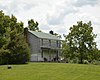
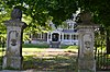
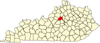
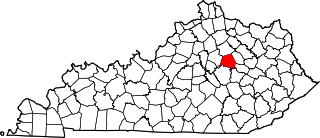
This is a list of the National Register of Historic Places listings in Franklin County, Kentucky.

National Register of Historic Places listings in Hardin County, Kentucky

This is a list of the National Register of Historic Places listings in Hardin County, Kentucky.

National Register of Historic Places listings in Boyle County, Kentucky

This is a list of the National Register of Historic Places listings in Boyle County, Kentucky.

National Register of Historic Places listings in Daviess County, Kentucky

This is a list of the National Register of Historic Places listings in Daviess County, Kentucky.

National Register of Historic Places listings in Barren County, Kentucky

This is a list of the National Register of Historic Places listings in Barren County, Kentucky.

National Register of Historic Places listings in Clark County, Kentucky

This is a list of the National Register of Historic Places listings in Clark County, Kentucky.

National Register of Historic Places listings in Calloway County, Kentucky

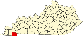
This is a list of the National Register of Historic Places listings in Calloway County, Kentucky. It is intended to be a complete list of the properties and districts on the National Register of Historic Places in Calloway County, Kentucky, United States. The locations of National Register properties and districts for which the latitude and longitude coordinates are included below, may be seen in a map.

National Register of Historic Places listings in Taylor County, Kentucky

This is a list of the National Register of Historic Places listings in Taylor County, Kentucky.

National Register of Historic Places listings in Pike County, Kentucky

This is a list of the National Register of Historic Places listings in Pike County, Kentucky.

National Register of Historic Places listings in Pulaski County, Kentucky

This is a list of the National Register of Historic Places listings in Pulaski County, Kentucky.

National Register of Historic Places listings in Madison County, Kentucky

This is a list of the National Register of Historic Places listings in Madison County, Kentucky.

National Register of Historic Places listings in Muhlenberg County, Kentucky

This is a list of the National Register of Historic Places listings in Muhlenberg County, Kentucky.

National Register of Historic Places listings in Mercer County, Kentucky

This is a list of the National Register of Historic Places listings in Mercer County, Kentucky.

National Register of Historic Places listings in Nicholas County, Kentucky

This is a list of the National Register of Historic Places listings in Nicholas County, Kentucky.

National Register of Historic Places listings in Floyd County, Kentucky

This is a list of the National Register of Historic Places listings in Floyd County, Kentucky.

National Register of Historic Places listings in Lawrence County, Kentucky

This is a list of the National Register of Historic Places listings in Lawrence County, Kentucky.

National Register of Historic Places listings in Leslie County, Kentucky

This is a list of the National Register of Historic Places listings in Leslie County, Kentucky.

References

  1. The latitude and longitude information provided in this table was derived originally from the National Register Information System, which has been found to be fairly accurate for about 99% of listings. Some locations in this table may have been corrected to current GPS standards.
  2. National Park Service, United States Department of the Interior, "National Register of Historic Places: Weekly List Actions", retrieved March 4, 2022.
  3. Numbers represent an alphabetical ordering by significant words. Various colorings, defined here, differentiate National Historic Landmarks and historic districts from other NRHP buildings, structures, sites or objects.
  4. The eight-digit number below each date is the number assigned to each location in the National Register Information System database, which can be viewed by clicking the number.