National Register of Historic Places listings in Fulton County, Kentucky

Last updated

Location of Fulton County in Kentucky Map of Kentucky highlighting Fulton County.svg
Location of Fulton County in Kentucky

This is a list of the National Register of Historic Places listings in Fulton County, Kentucky.

Contents

This is intended to be a complete list of the properties and districts on the National Register of Historic Places in Fulton County, Kentucky, United States. The locations of National Register properties and districts for which the latitude and longitude coordinates are included below, may be seen in a map. [1]

There are 16 properties and districts listed on the National Register in the county.


    This National Park Service list is complete through NPS recent listings posted March 4, 2022. [2]

Map all coordinates using: OpenStreetMap  
Download coordinates as: KML

Current listings

[3] Name on the RegisterImageDate listed [4] Location City or townDescription
1 Adams Site (15FU4) March 15, 1984
(#84001421)
Southern side of Bayou de Chien, northeast of Hickman [5]
36°36′05″N89°06′16″W / 36.601389°N 89.104444°W / 36.601389; -89.104444 (Adams Site (15FU4))
Hickman Also known as "Fort Bayou de Chien" or the "Roberts Mounds"; Fulton County's largest mound complex [5]
2 Amburg Mounds Site (15FU15) December 31, 1985
(#85003183)
Southwest of Hickman [6]
36°32′43″N89°14′40″W / 36.545278°N 89.244444°W / 36.545278; -89.244444 (Amburg Mounds Site (15FU15))
Hickman Two Woodland period mounds several miles west of Hickman [7]
3 Buchanan Street Historic District
Buchanan Street Historic District Dr. James Hubbard House in Hickman.jpg
Buchanan Street Historic District
August 3, 1990
(#90000779)
Roughly bounded by Wellington, Obion, Buchanan, and Union Sts.
36°34′13″N89°11′46″W / 36.570278°N 89.196111°W / 36.570278; -89.196111 (Buchanan Street Historic District)
Hickman
4 Carnegie Library
Carnegie Library Hickman Carnegie Library.jpg
Carnegie Library
August 3, 1990
(#90000780)
Moscow Ave. between Troy Ave. and 3rd St.
36°34′18″N89°11′07″W / 36.571667°N 89.185278°W / 36.571667; -89.185278 (Carnegie Library)
Hickman
5 Carr Historic District
Carr Historic District Park Avenue in the Carr HD.jpg
Carr Historic District
May 2, 2001
(#01000451)
Roughly bounded by Carr, 4th, W. State Line and West Sts.
36°30′18″N88°52′52″W / 36.505°N 88.881111°W / 36.505; -88.881111 (Carr Historic District)
Fulton
6 Ben F. Carr Jr. House
Ben F. Carr Jr. House Ben F. Carr, Jr. House in Fulton.jpg
Ben F. Carr Jr. House
July 16, 1979
(#79000987)
203 2nd St.
36°30′13″N88°52′47″W / 36.503611°N 88.879722°W / 36.503611; -88.879722 (Ben F. Carr Jr. House)
Fulton
7 Confederate Memorial Gateway in Hickman
Confederate Memorial Gateway in Hickman Confederate Memorial Gateway in Hickman.JPG
Confederate Memorial Gateway in Hickman
July 17, 1997
(#97000700)
Hickman City Cemetery, 0.5 miles south of the junction of Kentucky Routes 125 and 199
36°33′30″N89°10′40″W / 36.558333°N 89.177778°W / 36.558333; -89.177778 (Confederate Memorial Gateway in Hickman)
Hickman
8 Confederate Memorial in Fulton
Confederate Memorial in Fulton Confederate Memorial in Fulton.jpg
Confederate Memorial in Fulton
July 17, 1997
(#97000699)
Fairview Cemetery, 2 blocks north of the junction of College and 5th Sts.
36°30′44″N88°52′49″W / 36.512300°N 88.880139°W / 36.512300; -88.880139 (Confederate Memorial in Fulton)
Fulton
9 Fulton County Courthouse
Fulton County Courthouse Fulton County Courthouse.jpg
Fulton County Courthouse
April 22, 1976
(#76000887)
Off KY 94
36°34′18″N89°11′38″W / 36.571667°N 89.193889°W / 36.571667; -89.193889 (Fulton County Courthouse)
Hickman
10 Fulton Downtown Historic District
Fulton Downtown Historic District Downtown Fulton-South Fulton.jpg
Fulton Downtown Historic District
August 1, 2003
(#03000710)
Park of Carr, Commercial, Lake, Main and Walnut Sts.
36°30′16″N88°52′31″W / 36.504444°N 88.875278°W / 36.504444; -88.875278 (Fulton Downtown Historic District)
Fulton
11 Old Hickman Historic District
Old Hickman Historic District Hickmany Kentucky Keyhole door 1.jpg
Old Hickman Historic District
August 3, 1990
(#90000778)
Roughly bounded by Clinton, Exchange, Obion, Moulton, and Kentucky Sts.
36°34′20″N89°11′42″W / 36.572222°N 89.195°W / 36.572222; -89.195 (Old Hickman Historic District)
Hickman
12 Running Slough Site (15FU67) December 5, 1985
(#85003062)
Along Running Slough on the eastern edge of the Reelfoot National Wildlife Refuge [6]
36°31′00″N89°17′50″W / 36.516667°N 89.29722°W / 36.516667; -89.29722 (Running Slough Site (15FU67))
Hickman
13 Sassafras Ridge Site (15FU3)
Sassafras Ridge Site (15FU3) Sassafras Ridge Site mound.jpg
Sassafras Ridge Site (15FU3)
November 23, 1984
(#84000285)
Fish Pond Rd., west of Hickman [8] :48
36°34′34″N89°19′13″W / 36.576111°N 89.320278°W / 36.576111; -89.320278 (Sassafras Ridge Site (15FU3))
Hickman
14 Thomas Chapel C.M.E. Church
Thomas Chapel C.M.E. Church Thomas Chapel CME Church.jpg
Thomas Chapel C.M.E. Church
January 9, 1979
(#79000988)
Moscow Ave.
36°34′17″N89°11′21″W / 36.571389°N 89.189167°W / 36.571389; -89.189167 (Thomas Chapel C.M.E. Church)
Hickman
15 White Site (15FU24) March 21, 1988
(#88000183)
0.8 miles (1.3 km) north of the Adams Site [9]
36°36′47″N89°06′05″W / 36.613056°N 89.101389°W / 36.613056; -89.101389 (White Site (15FU24))
Moscow
16 Jesse Whitesell House
Jesse Whitesell House Jesse Whitesell House.jpg
Jesse Whitesell House
August 29, 1977
(#77000619)
West of Fulton on Kentucky Route 116; also Kentucky Route 116 west of the Purchase Parkway
36°30′10″N88°54′07″W / 36.502778°N 88.901944°W / 36.502778; -88.901944 (Jesse Whitesell House)
Fulton West of the Parkway represents a boundary increase of February 4, 2009, the Jesse Whitesell Farm, which extends into Obion County, Tennessee

Former listing

[3] Name on the RegisterImageDate listedDate removedLocationCity or townDescription
1 Vendome Opera House 1974
(#74002273)
1975Main and Commercial Sts.
Fulton Demolished in 1975. [10]

See also

Related Research Articles

National Register of Historic Places listings in Daviess County, Kentucky

This is a list of the National Register of Historic Places listings in Daviess County, Kentucky.

National Register of Historic Places listings in Bracken County, Kentucky

This is a list of the National Register of Historic Places listings in Bracken County, Kentucky.

National Register of Historic Places listings in Boyd County, Kentucky

This is a list of the National Register of Historic Places listings in Boyd County, Kentucky.

National Register of Historic Places listings in Butler County, Kentucky

This is a list of the National Register of Historic Places listings in Butler County, Kentucky.

National Register of Historic Places listings in Clark County, Kentucky

This is a list of the National Register of Historic Places listings in Clark County, Kentucky.

National Register of Historic Places listings in Calloway County, Kentucky

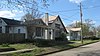
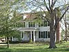
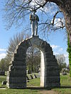
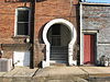
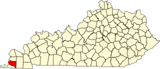
This is a list of the National Register of Historic Places listings in Calloway County, Kentucky. It is intended to be a complete list of the properties and districts on the National Register of Historic Places in Calloway County, Kentucky, United States. The locations of National Register properties and districts for which the latitude and longitude coordinates are included below, may be seen in a map.

National Register of Historic Places listings in Whitley County, Kentucky

This is a list of the National Register of Historic Places listings in Whitley County, Kentucky.

National Register of Historic Places listings in Powell County, Kentucky

This is a list of the National Register of Historic Places listings in Powell County, Kentucky.

National Register of Historic Places listings in Mercer County, Kentucky

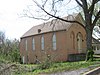
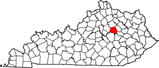
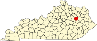
This is a list of the National Register of Historic Places listings in Mercer County, Kentucky.

National Register of Historic Places listings in Nelson County, Kentucky

This is a list of the National Register of Historic Places listings in Nelson County, Kentucky.

National Register of Historic Places listings in Ohio County, Kentucky

This is a list of the National Register of Historic Places listings in Ohio County, Kentucky.

National Register of Historic Places listings in Logan County, Kentucky

This is a list of the National Register of Historic Places listings in Logan County, Kentucky.

National Register of Historic Places listings in McLean County, Kentucky

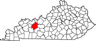
This is a list of the National Register of Historic Places listings in McLean County, Kentucky.

National Register of Historic Places listings in Bullitt County, Kentucky

This is a list of the National Register of Historic Places listings in Bullitt County, Kentucky.

National Register of Historic Places listings in Bath County, Kentucky

This is a list of the National Register of Historic Places listings in Bath County, Kentucky.

National Register of Historic Places listings in Bell County, Kentucky

This is a list of the National Register of Historic Places listings in Bell County, Kentucky.

National Register of Historic Places listings in Hickman County, Kentucky

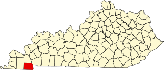
This is a list of the National Register of Historic Places listings in Hickman County, Kentucky.

National Register of Historic Places listings in Marshall County, Kentucky

This is a list of the National Register of Historic Places listings in Marshall County, Kentucky.

National Register of Historic Places listings in Menifee County, Kentucky

This is a list of the National Register of Historic Places listings in Menifee County, Kentucky.

National Register of Historic Places listings in New Madrid County, Missouri

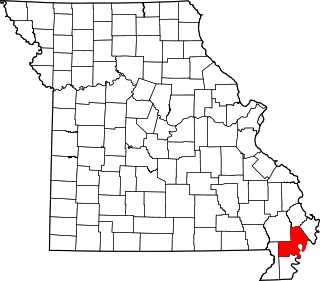
This is a list of the National Register of Historic Places listings in New Madrid County, Missouri.

References

  1. The latitude and longitude information provided in this table was derived originally from the National Register Information System, which has been found to be fairly accurate for about 99% of listings. Some locations in this table may have been corrected to current GPS standards.
  2. National Park Service, United States Department of the Interior, "National Register of Historic Places: Weekly List Actions", retrieved March 4, 2022.
  3. 1 2 Numbers represent an alphabetical ordering by significant words. Various colorings, defined here, differentiate National Historic Landmarks and historic districts from other NRHP buildings, structures, sites or objects.
  4. The eight-digit number below each date is the number assigned to each location in the National Register Information System database, which can be viewed by clicking the number.
  5. 1 2 Funkhouser, W.D., and W.S. Webb. "Archaeological Survey of Kentucky". University of Kentucky Reports in Anthropology 7.5 (1950): 131.
  6. 1 2 Pollack, David, ed. The Archaeology of Kentucky: An Update. Frankfort: Kentucky Heritage Council, 2008, 35.
  7. McNutt, Charles H., ed. Prehistory of the Central Mississippi Valley . Tuscaloosa: U of Alabama P, 1996, 82.
  8. Wesler, Kit W. "Fifty Years of Western Kentucky Prehistoric Ceramics", Journal of Kentucky Archaeology 1.1 (2011): 42-54.
  9. Sussenbach, Tom, and R. Barry Lewis. Archaeological Investigations in Carlisle, Hickman, and Fulton Counties, Kentucky: Site Survey and Excavations. Western Kentucky Project Report #4. Champaign: U of Illinois Department of Anthropology, 1987, 80-81.
  10. Fulton Downtown Historic District NRHP nomination form