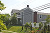
This is a list of the National Register of Historic Places listings in Woodford County, Kentucky.

This is a list of the National Register of Historic Places listings in Shelby County, Kentucky.

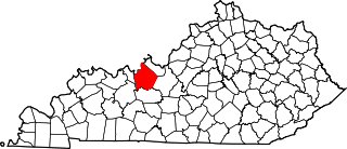
This is a list of the National Register of Historic Places listings in Franklin County, Kentucky.

This is a list of the National Register of Historic Places listings in Hardin County, Kentucky.

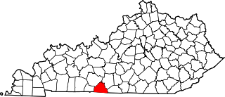
This is a list of the National Register of Historic Places listings in Boyle County, Kentucky.
This is a list of the National Register of Historic Places listings in Breckinridge County, Kentucky.
This is a list of the National Register of Historic Places listings in Allen County, Kentucky.

This is a list of the National Register of Historic Places listings in Pulaski County, Kentucky.

This is a list of the National Register of Historic Places listings in Madison County, Kentucky.

This is a list of the National Register of Historic Places listings in Mercer County, Kentucky.

This is a list of the National Register of Historic Places listings in Nelson County, Kentucky.

This is a list of the National Register of Historic Places listings in Floyd County, Kentucky.

This is a list of the National Register of Historic Places listings in Adair County, Kentucky.

This is a list of the National Register of Historic Places listings in Knox County, Kentucky.

This is a list of the National Register of Historic Places listings in Ballard County, Kentucky.

This is a list of the National Register of Historic Places listings in Clay County, Kentucky.

This is a list of the National Register of Historic Places listings in Elliott County, Kentucky.
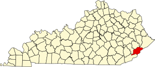
This is a list of the National Register of Historic Places listings in Letcher County, Kentucky.

This is a list of the National Register of Historic Places listings in Lyon County, Kentucky.

This is a list of the National Register of Historic Places listings in Wayne County, Kentucky.