National Register of Historic Places listings in Pulaski County, Kentucky

Last updated

Location of Pulaski County in Kentucky Map of Kentucky highlighting Pulaski County.svg
Location of Pulaski County in Kentucky

This is a list of the National Register of Historic Places listings in Pulaski County, Kentucky.

Contents

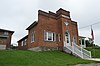
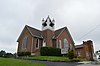
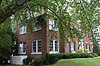
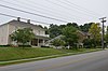
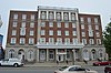
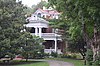
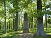
This is intended to be a complete list of the properties and districts on the National Register of Historic Places in Pulaski County, Kentucky, United States. The locations of National Register properties and districts for which the latitude and longitude coordinates are included below, may be seen in a map. [1]

There are 40 properties and districts listed on the National Register in the county, 1 of which is a National Historic Landmark. Another property was once listed but has been removed.


    This National Park Service list is complete through NPS recent listings posted November 17, 2023. [2]

Map all coordinates using: OpenStreetMap

Current listings

[3] Name on the RegisterImageDate listed [4] Location City or townDescription
1 Battle of Dutton's Hill Monument
Battle of Dutton's Hill Monument Dutton's Hill Cemetery 2.jpg
Battle of Dutton's Hill Monument
July 17, 1997
(#97000670)
Old Crab Orchard Rd., 1 mile north of the junction of Kentucky Routes 39 and 80
37°07′03″N84°36′14″W / 37.1175°N 84.603889°W / 37.1175; -84.603889 (Battle of Dutton's Hill Monument)
Somerset
2 Battle of Mill Springs Historic Areas
Battle of Mill Springs Historic Areas Cumberland River at Mill Springs.jpg
Battle of Mill Springs Historic Areas
February 18, 1993
(#93000001)
Three discontiguous areas: one south of Nancy, one in Mill Springs, and one to the north across the Cumberland River
37°00′19″N84°45′28″W / 37.005278°N 84.757778°W / 37.005278; -84.757778 (Battle of Mill Springs Historic Areas)
Nancy
3 Beatty-Newell House
Beatty-Newell House Beatty-Newell House.jpg
Beatty-Newell House
August 16, 1985
(#85001834)
Off Kentucky Route 90
36°59′09″N84°37′04″W / 36.985833°N 84.617778°W / 36.985833; -84.617778 (Beatty-Newell House)
Bronston
4 Boland House
Boland House Boland House in Burnside.jpg
Boland House
August 14, 1984
(#84001939)
Lakeshore Dr.
36°59′24″N84°36′19″W / 36.990000°N 84.605278°W / 36.990000; -84.605278 (Boland House)
Burnside
5 Buck-Mercer House August 14, 1984
(#84001941)
Waynesburg Rd.
37°14′02″N84°35′04″W / 37.233889°N 84.584444°W / 37.233889; -84.584444 (Buck-Mercer House)
Somerset
6 Burnside Historic District August 14, 1984
(#84001944)
Lakeshore Dr. and French Ave.
36°59′12″N84°36′11″W / 36.986667°N 84.603056°W / 36.986667; -84.603056 (Burnside Historic District)
Burnside
7 Burnside Lodge
Burnside Lodge Burnside Masonic Lodge.jpg
Burnside Lodge
August 14, 1984
(#84001946)
Off U.S. Route 27
36°59′13″N84°36′03″W / 36.986944°N 84.600833°W / 36.986944; -84.600833 (Burnside Lodge)
Burnside A Masonic lodge building
8 Burnside Methodist Church
Burnside Methodist Church Burnside United Methodist Church.jpg
Burnside Methodist Church
August 16, 1985
(#85001836)
Off U.S. Route 27
36°59′13″N84°36′03″W / 36.986806°N 84.600972°W / 36.986806; -84.600972 (Burnside Methodist Church)
Burnside
9 Confederate Mass Grave Monument in Nancy
Confederate Mass Grave Monument in Nancy Confederate Mass Grave Monument in Somerset 2.jpg
Confederate Mass Grave Monument in Nancy
July 17, 1997
(#97000671)
Zollicoffer Park Cemetery, 0.3 miles south of the junction of Kentucky Routes 235 and 761
37°03′20″N84°44′22″W / 37.055556°N 84.739444°W / 37.055556; -84.739444 (Confederate Mass Grave Monument in Nancy)
Nancy
10 Crawford House August 14, 1984
(#84001952)
121 Maple St.
37°05′40″N84°36′15″W / 37.094444°N 84.604167°W / 37.094444; -84.604167 (Crawford House)
Somerset Largest Victorian style house in the county, from c.1890; apparently moved or destroyed.
11 A. Jackson Crawford Building
A. Jackson Crawford Building A. Jackson Crawford Building.jpg
A. Jackson Crawford Building
August 18, 1980
(#80001665)
207 S. Main St.
37°05′25″N84°36′15″W / 37.090278°N 84.604167°W / 37.090278; -84.604167 (A. Jackson Crawford Building)
Somerset
12 Dabney Post Office August 14, 1984
(#84001954)
Kentucky Route 39
37°10′57″N84°33′00″W / 37.1825°N 84.55°W / 37.1825; -84.55 (Dabney Post Office)
Dabney
13 Evans House August 16, 1985
(#85001837)
Kentucky Route 461
37°12′10″N84°27′40″W / 37.202778°N 84.461111°W / 37.202778; -84.461111 (Evans House)
Shopville
14 William Fox House
William Fox House William Fox House in Somerset.jpg
William Fox House
July 31, 1978
(#78001391)
206 W. Columbia St.
37°05′34″N84°36′26″W / 37.092778°N 84.607361°W / 37.092778; -84.607361 (William Fox House)
Somerset
15 Gover-Hardin House
Gover-Hardin House Gover-Hardin House.jpg
Gover-Hardin House
July 11, 2007
(#07000674)
307 W. Mt. Vernon St.
37°05′29″N84°36′28″W / 37.091389°N 84.607778°W / 37.091389; -84.607778 (Gover-Hardin House)
Somerset
16 Harvey's Hill Historic District
Harvey's Hill Historic District Harvey's Hill in Somerset.jpg
Harvey's Hill Historic District
August 14, 1984
(#84001958)
401-527 N. Main St., and 402-526 N. Main St.
37°05′49″N84°36′24″W / 37.096944°N 84.606667°W / 37.096944; -84.606667 (Harvey's Hill Historic District)
Somerset
17 Hotel Beecher
Hotel Beecher Hotel Beecher.jpg
Hotel Beecher
August 14, 1984
(#84001960)
203 S. Main St.
37°05′26″N84°36′16″W / 37.090556°N 84.604444°W / 37.090556; -84.604444 (Hotel Beecher)
Somerset
18 James-Hansford House August 16, 1985
(#85001838)
On Kentucky Route 80
37°09′29″N84°28′40″W / 37.158056°N 84.477778°W / 37.158056; -84.477778 (James-Hansford House)
Shopville
19 James-Owens House August 16, 1985
(#85001839)
Off Kentucky Route 80
37°09′05″N84°28′45″W / 37.151389°N 84.479167°W / 37.151389; -84.479167 (James-Owens House)
Shopville
20 Mill Springs National Cemetery
Mill Springs National Cemetery Mill Springs National Cemetery Bivouac.JPG
Mill Springs National Cemetery
May 29, 1998
(#98000592)
9044 W. Kentucky Route 80
37°04′06″N84°44′14″W / 37.068333°N 84.737222°W / 37.068333; -84.737222 (Mill Springs National Cemetery)
Nancy
21 Morrow House
Morrow House Morrow House in Somerset.jpg
Morrow House
August 14, 1984
(#84001962)
208 E. Oak St.
37°05′45″N84°36′13″W / 37.095944°N 84.603611°W / 37.095944; -84.603611 (Morrow House)
Somerset
22 North Main Street Historic District
North Main Street Historic District Main at Columbia in Somerset.jpg
North Main Street Historic District
August 14, 1984
(#84001964)
N. Main and Columbia Sts.
37°05′26″N84°36′16″W / 37.090556°N 84.604444°W / 37.090556; -84.604444 (North Main Street Historic District)
Somerset
23 Parker House
Parker House Parker House in Somerset.jpg
Parker House
August 14, 1984
(#84001970)
206 N. Vine St.
37°05′35″N84°36′24″W / 37.093194°N 84.606667°W / 37.093194; -84.606667 (Parker House)
Somerset
24 Payne House August 16, 1985
(#85001840)
Off Kentucky Route 1247
37°16′51″N84°39′35″W / 37.280833°N 84.659722°W / 37.280833; -84.659722 (Payne House)
Eubank
25 Payne Mill August 14, 1984
(#84001968)
Off Kentucky Route 1247
37°16′51″N84°39′35″W / 37.280833°N 84.659722°W / 37.280833; -84.659722 (Payne Mill)
Eubank
26 Dr. John Milton Perkins House
Dr. John Milton Perkins House Dr. John Milton Perkins House.jpg
Dr. John Milton Perkins House
August 10, 1978
(#78001392)
109 N. Main St.
37°05′36″N84°36′18″W / 37.093333°N 84.605000°W / 37.093333; -84.605000 (Dr. John Milton Perkins House)
Somerset
27 Pin Oak Site November 13, 2023
(#100009538)
Address Restricted
Somerset vicinity
28 Robinson Mill August 14, 1984
(#84001971)
S. Main St.
37°04′55″N84°36′41″W / 37.081944°N 84.611389°W / 37.081944; -84.611389 (Robinson Mill)
Somerset
29 Dill Scott House
Dill Scott House Dill Scott House site.jpg
Dill Scott House
August 14, 1984
(#84001972)
200 N. Main St.
37°05′40″N84°36′21″W / 37.094444°N 84.605833°W / 37.094444; -84.605833 (Dill Scott House)
Somerset
30 Smith House
Smith House Smith House by Somerset schools.jpg
Smith House
August 14, 1984
(#84001974)
200 N. College St.
37°05′41″N84°36′08″W / 37.094722°N 84.602222°W / 37.094722; -84.602222 (Smith House)
Somerset
31 Beecher Smith House
Beecher Smith House Beecher Smith House.jpg
Beecher Smith House
August 14, 1984
(#84001973)
405 College St.
37°05′53″N84°36′10″W / 37.098056°N 84.602778°W / 37.098056; -84.602778 (Beecher Smith House)
Somerset
32 Somerset Armory
Somerset Armory Somerset Armory.jpg
Somerset Armory
September 6, 2002
(#02000926)
109 Grand Ave.
37°05′37″N84°35′49″W / 37.093611°N 84.596944°W / 37.093611; -84.596944 (Somerset Armory)
Somerset
33 Somerset City School and Carnegie Library
Somerset City School and Carnegie Library Somerset school, Carnegie library section.jpg
Somerset City School and Carnegie Library
July 7, 1978
(#78001393)
300 College St.
37°05′45″N84°36′06″W / 37.095833°N 84.601667°W / 37.095833; -84.601667 (Somerset City School and Carnegie Library)
Somerset
34 Somerset Downtown Commercial District
Somerset Downtown Commercial District East on Mount Vernon from Somerset square.jpg
Somerset Downtown Commercial District
August 27, 1982
(#82002742)
108-236 and 201-223 E. Mt. Vernon St.
37°05′32″N84°36′15″W / 37.092222°N 84.604167°W / 37.092222; -84.604167 (Somerset Downtown Commercial District)
Somerset
35 South Courthouse Square Historic District
South Courthouse Square Historic District South Courthouse Square in Somerset.jpg
South Courthouse Square Historic District
August 14, 1984
(#84001975)
Public Sq., Zachary Way, W. Mt. Vernon, S. Main, and S. Maple Sts.
37°05′31″N84°36′17″W / 37.091944°N 84.604722°W / 37.091944; -84.604722 (South Courthouse Square Historic District)
Somerset
36 US Post Office-Bronston
US Post Office-Bronston Bronston former post office.jpg
US Post Office-Bronston
August 16, 1985
(#85001835)
Kentucky Route 790
36°59′09″N84°37′09″W / 36.985833°N 84.619028°W / 36.985833; -84.619028 (US Post Office-Bronston)
Bronston
37 Waddle-Prather House
Waddle-Prather House Waddle-Prather House.jpg
Waddle-Prather House
August 14, 1984
(#84001976)
311 N. College St.
37°05′50″N84°36′09″W / 37.097361°N 84.602500°W / 37.097361; -84.602500 (Waddle-Prather House)
Somerset
38 West Columbia Street District
West Columbia Street District West Columbia Street Historic District.jpg
West Columbia Street District
August 14, 1984
(#84001977)
201-303 W. Columbia St.
37°05′32″N84°36′24″W / 37.092222°N 84.606667°W / 37.092222; -84.606667 (West Columbia Street District)
Somerset
39 Withers House August 14, 1984
(#84001978)
116 Maple St.
37°05′37″N84°36′15″W / 37.093611°N 84.604167°W / 37.093611; -84.604167 (Withers House)
Somerset
40 Gen. Felix K. Zollicoffer Monument
Gen. Felix K. Zollicoffer Monument General Felix K. Zollicoffer Monument.jpg
Gen. Felix K. Zollicoffer Monument
July 17, 1997
(#97000672)
Zollicoffer Park Cemetery, 0.3 miles south of the junction of Kentucky Routes 235 and 761
37°03′20″N84°44′22″W / 37.055556°N 84.739444°W / 37.055556; -84.739444 (Gen. Felix K. Zollicoffer Monument)
Nancy

Former listing

[3] Name on the RegisterImageDate listedDate removedLocationCity or townDescription
1 City Hall August 14, 1984
(#84001949)
July 25, 2012400 E. Mt. Vernon St.
37°05′36″N84°35′40″W / 37.093333°N 84.594444°W / 37.093333; -84.594444 (City Hall)
Somerset Delisted due to extensive renovations.

See also

Related Research Articles

<span class="mw-page-title-main">National Register of Historic Places listings in Woodford County, Kentucky</span>

This is a list of the National Register of Historic Places listings in Woodford County, Kentucky.

<span class="mw-page-title-main">National Register of Historic Places listings in Washington County, Kentucky</span>

This is a list of the National Register of Historic Places listings in Washington County, Kentucky.

<span class="mw-page-title-main">National Register of Historic Places listings in Franklin County, Kentucky</span>

This is a list of the National Register of Historic Places listings in Franklin County, Kentucky.

<span class="mw-page-title-main">National Register of Historic Places listings in Hopkins County, Kentucky</span>

This is a list of the National Register of Historic Places listings in Hopkins County, Kentucky.

<span class="mw-page-title-main">National Register of Historic Places listings in Green County, Kentucky</span>

This is a list of the National Register of Historic Places listings in Green County, Kentucky.

<span class="mw-page-title-main">National Register of Historic Places listings in Grayson County, Kentucky</span>

This is a list of the National Register of Historic Places listings in Grayson County, Kentucky.

<span class="mw-page-title-main">National Register of Historic Places listings in Barren County, Kentucky</span>

This is a list of the National Register of Historic Places listings in Barren County, Kentucky.

<span class="mw-page-title-main">National Register of Historic Places listings in Boone County, Kentucky</span>

This is a list of the National Register of Historic Places listings in Boone County, Kentucky.

<span class="mw-page-title-main">National Register of Historic Places listings in Clark County, Kentucky</span>

This is a list of the National Register of Historic Places listings in Clark County, Kentucky.

<span class="mw-page-title-main">National Register of Historic Places listings in Todd County, Kentucky</span>

This is a list of the National Register of Historic Places listings in Todd County, Kentucky.

<span class="mw-page-title-main">National Register of Historic Places listings in Taylor County, Kentucky</span>

This is a list of the National Register of Historic Places listings in Taylor County, Kentucky.

<span class="mw-page-title-main">National Register of Historic Places listings in Rowan County, Kentucky</span>

This is a list of the National Register of Historic Places listings in Rowan County, Kentucky.

<span class="mw-page-title-main">National Register of Historic Places listings in Pike County, Kentucky</span>

This is a list of the National Register of Historic Places listings in Pike County, Kentucky.

<span class="mw-page-title-main">National Register of Historic Places listings in Pendleton County, Kentucky</span>

This is a list of the National Register of Historic Places listings in Pendleton County, Kentucky.

<span class="mw-page-title-main">National Register of Historic Places listings in Madison County, Kentucky</span>

This is a list of the National Register of Historic Places listings in Madison County, Kentucky.

<span class="mw-page-title-main">National Register of Historic Places listings in Mercer County, Kentucky</span>

This is a list of the National Register of Historic Places listings in Mercer County, Kentucky.

<span class="mw-page-title-main">National Register of Historic Places listings in Nicholas County, Kentucky</span>

This is a list of the National Register of Historic Places listings in Nicholas County, Kentucky.

<span class="mw-page-title-main">National Register of Historic Places listings in Lawrence County, Kentucky</span>

This is a list of the National Register of Historic Places listings in Lawrence County, Kentucky.

<span class="mw-page-title-main">National Register of Historic Places listings in Johnson County, Kentucky</span>

This is a list of the National Register of Historic Places listings in Johnson County, Kentucky.

<span class="mw-page-title-main">National Register of Historic Places listings in Caldwell County, Kentucky</span>

This is a list of the National Register of Historic Places listings in Caldwell County, Kentucky.

References

  1. The latitude and longitude information provided in this table was derived originally from the National Register Information System, which has been found to be fairly accurate for about 99% of listings. Some locations in this table may have been corrected to current GPS standards.
  2. National Park Service, United States Department of the Interior, "National Register of Historic Places: Weekly List Actions", retrieved November 17, 2023.
  3. 1 2 Numbers represent an alphabetical ordering by significant words. Various colorings, defined here, differentiate National Historic Landmarks and historic districts from other NRHP buildings, structures, sites or objects.
  4. The eight-digit number below each date is the number assigned to each location in the National Register Information System database, which can be viewed by clicking the number.