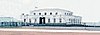
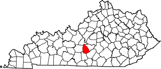
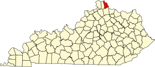
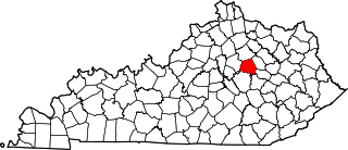
[3] Name on the Register Image Date listed [4] Location City or town Description 1 Dr. Abel House Upload image October 4, 1988 (# 88001768 Kentucky Route 1904 1 mile west of Kentucky Route 222 37°36′38″N 85°57′42″W / 37.610556°N 85.961667°W / 37.610556; -85.961667 (Dr. Abel House ) Glendale 2 Applegate-Fisher House Upload image October 4, 1988 (# 88001787 404 Elm St. 37°59′58″N 85°56′50″W / 37.999444°N 85.947222°W / 37.999444; -85.947222 (Applegate-Fisher House ) West Point 3 Philip Arnold House Upload image October 4, 1988 (# 88001798 422 E. Poplar St. 37°41′31″N 85°50′51″W / 37.691944°N 85.8475°W / 37.691944; -85.8475 (Philip Arnold House ) Elizabethtown 4 Ashe House Upload image October 4, 1988 (# 88001755 Kentucky Route 1868 , 1 mile west of its junction with Kentucky Route 1136 37°36′05″N 85°54′20″W / 37.601389°N 85.905556°W / 37.601389; -85.905556 (Ashe House ) Glendale 5 Bethlehem Academy Historic District Upload image October 4, 1988 (# 88001813 Near the junction of Kentucky Routes 253 and 1357 37°42′03″N 85°59′46″W / 37.700833°N 85.996111°W / 37.700833; -85.996111 (Bethlehem Academy Historic District ) St. John 6 John D. Bland House Upload image October 4, 1988 (# 88001729 Kentucky Route 720 , 2 miles west of its junction with Kentucky Route 84 37°30′40″N 85°54′51″W / 37.511111°N 85.914167°W / 37.511111; -85.914167 (John D. Bland House ) Sonora 7 William Bland House Upload image October 4, 1988 (# 88001734 Kentucky Route 222 , 2.5 miles west of Glendale 37°36′50″N 85°58′15″W / 37.613889°N 85.970833°W / 37.613889; -85.970833 (William Bland House ) Glendale 8 Bland-Overall House Upload image October 4, 1988 (# 88001728 Kentucky Route 1868 , 0.8 miles west of its junction with Kentucky Route 1136 37°34′53″N 85°55′47″W / 37.581389°N 85.929722°W / 37.581389; -85.929722 (Bland-Overall House ) Sonora 9 Blue Ball Church Upload image October 4, 1988 (# 88001727 Blue Ball Church Rd., 0.6 miles south of its junction with Kentucky Routes 220 and 1375 37°43′32″N 86°02′14″W / 37.725556°N 86.037222°W / 37.725556; -86.037222 (Blue Ball Church ) Howe Valley 10 J. Roy Bond House J. Roy Bond House October 4, 1988 (# 88001811 317 College St. 37°41′36″N 85°52′00″W / 37.693333°N 85.866667°W / 37.693333; -85.866667 (J. Roy Bond House ) Elizabethtown 11 Daniel Brackett House Upload image October 4, 1988 (# 88001752 Kentucky Route 1931 , 0.5 miles south of Kentucky Route 224 37°26′53″N 85°57′31″W / 37.448056°N 85.958611°W / 37.448056; -85.958611 (Daniel Brackett House ) Upton 12 Brown Pusey House Community Center Brown Pusey House Community Center July 12, 1974 (# 74000878 128 N. Maine St. 37°41′39″N 85°51′26″W / 37.694167°N 85.857222°W / 37.694167; -85.857222 (Brown Pusey House Community Center ) Elizabethtown 13 William Bush House William Bush House October 4, 1988 (# 88001807 1927 Tunnel Hill Rd. 37°43′43″N 85°50′05″W / 37.728611°N 85.834722°W / 37.728611; -85.834722 (William Bush House ) Elizabethtown 14 Dr. Clyde Carroll House Upload image October 4, 1988 (# 88001764 Dead Man's Cave Rd. 37°33′31″N 86°01′46″W / 37.558611°N 86.029444°W / 37.558611; -86.029444 (Dr. Clyde Carroll House ) White Mills 15 Chenault House Upload image October 4, 1988 (# 88001781 Kentucky Route 1375 , 1.5 miles north of Kentucky Route 84 37°34′26″N 85°58′21″W / 37.573889°N 85.9725°W / 37.573889; -85.9725 (Chenault House ) Star Mills 16 Chestnut Grove Upload image October 4, 1988 (# 88001731 Kentucky Route 222 , 1 mile west of Glendale 37°37′00″N 85°55′02″W / 37.616667°N 85.917222°W / 37.616667; -85.917222 (Chestnut Grove ) Glendale 17 Christ Episcopal Church Christ Episcopal Church October 4, 1988 (# 88001792 Poplar St. 37°41′42″N 85°51′32″W / 37.695°N 85.858889°W / 37.695; -85.858889 (Christ Episcopal Church ) Elizabethtown 18 Abraham Ditto House Upload image October 4, 1988 (# 88001789 204 Elm St. 37°59′59″N 85°56′44″W / 37.999722°N 85.945556°W / 37.999722; -85.945556 (Abraham Ditto House ) West Point 19 Ditto-Prewitt House Upload image October 4, 1988 (# 88001786 306 Elm St. 37°59′58″N 85°56′47″W / 37.999444°N 85.946389°W / 37.999444; -85.946389 (Ditto-Prewitt House ) West Point 20 Elizabethtown Armory Elizabethtown Armory September 6, 2002 (# 02000921 205 Warfield St. 37°41′57″N 85°51′22″W / 37.699167°N 85.856111°W / 37.699167; -85.856111 (Elizabethtown Armory ) Elizabethtown 21 Elizabethtown City Cemetery Elizabethtown City Cemetery August 18, 1997 (# 97000872 E. Dixie Ave., junction of E. Dixie Ave. and Crestwood St. 37°41′20″N 85°51′16″W / 37.688889°N 85.854444°W / 37.688889; -85.854444 (Elizabethtown City Cemetery ) Elizabethtown 22 Elizabethtown Courthouse Square and Commercial District Elizabethtown Courthouse Square and Commercial District March 19, 1980 (# 80001535 Kentucky Route 61 37°41′35″N 85°51′29″W / 37.693056°N 85.858056°W / 37.693056; -85.858056 (Elizabethtown Courthouse Square and Commercial District ) Elizabethtown 23 Embry Chapel Church Embry Chapel Church October 4, 1988 (# 88001803 117 Mulberry St. 37°41′40″N 85°51′38″W / 37.694444°N 85.860556°W / 37.694444; -85.860556 (Embry Chapel Church ) Elizabethtown 24 First Baptist Church First Baptist Church December 31, 1974 (# 74000879 112 W. Poplar St. 37°41′40″N 85°51′29″W / 37.694444°N 85.858139°W / 37.694444; -85.858139 (First Baptist Church ) Elizabethtown 25 First Presbyterian Church First Presbyterian Church October 4, 1988 (# 88001802 212 W. Dixie Ave. 37°41′39″N 85°51′38″W / 37.694028°N 85.860556°W / 37.694028; -85.860556 (First Presbyterian Church ) Elizabethtown 26 Fort Duffield Fort Duffield January 31, 1994 (# 93001584 East of U.S. Route 31W off West Point Marina Rd. 37°59′35″N 85°56′31″W / 37.993056°N 85.941944°W / 37.993056; -85.941944 (Fort Duffield ) West Point 27 Fort Sands Upload image November 25, 1994 (# 94001379 Off Interstate 65 southwest of Lebanon Junction, above the CSX railroad trestle over Sulfur Fork 37°45′28″N 85°48′28″W / 37.757778°N 85.807778°W / 37.757778; -85.807778 (Fort Sands ) Lebanon Junction 28 Glendale Historic District Upload image October 4, 1988 (# 88001816 Main St. between County Highway 1136 and Railroad Ave. 37°36′08″N 85°54′25″W / 37.602222°N 85.906944°W / 37.602222; -85.906944 (Glendale Historic District ) Glendale 29 Hagan House Upload image October 4, 1988 (# 88001760 Kentucky Route 1136 2.5 miles west of its junction with U.S. Route 31W 37°38′51″N 85°52′43″W / 37.6475°N 85.878611°W / 37.6475; -85.878611 (Hagan House ) Elizabethtown 30 Hance Hamilton House Upload image October 4, 1988 (# 88001741 Porter Rd., 1 mile east of its junction with U.S. Route 62 37°45′15″N 85°42′22″W / 37.754167°N 85.706111°W / 37.754167; -85.706111 (Hance Hamilton House ) Boston 31 Hardin Springs School Upload image October 4, 1988 (# 88001783 Kentucky Route 84 , 0.4 miles east of Hardin Springs Bridge 37°36′27″N 86°15′04″W / 37.6075°N 86.251111°W / 37.6075; -86.251111 (Hardin Springs School ) Hardin Springs 32 Fannie Harrison Farm Upload image February 7, 2008 (# 08000005 132 Arnold Ln. [5] 37°39′37″N 85°53′34″W / 37.660278°N 85.892778°W / 37.660278; -85.892778 (Fannie Harrison Farm ) Elizabethtown 33 Hatfield Hotel Upload image October 4, 1988 (# 88001763 Dead Man's Cave Rd. 37°33′18″N 86°01′50″W / 37.555°N 86.030556°W / 37.555; -86.030556 (Hatfield Hotel ) White Mills 34 Haycraft Inn Upload image October 4, 1988 (# 88001742 2315 S. Wilson Rd. 37°48′36″N 85°55′28″W / 37.81°N 85.924444°W / 37.81; -85.924444 (Haycraft Inn ) Radcliffe 35 Hazel Hill Upload image October 5, 1988 (# 88001744 Gaither's Station Rd., 2 miles south of U.S. Route 62 37°39′28″N 85°54′40″W / 37.657778°N 85.911111°W / 37.657778; -85.911111 (Hazel Hill ) Elizabethtown 36 Heller Hotel Upload image October 4, 1988 (# 88001756 Robinson St. 37°39′55″N 85°56′01″W / 37.665278°N 85.933611°W / 37.665278; -85.933611 (Heller Hotel ) Cecilia 37 Helm Place Helm Place November 9, 1976 (# 76000895 1.5 miles north of Elizabethtown on U.S. Route 31W 37°42′38″N 85°52′25″W / 37.710556°N 85.873611°W / 37.710556; -85.873611 (Helm Place ) Elizabethtown 38 Benjamin Helm House Benjamin Helm House October 4, 1988 (# 88001801 238 Helm Ave. 37°41′38″N 85°51′48″W / 37.693889°N 85.863333°W / 37.693889; -85.863333 (Benjamin Helm House ) Elizabethtown 39 John B. Helm House John B. Helm House October 4, 1988 (# 88001800 210 Helm Ave. 37°41′35″N 85°51′41″W / 37.693194°N 85.861389°W / 37.693194; -85.861389 (John B. Helm House ) Elizabethtown 40 Jonathan Hills House Jonathan Hills House December 23, 2009 (# 09001139 202 N. Main St. 37°41′40″N 85°51′26″W / 37.694444°N 85.857222°W / 37.694444; -85.857222 (Jonathan Hills House ) Elizabethtown 41 Kentucky and Indiana Bank Upload image October 4, 1988 (# 88001788 309 Elm St. 37°59′56″N 85°56′47″W / 37.998889°N 85.946389°W / 37.998889; -85.946389 (Kentucky and Indiana Bank ) West Point 42 W.T. Kerrick House W.T. Kerrick House October 4, 1988 (# 88001808 604 N. Main St. 37°41′57″N 85°51′05″W / 37.699028°N 85.851389°W / 37.699028; -85.851389 (W.T. Kerrick House ) Elizabethtown 43 Larue-Layman House Larue-Layman House October 4, 1988 (# 88001794 115 W. Poplar St. 37°41′43″N 85°51′29″W / 37.695278°N 85.858056°W / 37.695278; -85.858056 (Larue-Layman House ) Elizabethtown 44 Lincoln Heritage House Lincoln Heritage House March 26, 1973 (# 73000805 North of Elizabethtown on Freeman Lake 37°43′08″N 85°52′22″W / 37.718889°N 85.872778°W / 37.718889; -85.872778 (Lincoln Heritage House ) Elizabethtown 45 Louisville-Nashville Turnpike Segment Upload image July 31, 1996 (# 96000790 Northern boundary of Fort Knox at the foot of Muldraugh Hill and continuing south for 3 miles 37°57′22″N 85°57′23″W / 37.956111°N 85.956389°W / 37.956111; -85.956389 (Louisville-Nashville Turnpike Segment ) Fort Knox 46 Maple Hill Upload image October 4, 1988 (# 88001735 Maple St. 37°36′48″N 85°54′31″W / 37.613333°N 85.908611°W / 37.613333; -85.908611 (Maple Hill ) Glendale 47 Maplehurst Upload image October 4, 1988 (# 88001732 Kentucky Route 222 , 1 mile northeast of Glendale 37°37′21″N 85°54′35″W / 37.6225°N 85.909722°W / 37.6225; -85.909722 (Maplehurst ) Glendale 48 Haynes Mason House Upload image October 4, 1988 (# 88001782 Haynes Mason Rd., 0.3 miles south of Kentucky Route 720 37°29′43″N 85°55′49″W / 37.495278°N 85.930278°W / 37.495278; -85.930278 (Haynes Mason House ) Upton 49 David L. May House David L. May House October 5, 1988 (# 88001805 201 N. Main St. 37°41′39″N 85°51′24″W / 37.694167°N 85.856667°W / 37.694167; -85.856667 (David L. May House ) Elizabethtown 50 Stiles McDougal House Upload image October 4, 1988 (# 88001740 0.3 miles south of the junction of U.S. Route 62 and Kentucky Route 1375 37°37′23″N 85°58′43″W / 37.623056°N 85.978611°W / 37.623056; -85.978611 (Stiles McDougal House ) Glendale 51 McKinney-Helm House McKinney-Helm House October 5, 1988 (# 88001795 218 W. Poplar St. 37°41′44″N 85°51′36″W / 37.695556°N 85.86°W / 37.695556; -85.86 (McKinney-Helm House ) Elizabethtown 52 Melton House Upload image October 5, 1988 (# 88001769 Kentucky Route 1904 2 miles east of Kentucky Route 1375 37°35′58″N 85°57′11″W / 37.599444°N 85.953056°W / 37.599444; -85.953056 (Melton House ) Glendale 53 Adam Monin House Upload image October 5, 1988 (# 88001745 Monin Rd., off Route 1 37°41′43″N 85°51′33″W / 37.695167°N 85.859111°W / 37.695167; -85.859111 (Adam Monin House ) Glendale 54 Montgomery Avenue Historic District Montgomery Avenue Historic District October 5, 1988 (# 88001814 602, 606, 608, 610, 614, 616, and 624 Montgomery Ave. 37°41′55″N 85°50′56″W / 37.698611°N 85.848889°W / 37.698611; -85.848889 (Montgomery Avenue Historic District ) Elizabethtown 55 William Montgomery House William Montgomery House October 5, 1988 (# 88001806 414 Central Ave. 37°41′49″N 85°51′09″W / 37.696944°N 85.852631°W / 37.696944; -85.852631 (William Montgomery House ) Elizabethtown 56 Morrison Lodge Morrison Lodge October 5, 1988 (# 88001804 121 N. Mulberry St. 37°41′41″N 85°51′30″W / 37.694722°N 85.858333°W / 37.694722; -85.858333 (Morrison Lodge ) Elizabethtown 57 Nall House Upload image October 5, 1988 (# 88001784 Middle Creek Rd., 0.2 miles west of Locust Grove Rd. 37°39′59″N 85°47′24″W / 37.666389°N 85.79°W / 37.666389; -85.79 (Nall House ) Elizabethtown 58 Nolin Banking Company Upload image October 5, 1988 (# 88001749 Kentucky Route 1407 37°33′38″N 85°54′11″W / 37.560556°N 85.903056°W / 37.560556; -85.903056 (Nolin Banking Company ) Nolin 59 Penniston House Upload image October 5, 1988 (# 88001785 U.S. Route 62 , 0.4 miles east of Upper Colesburg Rd. 37°41′35″N 85°51′51″W / 37.693056°N 85.864167°W / 37.693056; -85.864167 (Penniston House ) Elizabethtown 60 Josiah Phillips House Upload image October 5, 1988 (# 88001747 Western Ave. 37°31′26″N 85°53′42″W / 37.523889°N 85.895°W / 37.523889; -85.895 (Josiah Phillips House ) Sonora 61 Dr. Robert B. Pusey House Dr. Robert B. Pusey House January 4, 1989 (# 88001793 204 N. Mulberry St. 37°41′44″N 85°51′30″W / 37.695556°N 85.858333°W / 37.695556; -85.858333 (Dr. Robert B. Pusey House ) Elizabethtown 62 John Raine House Upload image October 5, 1988 (# 88001748 Kentucky Route 84 37°31′27″N 85°53′24″W / 37.524167°N 85.89°W / 37.524167; -85.89 (John Raine House ) Sonora 63 Stephen Rawlings House Stephen Rawlings House October 5, 1988 (# 88001791 811 N. Main St. 37°42′07″N 85°50′45″W / 37.702083°N 85.845833°W / 37.702083; -85.845833 (Stephen Rawlings House ) Elizabethtown 64 Richards-Hamm House Upload image October 5, 1988 (# 88001766 Kentucky Route 1136 0.4 miles west of U.S. Route 31W 37°34′27″N 85°52′32″W / 37.574167°N 85.875556°W / 37.574167; -85.875556 (Richards-Hamm House ) Glendale 65 Richards-Murray House Upload image October 5, 1988 (# 88001767 Junction of U.S. Route 31W and Kentucky Route 1136 37°34′22″N 85°52′10″W / 37.572778°N 85.869444°W / 37.572778; -85.869444 (Richards-Murray House ) Glendale 66 Richardson Hotel Upload image October 5, 1988 (# 88001762 Dead Man's Cave Rd. 37°33′17″N 86°01′52″W / 37.554722°N 86.031111°W / 37.554722; -86.031111 (Richardson Hotel ) White Mills 67 Zachariah Riney House Upload image October 5, 1988 (# 88001758 Junction of Kentucky Routes 220 and 1600 37°44′58″N 85°58′10″W / 37.749444°N 85.969444°W / 37.749444; -85.969444 (Zachariah Riney House ) Rineyville 68 Samuel Robertson House Samuel Robertson House October 5, 1988 (# 88001812 214 W. Poplar St. 37°41′44″N 85°51′34″W / 37.695417°N 85.859583°W / 37.695417; -85.859583 (Samuel Robertson House ) Elizabethtown 69 Richard Skees House Upload image October 5, 1988 (# 88001780 Jerome Peerce Rd., off Kentucky Route 1823 37°34′27″N 85°58′57″W / 37.574167°N 85.9825°W / 37.574167; -85.9825 (Richard Skees House ) White Mills 70 William Skees House Upload image October 5, 1988 (# 88001757 Off Kentucky Route 1866 2 miles north of its junction with Kentucky Route 720 37°30′39″N 86°03′30″W / 37.510833°N 86.058333°W / 37.510833; -86.058333 (William Skees House ) White Mills 71 George W. Smith House Upload image October 5, 1988 (# 88001738 Kentucky Route 1904 , 3 miles south of its junction with U.S. Route 62 37°37′56″N 85°55′14″W / 37.632222°N 85.920556°W / 37.632222; -85.920556 (George W. Smith House ) Elizabethtown 72 William Sprigg House Upload image January 4, 1989 (# 88001736 Kentucky Route 1375 , 1 mile north of its junction with Kentucky Route 84 37°33′55″N 85°58′46″W / 37.565278°N 85.979444°W / 37.565278; -85.979444 (William Sprigg House ) Glendale 73 Stader Hotel Upload image October 5, 1988 (# 88001751 104 E. Main St. 37°48′34″N 85°58′57″W / 37.809444°N 85.9825°W / 37.809444; -85.9825 (Stader Hotel ) Vine Grove 74 Stark House Upload image October 5, 1988 (# 88001725 0.4 miles west of the junction of Kentucky Route 1868 and Gilead Church/Star Mills Rd. 37°38′51″N 85°52′43″W / 37.6475°N 85.878611°W / 37.6475; -85.878611 (Stark House ) Glendale 75 State Theatre State Theatre December 10, 1998 (# 98001492 205 W. Dixie Ave. 37°41′40″N 85°51′35″W / 37.694444°N 85.859722°W / 37.694444; -85.859722 (State Theatre ) Elizabethtown 76 John Stuart House Upload image October 5, 1988 (# 88001765 St. Anthony Church Rd., 0.5 miles east of U.S. Route 31W 37°34′36″N 85°51′05″W / 37.576667°N 85.851389°W / 37.576667; -85.851389 (John Stuart House ) Glendale 77 Samuel B. Thomas House Samuel B. Thomas House October 5, 1988 (# 88001797 337 W. Poplar St. 37°41′57″N 85°51′48″W / 37.699167°N 85.863333°W / 37.699167; -85.863333 (Samuel B. Thomas House ) Elizabethtown 78 William Tichenor House Upload image October 5, 1988 (# 88001753 Sonora-Upton Rd., 1 mile west of Upton 37°30′20″N 85°54′08″W / 37.505556°N 85.902222°W / 37.505556; -85.902222 (William Tichenor House ) Upton 79 US Bullion Depository, Fort Knox, Kentucky US Bullion Depository, Fort Knox, Kentucky February 18, 1988 (# 88000056 Gold Vault Rd. and Bullion Boulevard 37°53′00″N 85°57′55″W / 37.883333°N 85.965278°W / 37.883333; -85.965278 (US Bullion Depository, Fort Knox, Kentucky ) Fort Knox 80 US Post Office-Elizabethtown US Post Office-Elizabethtown October 5, 1988 (# 88001810 200 W. Dixie Ave. 37°41′39″N 85°51′34″W / 37.694028°N 85.859583°W / 37.694028; -85.859583 (US Post Office-Elizabethtown ) Elizabethtown 81 Jacob Van Meter House Upload image October 5, 1988 (# 88001746 Kentucky Route 222 , 0.6 miles west of Glendale 37°37′02″N 85°55′45″W / 37.617222°N 85.929167°W / 37.617222; -85.929167 (Jacob Van Meter House ) Glendale 82 Eliza Vertrees House Eliza Vertrees House October 5, 1988 (# 88001809 206 W. Poplar St. 37°41′42″N 85°51′30″W / 37.695°N 85.858333°W / 37.695; -85.858333 (Eliza Vertrees House ) Elizabethtown 83 Vine Grove Historic District Upload image October 5, 1988 (# 88001815 104-221 W. Main St. 37°48′36″N 85°59′01″W / 37.81°N 85.983611°W / 37.81; -85.983611 (Vine Grove Historic District ) Vine Grove 84 West Point Historic District Upload image November 15, 1996 (# 96001344 Roughly bounded by the Salt River, 2nd, South, 13th, Mulberry, and Elm Sts. 37°59′54″N 85°56′54″W / 37.998333°N 85.948333°W / 37.998333; -85.948333 (West Point Historic District ) West Point 85 West Point Hotel Upload image October 5, 1988 (# 88001790 401 South St. 37°59′51″N 85°56′47″W / 37.9975°N 85.946389°W / 37.9975; -85.946389 (West Point Hotel ) West Point 86 White Mill Upload image October 5, 1988 (# 88001761 Nolin River 37°33′19″N 86°01′52″W / 37.555278°N 86.031111°W / 37.555278; -86.031111 (White Mill ) White Mills 87 William Wilson House William Wilson House October 5, 1988 (# 88001799 200 Logan Ave. 37°42′02″N 85°50′43″W / 37.700556°N 85.845139°W / 37.700556; -85.845139 (William Wilson House ) Elizabethtown 88 Horatio Wintersmith House Horatio Wintersmith House October 5, 1988 (# 88001796 221 W. Poplar St. 37°41′45″N 85°51′35″W / 37.695972°N 85.859722°W / 37.695972; -85.859722 (Horatio Wintersmith House ) Elizabethtown 89 George Woodard House George Woodard House March 3, 2003 (# 02001467 232 W. Poplar St. 37°41′46″N 85°51′38″W / 37.696111°N 85.860556°W / 37.696111; -85.860556 (George Woodard House ) Elizabethtown 90 James Young House and Inn James Young House and Inn February 17, 1978 (# 78001336 109 Elm St. 38°00′02″N 85°56′40″W / 38.000556°N 85.944444°W / 38.000556; -85.944444 (James Young House and Inn ) West Point