National Register of Historic Places listings in Ohio County, Kentucky

Last updated

Location of Ohio County in Kentucky Map of Kentucky highlighting Ohio County.svg
Location of Ohio County in Kentucky

This is a list of the National Register of Historic Places listings in Ohio County, Kentucky.

Contents

This is intended to be a complete list of the properties and districts on the National Register of Historic Places in Ohio County, Kentucky, United States. The locations of National Register properties and districts for which the latitude and longitude coordinates are included below, may be seen in a map. [1]

There are 19 properties and districts listed on the National Register in the county, of which 1 is a National Historic Landmark and 6 are part of another National Historic Landmark spread across multiple counties.


    This National Park Service list is complete through NPS recent listings posted December 2, 2022. [2]

Map all coordinates using: OpenStreetMap  
Download coordinates as: KML

Current listings

[3] Name on the RegisterImageDate listed [4] Location City or townDescription
1 Archeological Site KHC-6 (15OH97) April 1, 1986
(#86000655)
Foot of Kirtley-River Rd. at the Green River above Livermore [5]
37°26′12″N87°06′08″W / 37.436667°N 87.102222°W / 37.436667; -87.102222 (Archeological Site KHC-6 (15OH97))
KirtleyPart of the Green River Shell Middens Archeological District National Historic Landmark [6] :30
2 J.T. Barnard Shell Midden (KHC-1) April 1, 1986
(#86000669)
Across the Green River from South Carrollton [5]
37°20′12″N87°07′48″W / 37.336667°N 87.130000°W / 37.336667; -87.130000 (J.T. Barnard Shell Midden (KHC-1))
Central City Part of the Green River Shell Middens Archeological District National Historic Landmark [6] :29
3 Bowles Site (15OH13) April 1, 1986
(#86000656)
Northern side of the Green River opposite Rochester [7]
37°12′51″N86°53′52″W / 37.214167°N 86.897778°W / 37.214167; -86.897778 (Bowles Site (15OH13))
Rochester Part of the Green River Shell Middens Archeological District National Historic Landmark [6] :27
4 Ceralvo Masonic Hall and School October 15, 2015
(#15000655)
942 Ceralvo Rd.
37°21′59″N87°01′52″W / 37.3663°N 87.031°W / 37.3663; -87.031 (Ceralvo Masonic Hall and School)
Centertown
5 Chiggerville Site (15OH1) April 1, 1986
(#86000665)
Right bank of the Green River, 3 miles (4.8 km) above the Paradise Fossil Plant [8]
37°14′25″N86°56′29″W / 37.240278°N 86.941389°W / 37.240278; -86.941389 (Chiggerville Site (15OH1))
Knightsburg Part of the Green River Shell Middens Archeological District National Historic Landmark [6] :25
6 Downtown Hartford Historic District
Downtown Hartford Historic District Ohio County Courthouse, Hartford.jpg
Downtown Hartford Historic District
December 12, 1988
(#88002760)
Roughly the 100 and 200 blocks of Main St. and Courthouse Sq.
37°27′04″N86°54′32″W / 37.451111°N 86.908889°W / 37.451111; -86.908889 (Downtown Hartford Historic District)
Hartford
7 Dundee Masonic Lodge No. 733
Dundee Masonic Lodge No. 733 OhioCountyKY-Dundee-Masonic-Lodge-735-front.JPG
Dundee Masonic Lodge No. 733
March 25, 2008
(#08000213)
11640 Kentucky Route 69 N.
37°33′25″N86°46′22″W / 37.556944°N 86.772778°W / 37.556944; -86.772778 (Dundee Masonic Lodge No. 733)
Dundee
8 Hartford Seminary
Hartford Seminary Hartford Seminary on Center Street.jpg
Hartford Seminary
June 19, 1973
(#73000826)
224 E. Center St.
37°27′07″N86°54′23″W / 37.451944°N 86.906389°W / 37.451944; -86.906389 (Hartford Seminary)
Hartford
9 Samuel E. Hill House
Samuel E. Hill House Samuel E. Hill House in Hartford.jpg
Samuel E. Hill House
May 27, 1980
(#80001663)
519 E. Union St.
37°27′28″N86°54′16″W / 37.457639°N 86.904444°W / 37.457639; -86.904444 (Samuel E. Hill House)
Hartford
10 Indian Knoll October 15, 1966
(#66000362)
Right bank of the Green River opposite the Paradise Fossil Plant at Paradise [9]
37°15′50″N86°58′24″W / 37.263889°N 86.973333°W / 37.263889; -86.973333 (Indian Knoll)
Paradise
11 Jackson Bluff Site (15OH12) April 1, 1986
(#86000666)
Address Restricted
Rockport
12 Jimtown Site (15OH19) April 1, 1986
(#86000667)
Jimtown Hill, 2 miles (3.2 km) above Livermore [5]
37°28′00″N87°06′32″W / 37.466667°N 87.108889°W / 37.466667; -87.108889 (Jimtown Site (15OH19))
KirtleyPart of the Green River Shell Middens Archeological District National Historic Landmark [6] :28
13 Louisville, Henderson, and St. Louis Railroad Depot
Louisville, Henderson, and St. Louis Railroad Depot OhioCountyKY-Fordsville-depot-obl.JPG
Louisville, Henderson, and St. Louis Railroad Depot
July 26, 1991
(#91000923)
Southeastern side of Walnut St., 200 feet north of its junction with Kentucky Route 54
37°38′11″N86°43′01″W / 37.636389°N 86.716944°W / 37.636389; -86.716944 (Louisville, Henderson, and St. Louis Railroad Depot)
Fordsville
14 Bill Monroe Farm
Bill Monroe Farm Bill Monroe Farm NRHP 03000648 Ohio County, KY.jpg
Bill Monroe Farm
July 18, 2003
(#03000648)
Approximately 2 miles west of the junction of U.S. Route 62 and Kentucky Route 1544
37°25′58″N86°45′53″W / 37.432778°N 86.764722°W / 37.432778; -86.764722 (Bill Monroe Farm)
Rosine
15 Old Town Historic District
Old Town Historic District Walker-Nall-Pirtle House.jpg
Old Town Historic District
November 15, 1988
(#88002535)
Roughly bounded by E. Union, Clay, E. Washington and Liberty Sts.
37°27′08″N86°54′24″W / 37.452222°N 86.906667°W / 37.452222; -86.906667 (Old Town Historic District)
Hartford
16 Pendleton House
Pendleton House John E. Pendleton House.jpg
Pendleton House
May 17, 1973
(#73000827)
403 E. Union St.
37°27′17″N86°54′21″W / 37.454722°N 86.905833°W / 37.454722; -86.905833 (Pendleton House)
Hartford
17 Rosine General Store and Barn
Rosine General Store and Barn Rosine General Store NRHP 03000708 Ohio County, KY.jpg
Rosine General Store and Barn
August 1, 2003
(#03000708)
8205 Blue Moon of Kentucky Highway/ U.S. Route 62
37°27′03″N86°44′28″W / 37.450834°N 86.741106°W / 37.450834; -86.741106 (Rosine General Store and Barn)
Rosine
18 Smallhous Shell Mound (15OH10) April 1, 1986
(#86000668)
Right bank of the Green River at Smallhous [10]
37°22′49″N87°05′33″W / 37.380278°N 87.092500°W / 37.380278; -87.092500 (Smallhous Shell Mound (15OH10))
Smallhous Part of the Green River Shell Middens Archeological District National Historic Landmark [6] :26
19 Charles Wallace House March 15, 1984
(#84001890)
Address Restricted
Hartford

See also

Related Research Articles

The Green River Shell Middens Archeological District is a historic district composed of archaeological sites in the U.S. state of Kentucky. All of the district's sites are shell middens along the banks of the Green River that date from the later portion of the Archaic period. Studies of this assemblage of sites were critical in the development of knowledge of the Archaic period in the eastern United States.

<span class="mw-page-title-main">National Register of Historic Places listings in Woodford County, Kentucky</span>

This is a list of the National Register of Historic Places listings in Woodford County, Kentucky.

<span class="mw-page-title-main">National Register of Historic Places listings in Warren County, Kentucky</span>

This is a list of the National Register of Historic Places listings in Warren County, Kentucky.

<span class="mw-page-title-main">National Register of Historic Places listings in Franklin County, Kentucky</span>

This is a list of the National Register of Historic Places listings in Franklin County, Kentucky.

<span class="mw-page-title-main">National Register of Historic Places listings in Henderson County, Kentucky</span>

This is a list of the National Register of Historic Places listings in Henderson County, Kentucky.

<span class="mw-page-title-main">National Register of Historic Places listings in Hopkins County, Kentucky</span>

This is a list of the National Register of Historic Places listings in Hopkins County, Kentucky.

<span class="mw-page-title-main">National Register of Historic Places listings in Green County, Kentucky</span>

This is a list of the National Register of Historic Places listings in Green County, Kentucky.

<span class="mw-page-title-main">National Register of Historic Places listings in Bracken County, Kentucky</span>

This is a list of the National Register of Historic Places listings in Bracken County, Kentucky.

<span class="mw-page-title-main">National Register of Historic Places listings in Campbell County, Kentucky</span>

This is a list of the National Register of Historic Places listings in Campbell County, Kentucky.

<span class="mw-page-title-main">National Register of Historic Places listings in Butler County, Kentucky</span>

This is a list of the National Register of Historic Places listings in Butler County, Kentucky.

<span class="mw-page-title-main">National Register of Historic Places listings in Powell County, Kentucky</span>

This is a list of the National Register of Historic Places listings in Powell County, Kentucky.

<span class="mw-page-title-main">National Register of Historic Places listings in Pulaski County, Kentucky</span>

This is a list of the National Register of Historic Places listings in Pulaski County, Kentucky.

<span class="mw-page-title-main">National Register of Historic Places listings in Mason County, Kentucky</span>

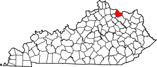
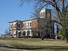
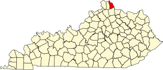
This is a list of the National Register of Historic Places listings in Mason County, Kentucky.

<span class="mw-page-title-main">National Register of Historic Places listings in Muhlenberg County, Kentucky</span>

This is a list of the National Register of Historic Places listings in Muhlenberg County, Kentucky.

<span class="mw-page-title-main">National Register of Historic Places listings in Mercer County, Kentucky</span>

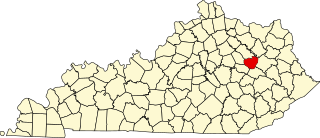
This is a list of the National Register of Historic Places listings in Mercer County, Kentucky.

<span class="mw-page-title-main">National Register of Historic Places listings in Floyd County, Kentucky</span>

This is a list of the National Register of Historic Places listings in Floyd County, Kentucky.

<span class="mw-page-title-main">National Register of Historic Places listings in McLean County, Kentucky</span>

This is a list of the National Register of Historic Places listings in McLean County, Kentucky.

<span class="mw-page-title-main">National Register of Historic Places listings in Ballard County, Kentucky</span>

This is a list of the National Register of Historic Places listings in Ballard County, Kentucky.

<span class="mw-page-title-main">National Register of Historic Places listings in Menifee County, Kentucky</span>

This is a list of the National Register of Historic Places listings in Menifee County, Kentucky.

<span class="mw-page-title-main">National Register of Historic Places listings in Wolfe County, Kentucky</span>

This is a list of the National Register of Historic Places listings in Wolfe County, Kentucky.

References

  1. The latitude and longitude information provided in this table was derived originally from the National Register Information System, which has been found to be fairly accurate for about 99% of listings. Some locations in this table may have been corrected to current GPS standards.
  2. National Park Service, United States Department of the Interior, "National Register of Historic Places: Weekly List Actions", retrieved December 2, 2022.
  3. Numbers represent an alphabetical ordering by significant words. Various colorings, defined here, differentiate National Historic Landmarks and historic districts from other NRHP buildings, structures, sites or objects.
  4. The eight-digit number below each date is the number assigned to each location in the National Register Information System database, which can be viewed by clicking the number.
  5. 1 2 3 Claassen, Cheryl. Feasting with Shellfish in the Southern Ohio Valley: Archaic Sacred Sites and Rituals. Knoxville: U of Tennessee P, 2010, 41.
  6. 1 2 3 4 5 6 National Historic Landmark Nomination: Green River Shell Middens. National Park Service: 1994-05-05.
  7. Emerson, Thomas E. Archaic Societies: Diversity and Complexity Across the Midcontinent. Albany: SUNY Press, 2009, 655.
  8. Moore, Christopher R. Production, Exchange, and Social Interaction in the Green River Region of Western Kentucky: A Multiscalar Approach to the Analysis of Two Shell Midden Sites. Diss. University of Kentucky, 2011, 163.
  9. Funkhouser, W.D., and W.S. Webb. "Archaeological Survey of Kentucky: Butler County". University of Kentucky Reports in Anthropology 7.5 (1950): 324.
  10. Moore, Clarence B. "Some Aboriginal Sites on Green River, Kentucky". Journal of the Philadelphia Academy of Natural Sciences 16 (1916): 431-487: 443.