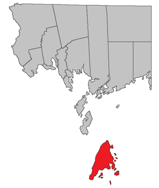
Pennfield | |
---|---|
Country | Canada |
Province | New Brunswick |
County | Charlotte County |
Erected | 1786 |
Area | |
• Land | 363.75 km2 (140.44 sq mi) |
Population (2021) [1] | |
• Total | 2,222 |
• Density | 6.1/km2 (16/sq mi) |
• Change 2016-2021 | 2.4% |
• Dwellings | 1,029 |
Time zone | UTC-4 (AST) |
• Summer (DST) | UTC-3 (ADT) |
Figures do not include portion within the village of Blacks Harbour |
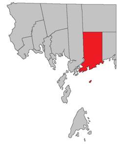
Pennfield is a geographic parish in Charlotte County, New Brunswick, Canada, [4] located west of Saint John located east of St. George and west of Saint John.
For governance purposes, Utopia and areas south of Route 780 are part of the incorporated rural community of Eastern Charlotte, [5] while the sparsely populated north and The Wolves islands in the Bay of Fundy are part of the Southwest rural district, [6] both of which are members of the Southwest New Brunswick Service Commission. [7]
Prior to the 2023 governance reform, it comprised one village of Blacks Harbour and two local service districts, all of which were members of the Southwest New Brunswick Service Commission (SNBSC). [8]
The Census subdivision of the same name includes all of the parish except the former village of Blacks Harbour. [1]
The parish was named by Quaker Loyalist settlers of the area for William Penn, early Quaker leader and founder of Pennsylvania. [9]
Pennfield was erected in 1786 as one of the county's original parishes; [10] it included Lepreau Parish, the southern part of Clarendon Parish, and a small piece of Saint George Parish.
Pennfield Parish is bounded: [2] [11] [12]
Pennfield's original northern boundary was a prolongation of the southern line of the Cape Association grant in Saint David Parish, [10] which runs south of Robinson Creek Road in Saint David Ridge. The prolongation passes near the northern end of Loon Lake in Clarendon Parish before striking the Queens County line. A small part of Saint George Parish near the head of the Letang River was also part of Pennfield; all islands in the river and Letang Harbour were part of Saint George.
In 1814 the parish was extended north [lower-alpha 1] to the county line, [13] adding the rest of Clarendon.
In 1850 the boundary with Saint George Parish near the head of the Letang River was changed to its modern line. [14]
In 1857 the eastern part of Pennfield was erected as LePreau Parish. [15]
In 1868 all of the parish north of the most southern point of Queens County was included in the Clarendon District, a polling district that also included the northern part of Lepreau Parish. [16]
In 1869 the northern part of Pennfield was included in the newly erected Clarendon Parish. [17]
In 1877 the boundary through the Letang River and Letang Harbour was changed, transferring some islands to Pennfield. [18]
The village of Blacks Harbour sat at the southwestern corner of the parish's mainland. [19]
Both LSDs assessed for the basic LSD services of fire protection, police services, land use planning, emergency measures, and dog control. [20]
The local service district of the parish of Pennfield originally included all of the parish outside Blacks Harbour.
The LSD was established in 1970 to assess for fire protection. [21] First aid and ambulance services were added in 1979. [22]
In 2022, the LSD additionally assessed for community & recreation services. [20] The taxing authority was 512.00 Pennfield.
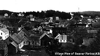
Beaver Harbour comprised an area on the western side of Beaver Harbour, including the eastern part of the old town plat and running north to the junction of Mountain Road and Waite's Lane. [23] The community of Beaver Harbour outgrew the boundaries of the LSD by 2013. [24]
The LSD was established in 1971 to add street lighting and community services. [25] First aid and ambulance services were added in 1979. [22]
Beaver Harbour additionally assessed street lighting and community & recreation services. [20] The taxing authority was 524.00 Beaver Harbour.
Beaver Harbour was the only LSD in Charlotte County with street lighting.
Communities at least partly within the parish. [11] [12] [26] bold indicates an incorporated municipality
Bodies of water [lower-alpha 2] at least partly within the parish. [11] [12] [26] italics indicate a name no longer in official use
Islands at least partly within the parish. [11] [12] [26] italics indicates a name no longer in official use
Parks, historic sites, and other noteworthy places at least partly within the parish. [11] [12] [26] [27] [28]
2021 | 2016 | 2011 | |
---|---|---|---|
Population | 2,222 (+2.4% from 2016) | 2,170 (-2.2% from 2011) | 2,218 (-4.5% from 2006) |
Land area | 363.75 km2 (140.44 sq mi) | 363.86 km2 (140.49 sq mi) | 363.88 km2 (140.49 sq mi) |
Population density | 6.1/km2 (16/sq mi) | 6.0/km2 (16/sq mi) | 6.1/km2 (16/sq mi) |
Median age | 48.8 (M: 48.8, F: 48.8) | 46.7 (M: 46.5, F: 47.0) | 44.3 (M: 44.1, F: 44.4) |
Private dwellings | 945 (total) | 996 (total) | 1,099 (total) |
Median household income | $60,992 | $58,972 |
|
|
| |||||||||||||||||||||||||||
[34] [35] [36] |
Canada Census Mother Tongue - Pennfield Parish, New Brunswick [34] | ||||||||||||||||||
---|---|---|---|---|---|---|---|---|---|---|---|---|---|---|---|---|---|---|
Census | Total | English | French | English & French | Other | |||||||||||||
Year | Responses | Count | Trend | Pop % | Count | Trend | Pop % | Count | Trend | Pop % | Count | Trend | Pop % | |||||
2011 | 2,195 | 2,045 | 7.3% | 93.17% | 90 | 38.9% | 4.10% | 5 | n/a% | 0.23% | 55 | 18.2% | 2.50% | |||||
2006 | 2,305 | 2,205 | 2.6% | 95.66% | 55 | 52.2% | 2.39% | 0 | 100.0% | 0.00% | 45 | 55.6% | 1.95% | |||||
2001 | 2,410 | 2,265 | 5.3% | 93.98% | 115 | 39.1% | 4.77% | 10 | n/a% | 0.42% | 20 | 20.0% | 0.83% | |||||
1996 | 2,240 | 2,145 | n/a | 95.76% | 70 | n/a | 3.12% | 0 | n/a | 0.00% | 25 | n/a | 1.12% |
Highways and numbered routes that run through the parish, including external routes that start or finish at the parish limits: [37]
Kingsclear is a geographic parish in York County, New Brunswick, Canada.
Dundas is a geographic parish in Kent County, New Brunswick, Canada.
Beaver Harbour is a community on the Fundy shore of New Brunswick, Canada.
Addington is a geographic parish in Restigouche County, New Brunswick, Canada.
Northampton is a geographic parish in Carleton County, New Brunswick, Canada, sitting across the Saint John River from Woodstock.
Bathurst is a geographic parish in Gloucester County, New Brunswick, Canada.
Shippegan is a geographic parish in Gloucester County, New Brunswick, Canada. Located in the northeastern corner of the province at the end of the Acadian Peninsula, the parish consists of the three main islands of Taylor, Lamèque, and Miscou, along with several smaller islands and tidal wetlands; Taylor Island is now joined to the mainland by an isthmus, which is crossed by a causeway.
Wakefield is a geographic parish in Carleton County, New Brunswick, Canada, located north on the west bank of the Saint John River north of Woodstock.
Brighton is a geographic parish in Carleton County, New Brunswick, Canada, northeast of Woodstock, extending from the eastern bank of the Saint John River to the York County line.
Woodstock is a geographic parish in Carleton County, New Brunswick, Canada, surrounding the town of the same name on its landward side.
Saint Andrews Parish is a geographic parish in Charlotte County, New Brunswick, Canada, located east of St. Stephen.
Lepreau is a geographic parish in Charlotte County, New Brunswick, Canada, west of Saint John.
Clarendon is a geographic parish in Charlotte County, New Brunswick, Canada, located in the interior to the north of Point Lepreau and southwest of CFB Gagetown.
West Isles is a geographic parish in Charlotte County, New Brunswick, Canada.
Saint George is a geographic parish in Charlotte County, New Brunswick, Canada, located between St. Stephen and Saint John.
Saint Patrick is a geographic parish in Charlotte County, New Brunswick, Canada, located west of St. George and Saint Andrews.
Saint Croix is a geographic parish in Charlotte County, New Brunswick, Canada, straddling Route 1 to the north of the original town of Saint Andrews.
Saint Stephen is a geographic parish in Charlotte County, New Brunswick, Canada, located in the southwestern corner of the province.
Saint David is a geographic parish in Charlotte County, New Brunswick, Canada, located northeast of St. Stephen and northwest of Saint Andrews.
Grand Manan is a geographic parish in Charlotte County, New Brunswick, Canada, comprising one village and part of a rural district; the rural district portion was formerly a local service district (LSD); both of which are members of the Southwest New Brunswick Service Commission (SNBSC). The parish includes Grand Manan Island and numerous lesser islands, only one of which has permanent year-round inhabitants.