Rockhampton is a city in the Rockhampton Region of Central Queensland, Australia. In the 2021 census, the population of Rockhampton was 79,293. A common nickname for Rockhampton is 'Rocky', and the demonym of Rockhampton is Rockhamptonite.

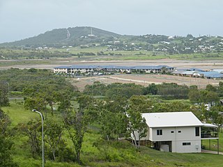
Yeppoon is a coastal town and locality in the Shire of Livingstone, Queensland, Australia. Yeppoon is renowned for its beaches, tropical climate, and the islands out on the bay. Located 41 kilometres (25 mi) from the city of Rockhampton, Yeppoon is the seat of the Shire of Livingstone and the principal town on the Capricorn Coast, a string of seaside communities stretching more than 150 kilometres (93 mi) from north to south. The beaches and shallow coves provide a destination both for tourists and retirees settling down in Central Queensland. Offshore, there are 27 islands including Great Keppel Island which is 20 kilometres (12 mi) from Yeppoon. In the 2021 census, the locality of Yeppoon had a population of 7,037 people; this does not include any neighbouring suburbs.

Mount Morgan is a rural town and locality in the Rockhampton Region, Queensland, Australia. The town was the administrative centre of the Mount Morgan Shire until March 2008, when it was amalgamated with neighbouring local government areas to form the Rockhampton Region.

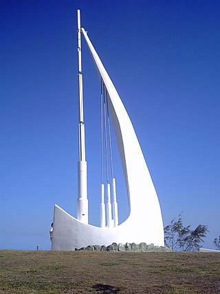
Emu Park is a coastal town and locality on the Capricorn Coast located 21 kilometres (13 mi) south of Yeppoon in Queensland, Australia. It is within the local government area of Shire of Livingstone. In the 2021 census, the locality of Emu Park had a population of 2,281 people.

Gracemere is a rural town and locality in the Rockhampton Region, Queensland, Australia. In the 2021 census, the locality of Gracemere had a population of 12,023 people.

Westwood is a town in the Rockhampton Region and a locality split between the Rockhampton Region and the Shire of Banana in Queensland, Australia. It was the first town that was gazetted by the Queensland Government. In the 2021 census, the locality of Westwood had a population of 199 people.

Rockhampton City is the central suburb of the city of Rockhampton in the Rockhampton Region, Queensland, Australia. It is informally known as Rockhampton central business district (CBD). In the 2021 census, Rockhampton City had a population of 2,059 people.

West Rockhampton is a suburb of Rockhampton in the Rockhampton Region, Queensland, Australia. In the 2021 census, West Rockhampton had a population of 1,848 people.

Depot Hill is a suburb of Rockhampton in the Rockhampton Region, Queensland, Australia. In the 2021 census, Depot Hill had a population of 995 people.

Kawana is a suburb of Rockhampton in the Rockhampton Region, Queensland, Australia. In the 2021 census, Kawana had a population of 4,434 people.

Zilzie is a coastal locality in the Livingstone Shire, Queensland, Australia. In the 2021 census, Zilzie had a population of 2,846 people.

Raglan is a rural town and locality in the Gladstone Region, Queensland, Australia. In the 2021 census, the locality of Raglan had a population of 143 people.

Koongal is a suburb of Rockhampton in the Rockhampton Region, Queensland, Australia. In the 2021 census, Koongal had a population of 4,252 people.
Kabra is a rural town and locality in the Rockhampton Region, Queensland, Australia. In the 2021 census, the locality of Kabra had a population of 430 people.

Bajool is a rural town and locality in the Rockhampton Region, Queensland, Australia. In the 2021 census, the locality of Bajool had a population of 447 people.

Nerimbera is a rural locality in the Livingstone Shire, Queensland, Australia. In the 2021 census, Nerimbera had a population of 285 people.

Norman Gardens is a suburb in the Rockhampton Region, Queensland, Australia. In the 2021 census, Norman Gardens had a population of 10,534 people.
Callaghan Park is a horse and greyhound racing venue in Rockhampton, Queensland, Australia. It is located in the suburb of The Common.

Curtis Island is an offshore locality in the Gladstone Region, Queensland, Australia. In the 2021 census, Curtis Island had a population of 36 people.

Thompson Point is a coastal locality in the Livingstone Shire, Queensland, Australia. It was the site of a short-lived town and port called Broadmount. In the 2021 census, Thompson Point had "no people or a very low population".


