
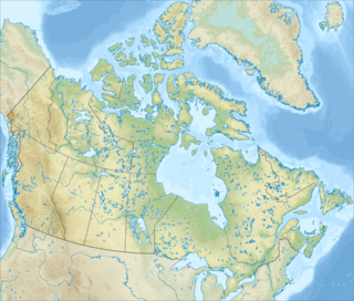
The geography of Canada describes the geographic features of Canada, the world's second largest country in total area.

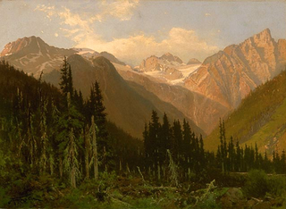
The Rocky Mountains, also known as the Rockies, are a major mountain range in western North America. The Rocky Mountains stretch more than 4,800 kilometers (3,000 mi) from the northernmost part of British Columbia, in western Canada, to New Mexico in the Southwestern United States. Located within the North American Cordillera, the Rockies are somewhat distinct from the Pacific Coast Ranges, Cascade Range, and the Sierra Nevada, which all lie farther to the west.
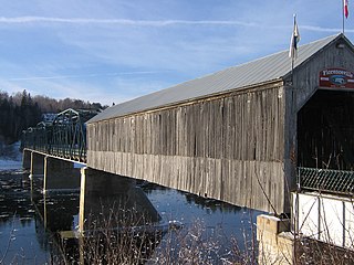
Florenceville-Bristol is a town in the northwest part of New Brunswick, Canada. The town is located on the banks of the Saint John River in Carleton County. As of 2016, the population was 1,604.
Waterton Lakes National Park is a national park located in the southwest corner of Alberta, Canada. It borders Glacier National Park in Montana, United States. Waterton was the fourth Canadian national park, formed in 1895 and named after Waterton Lake, in turn after the Victorian naturalist and conservationist Charles Waterton. Its range is between the Rocky Mountains and prairies. This park contains 505 km2 (195 sq mi) of rugged mountains and wilderness.
The Slate Range is a mountain range of the Canadian Rockies, located in Banff National Park, Canada. The range is named after slate, the primary composition of the mountains in the area.
The Selkirk Mountains are a mountain range spanning the northern portion of the Idaho Panhandle, eastern Washington, and southeastern British Columbia which are part of a larger grouping of mountains, the Columbia Mountains. They begin at Mica Peak near Spokane and extend approximately 320 km north from the border to Kinbasket Lake, at the now-inundated location of the onetime fur company post Boat Encampment. The range is bounded on its west, northeast and at its northern extremity by the Columbia River, or the reservoir lakes now filling most of that river's course. From the Columbia's confluence with the Beaver River, they are bounded on their east by the Purcell Trench, which contains the Beaver River, Duncan River, Duncan Lake, Kootenay Lake and the Kootenay River. The Selkirks are distinct from, and geologically older than, the Rocky Mountains. The neighboring Monashee and Purcell Mountains, and sometimes including the Cariboo Mountains to the northwest, are also part of the larger grouping of mountains known as the Columbia Mountains. A scenic highway loop, the International Selkirk Loop, encircles the southern portions of the mountain range.

The Queen Elizabeth Ranges is a group of mountain ranges in the Canadian Rockies on the southeastern side of Jasper National Park, Canada. The northern end of the ranges begins east of Medicine Lake and extends in a southeasterly direction past the southern shore of Maligne Lake. The group was named in 1953 to celebrate the coronation of Queen Elizabeth II as Canada's sovereign.

The Palliser Range is a mountain range of the Canadian Rockies that lies in the extreme southeast corner of Banff National Park.

Mount Abraham is the fifth tallest peak in the U.S. state of Vermont. The summit supports a small amount of alpine vegetation and offers a view of the Champlain Valley and Adirondack Mountains to the west. Mount Abraham is on the Long Trail, a 272-mile (438 km) hiking trail running the length of Vermont. The mountain summit can be reached from the south or from the north. There is no camping permitted at the summit, but Battell Shelter is located roughly one mile from the summit south on the Long Trail.

Pemberton is a village municipality north of Whistler in the Pemberton Valley of British Columbia in Canada, with a population of 2,574. Until the 1960s the village could be reached only by train, but that changed when Highway 99 was built through Whistler and Pemberton.

Northern Rocky Mountains Provincial Park is a provincial park in British Columbia, Canada. It is located in the north-eastern part of the province, 90 km south-west from Fort Nelson and it is bordered to the north by the Alaska Highway. Access is mostly done by boat, aircraft, on horseback or by hiking.

The Bow Range is a mountain range of the Canadian Rockies in Alberta and British Columbia, Canada. The range is named in associated with the Bow River and was officially adopted on March 31, 1917 by the Geographic Board of Canada.

The Tuya Range is a rmountain range in the Stikine Ranges of the Cassiar Mountains in the far north of the Canadian province of British Columbia, near its border with the Yukon Territory and to the southwest of Watson Lake, Yukon, which is the nearest major settlement.
The Northern Rocky Mountains, usually referred to as the Northern Rockies, are a subdivision of the Canadian Rockies comprising the northern half of the Canadian segment of the Rocky Mountains. While their northward limit is easily defined as the Liard River, which is the northward terminus of the whole Rockies, the southward limit is debatable, although the area of Mount Ovington and Monkman Pass is mentioned in some sources, as south from there are the Continental Ranges, which are the main spine of the Rockies forming the boundary between British Columbia and Alberta. Some use the term to mean only the area north of Lake Williston, and in reference to Northern Rocky Mountains Provincial Park, while others consider the term to extend all the way south, beyond the limit of the Hart Ranges at Mount Ovington, to McBride and Mount Robson.

The Gogebic Range is an elongated area of iron ore deposits located within a range of hills in northern Michigan and Wisconsin just south of Lake Superior. It extends from Lake Namakagon in Wisconsin eastward to Lake Gogebic in Michigan, or almost 80 miles. Though long, it is only about a half mile wide and forms a crescent concave to the southeast. The Gogebic Range includes the communities of Ironwood in Michigan, plus Mellen and Hurley in Wisconsin.

The Hogem Ranges are a group of mountain ranges in the northwest part of the Omineca Country of the North-Central Interior of British Columbia, Canada, located between Takla Lake (W) and the Omineca River (E) and from the Nation Lakes (SE) to the Sustut River (NW). The ranges have a collective area of 8868 km2 and is a subgrouping of the Omineca Mountains which in turn form part of the Interior Mountains.
The Tatlatui Range is a large and very alpine mountain range on the east flank of the upper Skeena River in northern British Columbia, Canada. It has an area of 2307 km2 and is a subrange of the Omineca Mountains which in turn form part of the Interior Mountains. The range features several lakes, the largest of which, Thutade Lake, is at the head of the Finlay River, and is considered the ultimate source of the Mackenzie River. Tatlatui Lake, the next largest lake in the range, to the northwest of Thutade Lake, is at the head of the Firesteel River, a tributary of the Finlay. Various summits of the range, which as described separates the Pacific and Arctic drainages, form part of the Continental Divide. Most of the range and its lakes are in Tatlatui Provincial Park.
The Bunster Range are a small mountain range in southwestern British Columbia, Canada, located west of Powell Lake. It has an area of 290 km2 and is a subrange of the Pacific Ranges which in turn form part of the Coast Mountains.
Muncho Pass, also known as Muncho Lake Pass, Drogheda Lake Pass, or Muncho-Toad Pass, is the northernmost mountain pass in the Rocky Mountains to be traversed by a public highway. Located in Muncho Lake Provincial Park, British Columbia, Canada, the pass links the Toad River and Trout River drainages. The Alaska Highway travels across the pass.
Potato Range may refer to:


