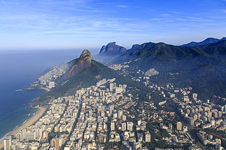
Leblon is a neighborhood of Rio de Janeiro, Brazil. It is also the name of the local beach. The neighborhood is located in the South Zone of the city, between Lagoa Rodrigo de Freitas, Morro Dois Irmãos and the Jardim de Alá channel, bordering the Gávea, Ipanema, Lagoa, and Vidigal neighborhoods. It is regarded as having the most expensive price per residential square meter in Latin America.
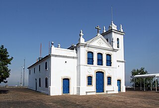
Jacarepaguá, with a land area of 29.27 square miles (75.8 km2), is a neighborhood situated in the West Zone of Rio de Janeiro, Brazil. In 2010, it had a population of 157,326. The name comes from the indigenous name of the location, "shallow pond of caymans", yakaré + upá (pond) + guá (shallow), by the time of the Portuguese invasion.

Maracanã is a middle-class neighborhood in the Northern Zone of Rio de Janeiro city. The Maracanã Stadium is located in this neighborhood, as well as the Ginásio do Maracanãzinho. Maracanã is bordered by these neighborhoods: Praça da Bandeira, Tijuca and Vila Isabel.

Centro ("Center") is a neighborhood in Zona Central of Rio de Janeiro, Brazil. It represents the financial heart of the city, and the crux of the Central Region.

Abolição (Abolition) is a middle-class neighborhood of the North Zone of the city of Rio de Janeiro, Brazil.

Catete is a neighborhood in South Zone of Rio de Janeiro, Brazil. It has strong commerce, with the majority of population being middle class.
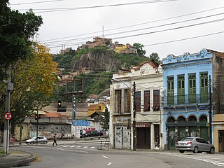
Santo Cristo is a neighborhood in Rio de Janeiro, Brazil. The neighbourhood is named after the Catholic church Santo Cristo dos Milagres situated in the port area.

Freguesia is a neighborhood in the North Zone of Rio de Janeiro, Brazil.

Galeão is a neighborhood in the North Zone of Rio de Janeiro, Brazil. It is located on Governador Island besides the Rio de Janeiro–Galeão International Airport.

Higienópolis is a neighborhood in the North Zone of Rio de Janeiro, Brazil.

Jardim Carioca is a neighborhood in the North Zone of Rio de Janeiro, Brazil.
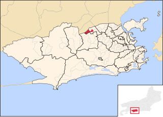
Parque Anchieta is a neighborhood in the North Zone of Rio de Janeiro, Brazil.

Tomás Coelho is a neighborhood in the North Zone of Rio de Janeiro, Brazil.

Jardim Sulacap is a neighborhood in the West Zone of Rio de Janeiro, Brazil.

The Praça XV de Novembro, is a public square in the Centro section of the city of Rio de Janeiro, Brazil.

Teleférico da Providência is a gondola lift service operating in the Central region of Rio de Janeiro, Brazil. The cable car runs between Central do Brasil and Gamboa, Rio de Janeiro, servicing the unofficial neighborhood of Providência.
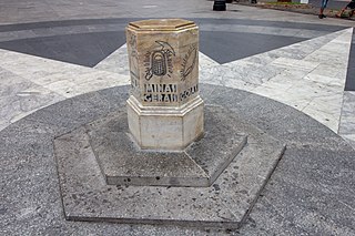
Marco Zero is a geographic monument in downtown São Paulo. In 1934, the marble milestone was installed in front of the São Paulo Cathedral on the Praça da Sé to symbolize the center of the city. The sculpture is a both a tourist attraction and a central point of reference for street numbers in the city. Marco Zero has been registered for historic preservation since 2007.

Monument to the Bandeiras is a large-scale granite sculpture by the Italian-Brazilian sculptor Victor Brecheret (1894-1955) at the entrance of Ibirapuera Park in São Paulo, Brazil. It was commissioned by the government of São Paulo in 1921 and completed in 1954. It commemorates the 17th-century bandeiras, or settling expeditions into the interior of Brazil. The monument, given its size and location, has now become an integral part of the landscape of São Paulo.

General Osório Square is a square in Ipanema, Rio de Janeiro, Brazil. The square is bordered to the north by Rua Visconde de Pirajá, the main commercial street in Ipanema; Rua Jangadeiros to the east; Rua Prudente de Morais to the south, which extends west from the square; and the small Rua Teixeira de Melo to the west.

The Rio de JaneiroBus Rapid Transit (BRT) forms an important part of the public transport system in the city of Rio de Janeiro in Brazil.


