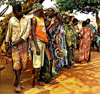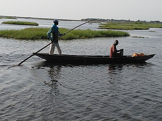
Bohicon or Gbɔ̀xikɔn is a city in Benin, and a conurbation of Abomey lying 9 kilometres east of the city on the railway line from Cotonou to Parakou and on Benin's main highway RNIE 2 which joins the RNIE 4. The commune covers an area of 139 square kilometres and as of 2012 had a population of 149,271 people.

Cové is a city in the Zou Department of Benin. The commune covers an area of 525 square kilometres and as of 2012 had a population of 43,554 people.
Akpro-Missérété is a city, arrondissement, and commune in Ouémé Department, Benin. The commune covers an area of 79 square kilometres and as of 2013 had a population of 127,249 people.
Kalalè is a town, arrondissement, and commune in the Borgou Department of eastern Benin. The commune covers an area of 3,586 square kilometres (1,385 sq mi) and as of 2013 had a population of 168,882 people.
Sinendé is a town, arrondissement, and commune in the Borgou Department of central Benin. The commune covers an area of 2289 square kilometres and as of 2013 had a population of 91,672 people.
Glazoué is a town, arrondissement, and commune in the Collines Department of central Benin. It is located on the railway line from Cotonou to Parakou. The commune covers an area of 1350 square kilometres and as of 2013 had a population of 124,431 people.

Copargo is a town, arrondissement, and commune in the Donga Department of western Benin. The commune covers an area of 876 square kilometres and as of 2013 had a population of 70,938 people.
Ouaké is a town, arrondissement, and commune in the Donga Department of western Benin. The commune covers an area of 663 square kilometres and as of 2013 had a population of 74,289 people.

Bopa is a town, arrondissement, and commune in the Mono Department of south-western Benin.The commune covers an area of 365 square kilometres and as of 2002 had a population of 70,268 people.
Bonou is a town, arrondissement, and commune in the Ouémé Department of south-eastern Benin. The commune covers an area of 275 square kilometres and as of 2013 had a population of 44,349 people.
Dangbo is a town, arrondissement, and commune in the Ouémé Department of south-eastern Benin.The commune covers an area of 340 square kilometres and as of 2002 had a population of 66,055 people. Dangbo is the site of Benin's Institute for Mathematics and Physical Sciences.

Sèmè-Kpodji is a town, arrondissement, and commune in the Ouémé Department of south-eastern Benin. The commune covers an area of 250 square kilometres and as of 2013 had a population of 222,701 people.
Agbangnizoun is a town, arrondissement, and commune in the Zou Department of south-western Benin. The town lies 20 kilometres south-east of Abomey. The commune covers an area of 244 square kilometres and as of 2002 had a population of 55,001 people.
Ouinhi is a town, arrondissement, and commune in the Zou Department of south-western Benin. The commune covers an area of 483 square kilometres and as of 2013 had a population of 59,381 people. It is bounded on the north-west by the commune of Zagnanado, south-west by the commune of Zogbodomey, south by the commune of Bonou and east by the commune of Adja-Ouèrè. The commune is divided into arrondissements which include Dasso, Ouinhi, and Tohu, comprising 28 villages.
Zogbodomey or Zogbodomè is a town, arrondissement, and commune in the Zou Department of south-western Benin. The commune covers an area of 600 square kilometres and as of 2002 had a population of 72,338 people.
Gninsy is a town and arrondissement in the Borgou Department of Benin. It is an administrative division under the jurisdiction of the commune of Pèrèrè. According to the population census conducted by the Institut National de la Statistique Benin on February 15, 2002, the arrondissement had a total population of 10,485.
Guinagourou is a town and arrondissement in the Borgou Department of Benin. It is an administrative division under the jurisdiction of the commune of Pèrèrè. According to the population census conducted by the Institut National de la Statistique Benin on February 15, 2002, the arrondissement had a total population of 11,411.
Kpané is a town and arrondissement in the Borgou Department of Benin. It is an administrative division under the jurisdiction of the commune of Pèrèrè. According to the population census conducted by the Institut National de la Statistique Benin on February 15, 2002, the arrondissement had a total population of 2,067.
Pébié is a town and arrondissement in the Borgou Department of Benin. It is an administrative division under the jurisdiction of the commune of Pèrèrè. According to the population census conducted by the Institut National de la Statistique Benin on February 15, 2002, the arrondissement had a total population of 3,563.
Sontou is a town and arrondissement in the Borgou Department of Benin. It is an administrative division under the jurisdiction of the commune of Pèrèrè. According to the population census conducted by the Institut National de la Statistique Benin on February 15, 2002, the arrondissement had a total population of 4,583.


