Zè | |
|---|---|
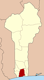
 Zè Location in Benin | |
| Coordinates: 6°47′N2°18′E / 6.783°N 2.300°E | |
| Country | |
| Department | Atlantique Department |
| Area | |
• Total | 210 sq mi (543 km2) |
| Population (2013) | |
• Total | 106,913 |
| Time zone | UTC+1 (WAT) |
Zè [zɛ] is a town, arrondissement, and commune in the Atlantique Department of southern Benin. The commune covers an area of 543 square kilometres and as of 2013 had a population of 106,913 people. [1]