Ratua II (community development block)

Last updated
Ratua II
রতুয়া II সমষ্টি উন্নয়ন ব্লক
Community development block
India West Bengal location map.svg
Red pog.svg
Ratua II
Location in West Bengal, India
Coordinates: 25°08′05″N88°02′11″E / 25.1346610°N 88.0363770°E / 25.1346610; 88.0363770 Coordinates: 25°08′05″N88°02′11″E / 25.1346610°N 88.0363770°E / 25.1346610; 88.0363770
CountryFlag of India.svg  India
State West Bengal
District Malda
Area
  Total 101.29 km2 (39.11 sq mi)
Population (2001)
  Total 160,922
  Density 1,600/km2 (4,100/sq mi)
Languages
  Official Bengali, English
Time zone IST (UTC+5:30)
Lok Sabha constituency Maldaha Uttar
Vidhan Sabha constituency Ratua, Malatipur
Website malda.nic.in

Ratua II (community development block) is an administrative division in Chanchal subdivision of Malda district in the Indian state of West Bengal. Pukhuria police station serves this block. Headquarters of this block is at Pukhuria. [1]

Chanchal subdivision Subdivision in West Bengal, India

Chanchal subdivision is an administrative subdivision of the Malda district in the Indian state of West Bengal.

Malda district District of West Bengal in India

Malda district, also spelt Maldah or Maldaha (Bengali: [malda], [maldɔɦ], often [maldɔɦo]; is a district in West Bengal, India. It lies 347 km north of Kolkata, the capital of West Bengal. Mango, jute and silk are the most notable products of this district. The special variety of mango, Fazli produced in this region, popularly known by the name of the district, is exported across the world and is acclaimed internationally. The folk culture of gombhira is a feature of the district, being a unique way of representation of joy and sorrow of daily life of the common people, as well as the unique medium of presentation on national and international matters. According to the National Investigation Agency Malda is believed to be a hub of a fake currency racket. It is reported that 90 per cent of the fake currency that enters India originates in Malda.

India Country in South Asia

India, also known as the Republic of India, is a country in South Asia. It is the seventh largest country by area and with more than 1.3 billion people, it is the second most populous country as well as the most populous democracy in the world. Bounded by the Indian Ocean on the south, the Arabian Sea on the southwest, and the Bay of Bengal on the southeast, it shares land borders with Pakistan to the west; China, Nepal, and Bhutan to the northeast; and Bangladesh and Myanmar to the east. In the Indian Ocean, India is in the vicinity of Sri Lanka and the Maldives, while its Andaman and Nicobar Islands share a maritime border with Thailand and Indonesia.

Contents

Geography

Pukhuria is located at 25°08′05″N88°02′11″E / 25.1346610°N 88.0363770°E / 25.1346610; 88.0363770 .

Ratua II community development block has an area of 101.29 km2. [2]

Gram panchayats

Gram panchayats of Ratua II block/ panchayat samiti are: Sripur I, Sripur II, Maharajpur, Sambalpur, Paranpur, Arhaidanga, Pukhuria and Pirganj. [3]

A gram panchayat is the only grassroots-level of panchayati raj formalised local self-governance system in India at the village or small-town level, and has a sarpanch as its elected head.

Impact of Farakka Barrage on the Human Fabric

Left bank erosion of the Ganges upstream of Farakka Barrage has rendered nearly 4.5 lakh people homeless in Manikchak, Kaliachak I, II and III and Ratua blocks over the last three decades of the past century. The worst hit area is between Bhutnidiara and Panchanandapore in Kaliachak II block. According to the Ganga Bhangan Pratirodh Action Nagarik Committee 750 km2 area was lost in 30 years in the Manikchak and Kalichak areas. [4]

River bank erosion along the Ganges in Malda and Murshidabad districts focusses on river bank erosion along the main channel of the Ganges in Malda and Mushidabad districts of West Bengal, India.

Ganges river in Bangladesh and India with major tributeries from Nepal

The Ganges, or Ganga, is a trans-boundary river of the Indian subcontinent which flows through the nations of India and Bangladesh. The 2,525 km (1,569 mi) river rises in the western Himalayas in the Indian state of Uttarakhand, and flows south and east through the Gangetic Plain of North India. After entering West Bengal, it divides into two rivers: the Hooghly and the Padma River. The Hooghly, or Adi Ganga, flows through several districts of West Bengal and into the Bay of Bengal near Sagar Island. The other, the Padma, also flows into and through Bangladesh, and joins the Meghna river which ultimately empties into the Bay of Bengal.

Farakka Barrage Barrage of India

Farakka Barrage is a barrage across the Ganges River, located in Murshidabad district in the Indian state of West Bengal, roughly 16.5 kilometres (10.3 mi) from the border with Bangladesh near Shibganj. Farakka Barrage Township is located in Farakka in Murshidabad district. Construction was started in 1961 and completed in 1975 at a cost of 156.49 crore (US$22 million). Operations began on 21 April 1975. The barrage is about 2,240 metres (7,350 ft) long. The Feeder Canal (Farakka) from the barrage to the Bhagirathi-Hooghly River is about 25 miles (40 km) long.

Demographics

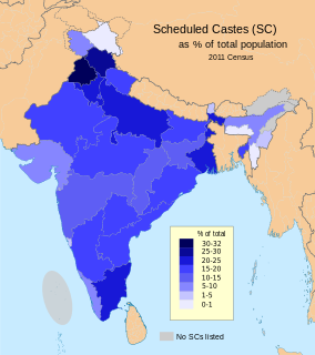
As per 2011 Census of India Ratua II CD Block had a total population of 202,080 all of which were rural. There were 102,962 males and 99,118 females. Scheduled Castes numbered 12,880 and Scheduled Tribes numbered 1,954. [5]

The 15th Indian Census was conducted in two phases, house listing and population enumeration. House listing phase began on 1 April 2010 and involved collection of information about all buildings. Information for National Population Register(NPR)was also collected in the first phase, which will be used to issue a 12-digit unique identification number to all registered Indian residents by Unique Identification Authority of India (UIDAI). The second population enumeration phase was conducted between 9 and 28 February 2011. Census has been conducted in India since 1872 and 2011 marks the first time biometric information was collected. According to the provisional reports released on 31 March 2011, the Indian population increased to 1.21 billion with a decadal growth of 17.70%. Adult literacy rate increased to 74.04% with a decadal growth of 9.21%. The motto of the census was 'Our Census, Our future'.

Scheduled Castes and Scheduled Tribes official designations given to various groups indigenous people in India

The Scheduled Castes (SCs) and Scheduled Tribes (STs) are officially designated groups of historically disadvantaged people in India. The terms are recognised in the Constitution of India and the groups are designated in one or other of the categories. For much of the period of British rule in the Indian subcontinent, they were known as the Depressed Classes. The people in scheduled castes are essentially the lowest part of Hindu society.

Literacy

As per 2011 census the total number of literates in Ratua II CD Block was 95,915 out of which 50,738 were males and 45,177 were females. [5]

Transport

Kumarganj and Sripur Halt are railway stations on the Malda-Raiganj section, within the block.

See also

Related Research Articles

Harishchandrapur I Community development block in West Bengal, India

Harishchandrapur I is a community development block that forms an administrative division in Chanchal subdivision of Malda district in the Indian state of West Bengal.

Ratua I Community development block in West Bengal, India

Ratua I is a community development block that forms an administrative division in Chanchal subdivision of Malda district in the Indian state of West Bengal.

Gazole (community development block) Community development block in West Bengal, India

Gazole is a community development block that forms an administrative division in Malda Sadar subdivision of Malda district in the Indian state of West Bengal.

Kaliachak I Community development block in West Bengal, India

Kaliachak I is a community development block that forms an administrative division in Malda Sadar subdivision of Malda district in the Indian state of West Bengal.

Manikchak Community development block in West Bengal, India

Manikchak is a community development block that forms an administrative division in Malda Sadar subdivision of Malda district in the Indian state of West Bengal.

Habibpur (community development block) Community development block in West Bengal, India

Habibpur is a community development block that forms an administrative division in Malda Sadar subdivision of Malda district in the Indian state of West Bengal.

Bamangola (community development block) Community development block in West Bengal, India

Bamangola is a community development block that forms an administrative division in Malda Sadar subdivision of Malda district in the Indian state of West Bengal.

Kaliachak II Community development block in West Bengal, India

Kaliachak II is a community development block that forms an administrative division in Malda Sadar subdivision of Malda district in the Indian state of West Bengal.

Kaliachak III Community development block in West Bengal, India 87.9776

Kaliachak III is a community development block that forms an administrative division in Malda Sadar subdivision of Malda district in the Indian state of West Bengal.

Old Malda (community development block) Community development block in West Bengal, India

Old Malda is a community development block that forms an administrative division in Malda Sadar subdivision of Malda district in the Indian state of West Bengal.

English Bazar (community development block) Community development block in West Bengal, India

English Bazar is a community development block that forms an administrative division in Malda Sadar subdivision of Malda district in the Indian state of West Bengal.

Chanchal II Community development block in West Bengal, India

Chanchal II is a community development block that forms an administrative division in Chanchal subdivision of Malda district in the Indian state of West Bengal.

Chanchal I Community development block in West Bengal, India

Chanchal I is a community development block that forms an administrative division in Chanchal subdivision of Malda district in the Indian state of West Bengal.

Harishchandrapur II Community development block in West Bengal, India

Harishchandrapur II is a community development block that forms an administrative division in Chanchal subdivision of Malda district in the Indian state of West Bengal.

Ratua Village in West Bengal, India

Ratua is a village in Ratua I CD Block in Chanchal subdivision of Malda district in the state of West Bengal, India.

Manikchak, Malda Village in West Bengal, India

Manikchak is a village in Manikchak CD Block in Malda Sadar subdivision of Malda district in the state of West Bengal, India.

Mathabari Village in West Bengal, India

Mathabari or Mothabari is a village in Kaliachak II CD Block in Malda Sadar subdivision of Malda district in the state of West Bengal, India.

Pukhuria Village in West Bengal, India

Pukhuria is a village in Ratua II CD Block in Chanchal subdivision of Malda district in the state of West Bengal, India.

Khanta Village in West Bengal, India

Khanta is a village in Harishchandrapur II CD Block in Chanchal subdivision of Malda district in the state of West Bengal, India.

References

  1. "Contact details of Block Development Officers". Malda district. West Bengal Government. Retrieved 2011-02-17.
  2. "Harishchandrapur I at a Glance". Maldah District. District administration. Retrieved 2011-02-14.
  3. "GPwise Population of Malda district". Malda district. Malda district administration. Retrieved 2011-02-14.
  4. Banerjee, Manisha. "A Report on the Impact of Farakka Barrage on the Human Fabric, November 1999" (PDF). The social impact of erosion, pp 13-14. South Asia Network On Dams, Rivers and People, New Delhi: 110 088 India. Retrieved 2011-02-17.
  5. 1 2 "C.D. Block Wise Primary Census Abstract Data(PCA)". West Bengal – District-wise CD Blocks. Registrar General and Census Commissioner, India. Retrieved 21 September 2015.